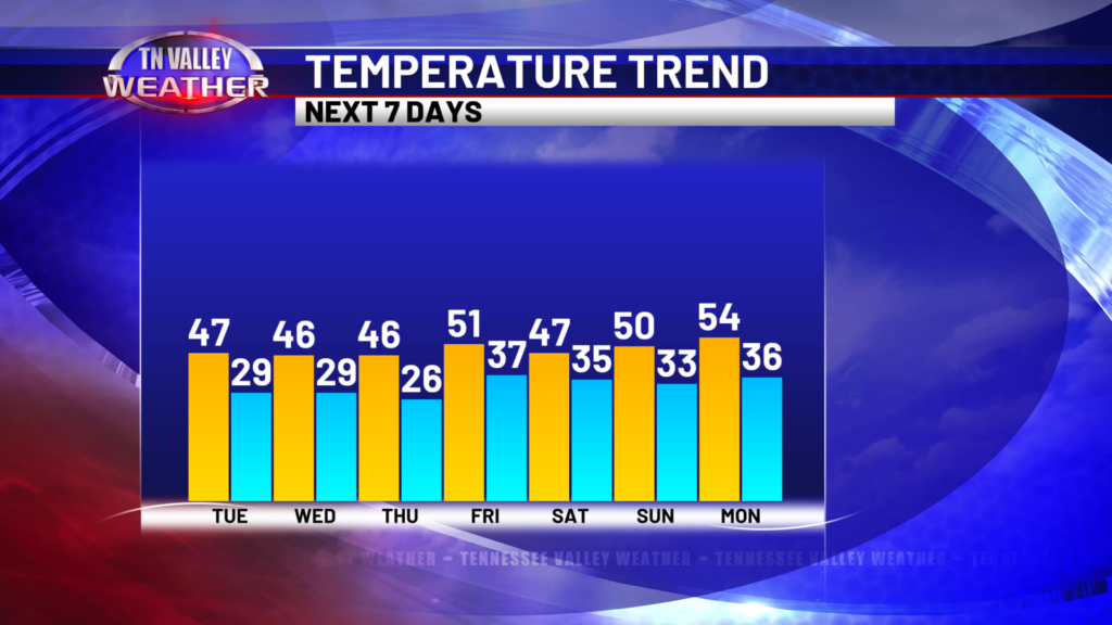
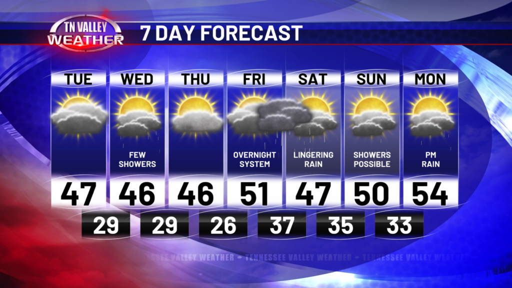
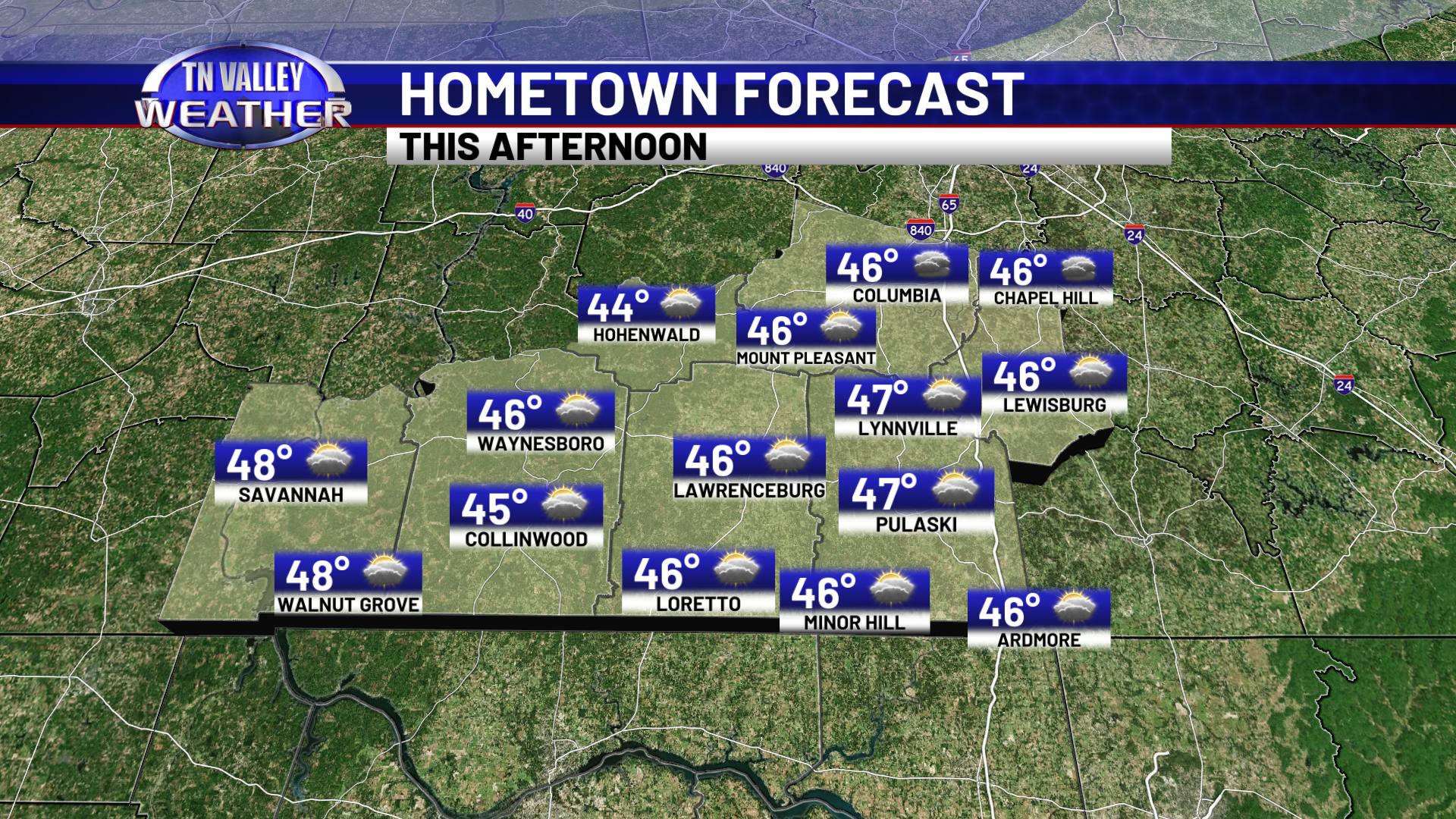
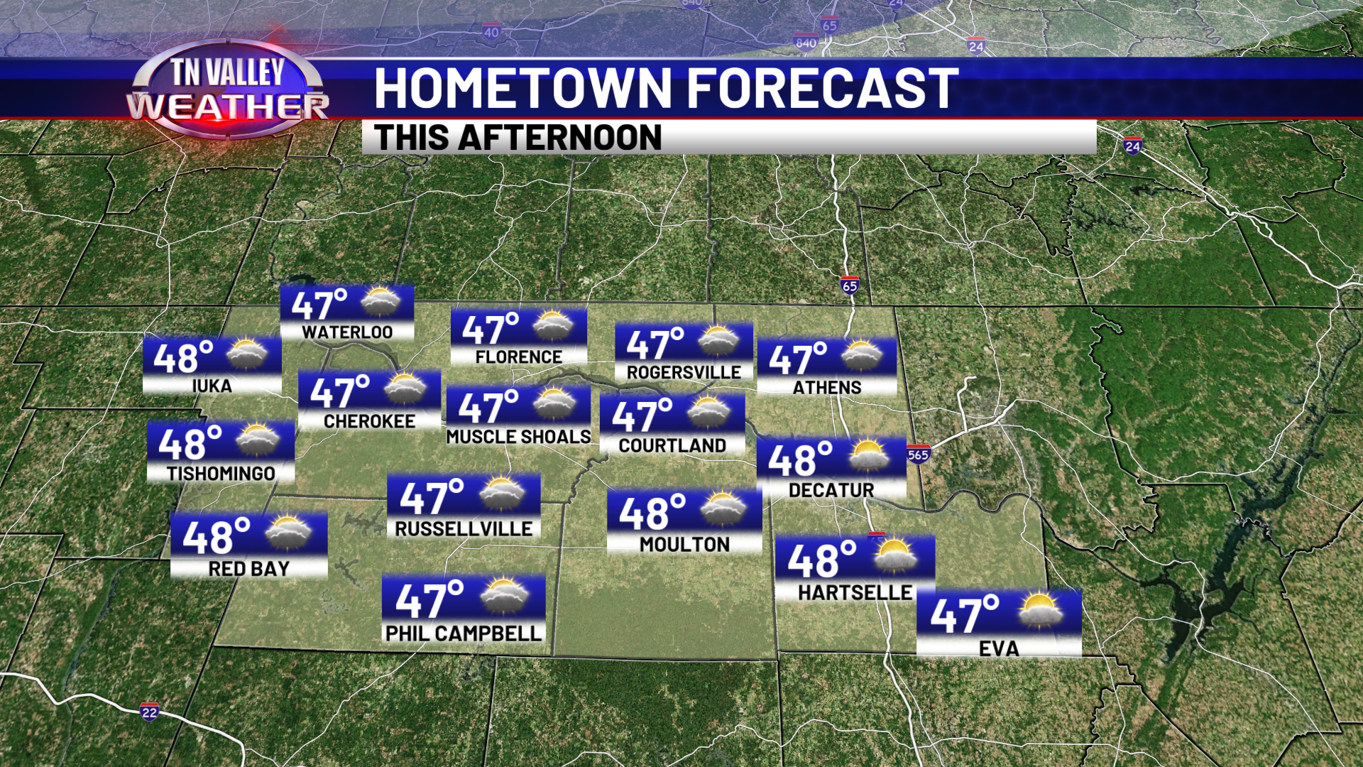
I hope everyone had a wonderful New Year holiday and I hope you’re doing well on all those new year resolutions! We’ve got quiet weather for the rest of today, but we have multiple rain chances to discuss over the course of the next week here in the Tennessee Valley. For the rest of today, cloud cover will increase but we stay dry, with highs in the mid 40s for southern middle TN and upper 40s for northwest Alabama and northeast Mississippi.
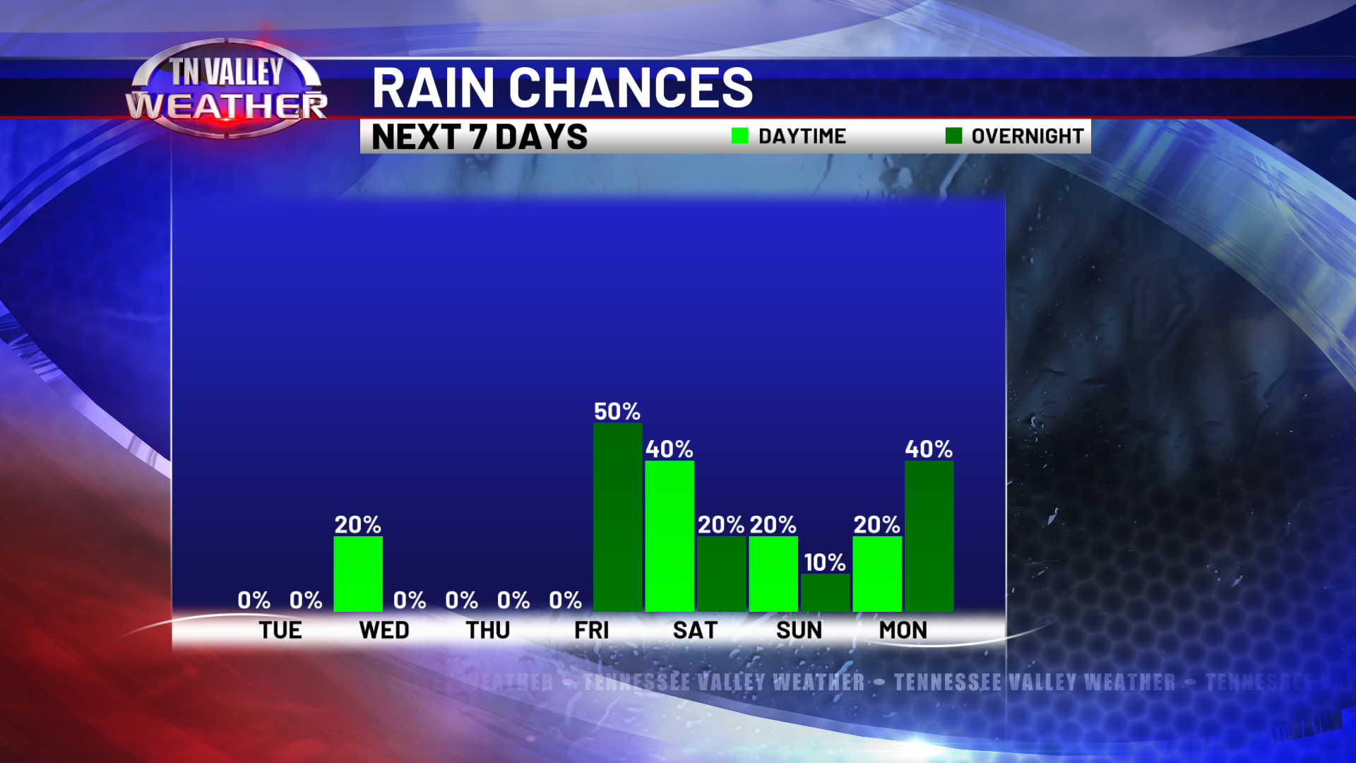
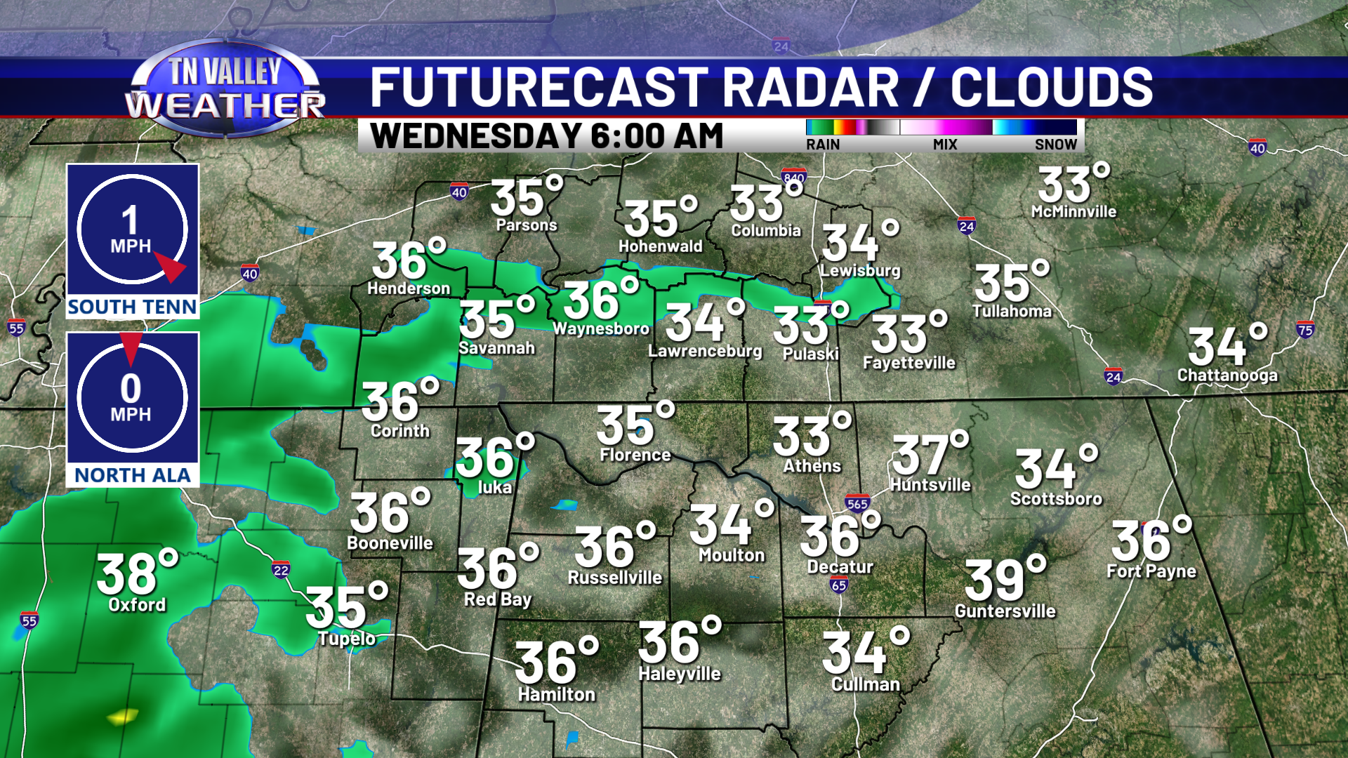
Tonight, lows will get down into the lower 30s, but as moisture moves in Wednesday morning, we will be above freezing. There is the slightest chance that we see a few light flurries before temps warm above freezing, but that’ll be very short lived with the small chance that even happens. Spotty light showers will persist throughout the morning and early afternoon, as temps reach the 40s by afternoon. Rain should be moved out for everyone by 5pm. In my opinion, our in-house Futurecast model is overdoing rain coverage, but a 20-30% spread is the likely outcome. As we lose cloud cover throughout the evening, temps overnight will get down into the upper 20s.

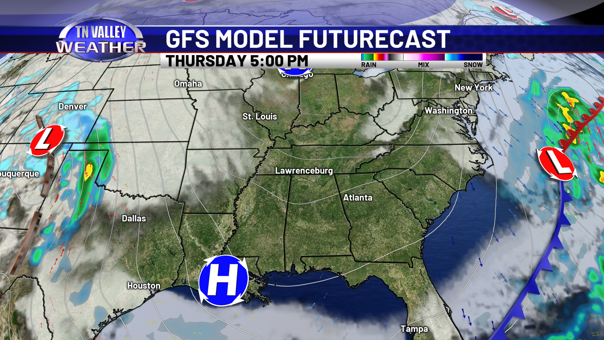
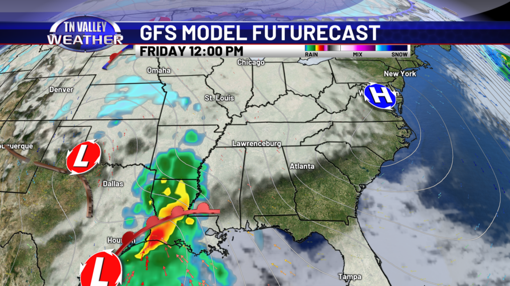
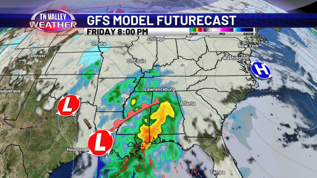
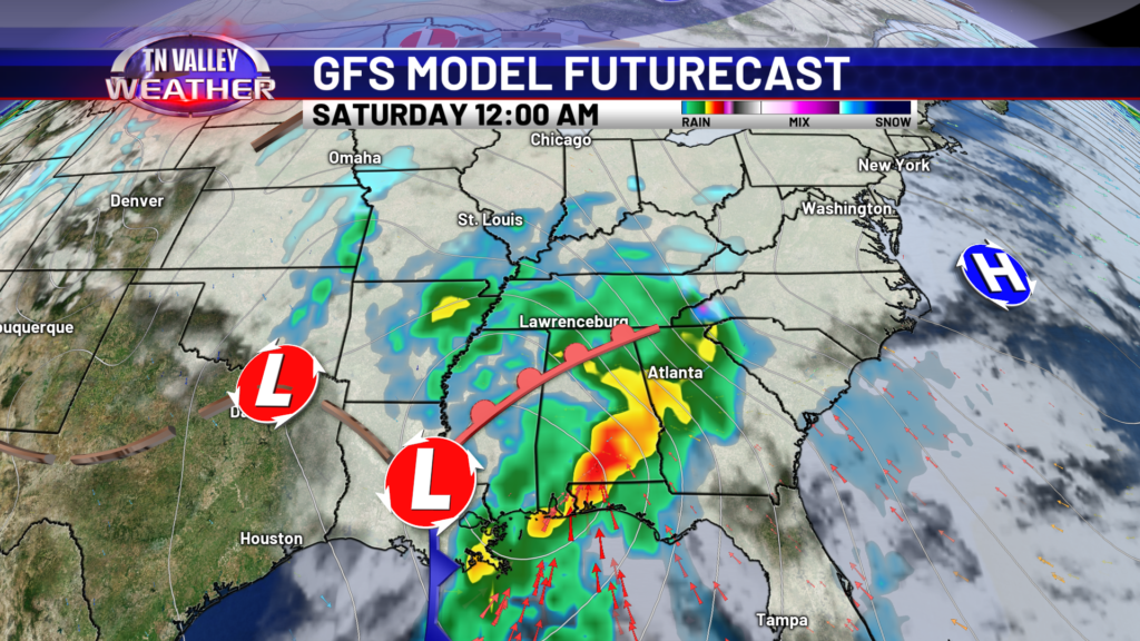
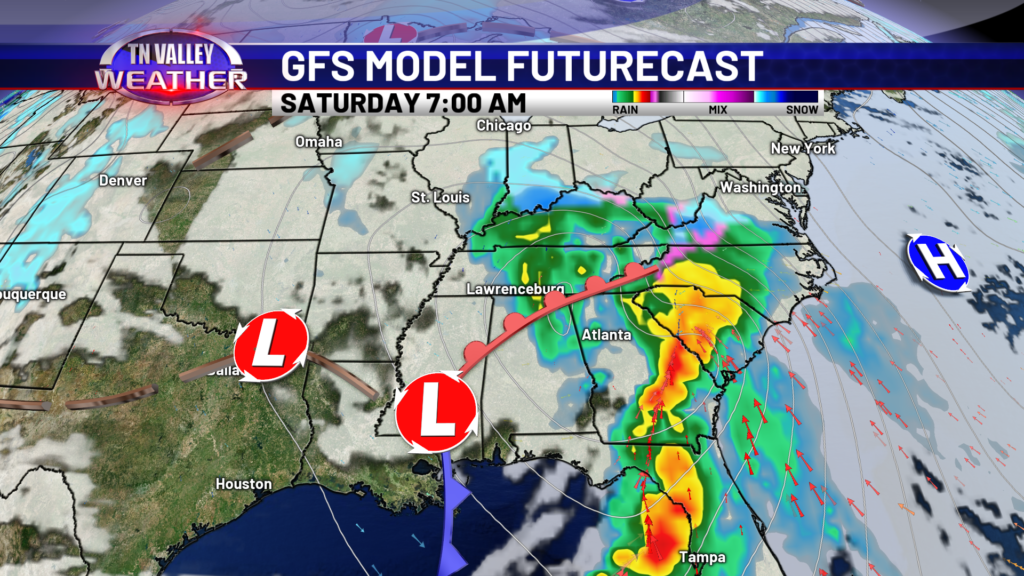
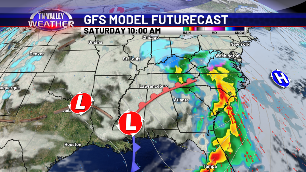
Thursday will be a nice day across the region. A few clouds but plenty of sunshine. Enjoy it, because more rain moves in by Friday. Models are now speeding up what was Saturday’s system- it now looks to impact the Tennessee Valley beginning Friday evening. While there has been some question about temperatures with this moisture, as of now, temps look to stay above freezing and we get a good rain soaking Friday night into Saturday morning. We are still closely watching the temperature profiles and will update the forecast accordingly. Moisture may linger into Sunday but coverage will be spotty at best.
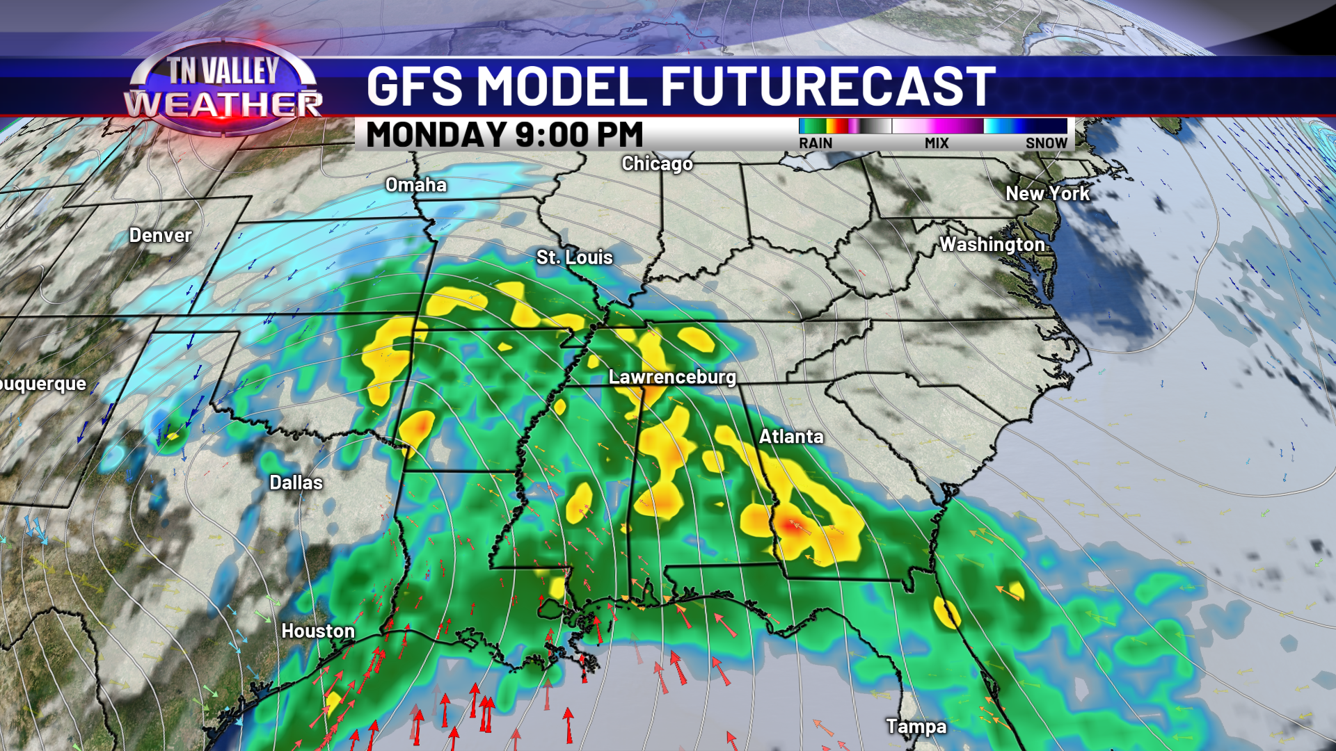
Just when you thought I was done…sorry! One more system we are keeping an eye on falls Monday night to Tuesday morning, at the time I write this, at least. At this time, cold air is well to our north and it looks to be another heavy rainmaker for us, but we’ll watch out for it. Low pressure systems during an El Nino winter can be tricky with temperature profiles. We’ll be keeping an eye on it. Monday night’s system is still very far out.
Today and Thursday look to be our quiet weather days this week. We’ll be watching these low pressure systems as they continue to develop, as we expected an active January. We’ll be staying busy here in the weather center for the foreseeable future!