TENNESSEE VALLEY WEATHER'S STORM ALERT POLICY
Storm Alert & Use of "Red" Graphics

When we are in "Storm Alert", we are expecting a significant weather threat that has an elevated potential to be a danger to life and property and/or cause major disruptions to everyday life. At these times, you will see red colored graphics in our weathercasts, in our live coverage, on our channel's L-Bar layout, and even on the monitors and studio set graphics we have. These are all used as visual cues to let you know that what we're talking about isn't something you see every day, and it's something you need to pay particular attention to.
We have a very specific set of things we look for in order to put our operations into "Storm Alert" red mode like this. Here is our somewhat strict criteria as follows:
- The NWS Storm Prediction Center has placed our area in a Level 4 of 5 or Level 5 of 5 risk of severe storms, specifically for the potential for EF2-EF5 intensity long-track type tornadoes, widespread damaging winds of 75+ mph, or widespread hail of 2+ inches in diameter. These Level 4 and Level 5 risk level outlooks happen pretty infrequently. We may only have a couple of these each year in our local area.
- The NWS Weather Prediction Center office has placed us in a "High Risk" of excessive rainfall and flooding or a "Moderate Risk" is issued in the "today" or "tomorrow" timeframes with 8+ inches of rain expected within 36 hours or less. This signifies a higher-end type of flash flooding threat that is infrequently seen and is a direct threat to life and property.
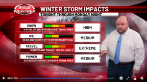
- A Winter Storm Watch or Warning is issued for either 4+ inch snow accumulations expected, ice storm conditions (1/4 inch ice accumulation or greater), flash freeze wintry travel conditions, or blizzard conditions.
- A Winter Weather Advisory is issued (below watch/warning accumulation criteria) but includes the likelihood of flash freeze wintry travel conditions.
- High wind events (not associated with thunderstorm wind gusts) that are likely to produce 60+ mph gusts or 50+ mph sustained winds.
- Landfalling tropical systems or remnants that are expected to produce widespread 50+ mph gusts for 3 hours or longer within the next 48 hours. The wind speed here is lowered a little to account for heavy rain making tree root systems weaker so that it's easier for trees to be knocked down.

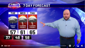
For severe storm threats, winter threats, tropical storm threats, flooding threats, and high wind threats that are either several days out in time or aren't as much of a "high-end" type threat, we do also have the capability of placing a red panel on the 7-Day Forecast graphic in our weathercasts and on the 5-Day Forecast at the bottom of the screen on our 24/7 channel to highlight those days where impactful weather is expected, but it doesn't meet our stricter criteria for the full "Storm Alert" mode.
You won't see this too often either, but it's typically used when there's an organized severe storm threat that includes tornadoes within the next 7 days (or a wind/hail threat within the next 3 days), when a flooding threat is significant enough to warrant a Flood Watch, when a high wind event may produce widespread 40+ mph winds, when a landfalling tropical system may bring tropical storm force conditions to the area, or when a winter weather system may produce snow, sleet, or ice accumulations that would impact travel or utilities.

The basic idea is that we only use these red graphics to highlight either impactful or dangerous weather threats that are upcoming in our area. Seeing these graphics is NOT a 100% guarantee that a high-end weather event WILL happen, because we're not perfect and the science isn't either, but we have a long-standing good track record with there actually being impactful weather in the area when our red graphics are used.
We can't speak for everyone else, but here at Tennessee Valley Weather, it's not a marketing gimmick. It's another tool we use to keep you informed and better prepared, without unnecessary hype or alarmism, when dangerous weather threatens.
