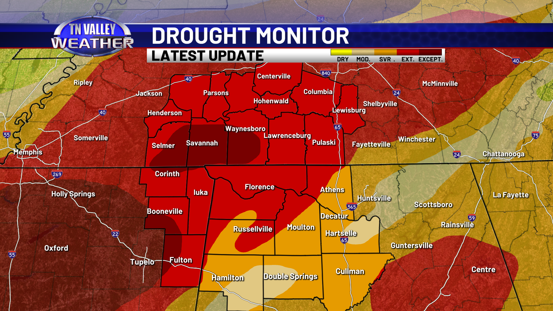
It’s the gift that keeps on giving. Yes, we have had multiple rain events over the last several weeks, but drought conditions are still ongoing across the Tennessee Valley and have actually worsened a little bit over the last seven days.
The latest update to the Drought Monitor released yesterday has placed portions of Hardin and Wayne Counties of TN in the “Exceptional Drought” category. Almost all of the remainder in our viewing area is in the step just below that, the “Extreme Drought” category.
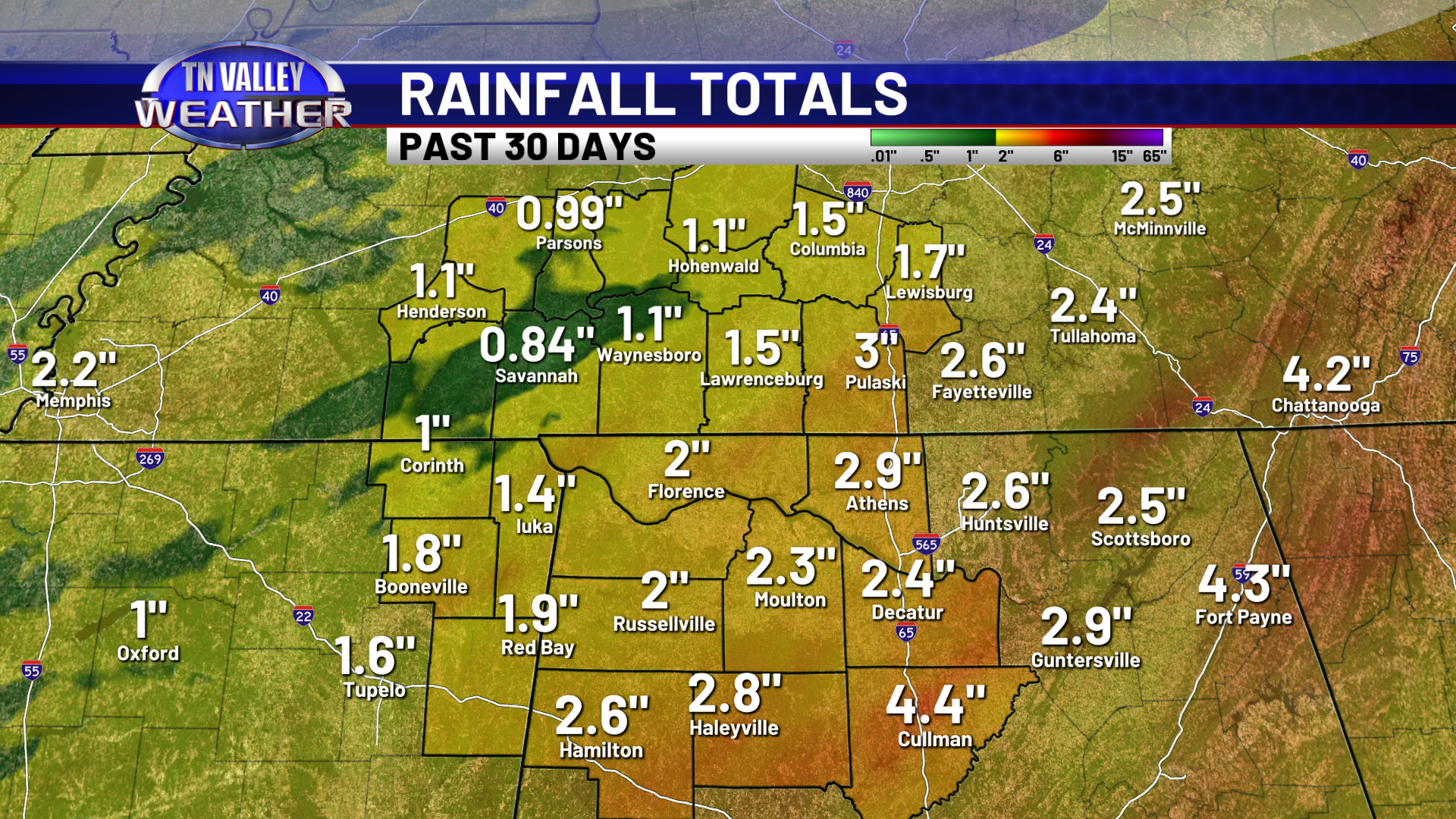
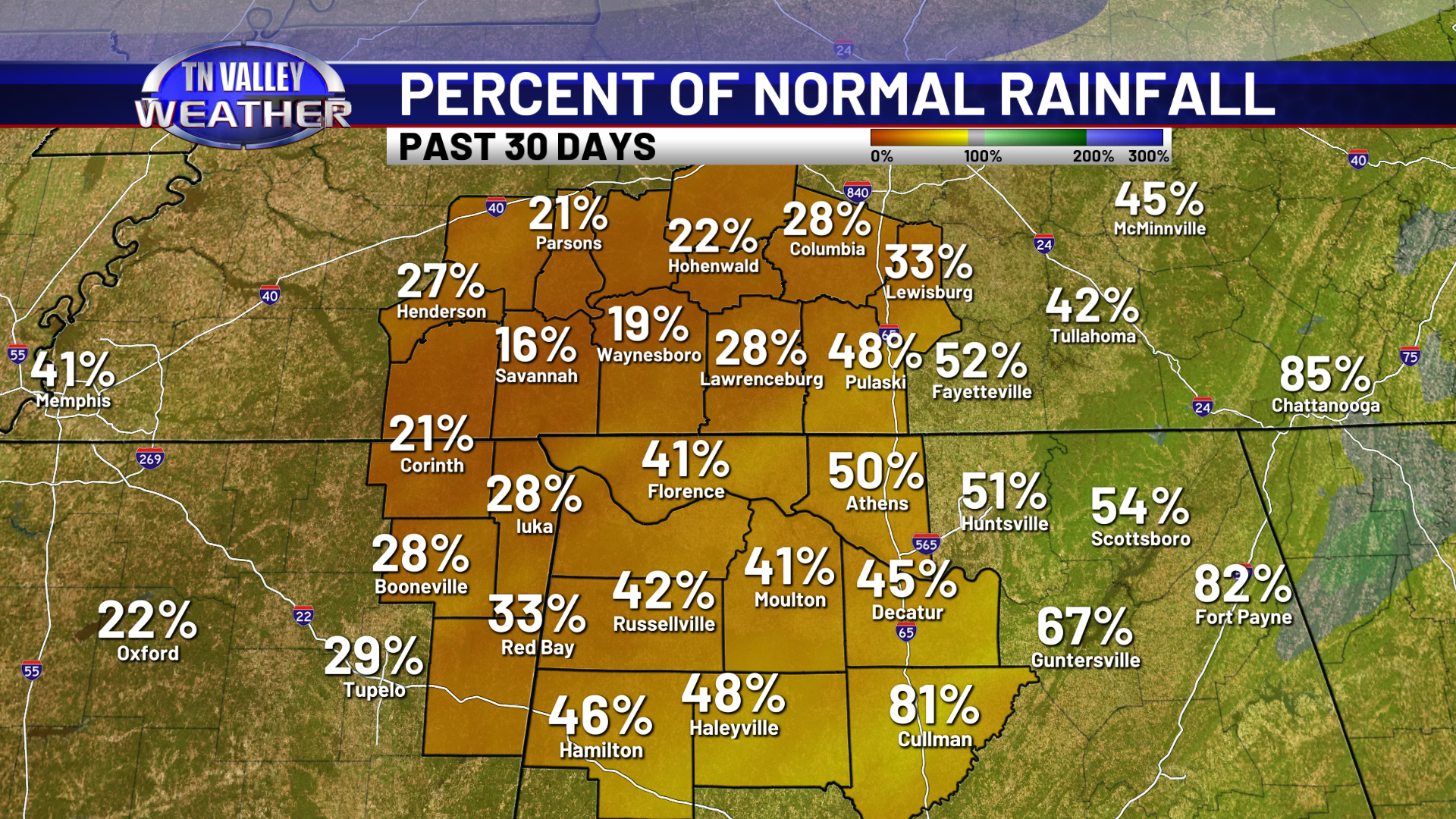
Just about all of our area has seen anywhere from 1 to 3 inches of rain the last 30 days, with the heaviest of that falling during the storm system that moved through Christmas Eve night into Christmas morning. While that is an improvement compared to the pattern we were in for a large part of the fall, those totals are only a quarter to half as much as we normally see for the 30 day calendar period we were just in. Adding this fact to the ongoing longer-term rainfall deficits we have, it’s easy to see how longer-term drought conditions have worsened, even if fire danger isn’t high and top-layer soil moisture isn’t all that deficient.
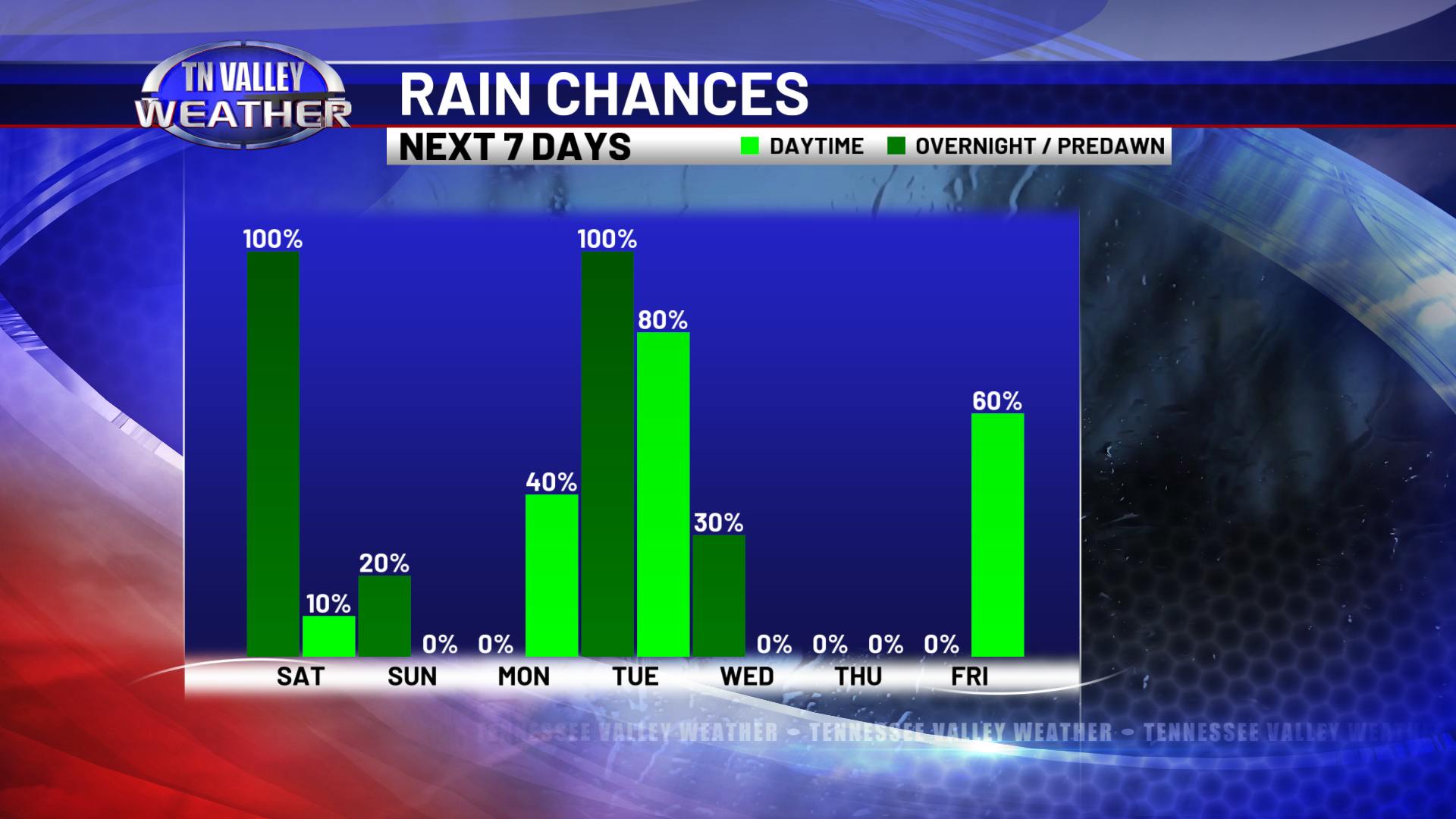
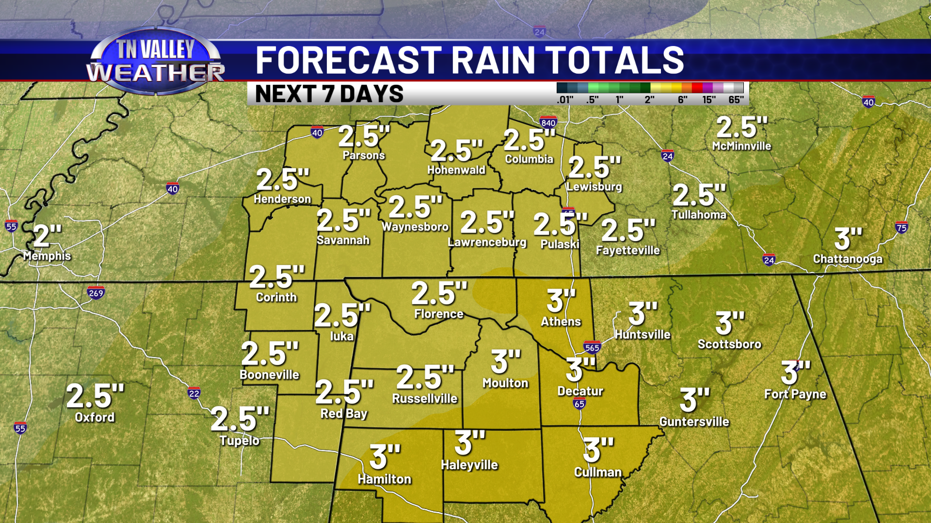
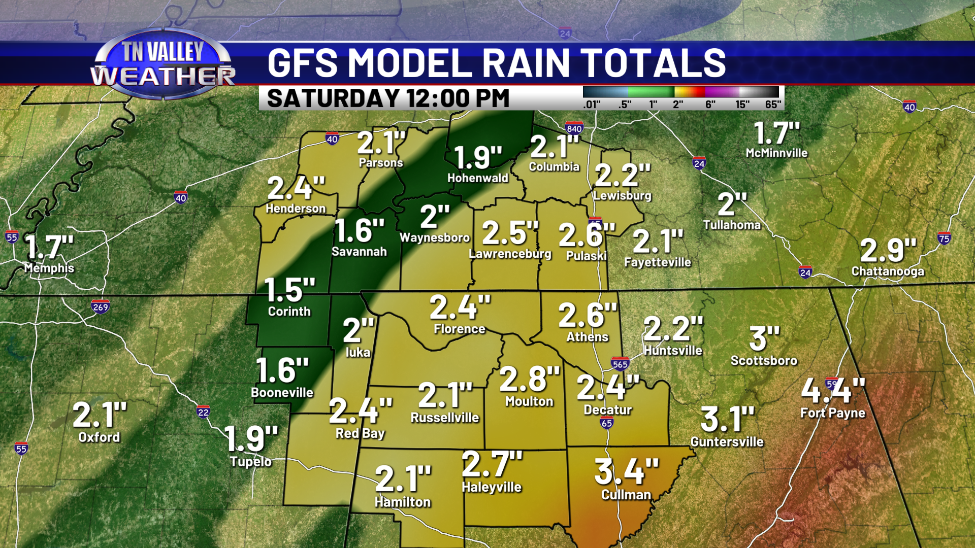

The good news is that we have multiple rain events on the way! Three systems are now on the board during the next seven days, and all three of them have elevated chances of widespread rainfall. The first system arrives tonight, with a second system Monday night into Tuesday, and a third already in the lineup toward next Friday. The NWS Weather Prediction Center office is forecasting an areawide 2.5 to 3″ of rain across our viewing area from these systems over the next seven days, and our two main large scale computer models (the GFS and the Euro) both agree on that idea. The Euro model actually has slightly higher totals, with some locations possibly seeing in excess of 3 inches of rain over the next seven days. That certainly can’t be ruled out, depending on how storms to our south set up with these systems and whether or not that tries to cut us off from deeper Gulf moisture.
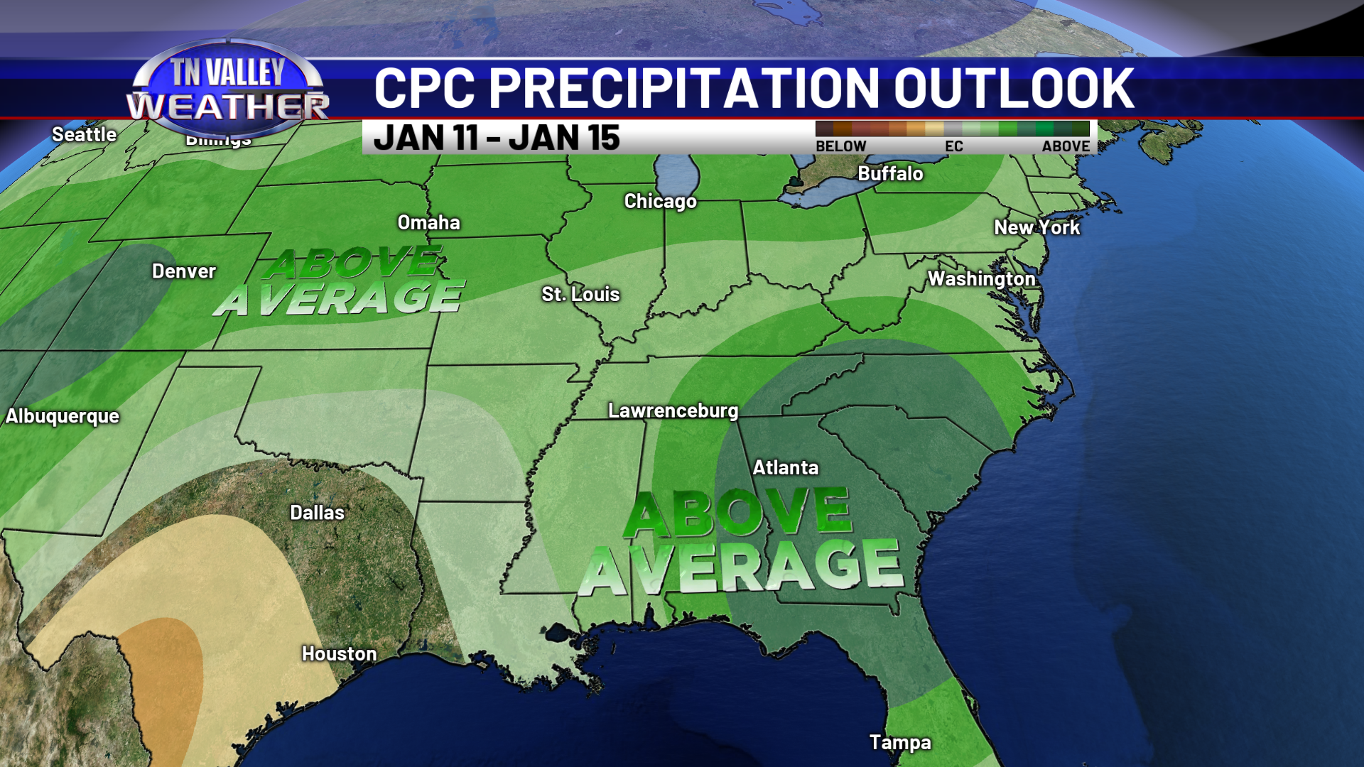
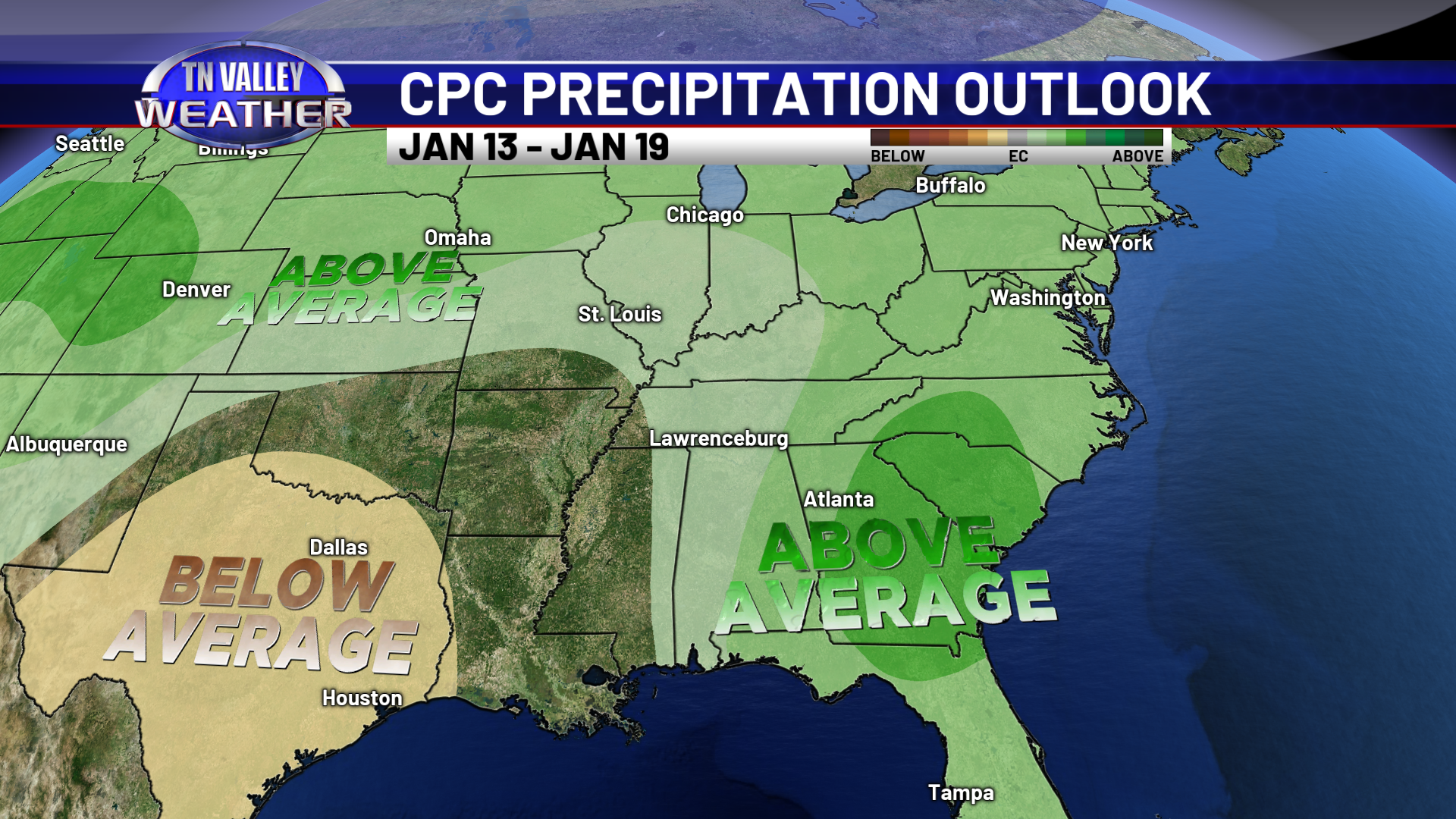
Looking ahead into the extended range, the active pattern we have looks to remain in place for the foreseeable future. The NWS Climate Prediction Center office is forecasting above average precipitation across our region in their 6-10 day outlook and their 8-14 day outlook. The idea of this active pattern remaining in place is heavily supported by long range ensemble guidance, including the same longer-range data that first started seeing for active pattern for early this month way back as far as near and just before Thanksgiving. This is expected during a winter season with a strong El Nino in place, due to the active subtropical jet stream that sets up as a result.