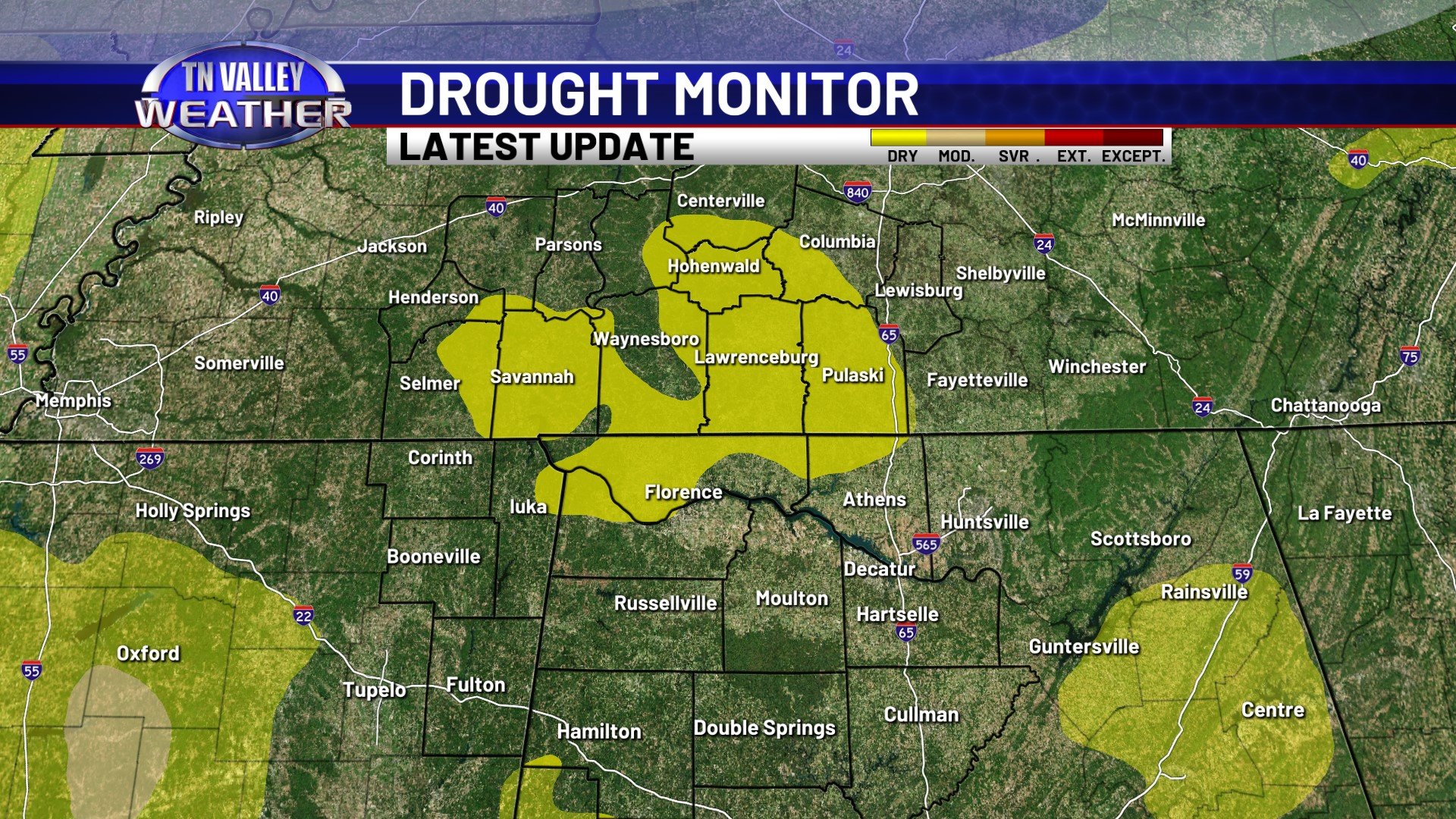
If you’ve noticed plants and the ground getting dry around our area the last week or two, you’re definitely not imagining things. While we aren’t officially outlined in drought conditions at this point, today’s Drought Monitor Update from the NWS Climate Prediction Center has placed much of the southern middle Tennessee portion of our viewing area, as well as parts of northwest Alabama, back into “Abnormally Dry” conditions. We also note expanding “Abnormally Dry” and low-end drought conditions to our south across parts of central Mississippi and central Alabama.
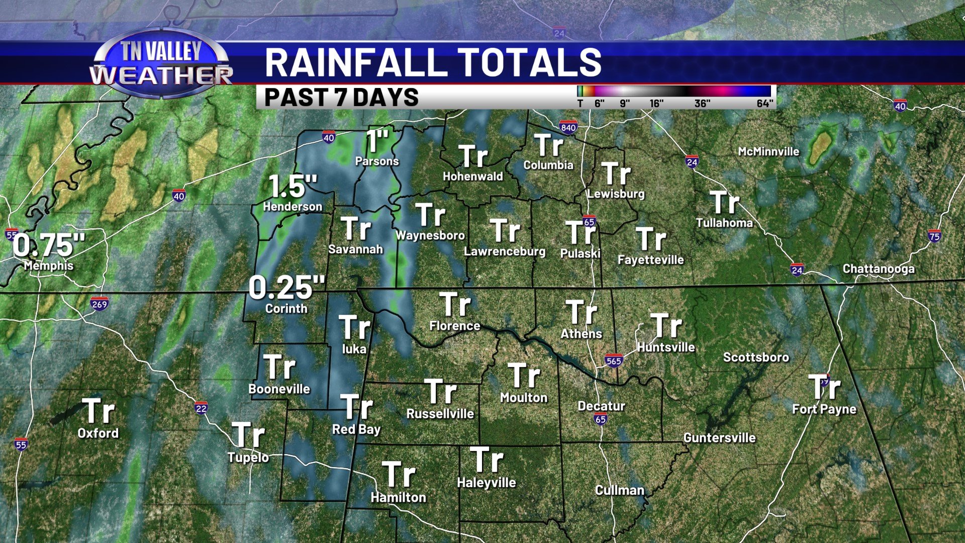
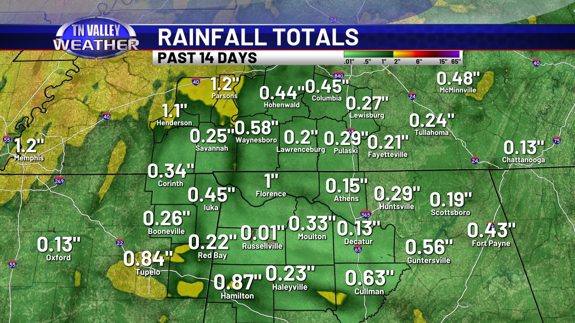
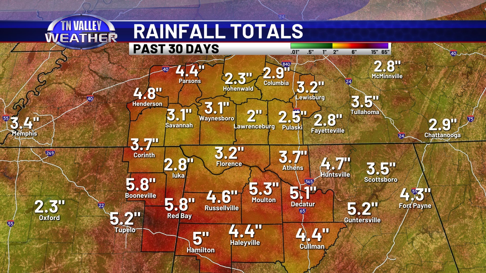
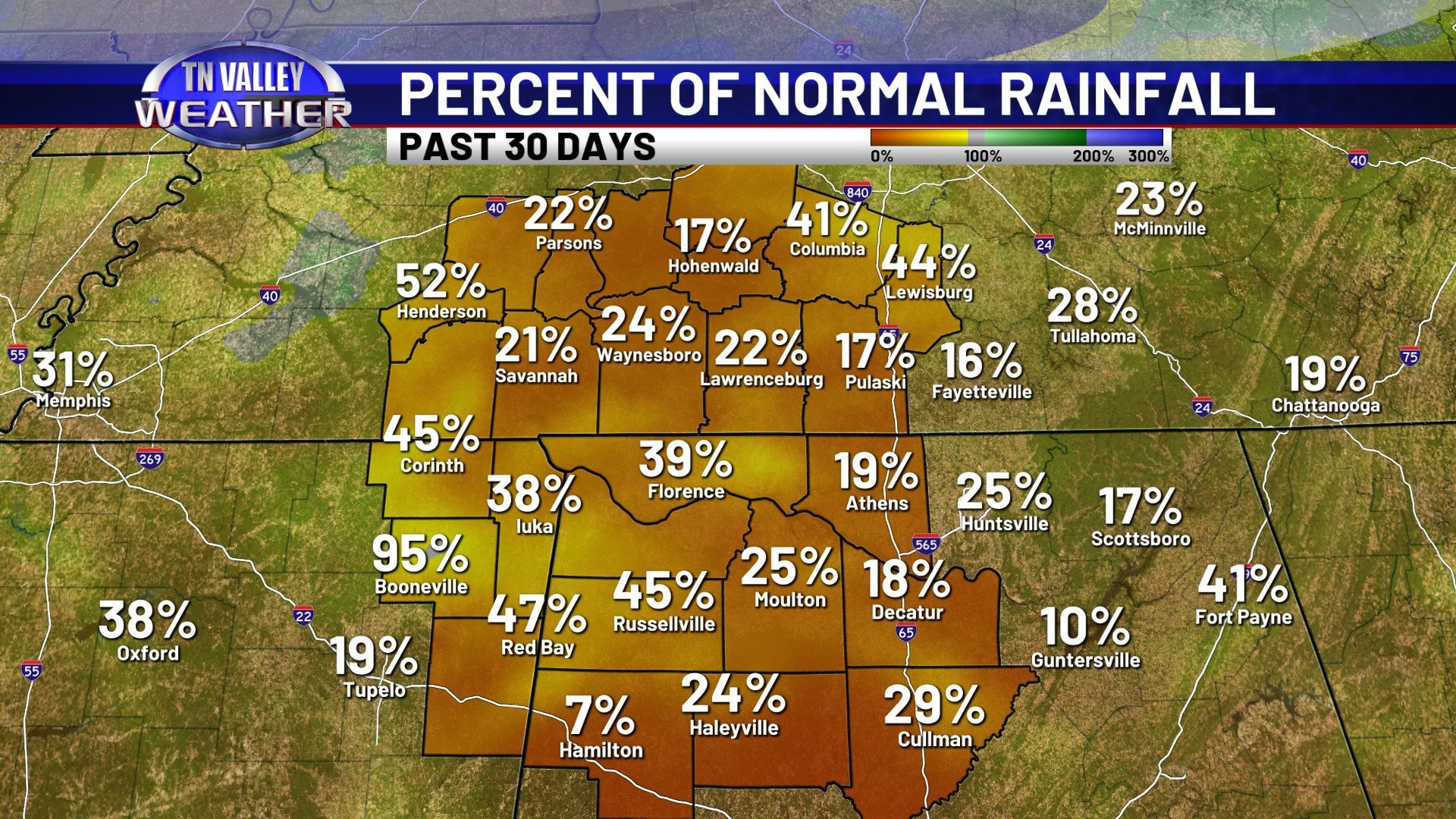
Looking at rainfall totals for the past couple of weeks, the vast majority of our area has seen half an inch or less of rain over the last 14 days. There are isolated spots that have seen that or a little more, but if anything, most spots have seen little to no rain. Even for the past 30 days, most portions of southern middle Tennessee have only seen 2 to 3 inches of rain, and northwest Alabama has seen anywhere from 3 to 5 inches of rain. This is significantly less rainfall than we usually see in the same period on the calendar, on average.
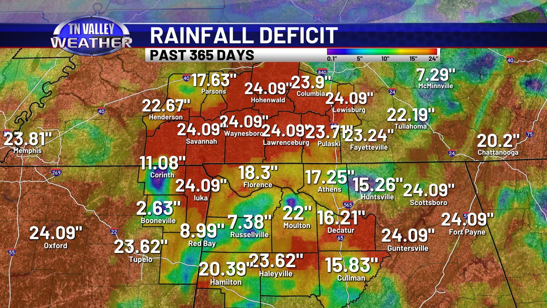
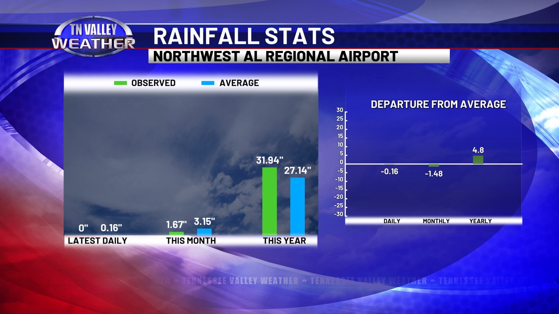
This only adds to a long-term rainfall deficit that we’ve had across much of the area for a while now. Rainfall deficits for the past 365 days across much of southern middle Tennessee are still running near the 2 FOOT range, and 365-day rainfall deficits over northwest Alabama are starting to get into the 16+ inch range. At the Muscle Shoals Airport, there is still officially a rainfall surplus of almost 5 inches dating back to the start of the year, but that has been decreasing in the past 30 days.
We will have to start getting meaningful rainfall soon, before we head into the drier months of late summer and especially fall, or we will run the risk of more significant drought conditions officially returning to the area.