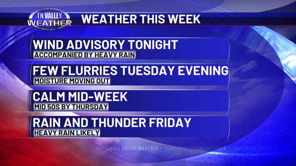
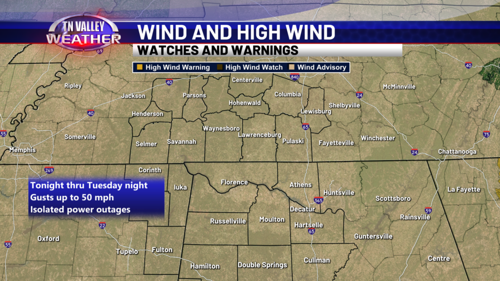
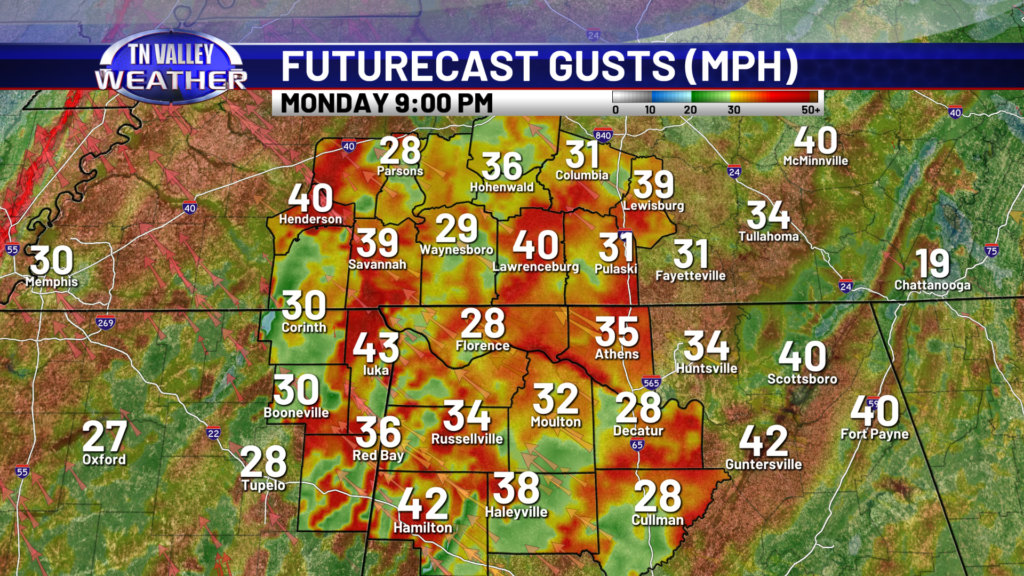
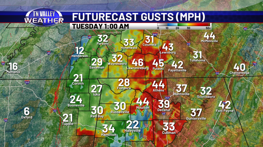
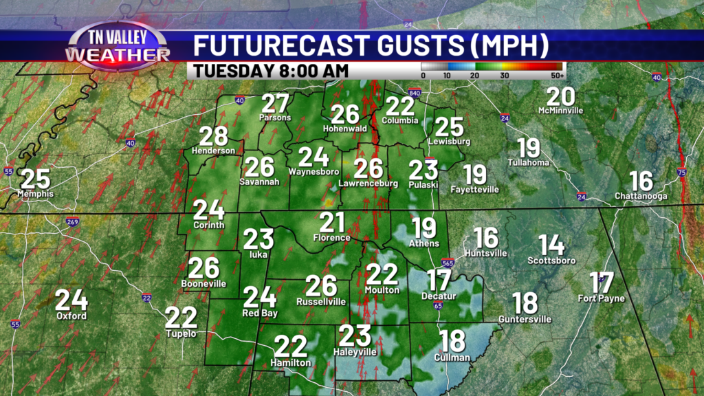
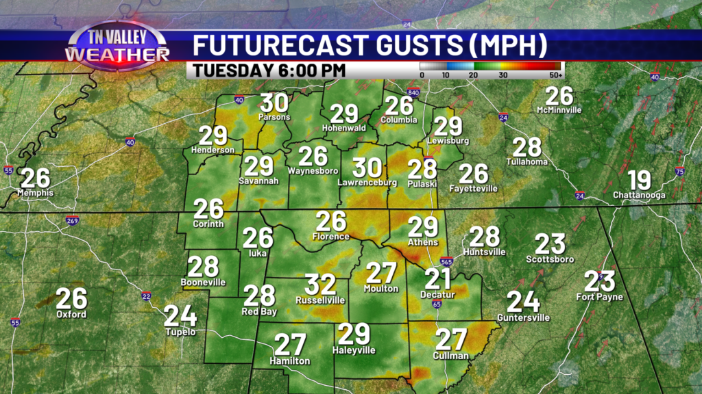
I hope you had a wonderful weekend! We’ve got a very active weather pattern and busy week weather-wise here in the Tennessee Valley, starting tonight. A strong low pressure system is bringing heavy rain, some thunder, and very gusty winds. A Wind Advisory is in effect for the entire TN Valley viewing area through Tuesday night, with wind gusts up to 50mph possible. Paired with heavy rain making for a wet ground, we have reason to be concerned about downed trees and power lines causing isolated power outages. That threat continues through Tuesday evening as well. Be aware that is a possibility going into this evening. I don’t foresee this being a widespread issue, but isolated issues may arise across the Tennessee Valley.
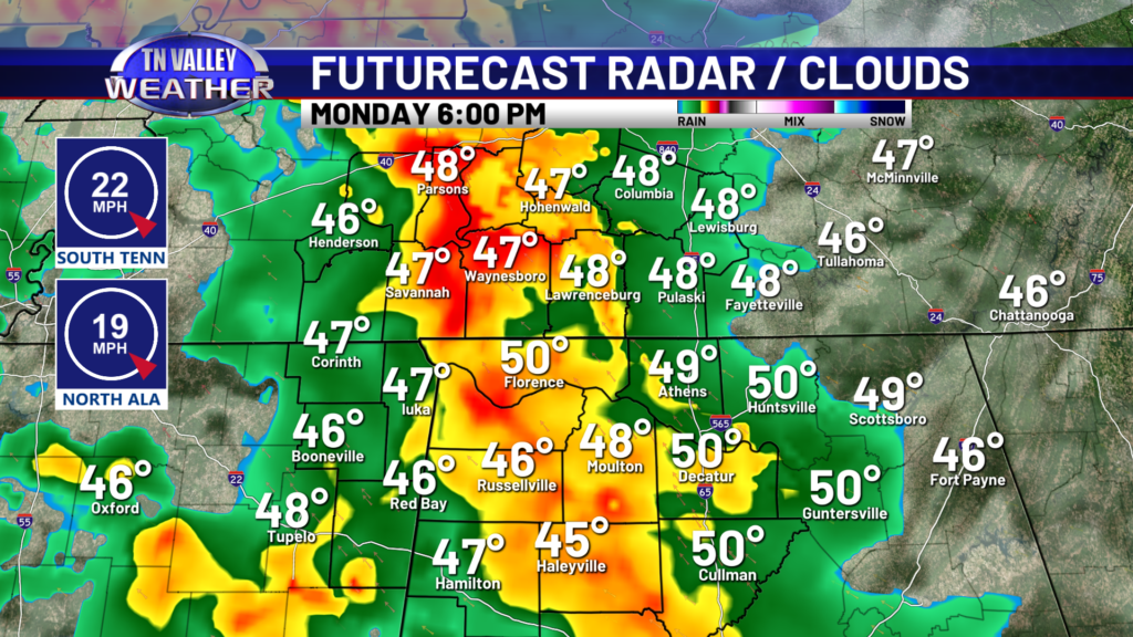
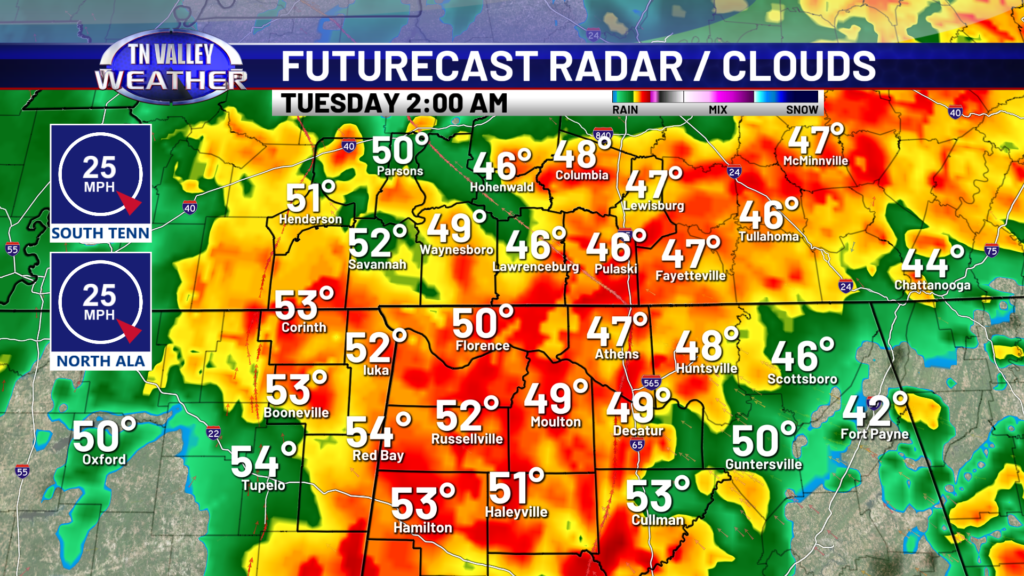
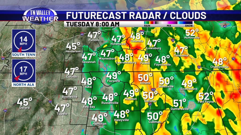
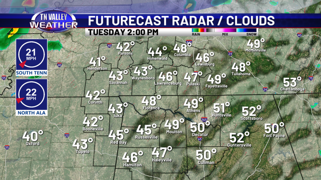
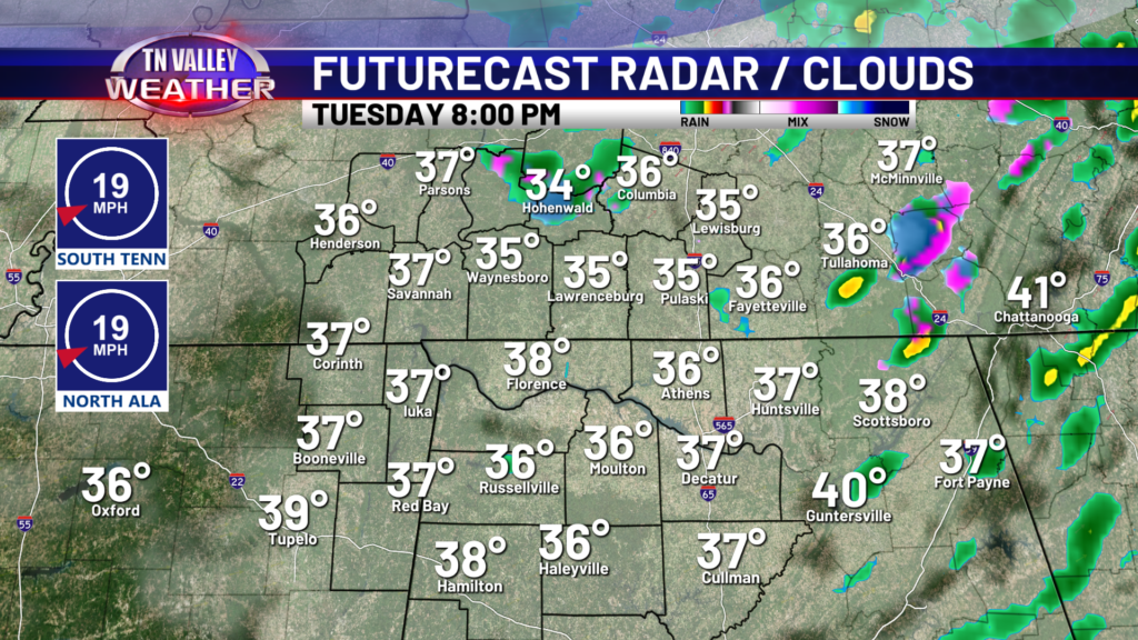
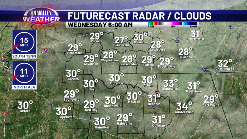
Heavy rain moves in this evening, with some embedded thundershowers possible. Heavy rainfall and gusty winds will persist throughout the night with widespread rain coverage eventually breaking up by mid-morning.
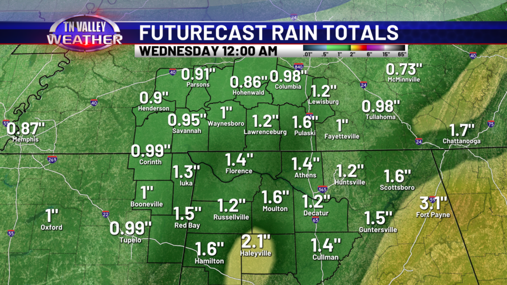
Everybody will see plenty of rainfall, some folks will see over two inches of rain, and I think everyone will see at least an inch of rain, if not very close to it. We’ll catch a break from the rain Tuesday afternoon, allowing temperatures to cool on the back side of the cold front. Virtually all models show lingering spotty moisture into Tuesday evening, which is when we could see a few light rain showers or snow flurries, if we are able to cool off close enough to freezing which I believe is a very real possibility. There will not be a lot of moisture and we are not expecting any impacts with these potential spotty light flurries. Not everyone will see flakes.
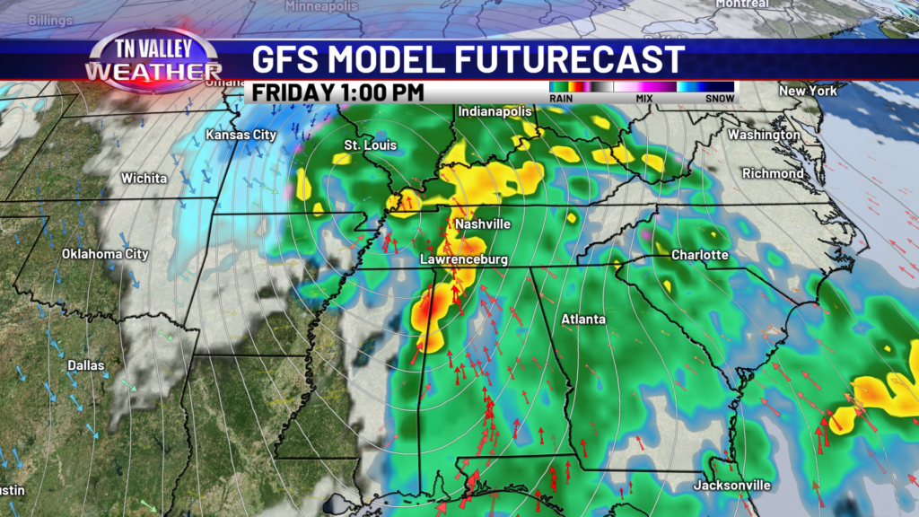
I’ve got some good news and I’ve got some bad news. The good news- we get a breather Wednesday and Thursday. Sunshine returns and our weather will be calm. The bad news- that calm weather will not last long, as we are tracking another impactful low pressure system that moves in Friday. At this time, it looks like widespread heavy rain with a few embedded thunderstorms Friday morning through late afternoon. This system has the potential to bring us another inch or so of rain. Most models have the moisture from this system moving out before very cold air filters in behind it! That being said, we are watching that remnant moisture closely as temps crash Friday night.
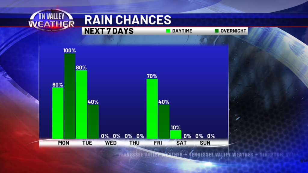
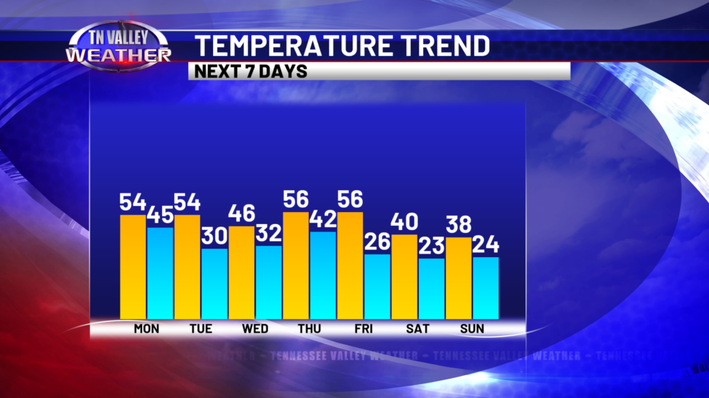
After Friday’s cold frontal passage, very cold air moves in. Highs this weekend will likely not make it out of the 30s. We’ll be dry Saturday and Sunday, but we’ve already got another weather system on tap for Monday. We’re keeping a close eye on temps with this system. At this time, 7 days out (so take that with a grain of salt) models are favoring cold air sticking around for that weather system. We’re watching this system and will update the forecast accordingly. It’s a bit too early to determine precipitation type as the track of the low pressure is crucial, and there is a larger margin for error the further out the forecast is.
