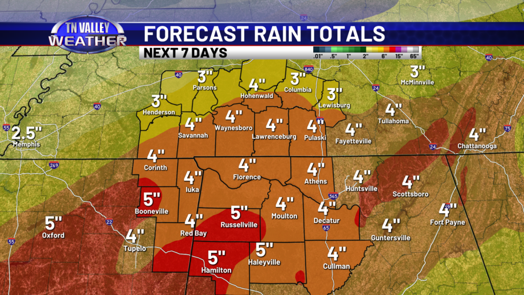
Well, well, well, we’re finally able to see the light at the end of the tunnel from last week’s wintry mess! Main roads are clear, although side roads still have ice on them, despite above-freezing temps. Give it some time and a little more patience, and roads will be clear soon. Not only do we have warm temps this week, but also a lot of rain. That comes with good news and bad news. Roads will be clear of ice, but we’ll now have to watch for flooding potential by mid week. We are expecting several inches of rain, in addition to several inches of snow that just melted. The ground is saturated and will not handle several inches of rain well.
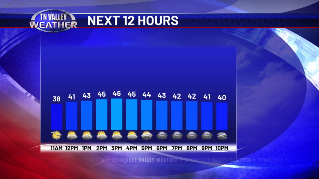
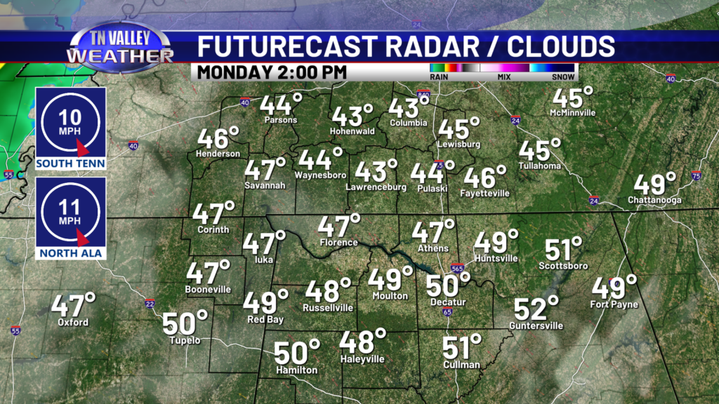
The Tennessee Valley stays dry for the rest of today, but showers move in overnight, mainly after midnight. Rain moves out by lunchtime, giving us a little break from rain before much more arrives Wednesday. We will experience multiple rounds of heavy rain with embedded thunderstorms Wednesday and Thursday, as early as Wednesday morning. Wednesday holds the potential for the heaviest rainfall totals, which we will have to watch for flooding potential.
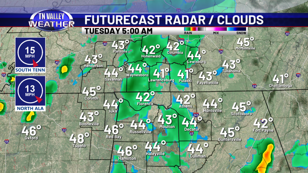
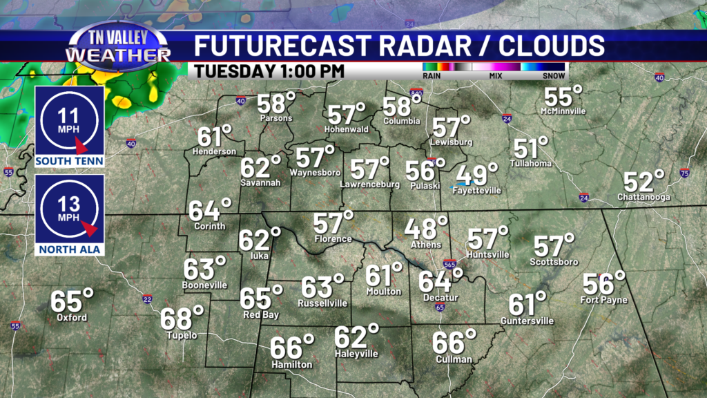
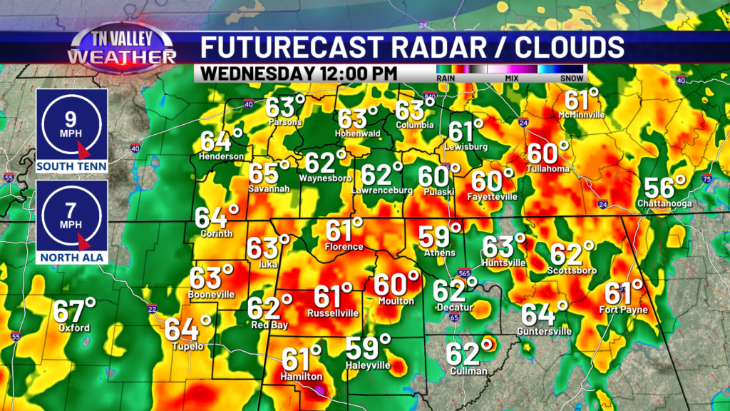
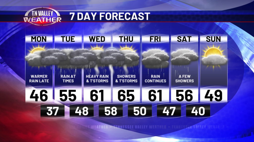
Rain chances will be going up as confidence increases, I see a few 100% chance blocks in our future this week. The highest chance for rain looks to be Wednesday into Thursday, but moisture hangs around through Saturday.
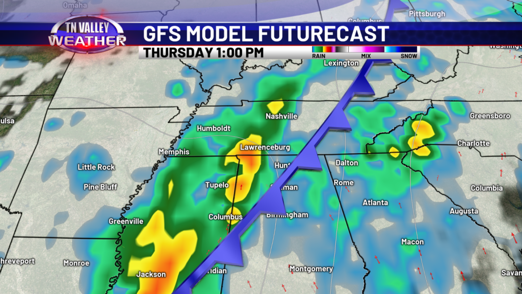
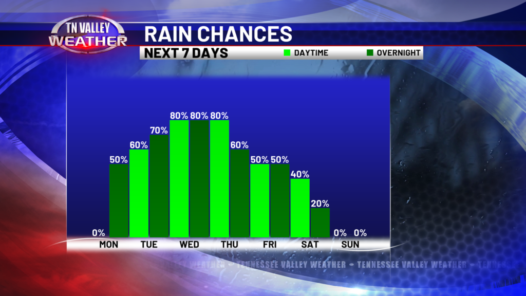
As far as rainfall totals by the end of the week, a solid 3-5 inches is certainly in the realm of possibility, if not some locally higher totals. Expect many gloomy days ahead, with the highest flooding potential Wednesday and Thursday. Check out the temps, too! We’re warm this week, ESPECIALLY compared to last week. Hello 50s and 60s! The tradeoff, is overcast skies and a lot of rain. We start to dry out and clear out by Sunday, so hang tight and we’ll get through it!
