It’s been something of a busy severe weather season worldwide, and this week has certainly not bucked the trend.
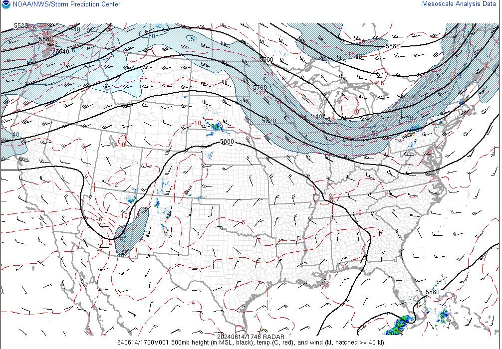
To kick things off, the dominant weather pattern in the US has been that of a broad, high pressure system across the central majority of CONUS, mostly relegating heat to the middle parts of the country, with the more active weather pushed off to the Northern and Southern extrema of CONUS (and into Canada as well) – and we have certainly seen that born out in the last 7 days.
Starting down south in Southern Florida, the last several days have featured an incredible 15-20 inches(!) of rainfall across the area, flooding dozens of streets and stranding dozens of vehicles, and unfortunately claiming 2 lives thus far. As of today, June 14th, a 4th day of intense tropical rainfall is expected across the area, adding an additional several inches locally to already heavily saturated marsh/lowlands of the Miami metro. Of note is the fact that this system is not tropical in the sense that it isn’t a tropical depression/cyclone, but is rather just a large batch of source moisture that stemmed from tropical sources throughout the VERY toasty waters of the Gulf of Mexico (lets keep an eye on this Hurricane season for that reason… it’s scorching down there!).
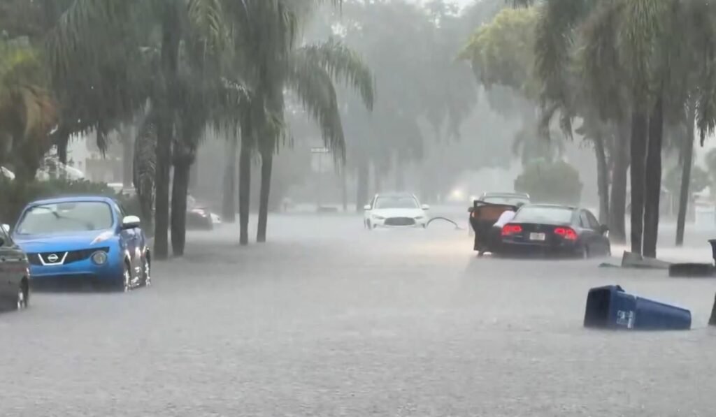
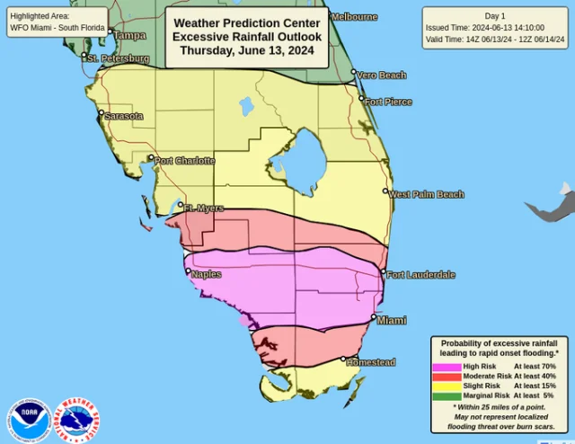
Of note is the fact that, at it’s peak on June 13th, the flooding threat even warranted a rare level 4/4 HIGH RISK of excessive rainfall from the Weather Prediction Center, a risk category only used during higher end events, seen typically only once or twice in any given year. It certainly verified – according to data from the Ochopee weather station operated by NWS Miami, 27.95 inches of rain fell in a matter of 4 days, with a majority of that falling in just 2. For comparison, that is roughly 8 months of that weather stations typical rainfall that fell in a matter of just 72 hours!

To the North, something of a minor, localized tornado outbreak took place over the last several days, with tornadoes spotted in Quebec – fortunately, no casualties have been reported, but heavy damage to homes and vehicles have been reported in isolated spots, with surveys ongoing to determine the exact strengths of the tornadoes, and how many touched down. While it may seem bizarre, this sort of event is not without precedent – as we exit the “core” of the warm tornado season (March – May), a secondary High Plains tornado season often takes hold, and Southern Canada is no stranger to seeing impacts from this sort of pattern – in fact, Canada averages 230 tornadoes annually, which, while not exactly the ~1,000 of the US, is still a substantial figure climatologically speaking.


Across the ocean in the Jiangsu province in Northeastern China, several tornadoes were reported and captured by residents on Social Media from June 12th to June 13th, with heavy damage reported in several rural villages and some injuries resulting as of current reports. This is only the most recent tornado event spawned by a relatively active Chinese severe weather season – from March to June, Eastern China (considered China’s Tornado Alley) saw 4 tornado outbreaks of similar magnitude or greater (which is to some extent not a huge surprise when considering the extreme activity seen across the Pacific in the CONUS region over the same time frame). Indications point to calmer weather in the region, so recovery efforts will have that working in their favor. Better, drier, HOTTER conditions will dominate CONUS as well, so expect heat to be in next weeks discussion!
This paragraph is truly a pleasant one it helps new internet users,
who are wishing in favor of blogging.