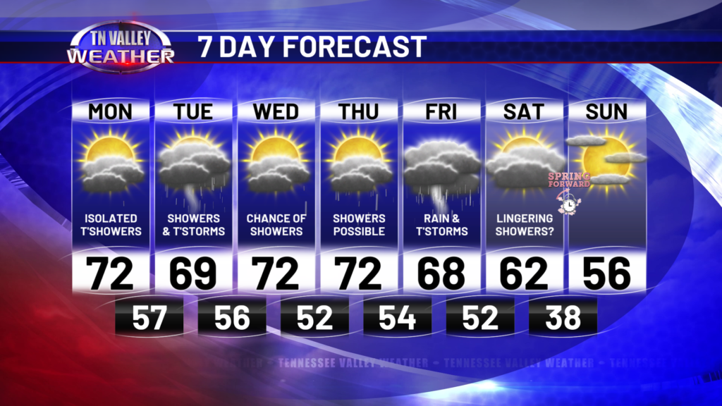
It’s been a mostly cloudy morning for *most* of the Tennessee Valley this morning. Some of our western counties have seen sunshine, and they broke into the 70s a while ago! I do expect mostly cloudy conditions to continue this afternoon, but if there are any breaks in the clouds, it’s going to feel much warmer quite quickly! That being said, those of you with thick cloud cover all day may stay in the upper 60s for highs. Those of you who see sunshine may reach the mid 70s!
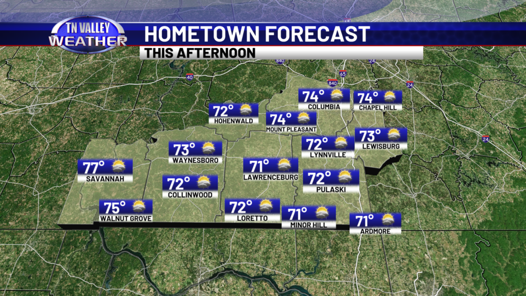
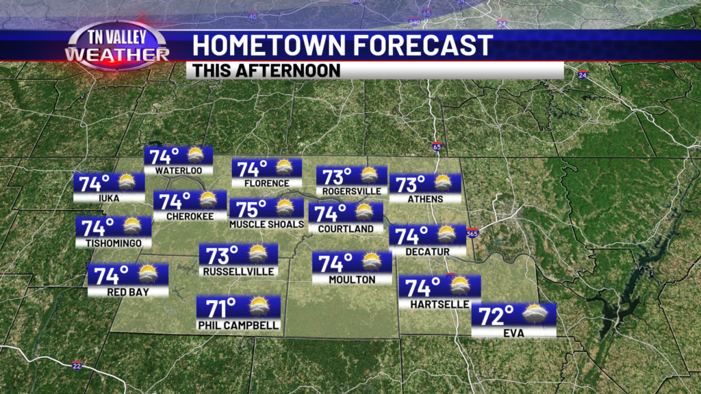
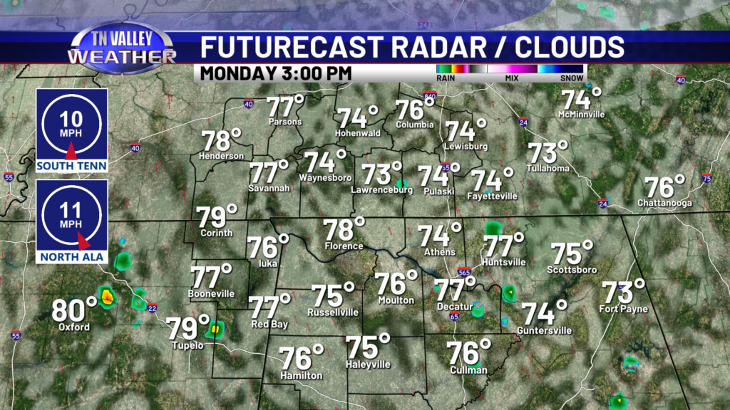
We do have a very spotty, isolated storm chance this afternoon, as depicted on our in-house Futurecast model. Chances are NOT great, but they are not zero either. Futurecast is too warm with this afternoon’s temperatures due to its lack of modeled cloud cover. We will stay mostly cloudy overnight with a few spotty showers potentially sneaking through the area.
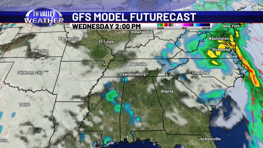
For Tuesday, the early afternoon will be mainly dry, and models are still trying to figure out whether we will be impacted by a storm system diving in from the north, or a storm system swooping up from the south. You can see the two separate system in the last two Futurecast frames. As for our forecast, we are expecting rain and Storms Tuesday evening and overnight, where the system comes from doesn’t really matter. I could anticipate more thunder and lightning with the northern system, but instability will be present regardless. Not enough for severe weather, but enough for some thunder!
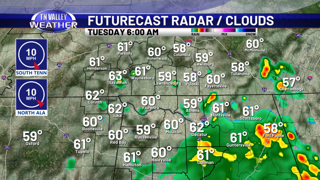
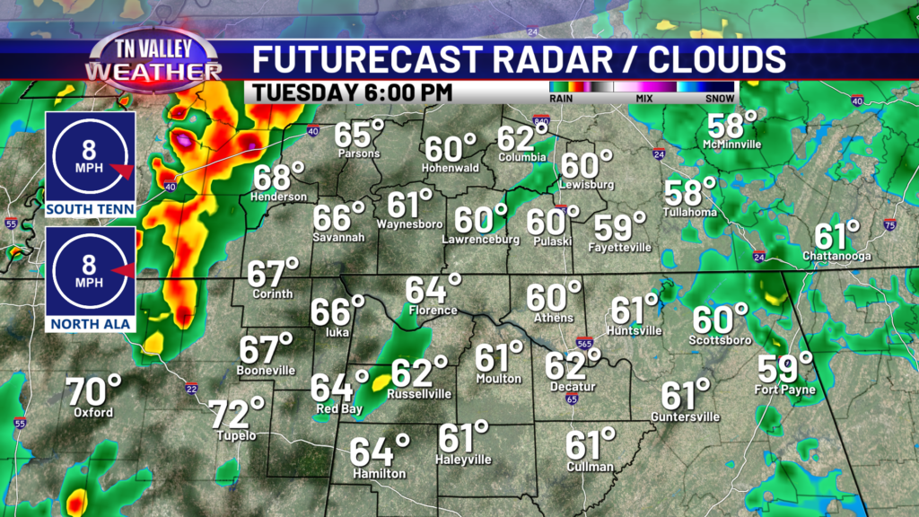
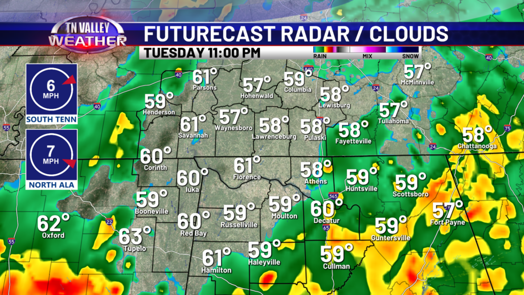
Wednesday’s rain chance is small, so we will call this day our break from the unsettled weather. A spotty shower or two can’t be ruled out, but Wednesday is trending dry. A few showers will be around throughout the day Thursday, but widespread rain and thunder moves in Thursday night into Friday morning. That moisture should be out by mid to late afternoon, setting us up for a nice weekend!
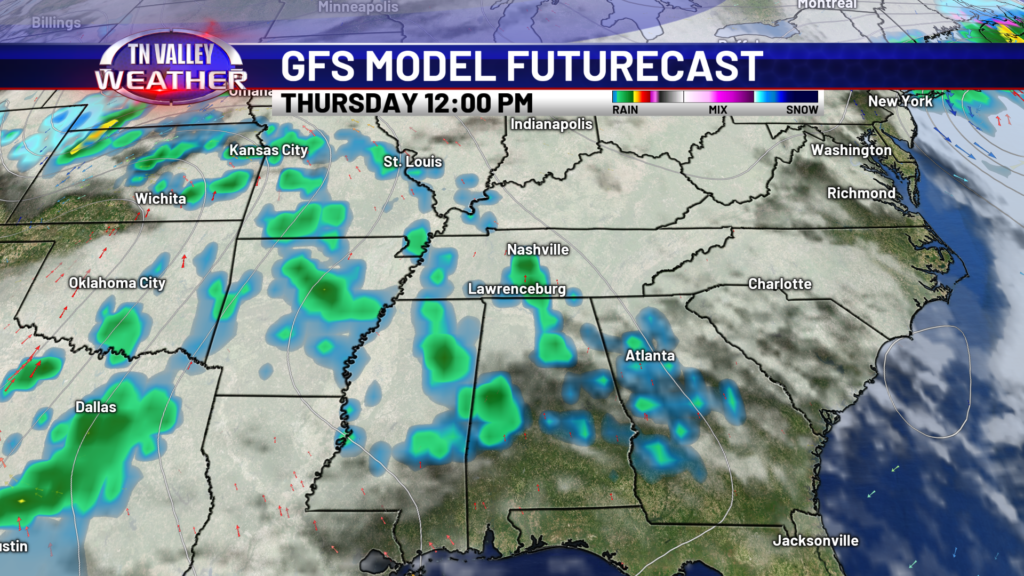
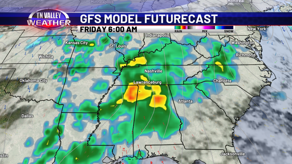
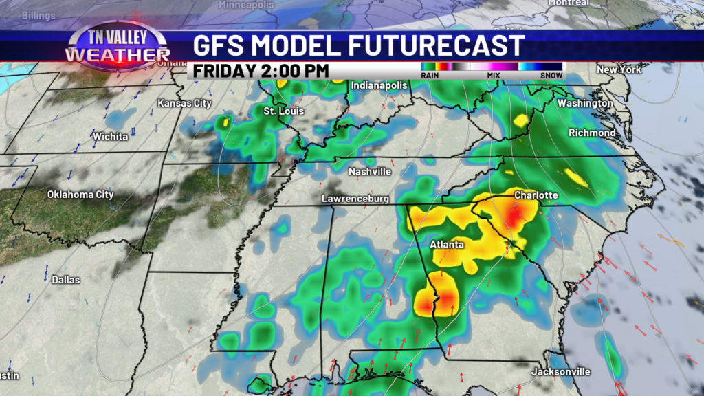
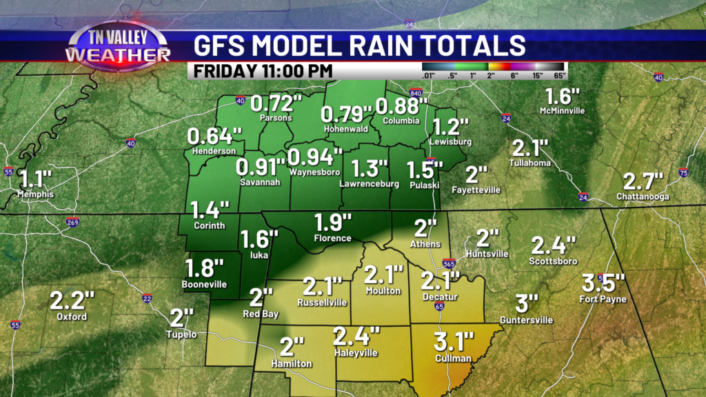
We have multiple rain chances, but models have started to back off on rain totals a bit. That doesn’t mean these numbers won’t continue to fluctuate. Overall, 1-2 inches is a pretty good bet through Friday evening.
While our weather here in the Tennessee Valley will be quite unsettled and gloomy this week, at least the temperatures won’t feel too bad. Upper 60s to lower 70s are expected for highs this week, until we cool off this weekend once the rain is gone. Saturday will be mainly dry aside from perhaps a few lingering morning showers. Sunday looks great, just a little chilly. DON’T FORGET! We spring forward this weekend. Hellooo later sunsets!
