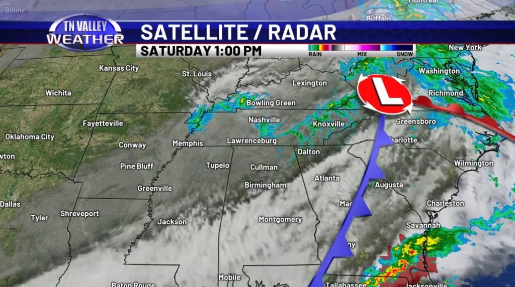
That cold front sure knows a thing or two about bad timing. It seems like we’ve been in this little stretch of warm Spring-like weather, just for the WEEKEND of all times to come crashing down. What luck, huh?
We’ve been stuck in the 50s (and even 40s) throughout the Valley today, and we’re only going to be getting cooler. Combine that with the widespread overcast skies and the very sharp NW winds at 15-20mph, and you have yourself a solid “stay inside and drink some hot chocolate” day.
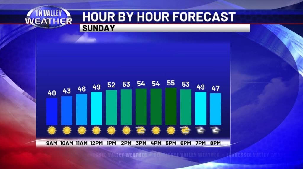
Not seeing many signs that tomorrow will be much warmer (in fact, we’re likely going to stick around in the mid-50s, with freezing temperatures returning tonight and into tomorrow morning), but on the bright side, we will have some crystal clear skies to wrap our weekend up. It’ll still be a bit gusty outside, so you may want to keep that light jacket on hand, but I am increasingly starting to believe that tomorrow will be the last day we need any sort of winter apparel for quite some time, at least looking into the workweek ahead.
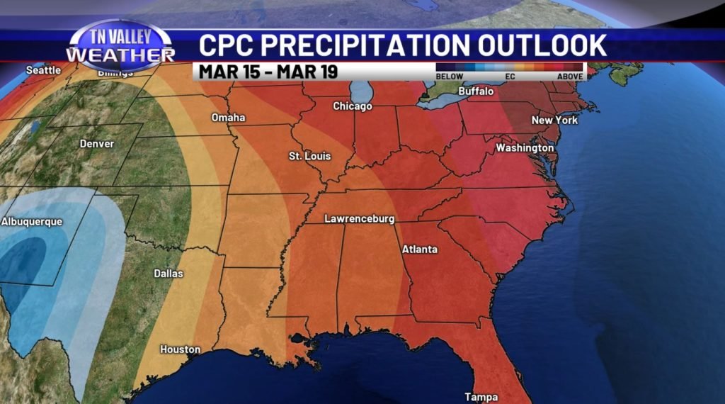
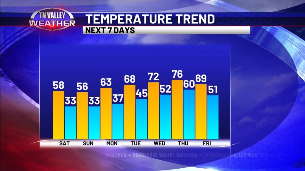
In fact, all trends point towards us getting right back into that well-above average temperature range as we progress into the next 5-7 days (and frankly, very likely into the first week of Spring itself). As soon as Monday rolls around, we’re right back into the lower-mid 60s, and by Tuesday, I would be willing to wager at least a few of us are seeing temperatures hit 70. Past that, all bets are off – we’ll be squarely in the mid to upper-70s as we enter the midweek, with mostly dry conditions at least through Thursday, though you may not be surprised to hear that with this unseasonable warmth comes more thunderstorm chances as we wrap this coming week up and start to approach next weekend.
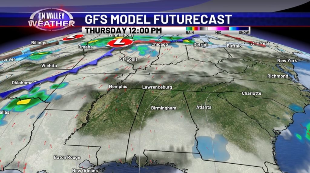
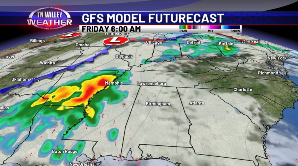
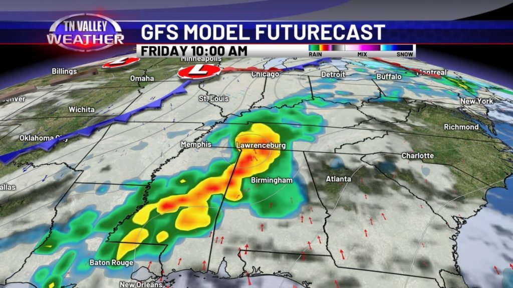
There has been some variation in the modeling so far (and there will continue to be some waffling back and forth until we get into within a few days of it), but there is solid agreement that, as of now, it seems we’ll be contending with these storms as a system pushes eastward late late Thursday, with our highest chances lasting from Friday morning and into the weekend. Looks as of right now to be a heavy rain and thunderstorm issue, with maybe some stronger storms mixed in the batch, but as of current indications, I am not seeing signs of some notable severe weather occurrence coming at us. We’ll watch it and keep you updated on the timing and more as we get closer to this system… but we’re approaching the stormy time of year, so no shockers here!
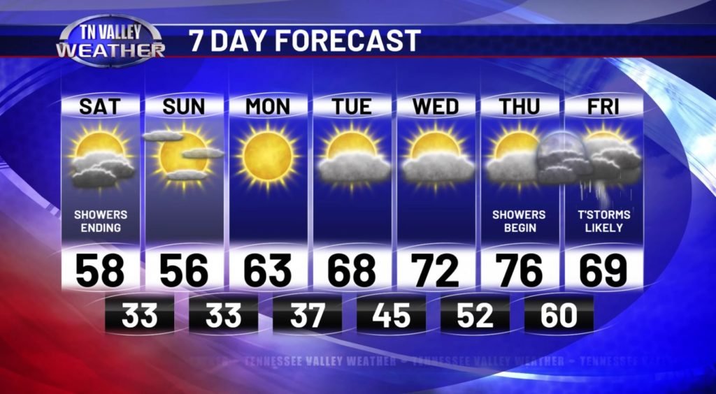
All and all, I think this we have an awesome week to look forward to. For the majority of it, we’re basically dry – granted, patchy clouds may linger each day, but generally sunny and 70s is hard to beat for early March. I suspect that Thursday is very likely going to be our best day all around – I’m convinced as of now that essentially most of the useable chunk of the day will be dry and partly cloudy, and that’s also our best shot at seeing those temperatures inch into the 76-78 range… so go take advantage of this early Spring!
