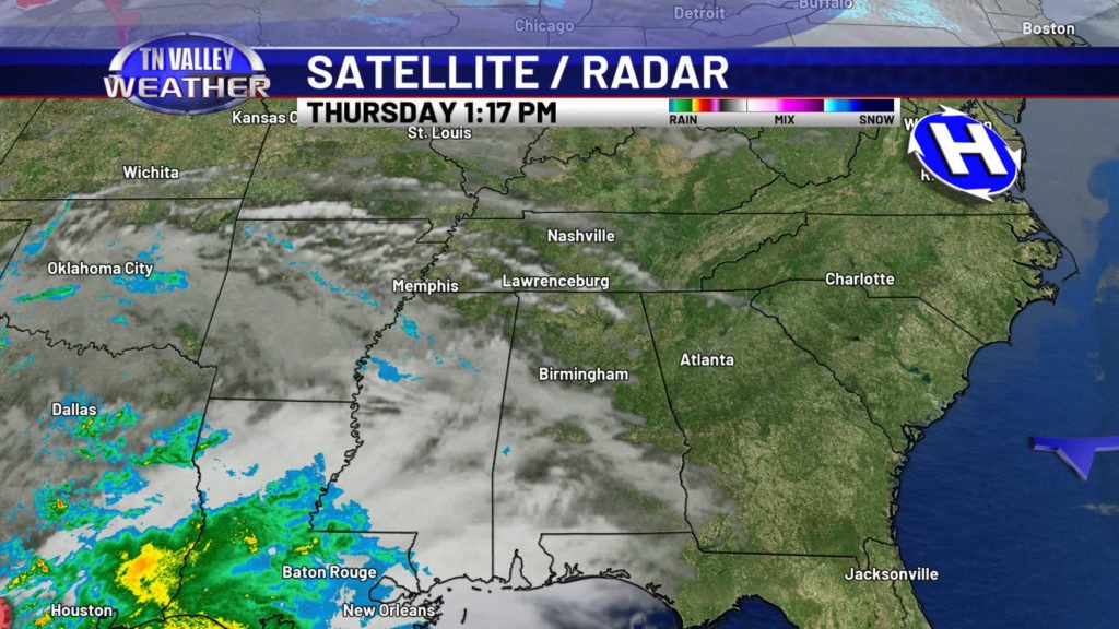
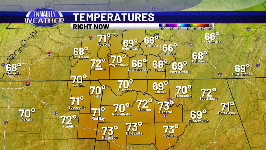
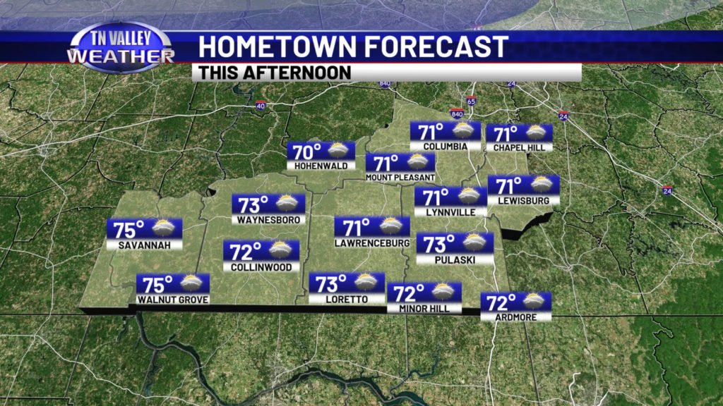
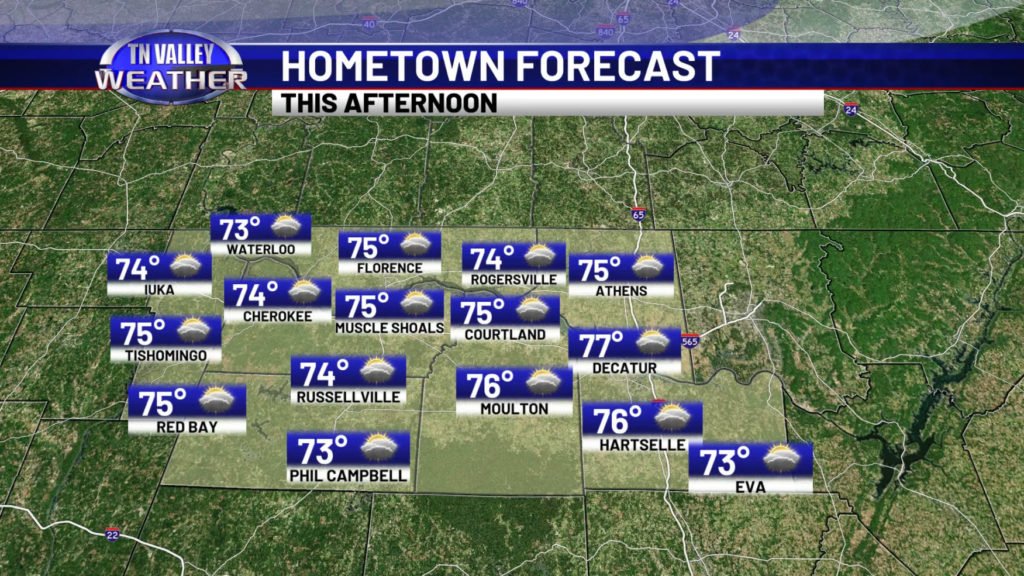
We’ve had some sunshine across the Tennessee Valley on this Thursday, but clouds are beginning to thicken up ahead of the next weather system off to our southwest. Temperatures are mainly in the upper 60s and lower 70s as of the early afternoon, but I expect us to climb into the low to mid 70s most areawide for highs before the day is out, with a few more hours of daytime heating left.
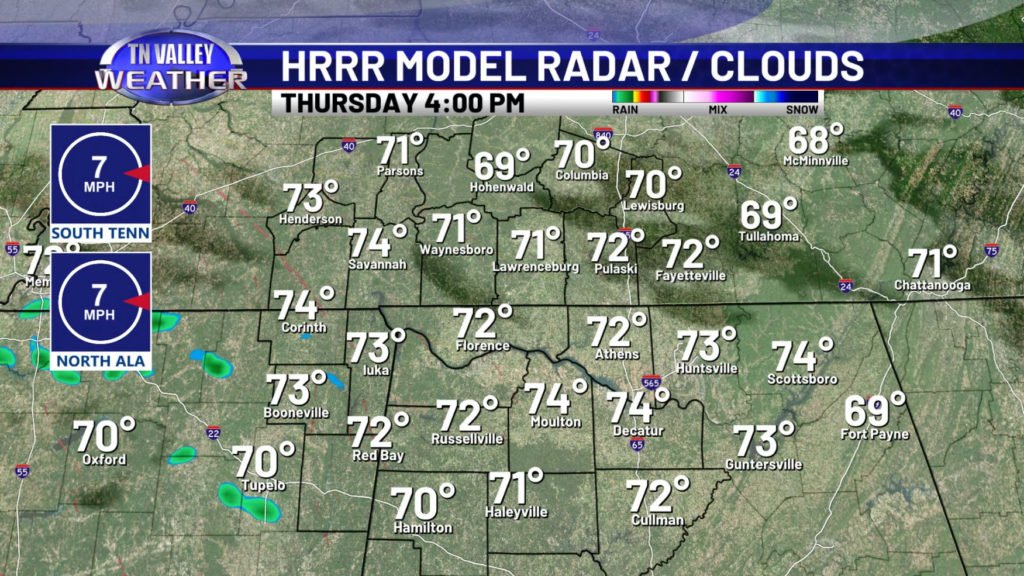
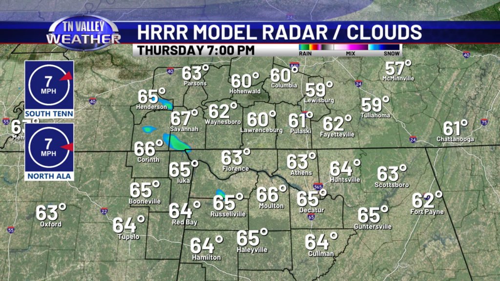
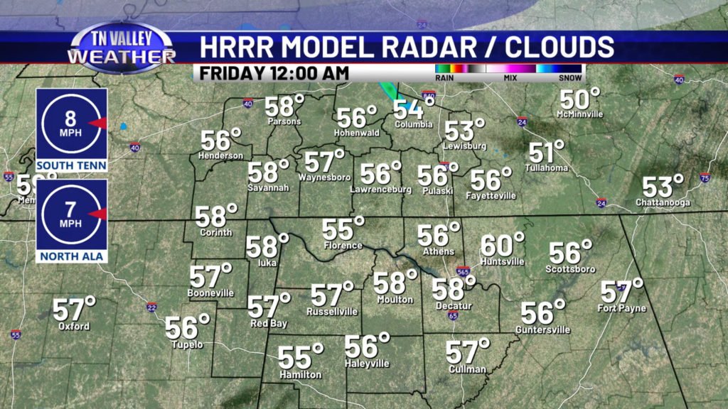
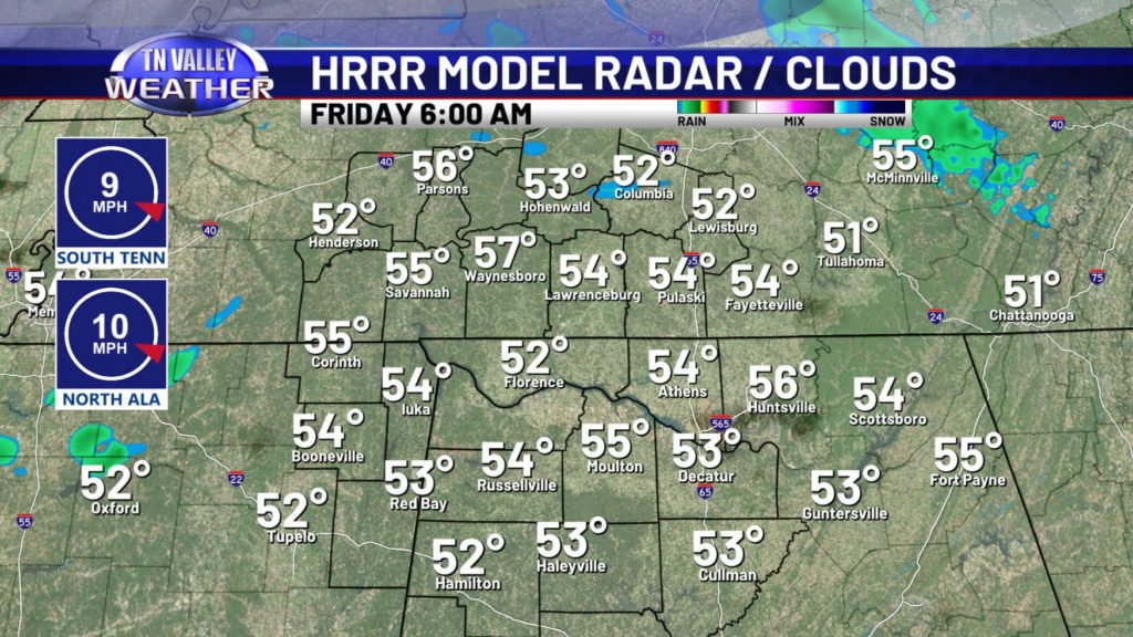
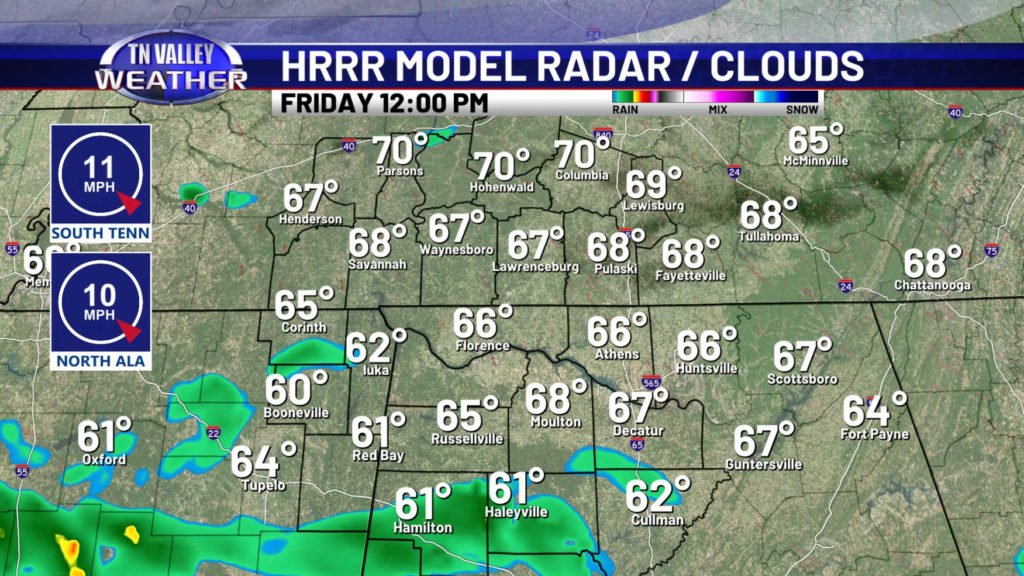
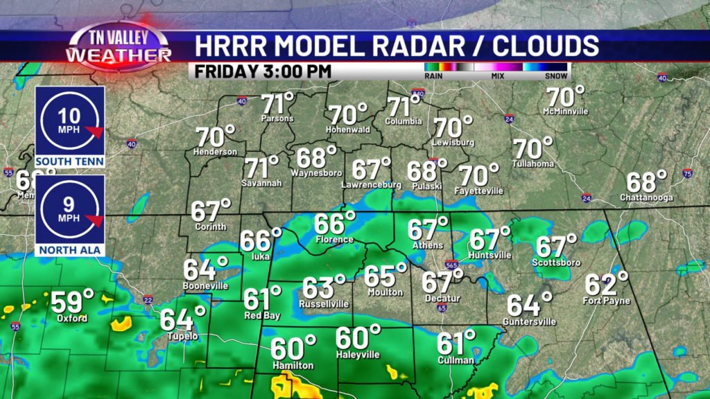
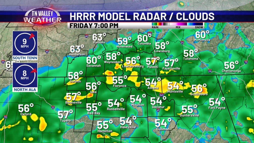
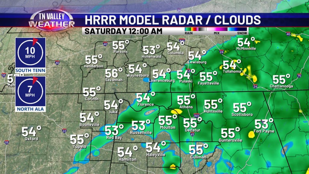
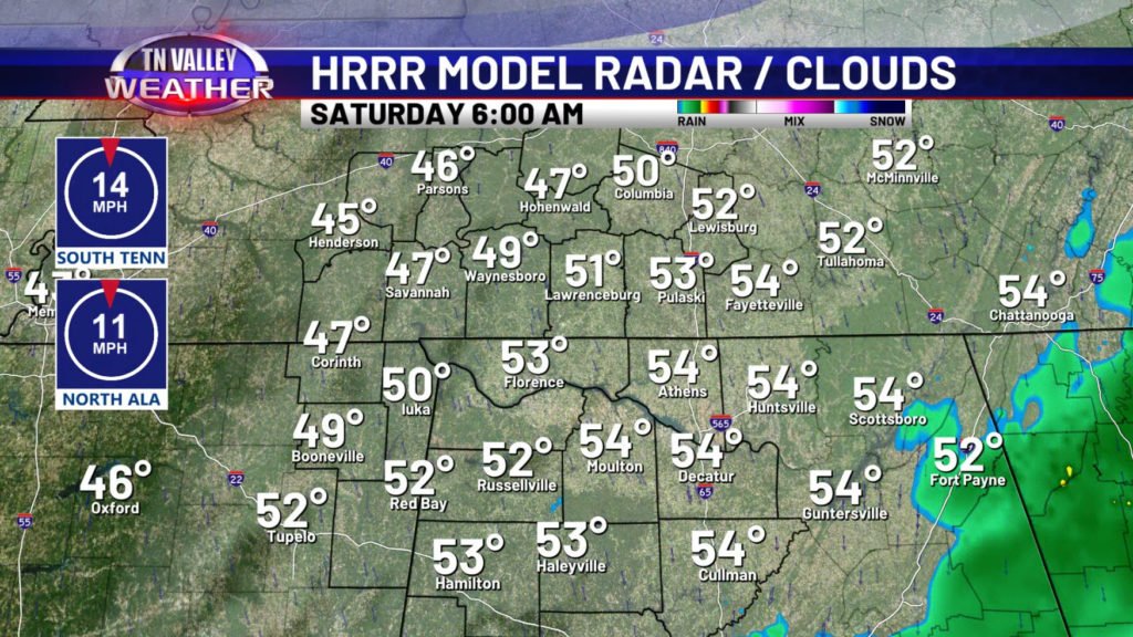
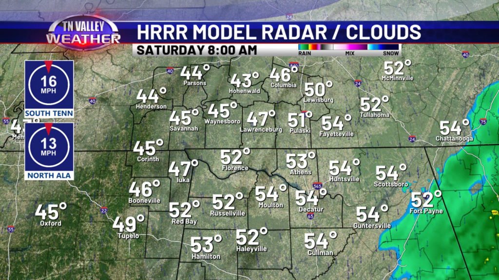
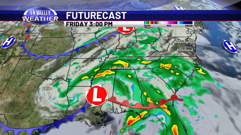
Clouds will continue to thicken the rest of today and tonight, and we might even see a few spotty showers this evening or during the overnight. Rain coverage will be very limited, however. The main weather system pulls northeast across our area going into Friday, and rain chances increase by the late morning to afternoon. No severe storms are expected, but rain is likely, and a heavy downpour here and there is possible. Rain continues on into the evening for Friday before shifting to the east before we get to Saturday morning.
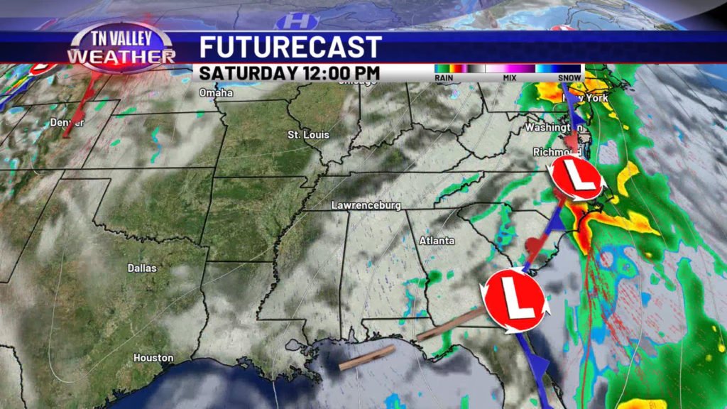
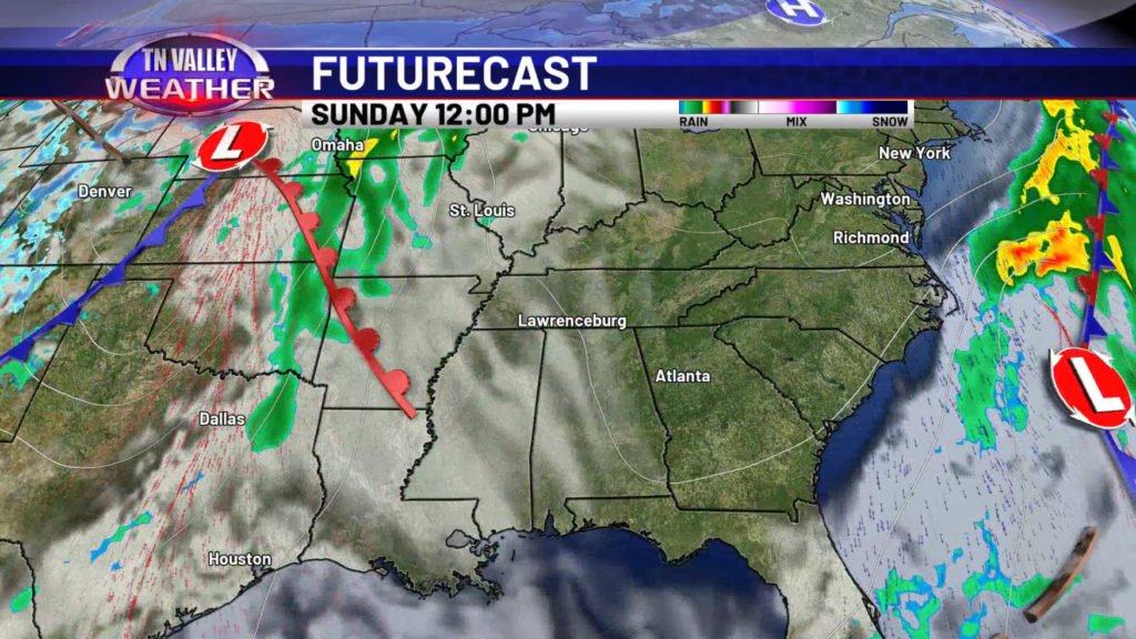
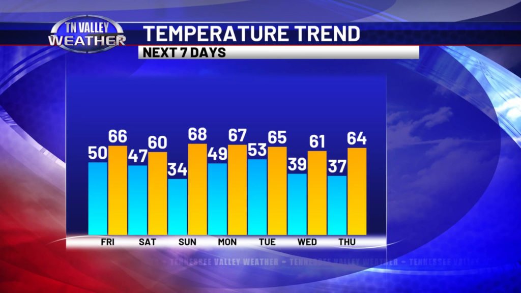
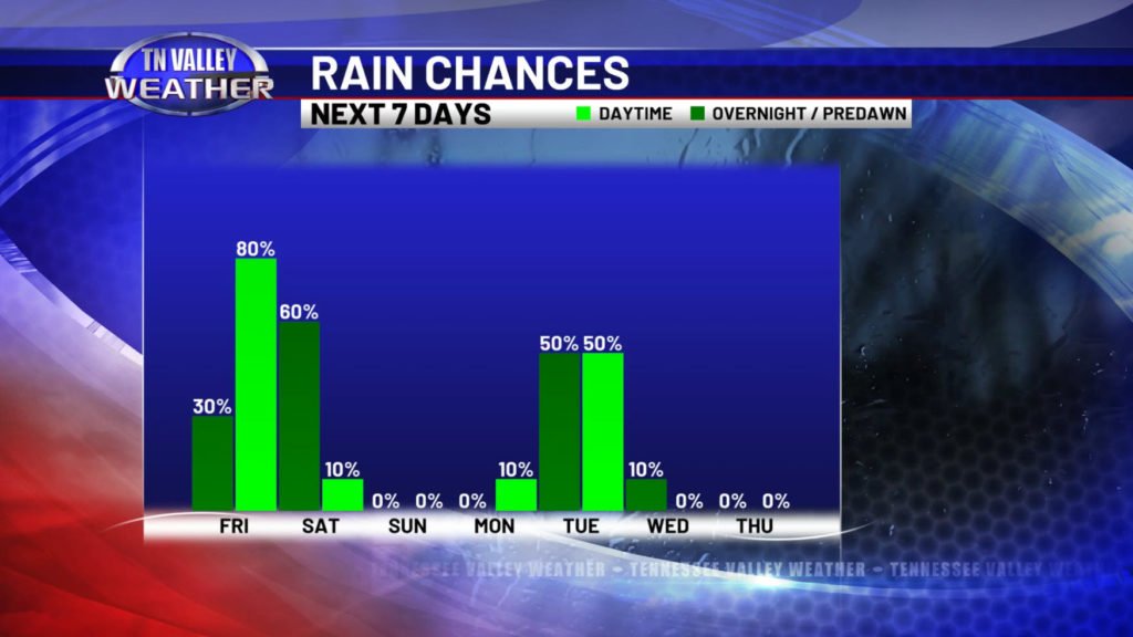
Drier and slightly cooler air moves in temporarily behind the system. Daytime highs for Saturday only look to get into the upper 50s to lower 60s, and we might be flirting with patchy light frost again by daybreak Sunday morning. We do have a quick warming trend going into Sunday afternoon and early next week though with daytime highs back into the upper 60s to lower 70s. This is ahead of the next system that brings rain and thunderstorm chances to our area Monday night into Tuesday.
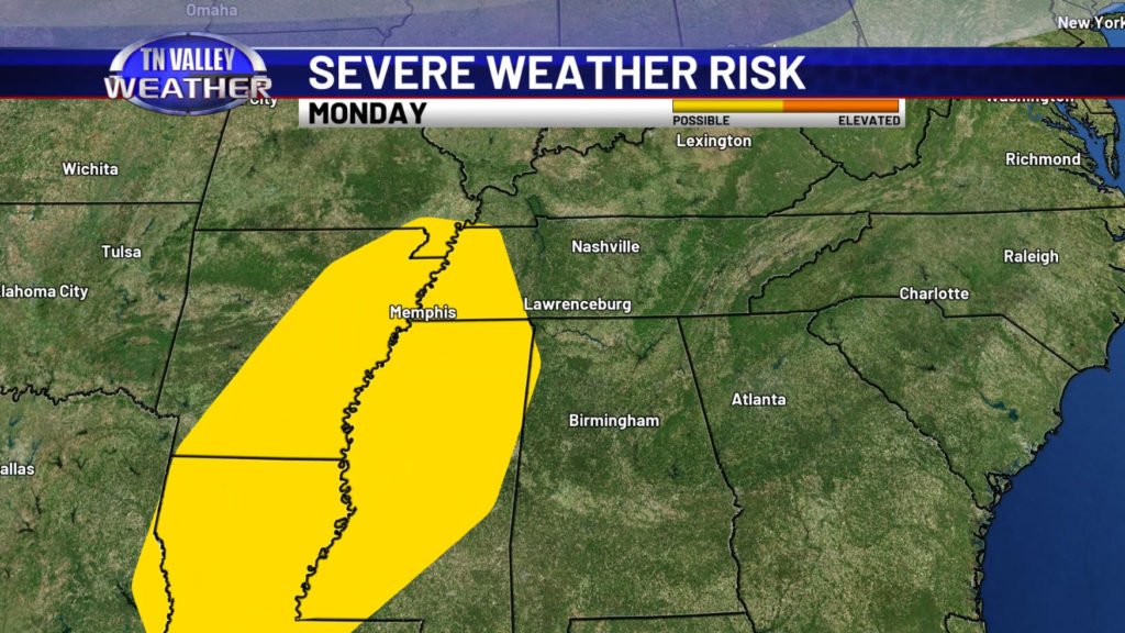
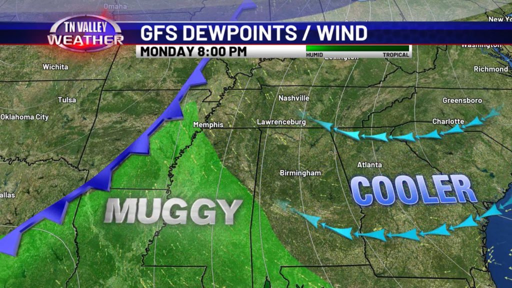
The NWS Storm Prediction Center has already placed areas just to our west in a risk of possibly seeing severe storms with that system Monday into Monday night. However, this looks like one of those cases where there’s easterly flow of cooler and stable air from Georgia and the Carolinas that “pinches off” the humid and unstable air to the south of our area. We will keep watching in case that tries to change, but as of how things currently look, that would likely keep any risk of strong storms shifted to the south and west of our area…. and to be honest, a lot of the model guidance even looks a bit questionable about this risk even to our south and west! We’ll continue to monitor things to see how it all shakes out, and we will provide updates as needed, but we get the idea that risk area might have been put out a little prematurely…
