Tennessee and it’s surrounding neighbors are no stranger to tornadoes.
One only needs to look back at the Spring of last year – 2023 – to see that the state was host to the strongest tornado of the 3rd most widespread tornado outbreak in American history – and the long-term trends aren’t painting any more favorable of a picture.
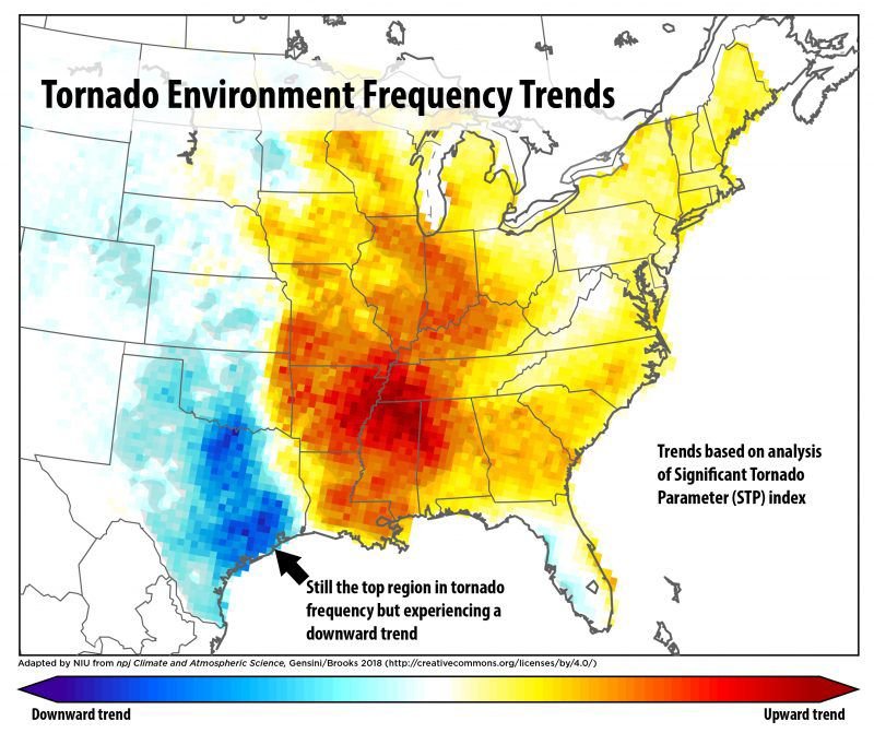
A team by led by Victor Gensini from Northern Illinois University performed a multi-year analysis using the “Significant Tornado Parameter”, a tool used by meteorologists to analyze how favorable the atmosphere is for tornado activity, and found a dramatic upward trend in the likelihood of impactful tornadoes over much of the Southeastern United States, with the highest bullseye being painted over Northern Alabama, Mississippi, and Southern Tennessee, with slightly more elevated possibilities extending as far as the Carolinas.
These long-term trends have been duly noted by the National Weather Service, and from 1988 to 2011, one of the most robust radar networks in the world was installed to help remedy the shortcomings of the sparsely-placed radars of decades past – and it worked.
Almost.
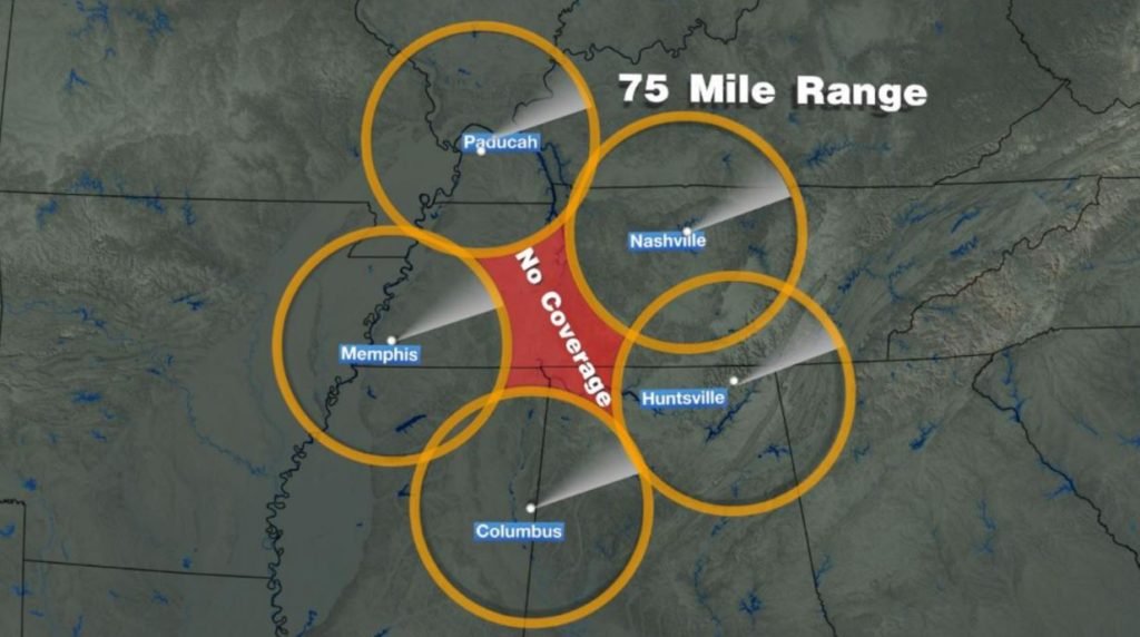
Despite the apparent completion of the network ending in 2011, our region – especially Southern and Middle Tennessee, notable for the aforementioned trend of leading the nation in increasing tornado probabilities – has been left without a local radar in the network, meaning a population of some staggering 1.5 million residents stretching from Humphreys County, TN to Lawrence County, AL have zero low-level, tornado detecting radar coverage; and haven’t for decades.
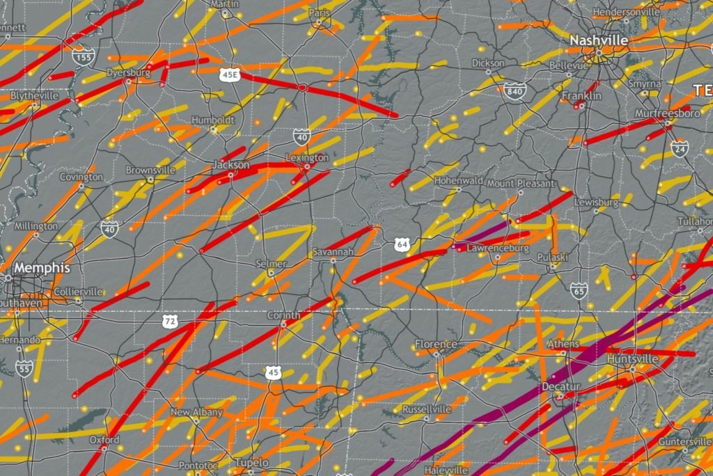
This fact is doubly concerning when the preponderance of significant (EF/F2+) tornadoes since 1950 is considered.
From 1950 to 2023, almost 100 significant tornadoes have impacted the previously highlighted region – of which almost 2 dozen were E/F4 or E/F5, the most intense tornadoes possible based on the current understanding of the Fujita scale (winds equal to/greater than 200mph).
Moreover, this is to make no mention of the hundreds of detected – and undetected – weaker, still-dangerous tornadoes that happen almost every season in this portion of the country, with one recent example being that of the series of EF-1 tornadoes that struck Lawrence County, TN in February 2020 without warning due to no low-level radar coverage, injuring 1 and doing more than 1 million dollars in damage.
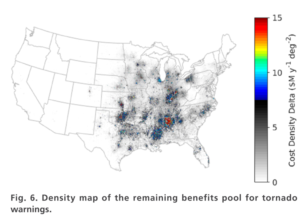
It was this confluence of factors that sparked a team of 32 scientists, led by Mark Weber of the Cooperative Institute for Mesoscale Meteorological Studies, to investigate just how much the true benefits of new radars could benefit portions of the United States, with a special focus on tornado prone regions.
Considering the previous factors we’ve been talking about over the last few minutes, the results aren’t shocking.
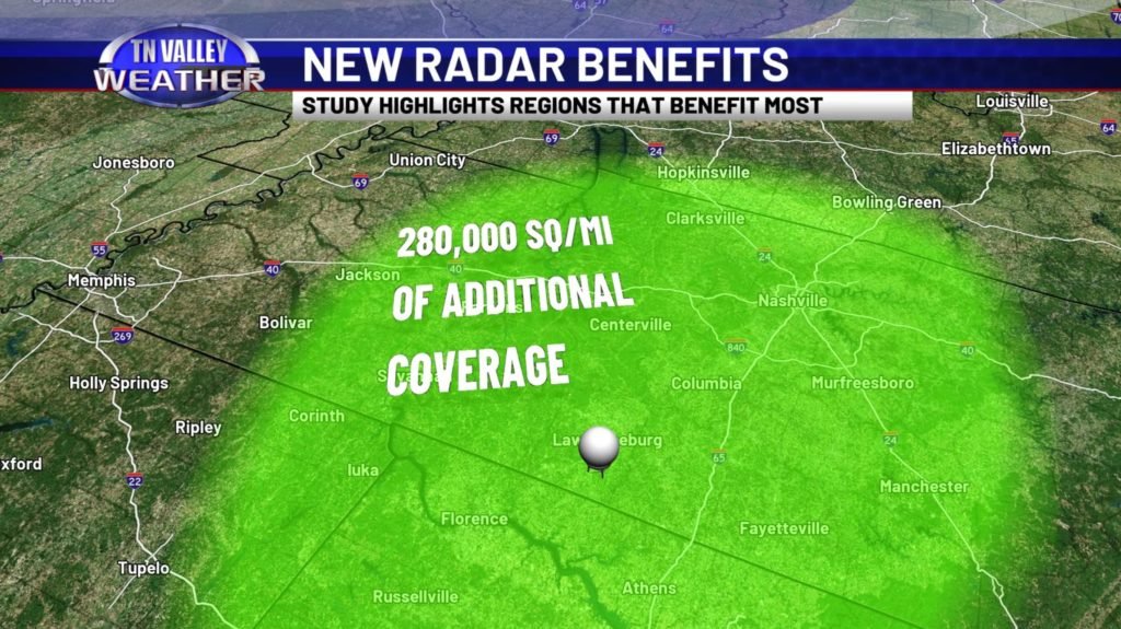
One of the key takeaways was that, by a significant margin, the area that seeks to benefit to most from additional low-level radar coverage and it’s resultant economic and safety benefits was a stretch of TN and AL. Overall, the study revealed that nationally, saving benefits of up to nearly $700 million dollars are possible when considering the cumulative impacts of severe weather, and dozens – if not hundreds – of additional lives could be saved. This data considered factors such as financial burden incurred by injuries, clean-up crews, and the opportunity costs lost due to impactful severe weather.
Notably, the study also revealed that, when considering a hypothetical new radar somewhere near the TN/AL state-line, the combined economic benefits per year – not just one time, but annually – for the aforementioned stretch of poorly covered counties (NW TN to NW AL) was just shy of $10 million dollars assuming 1-minute data updates. Assuming a linear relationship between scan frequency and benefit savings, some $21 million dollars could be saved annually with modern radar technology scanning at 20 second intervals, as many non-government radars do in this age.
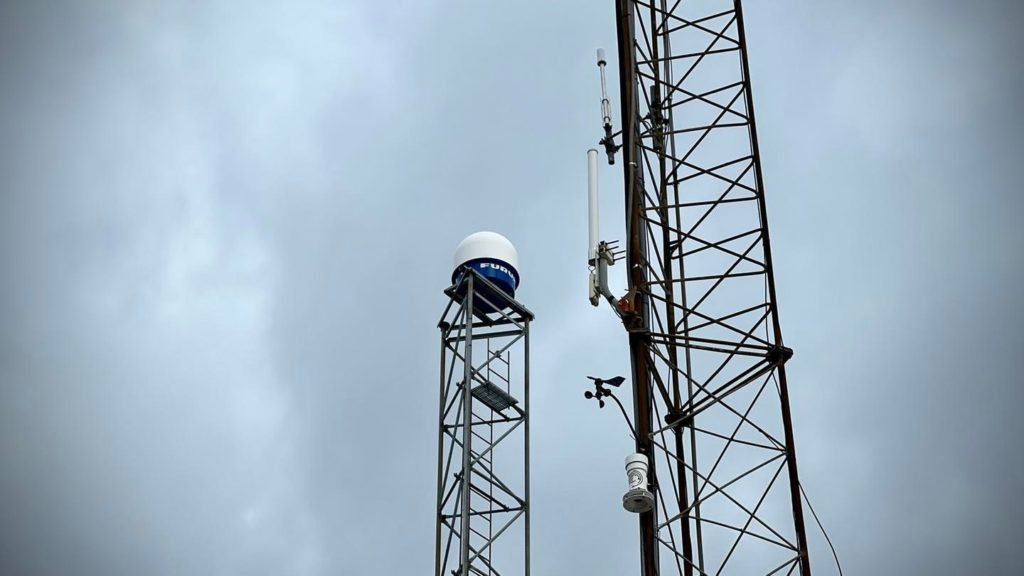
In 2020, Ben Luna and team members at Tennessee Valley Weather made it a point to obtain a compact, locally scanning radar to prove that a larger radar is necessary in this region.
And it worked.
In it’s 4 year lifespan, it captured numerous tornadoes, squall lines, pop-up thunderstorms, flood events, snow, and more – all with a limited range of just 40 miles. A full-power radar, scanning up to 300 miles, would, once and for all, lift the weather blindfold currently worn by residents of much of Middle TN, Southern TN, and Northern AL, according to Ben Luna, the Managing Meteorologist at Tennessee Valley Weather. “It’s laid the groundwork perfectly. To me, and to my entire team, it honestly proves that something that will fix this gap permanently – this huge, ominous information gap across this portion of the country – is within arms reach.“
When asked about similar efforts being undertaken by companies such as Climavision, who is installing a network of similar compact, X-band doppler radars, Luna remarked that, “The difference in data quality, among other aspects, is astonishing between these ‘bands’. Are X-band radars good for certain applications? Absolutely, but they have many major drawbacks. The long term fix is simple – a powerful, long-range C-band Doppler Radar. It’s like comparing a game of tic-tac-toe to chess.“
