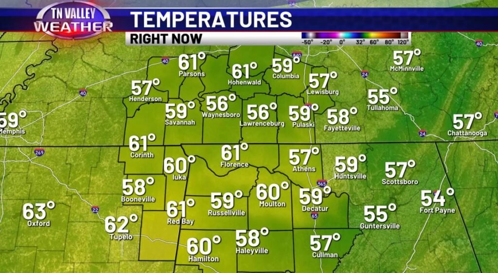
Well, we’ve made it to late April… but you can’t take that fact for granted – 70s and 80s being consistent are no guarantee. Today and yesterday have been a couple days of proof of that; in fact, today is the coolest day of the week, with widespread upper-50s and lower-60s being the story for highs.
Unsurprisingly, that means we’re not entirely done with truly cold overnight temperatures, either – especially in S TN tonight.
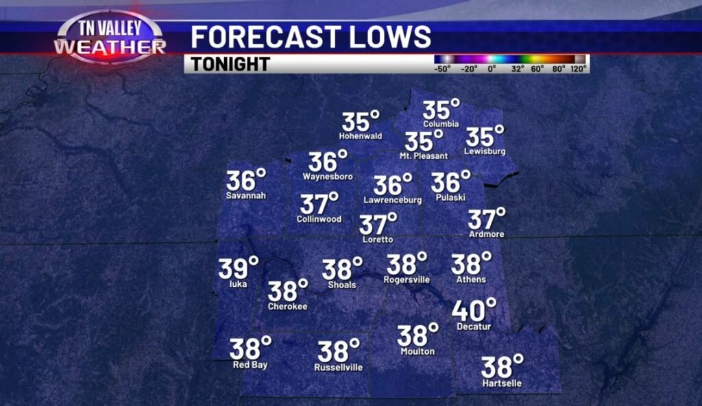
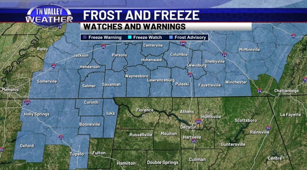
Though freezing temperatures aren’t looking likely in any widespread fashion, the possibility of some frosty conditions exists especially into the early hours of tomorrow morning. All of our Southern Tennessee counties are under a “Frost Advisory” as a result, as well as Tishomingo County in Mississippi. No advisory in North Alabama as of now, but if that changes, we’ll let you know (though, from this forecasters personal perspective, I don’t suspect this’ll happen – temperatures in the upper-30s near 40 will be less conducive for frost conditions south of the state line.) Besides this, no precipitation is expected, and this is the beginning of our few day dry out.
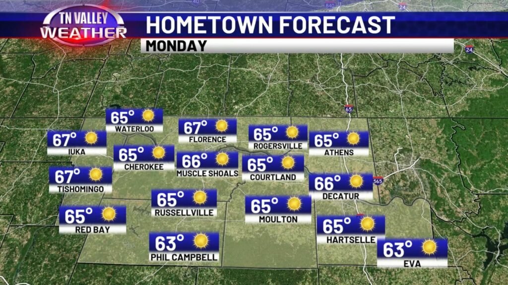
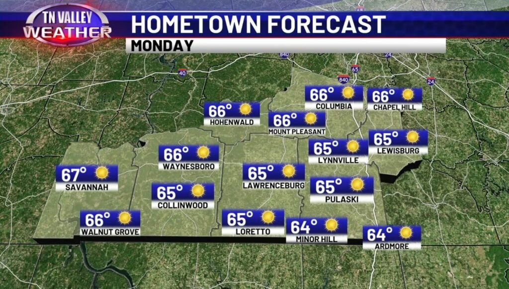
Those drier, clearer conditions really do help pave the way for a warm-up, too. Now, our Monday won’t be host to 70s just yet – we’ll be mostly clear with great skies out, but we’ll be relatively limited in terms of temperatures, with highs expected in the mid-60s (perhaps a couple upper-60s) widespread across the Tennessee Valley.
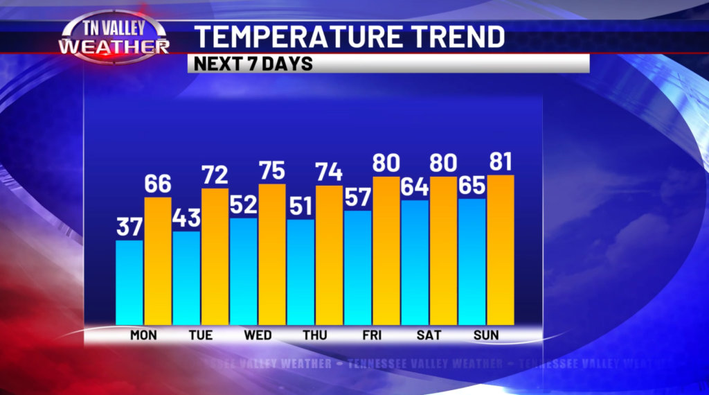
If you’re antsy to get back to Spring though, you won’t have to wait too much longer… Current indications are that 70s will take hold starting Tuesday, and by the end of the week (and especially into next weekend), we’ll be squarely back into the 80s for our daytime highs. Also notice those night-time lows getting back to more mild temperatures as well – interestingly, on average, our last freeze is typically around April 20-April 30, so if the expected patchy frost tonight and tomorrow morning pans out, we’ll be roughly on-track. Can’t make any guarantees, of course… Mother Nature throws more curveballs than ol’ Lefty Grove in the 1941 Baseball season.
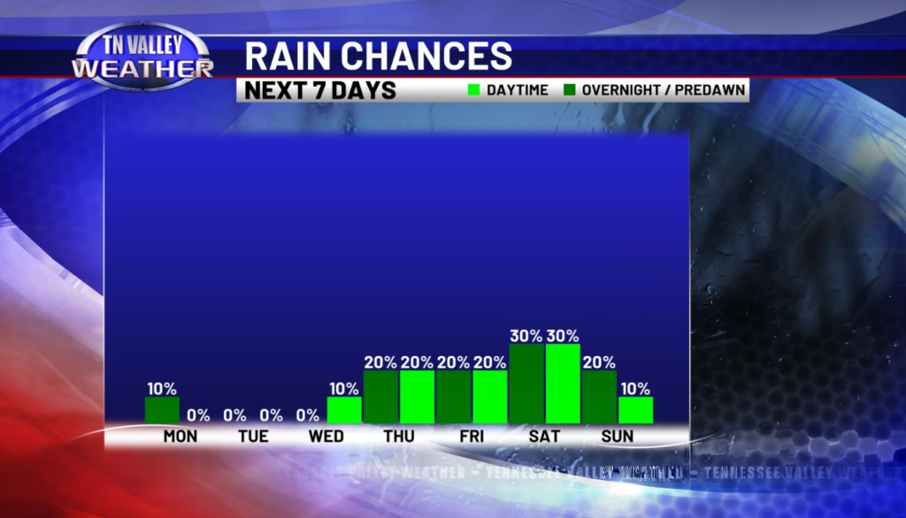
Lastly want to mention the relatively mediocre chance for some precipitation towards the second half of this week – for much of the week itself, probabilities are low, but not necessarily zero, due to the fact that we have SOME energy locally to work with according to a couple models, so a shower or two in an isolated fashion can’t be ruled out… but it’s not looking like too big of an issue by any stretch. It’s more towards the weekend that we start to see the bigger chunk of energy move east into this area, and it’s this time frame with slightly higher rain chances… but even this doesn’t quite look like some big, widespread soaker as of current indications. All and all, I’d say we have a pretty nice week in store – those climbing temperatures definitely doing us favors on that front.
