It doesn’t take a meteorologist to know that it’s been a fairly wet spring so far here across the Tennessee Valley. I don’t think we’ve gone a full week-long stretch without at least small rain chances somewhere in the area for at least the past few months. Fortunately, the rain we have gotten has been fairly spread out and not coming in huge amounts in a short period of time, reducing the amount of flooding we’ve had to deal with locally.
If you pay attention to our monthly climatology posts, you know that our viewing area’s centralized NWS climate reporting station is at the Northwest Alabama Regional Airport in Muscle Shoals. While it doesn’t show exact variations in local weather across the area, data from there does do a good job of being an overall general representation of what our area sees.
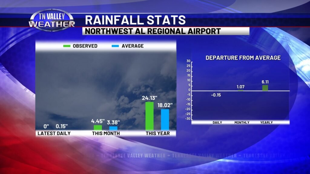
From the start of the year, the Muscle Shoals reporting station has seen just over 24 inches of measured precipitation. That is a little over 6 inches above normal for this deep into the year, putting is into a running surplus for 2024 so far. That includes running slightly above average for this month specifically, with 4.45 inches of rainfall observed, which is 1.07 inches above normal for the month so far.
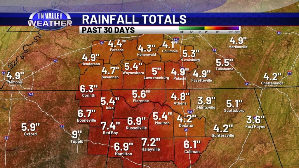
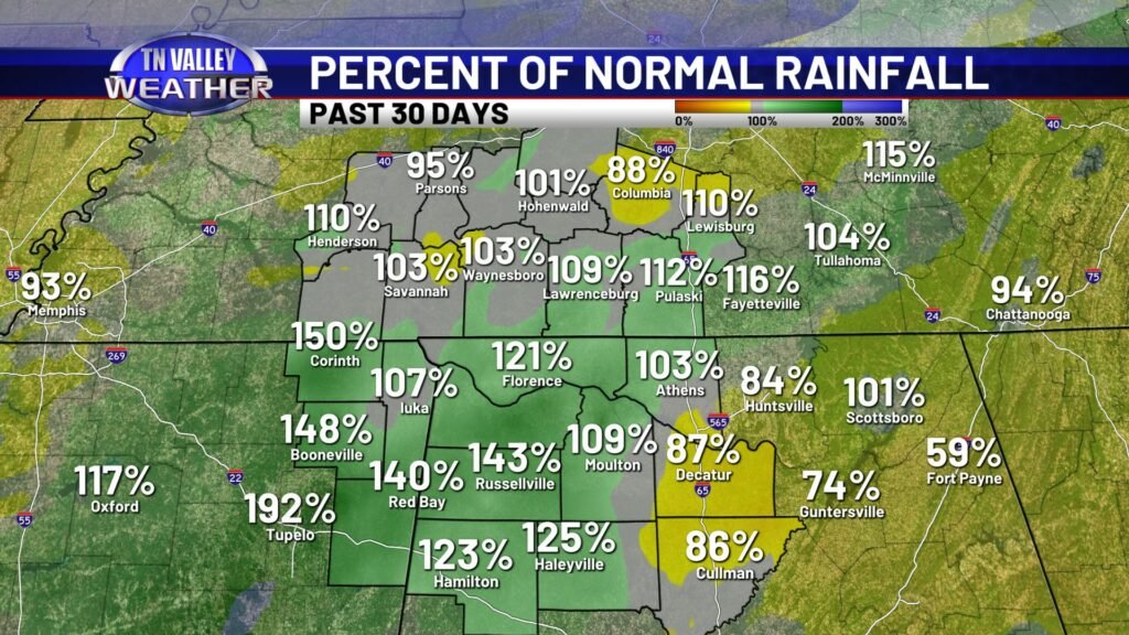
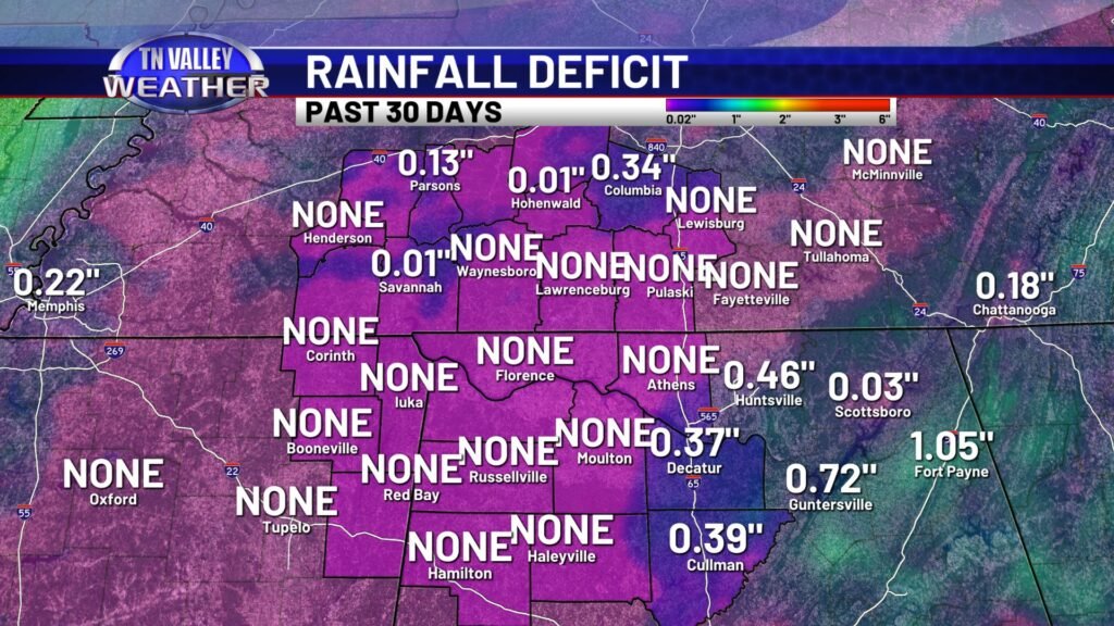
In fact, when we look at the last 30 days across the local region, we are running near to a bit above normal in the rainfall department. Areawide, we have seen a range of 4 to 7+ inches of rain, and this is putting us above normal in many locations. Where it’s not, those areas are only slightly below normal and have 30-day rainfall deficits of less than half an inch.
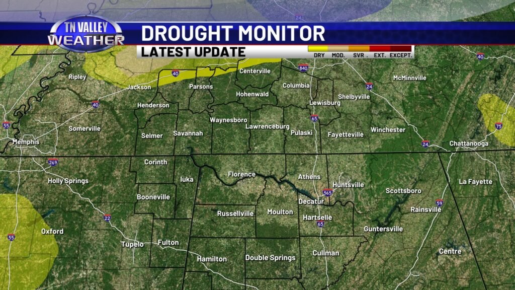
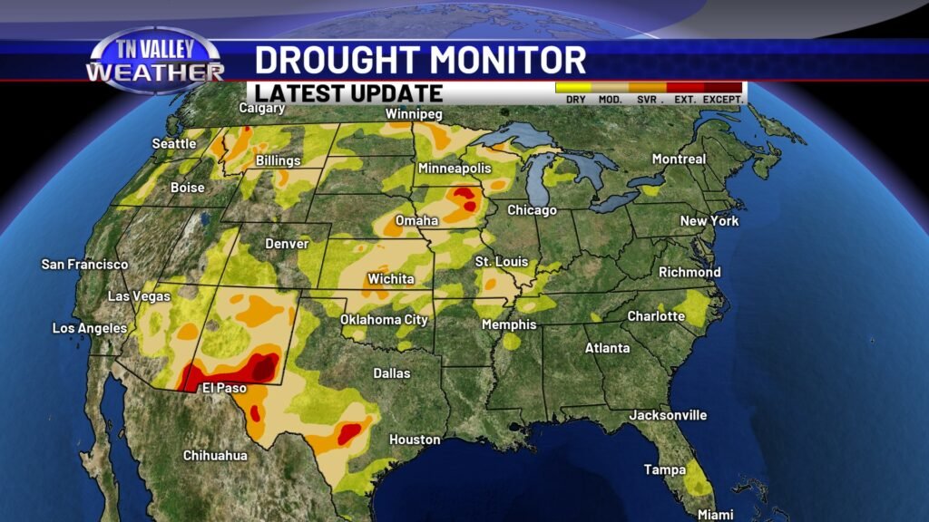
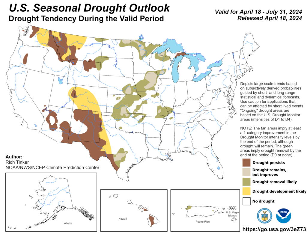
This persistent rainy activity the past several weeks has completely eradicated the drought conditions that have been locked in across our area since last summer. Our viewing area counties have been officially removed from drought conditions by the NWS Climate Prediction Center for a few weeks now, and there has been major improvement in previous drought conditions across month of the Southeast. The seasonal drought forecast that runs from mid April through the end of July calls for no return to drought conditions across our part of the country.
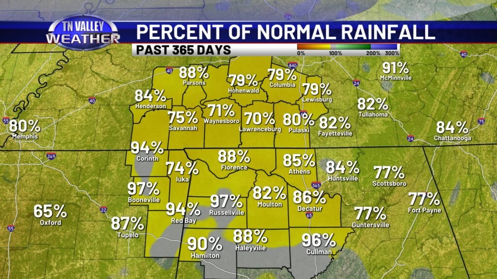
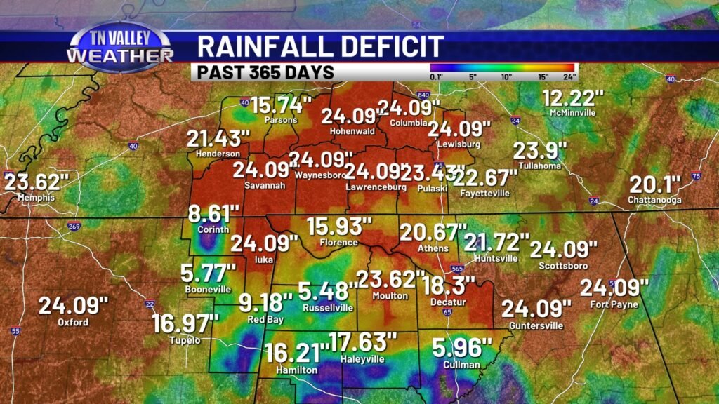
Having said all of the above, there are still long-term rainfall deficits across the area. While we have been above average in rainfall since the start of 2024, we are only at about 70-85% of our normal rainfall for the past 365 days. More noticeable is that most of our viewing area is still running measured 365-day rainfall deficits in the double digits, with much of southern middle Tennessee running 2 FEET or more below normal. The rain we’ve had the past several months has helped to overcome our dry soil conditions, help raise water levels in area lakes and streams, and has helped our local agriculture. However, the above long-term deficits show that we need to stay fairly regular with rainfall the next several months in order for that to remain the case. It wouldn’t take too long of a significantly dry period for us to lapse back into drought conditions later in the year.
