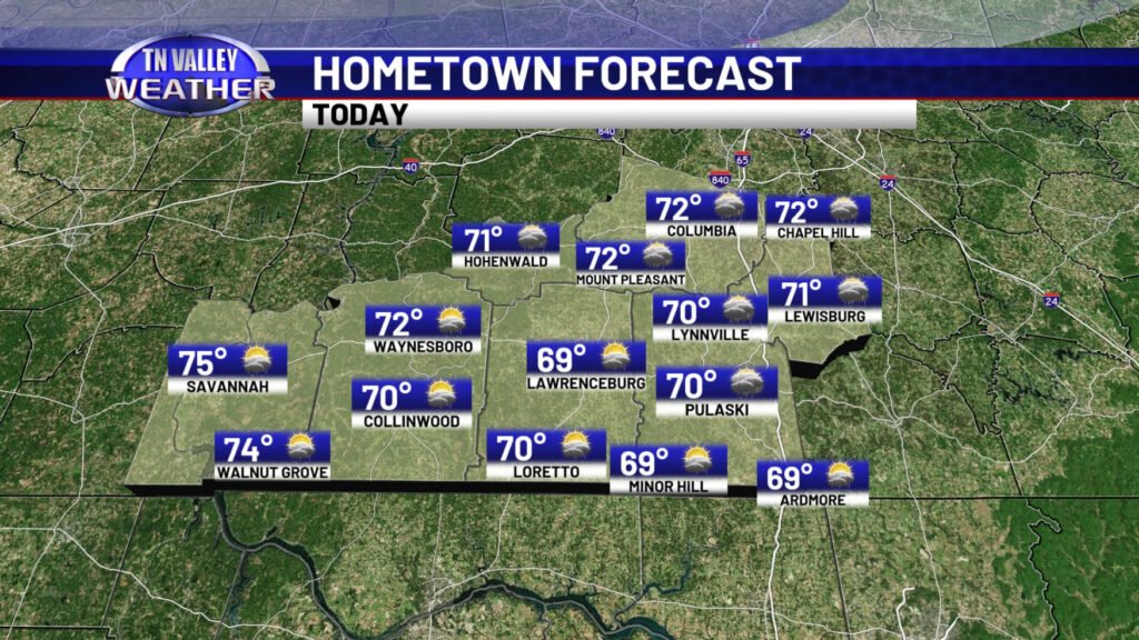


Clouds are thick in place across the Tennessee Valley early this Monday morning as a complex of showers and thunderstorms tracks south of our region across the southern half of Mississippi into south Alabama. The northern edge of that complex is spreading a few light showers into the area this morning, but nothing of too much consequence. Temperatures early this morning range from the mid 60s over northwest Alabama where clouds are thickest to as low as the mid to upper 50s over south parts of southern middle Tennessee where clouds returned to the area slower overnight and where the low-level air mass is a little drier. Overall, expect a mostly cloudy day today, although a few peaks of sun are certainly possible. The clouds and occasional showers (can’t rule out a rumble of thunder) will keep daytime highs generally into the lower half of the 70s for most of us, although a few spots in southern middle Tennessee may struggle to get out of the upper 60s if the clouds do hang tough.


We certainly do have some bit of a rain chance for the daytime hours today, especially over the Alabama portion of the viewing area and during the morning hours, but the most widespread and the heaviest of the rain today will stay off to our south. A few spotty showers are spotty areawide though. It looks like the best chance of rain locally may hold off until after midnight tonight into the early morning hours of Tuesday when a round of scattered showers and storms will be possible across the area. These aren’t expected to be severe, but they may produce some 30-40 mph wind gusts or pea size hail in one or two spots. Otherwise, don’t be surprised to be awakened by thunder late into the overnight.


Those showers and storms may also weaken as they move in during the morning, before redeveloping again over the area in the midday and afternoon hours with some added daytime heating as temperatures climb into the mid to upper 70s with a few sun breaks. They will be spotty and random in nature, and not everybody will even see them, but those scattered storms look to hold on through the afternoon until about the mid evening when we lose daytime heating and the disturbance shifts east of our area.


During the midday, afternoon, and early evening hours, a few of those storms may try to become briefly strong to severe. The NWS Storm Prediction Center has a low-end Level 1 of 5 risk of severe storms for this threat for areas basically along and east of the Natchez Trace Parkway, although they may expand it westward to include more of the area in future updates. This is a lower-end threat, and tornadoes are not expected to be a problem with this system. This is NOTHING like the weather event we had back last Wednesday evening. This is just a case where a few isolated storms may have hail up to the size of quarters (but most pea to dime size) and isolated wind gusts of 40 to 60 mph. This may cause a few severe thunderstorm warnings to be issued across the area. With the more widespread and heavy rain staying south of us with those thunderstorm complexes and the Tuesday activity here being very spotty in nature, flooding and flash flooding are also not expected to be a problem in our area.


A few lingering wrap-around showers are possible across the area in Wednesday as the system departs, and then we get a temporary break in rain chances for Thursday, before the next system brings a few showers into the area late Thursday night and then a more likely chance of showers and storms into the area Friday before showers wrap up on Saturday. Daytime highs through mid week hang out in the 70s, but we do start getting back closer to the 80s by the end of the week and especially the weekend.
