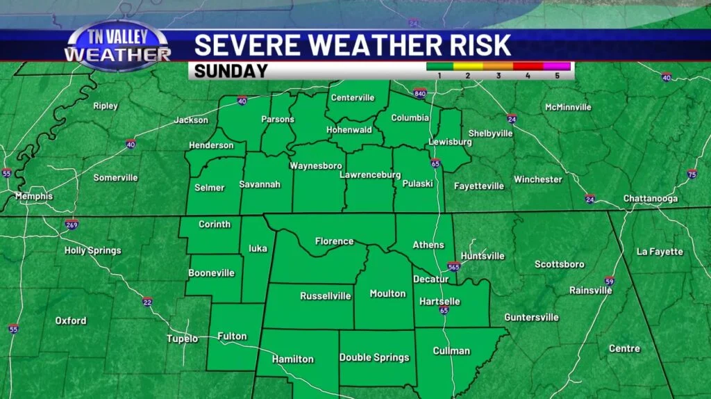
New data coming in from today seems to suggest trends in favor of the possibility of some stronger thunderstorm activity as we wrap up our weekend. First things first, as of this afternoon the entire Tennessee Valley is under a level 1 out of 5 risk of severe weather as issued by the Storm Prediction Center, primarily in place for the afternoon-evening timeframe of tomorrow. Let’s look at the Futurecast and break the threats down – which include damaging winds, small hail, and perhaps too some local flooding possible in the saturated areas of the TN Valley.
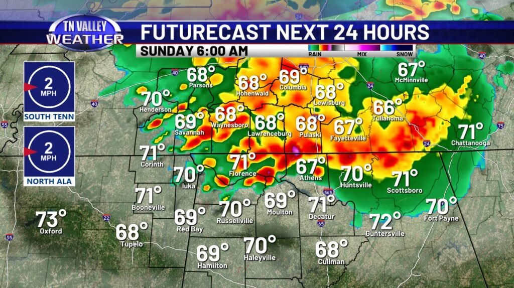
First thing of note is that trending possibility of some thunderstorm activity through the late late night/early morning timeframe here over the next 12 hours – we’ll watch that, but this doesn’t look like some extreme impact situation – more like heavy downpours, noisy thunder, and perhaps some areas of gusty winds. This first round moves through predawn and has some lingering showers by late morning.
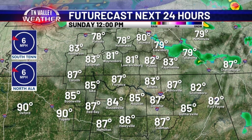
After church as we’re heading to lunch, we’re looking at mostly dry conditions with temperatures recovering back to the 80s – this midday time frame is the temporary break we get in the more widespread rain/t’storm activity, but some areas could already have some saturation from the earlier morning rainfall, so we’ll be damp out there heading into round 2.
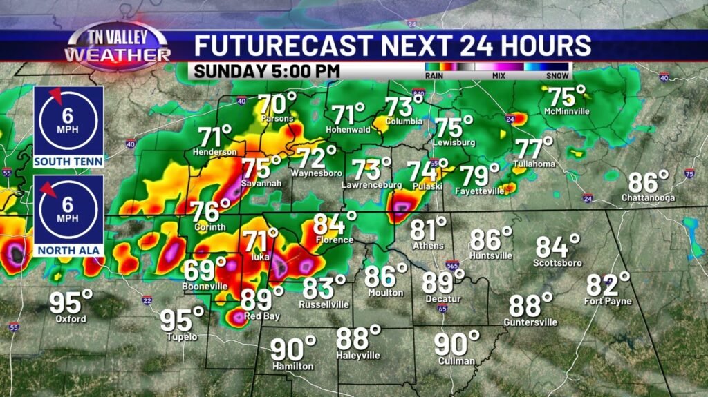
This round 2 is likely to impact the Tennessee Valley around the 4pm-7pm timeframe in terms of the timing of the strongest storms – again, it’s worth considering that these storms look pretty intense on the models, and could produce some gusty winds (50-60mph) and small hail, and do also pose a flash flooding threat when taking into consideration the prior 12 hours of rain that some of us may have received earlier in the day, so be careful if you have to drive in the evening, especially in lower spots – the heaviest rain will likely be off to our south by 8-9pm, but showers will linger behind through the night. A question I’m sure you’re wondering is if a tornado threat is there, and there are really not many indications at ALL that this is a tornado threat – is it ever zero? No. But you don’t find many events with a lower tornado threat than this. Still keep an eye out, but don’t expect some big tornado issues – this is not that kind of threat by all current indications. In terms of your best bets, just keep an eye on our app and our updates through tomorrow, and it shouldn’t be too much of a headache at all for you. We’ll certainly keep you up to date!