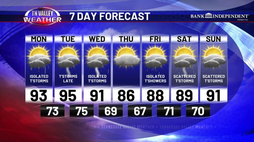
Now that I have your attention… yes the Tennessee Valley will be affected by a cold front this week. BEFORE we get to that, we have some intense heat to deal with the next few days.
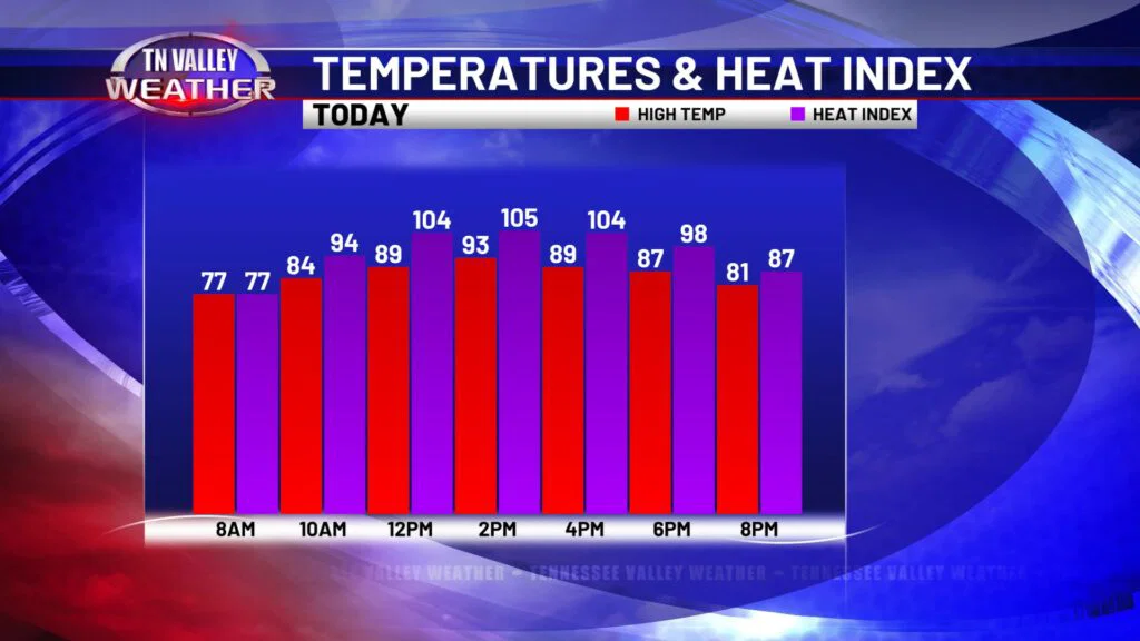
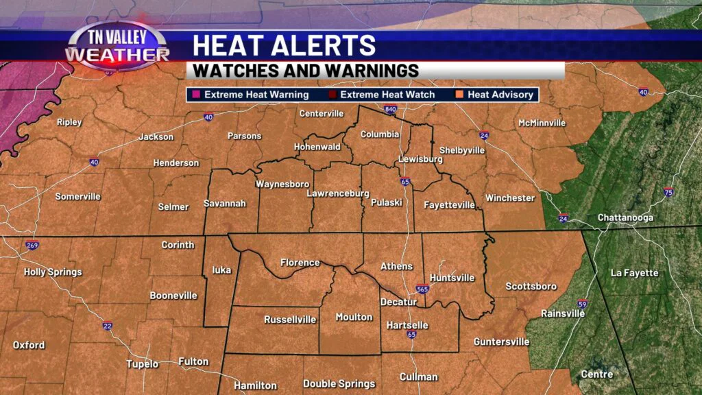
A Heat Advisory is in effect for this afternoon/early evening for our entire viewing area. Air temperatures will reach the low to mid 90s, with heat index values up to 108 degrees. Practice heat precautions if you plan to be outdoors today! Aside from the heat, a few spotty thundershowers may pop up this afternoon. Today’s rain chance is not quite as high as the last few days, but I don’t think we stay completely dry throughout the day. We’ve already had some heavy downpours move through this morning. Tonight, lows will get down into the low to mid 70s under a partly cloudy sky with patchy fog developing in spotty areas.
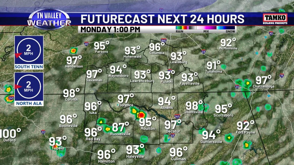
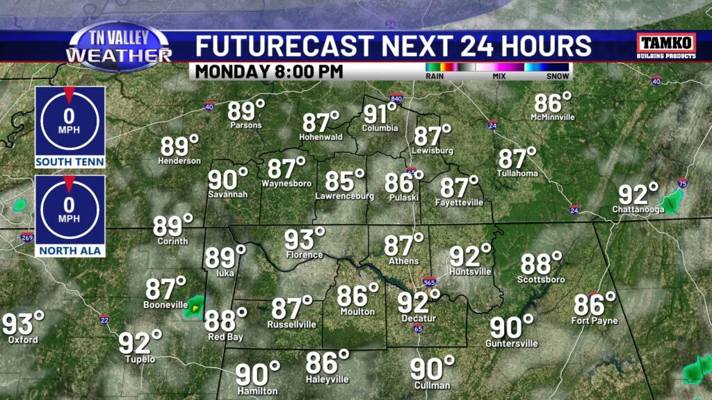
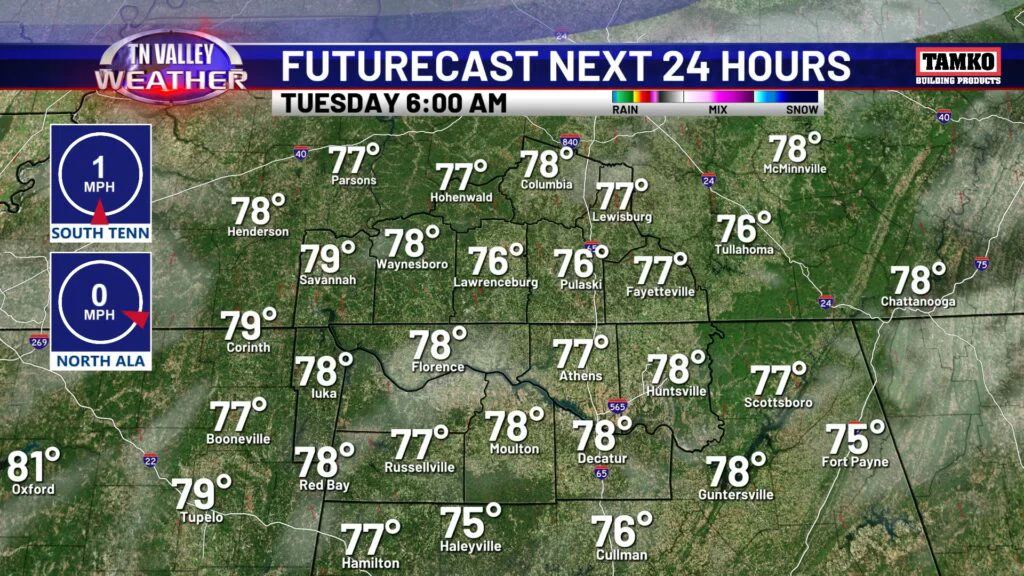
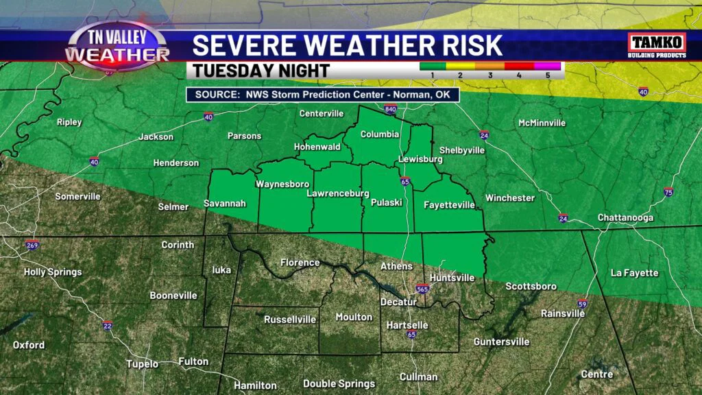
Tuesday will be another day of intense heat with spotty storms, at least for the afternoon. Highs Tuesday will be in the mid 90s, with heat index values up to 108 degre4es once again. The good news is, brief relief is on the way. A cold front will cool us off, but also bring with it overnight thunderstorms Tuesday in to Wednesday. The Storm Prediction Center has part of our area in a level 1 of 5 risk for strong to severe storms. The line of storms is expected to weaken as it moves south into the TN Valley, but a storm or two may still produce brief gusty winds. Otherwise we are not expecting much in terms of severe weather here locally.
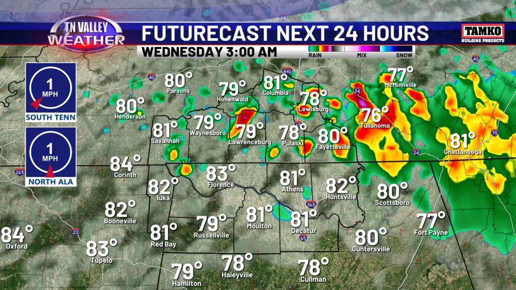
Wednesday morning there will be a few lingering thundershowers but we will start to dry out as we ease into some cooler temps! Now, we’re not talking anything crazy, but we are talking mid 90s to mid 80s for highs! Thursday will be quite nice and refreshing with lower humidity as well. Enjoy it for the singular day we will have it, because it’s right back to feeling like mid to late July by the weekend.
TROPICS: Tropical Depression Two is expected to become Tropical Storm Bertha later today. The storm is not expected to bring impacts to our local area here in the Tennessee Valley. However, it is expected to bring several inches of rain to the Gulf Coast as it tracks west towards Texas.