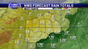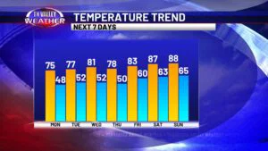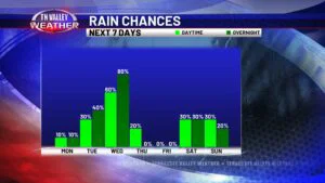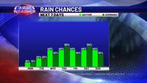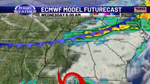
Intense heat for the Tennessee Valley before a mid-week cold front
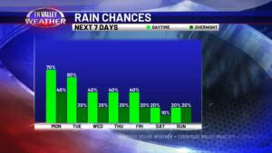
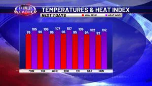
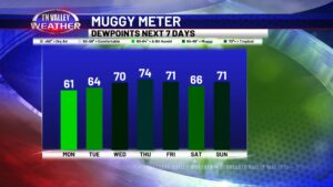
Now that I have your attention… yes the Tennessee Valley will be affected by a cold front this week. BEFORE we get to that, we have some intense heat to deal with the next few days. A Heat Advisory is in effect for this afternoon/early evening for our entire viewing area. Air temperatures will reach […]
Intense heat for the Tennessee Valley before a mid-week cold front Read More »