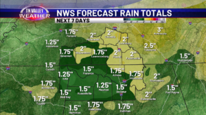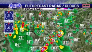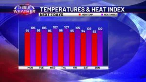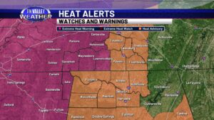
Intense heat to start the week as July comes to an end
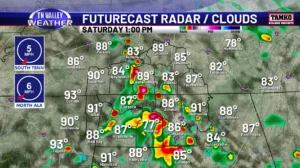
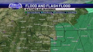
It was quite the stormy night across the Tennessee Valley but that is not stopping intense heat from building up this afternoon. An Excessive Heat Warning is in effect for the western half of our TN counties, and Tishomingo County MS. A Heat Advisory is in effect for all other counties, through 8pm. Heat index […]
Intense heat to start the week as July comes to an end Read More »