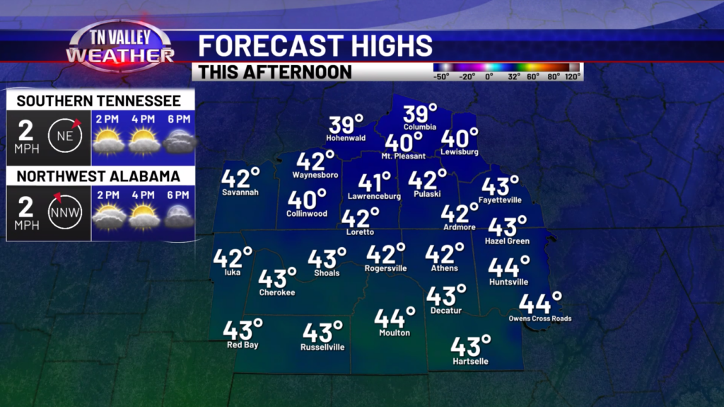
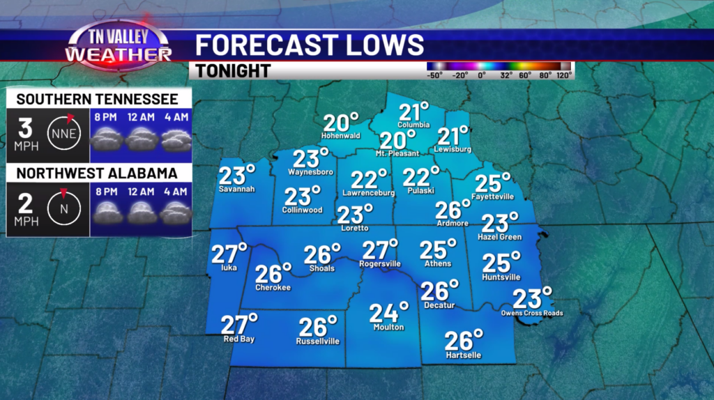
Good Thursday morning! We continue our dry stretch of weather today before some snowflakes occur tomorrow and Saturday. For today, expect partly cloudy skies with highs in the lower 40s. This evening, we will drop down into the low to mid 20s overnight, so not as chilly but still below freezing.
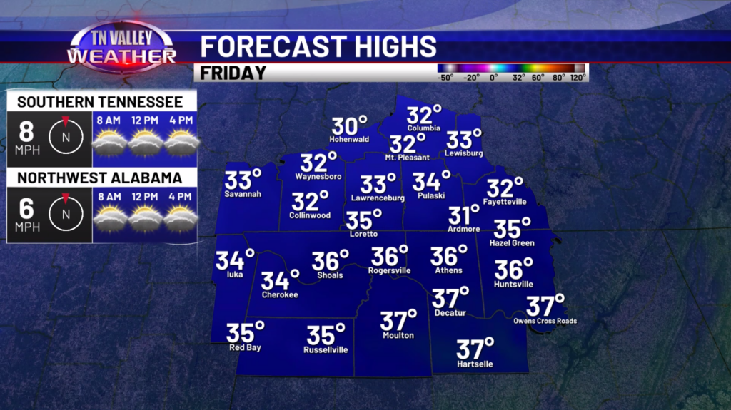
During the day on Friday, we will have a wave of low pressure move nearby bringing the chance at some snowflakes and perhaps some rain showers. The better odds at seeing some flurries or snow showers will be during the evening hours. There could be some periods of moderate snow in any banding features that setup which could cause some quick accumulations. Even though this would be light accumulations (generally below an inch), it could be enough to cause some slick spots on area roadways.
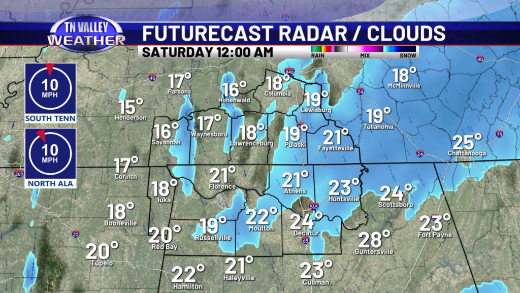
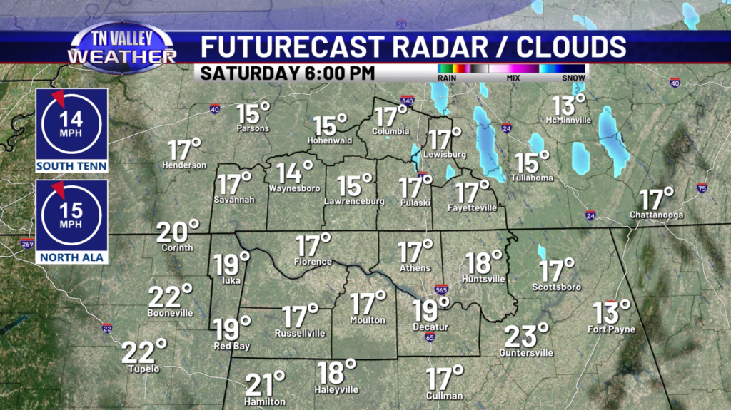
On Saturday, more snow flurries or snow showers will be possible bringing the chance at additional light accumulations. There could be more slick spots on the roads depending on how much snow shower activity we see so keep that in mind. With the temperatures in the teens and 20s, whatever falls will stick. The other story will be in the very cold temperatures coming in with lows in the single digits Saturday morning and then again Sunday morning. Wind chills will be below zero during the morning hours as well.
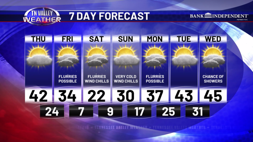
Going into next week, we will see a quick warmup with highs in the mid and upper 30s Monday before getting into the middle 40s on Wednesday. There could be a few snowflakes Monday and then some rain showers on Wednesday.
Have a great Thursday!