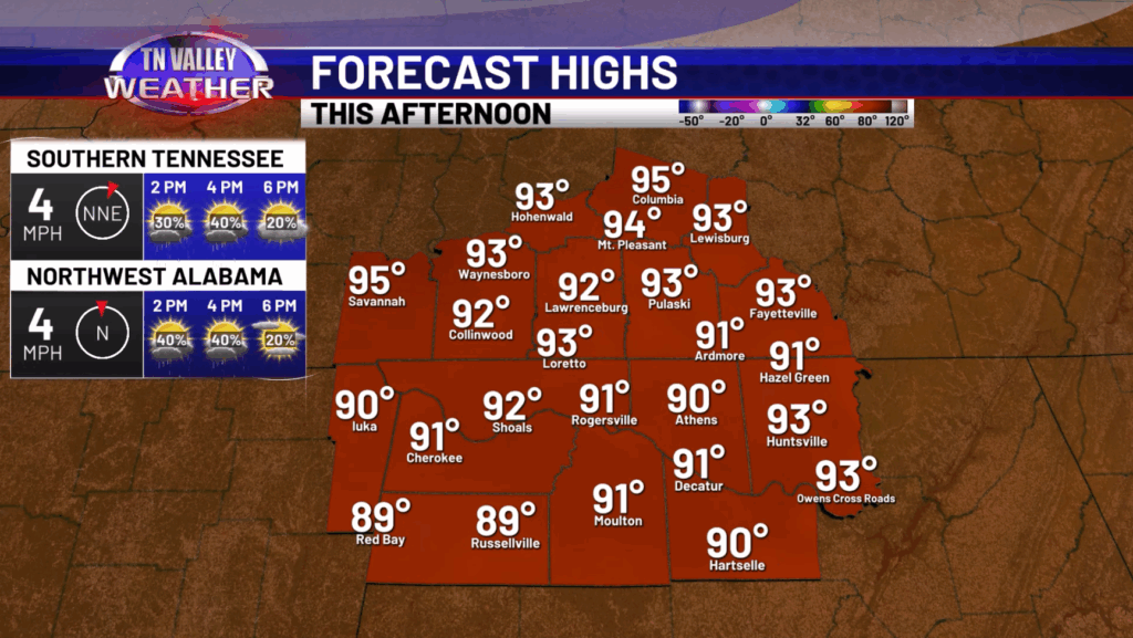
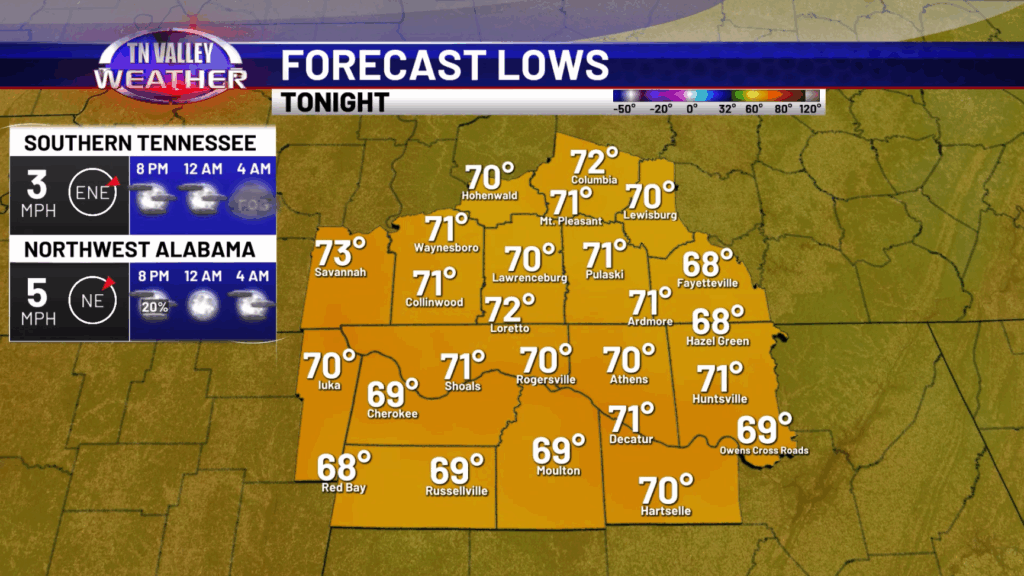
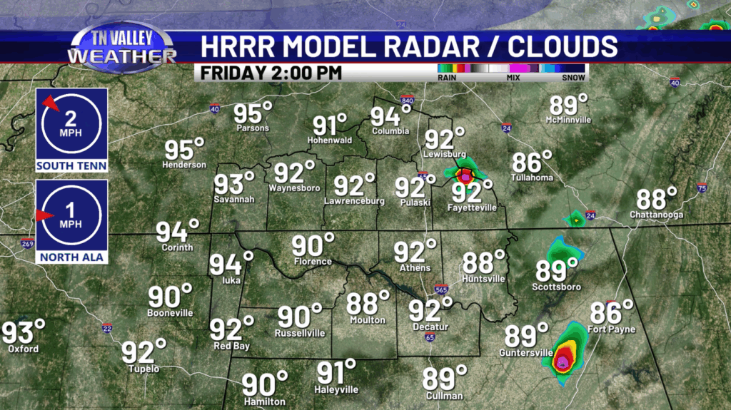
Happy Friday! The warming trend continues today as highs will be getting into the lower 90s with some mid 90s possible. Some isolated to widely scattered showers and storms are expected to develop this afternoon and into the early evening hours. Any of those high school football games might have some thunder and lightning around, at least early, so keep that in mind. Temperatures will be cooling off into the lower 70s by the mid evening hours and then upper 60s and lower 70s going into Saturday morning.


Over the weekend, rain chances will be very low with only an isolated shower or storm possible. The main issue will be our temperatures getting back into the mid and even upper 90s with heat index values over 100, possibly as high as 105-107.


Our temperatures will continue to be in the mid and upper 90s on Monday and Tuesday before some relief is in sight. Rain chances will increase going into the middle of next week which will lower our highs.
Have a great Friday and weekend!