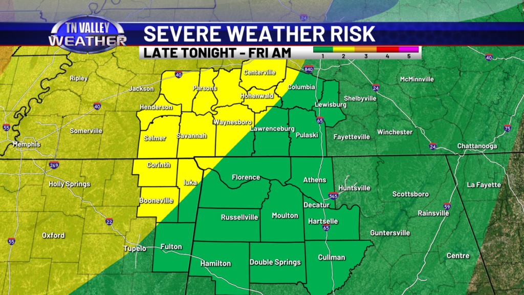
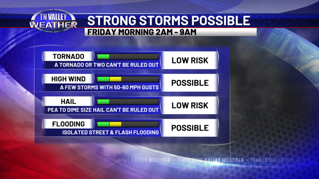
The mid afternoon update from the NWS Storm Prediction Center maintains a Level 2 risk of severe storms for about the northwestern 40% or so of our viewing area, roughly along and northwest of the Natchez Trace Parkway give or take a few miles. Folks south and east of there remain in a Level 1 of 5 risk of severe storms. Nothing has really changed with the overall forecast or our line of thinking concerning what we expect to happen later tonight. This will be a lower-end type of severe storm risk. The main concern is that a few storms in the line may be strong enough to produce 50-60 mph wind gusts. That’s strong enough to knock down trees, cause power outages, etc. However, there are enough ingredients in place that we also can’t rule out one or two short-lived tornadoes embedded in the line, although this risk is low. Localized street flooding and lower-end type flash flooding will be possible all the way into the late morning hours of Friday with moderate to locally heavy downpours that will continue even behind the line. Hail isn’t too much of a concern, but a few storms with pea to dime size hail can’t be ruled out. If we get a stray storm this evening well out ahead of the line grow strong, we can’t even rule out an isolated instance or two of quarter size hail.
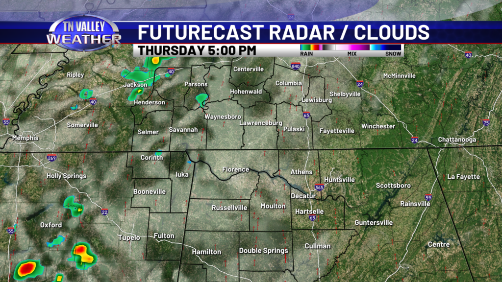
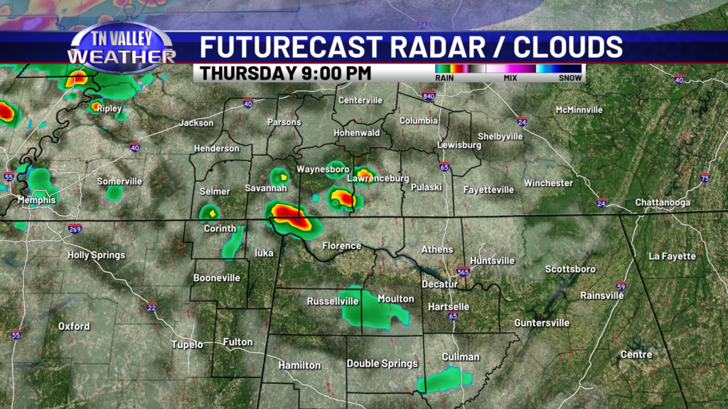
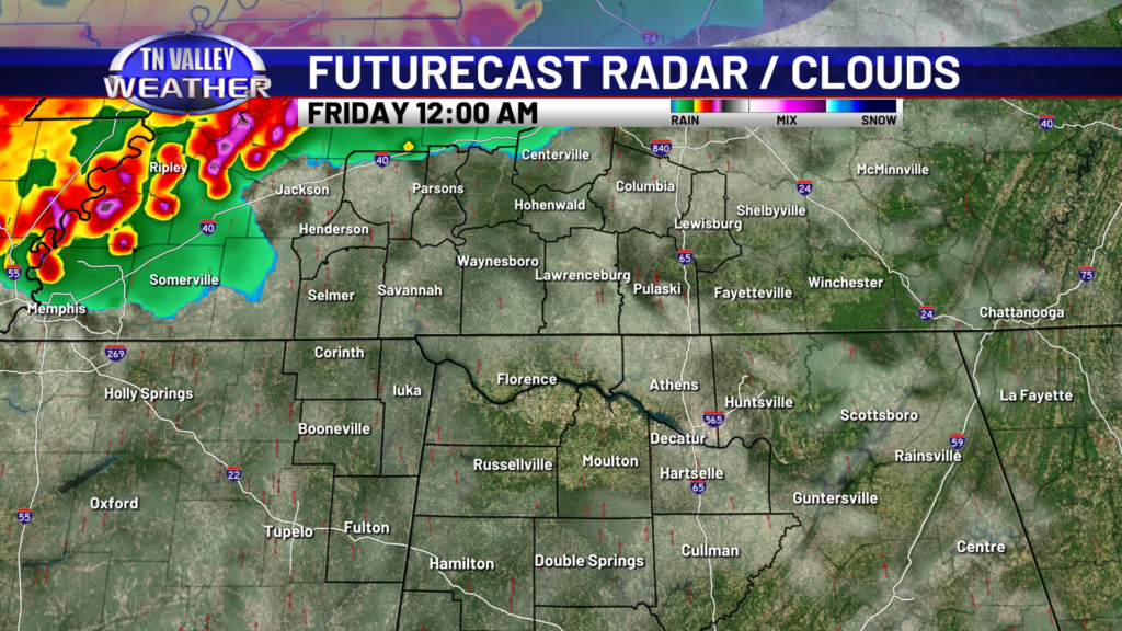
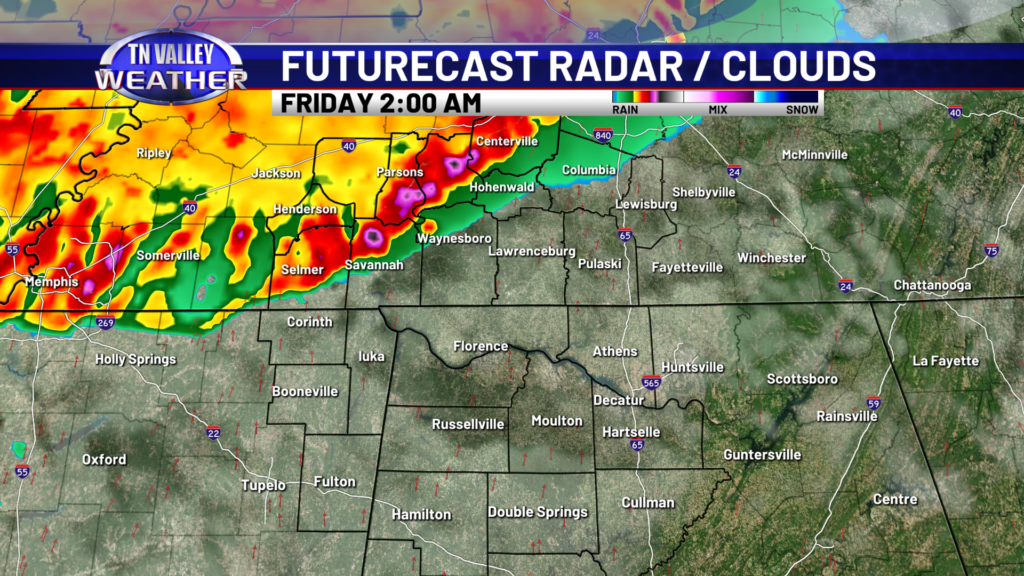
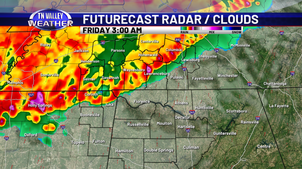
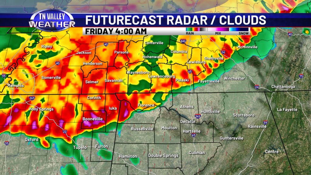
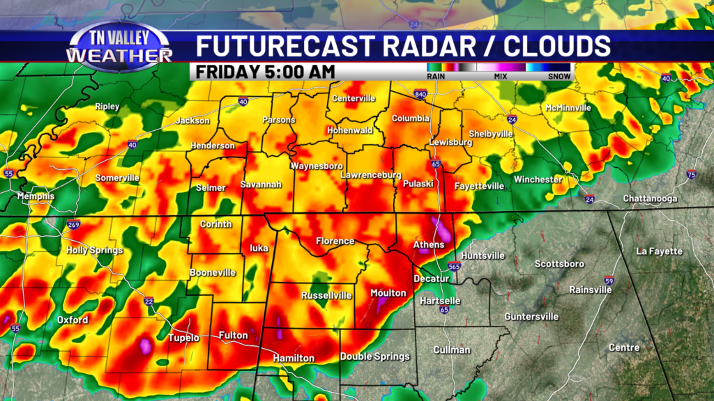
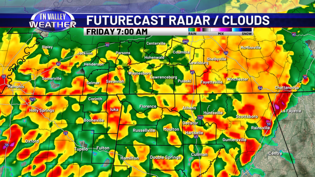
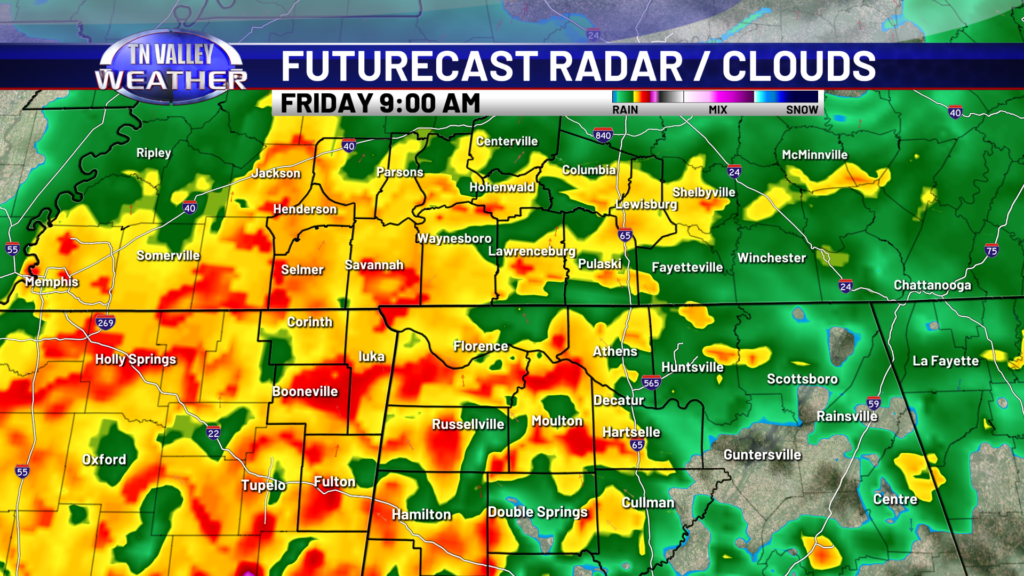
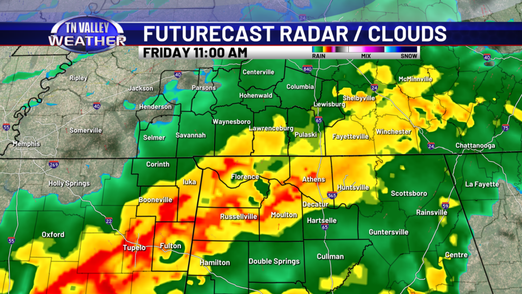
Here’s an overall breakdown of the timing of everything using the in-house Baron 3k Futurecast model. We will be watching at least the potential for a couple of isolated storms this evening between 6:00-10:00pm. The chance of these are only around 20-30%, but if we have one or two, they could be strong with gusty winds and hail. They would be very isolated in nature with no true rhyme or reason for exactly where they would be located. By midnight, the main line of thunderstorms looks to be moving into western Tennessee into northwest Mississippi, and this is the main event that will be pushing toward our area. The latest run of the Baron Futurecast model has the main line arriving in our western counties around 2:00-3:00 AM and then moving southeastward across the area through around 6:00-7:00 AM. The line may be in a gradual weakening mode as it comes in, but despite that, a few individual storms within the overall line may be strong enough to produce the severe weather hazards we talked about above. By 6:00-7:00 AM the actual severe storm threat itself will very likely be off to the south of our area, but moderate to heavy rain looks to linger behind the storm line into the late morning, and this may cause some localized areas of street flooding or lower-end type flash flooding. This does not look to be a major flooding threat. Additional rain may linger into the afternoon, but the risk of flooding will be diminishing by that time and any severe storm risk will be long gone from our area.
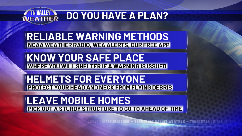
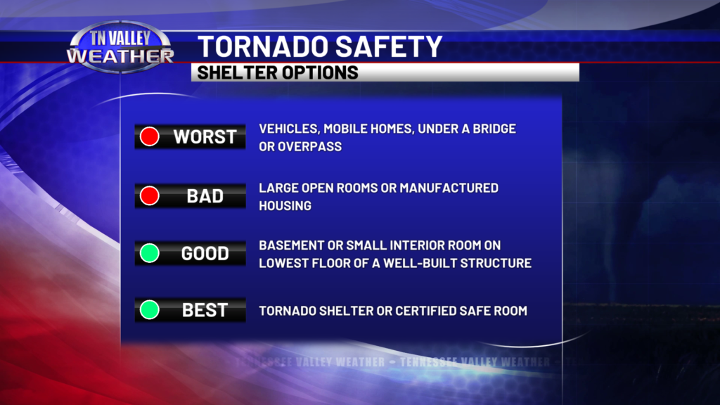
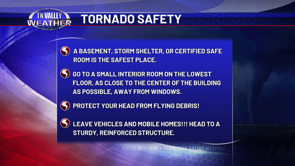
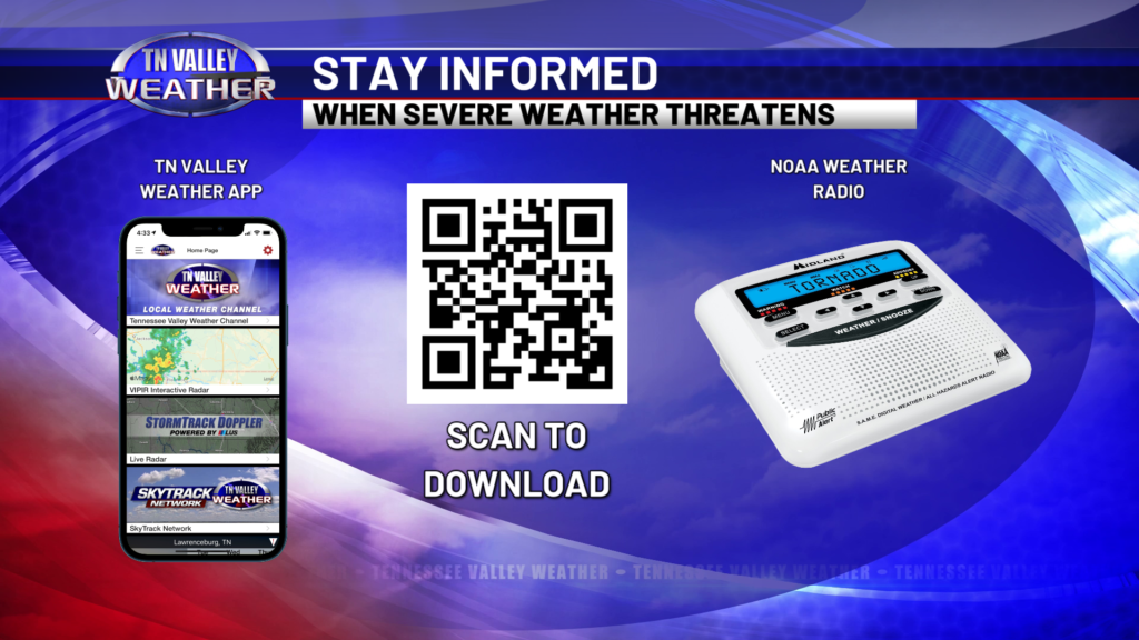
Even though this is a lower-end type severe risk, and the threat of tornadoes is low to very low, it’s still important that you have a severe weather safety plan in place. You have to know ahead of time where you will go and what you will do for safe shelter if a warning is issued for your area. With this being timed to happen in the late overnight and early morning hours, it’s critically important that you be able to receive warnings even if you are asleep. The best way to do that is a programmed NOAA Weather Radio. There is also the Wireless Emergency Alert system (the same thing that triggers Amber Alerts on your phone) that will alert your phone with a LOUD tone and message if your specific location is placed in a tornado warning, a high-end severe thunderstorm warning, or a higher-end flash flood warning. It’s a good idea to have those enabled and for you to leave your phone in the Do Not Disturb mode. Our free Tennessee Valley Weather App will also send push notifications to your phone if your specific area is placed in watches and warnings. We will have the weather center staffed overnight, and we will be ready to provide LIVE updates on all platforms as conditions warrant. That includes LIVE NON-STOP coverage if a tornado warning is issued for any county in our viewing area across southern middle Tennessee, northwest Alabama, or northeast Mississippi.
