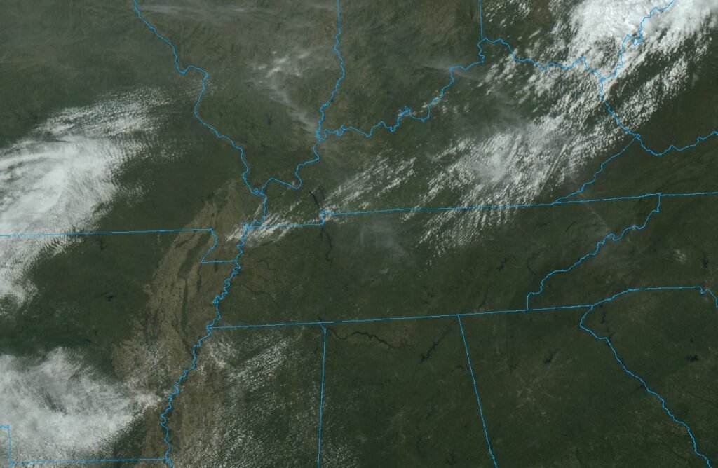
Before we get into the gory details of the forecast, the elephant in the room is… just how nice today is. Looking down from 22,000 miles up, the satellite shows almost no cloud cover anywhere in the Tennessee Valley (and the nearest rainfall? Something like 600 miles away!). When you take this beautiful clear weather and combine it with the fact we have southerly winds, you get two things… 1.) some fantastic weather for the next couple days, and 2.) some not so fantastic weather following that as we head into the workweek.
Let’s break it down.
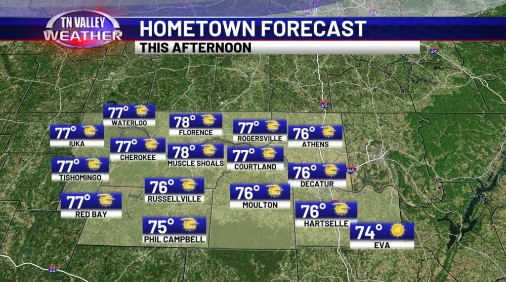
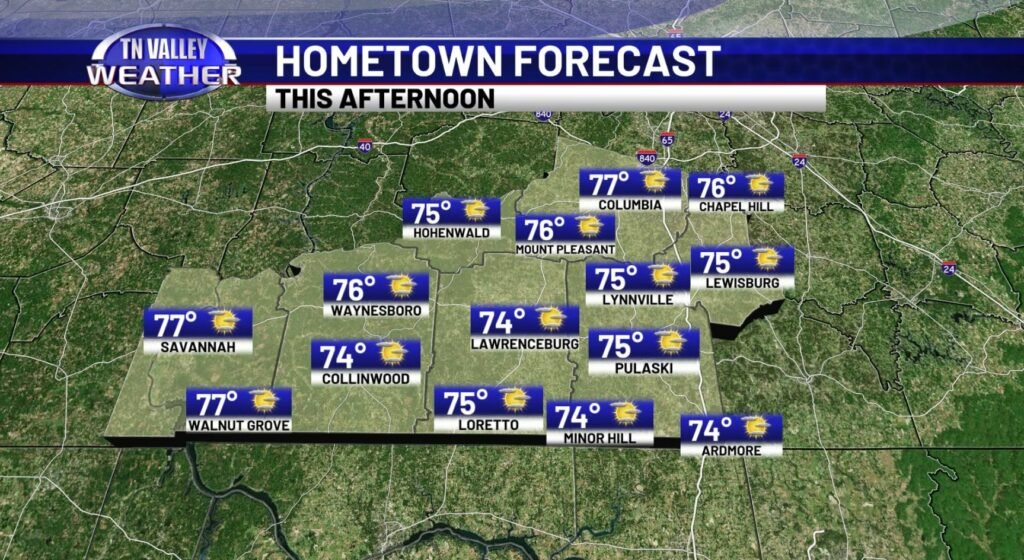
All said and done, today will be dry, clear, and warm – pretty much the type of Spring day you would want for your weekend. Across the area we’ll end up in the 70s, with some of us in N AL perhaps even flirting on the edge of 80 today, ahead of schedule. You can expect some cooler temps tonight in the 50s – so not too bad at all.

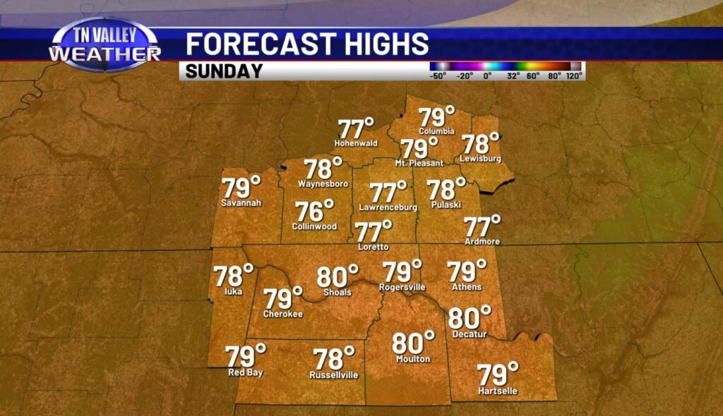
If you’ve been keeping up with the forecast over the last several days, you probably already know the good news, but if you’re still curious as to what you can expect for your Easter Sunday, worry no more – at least by my books, it’ll be even better today – with some building clouds, sure, but with higher highs than today. Current data suggests a good handful of us will probably end up at 80 in N AL, but in S TN, we’ll probably stay there in that 77-79 range for most of the day. If any day sees REALLY widespread 80 degree temps, it’ll be the equally nice Monday, if you ask me.
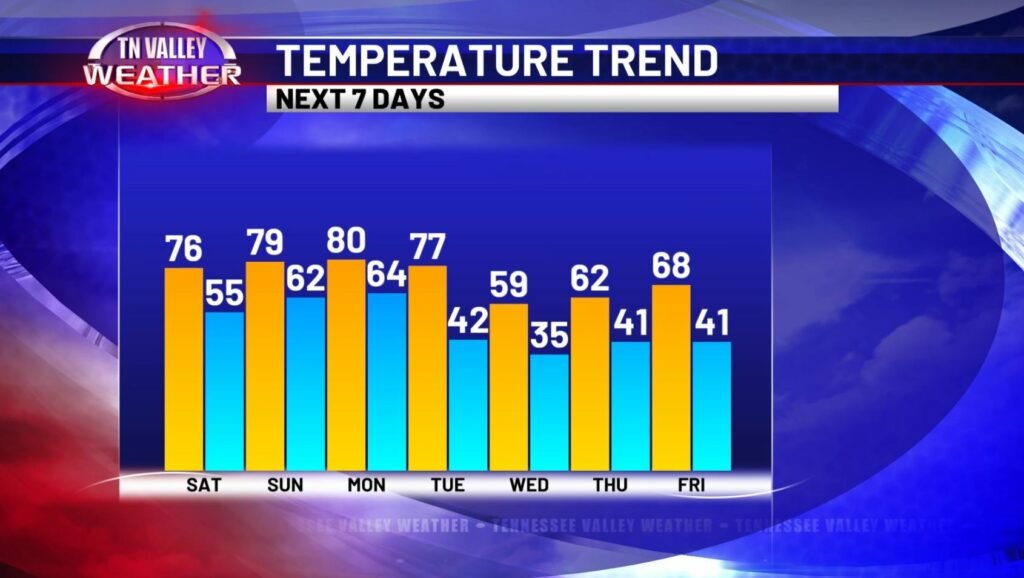
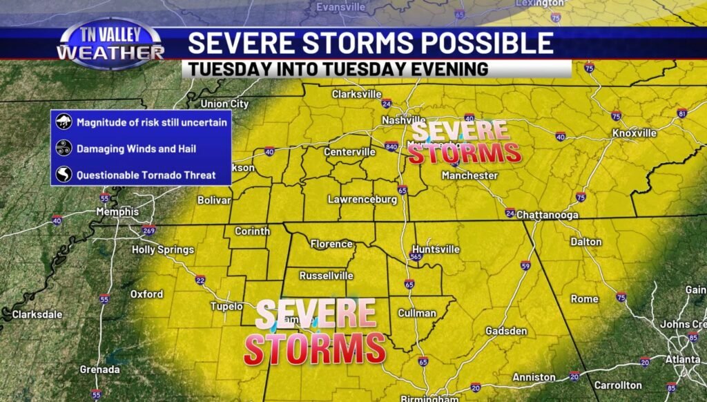
Temp trends for the next seven days reveal that pretty nicely – but also shows another story unfolding there as we head into Tuesday and especially Wednesday and beyond. Now, it’s relatively brief, but that cooldown is pretty substantial Wednesday and Thursday before we get back to more reasonably Spring-like temperatures by the end of the week. That’s associated with a frontal passage on Tuesday, and it’s this system we’ve been keeping a close eye on over the last several days, and the system we’ve also highlighted as our next thunderstorm chance, featuring the possibility of severe weather locally.
The key timeframe to watch for this activity will be midday and PM Tuesday. Some questions still linger in the air regarding PRECISELY how the storms themselves will evolve, but the current thinking is that this system could yield some damaging winds (60mph+), and some large hail – in fact, I think this system may have somewhat better chances of large hail than you would typically find in the TN Valley for this time of year.
The big question you are probably wondering is regarding the tornado threat – and that’s a bit questionable, but I would personally err on the side of damaging wind and hail being what we have to focus on as the PRIMARY threats.
That being said, just because this isn’t shaping up to be some big April tornado outbreak doesn’t mean the threat is zero – not at all. If a storm DOES mature, stabilize and take advantage of it’s environment, a tornado could spin-up with these conditions. The particulars of how these storms will evolve will reveal itself when we get closer, so the best advice? Keep up with us as we keep up with it. You’ll have the info faster than you can say “lightning”.
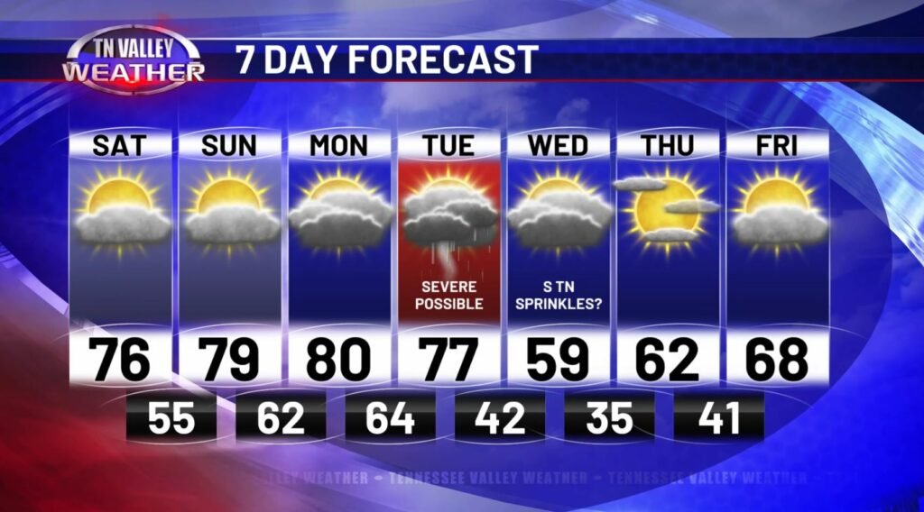
Behind that system, the environment gets “wiped out” so to speak – that is, we dry out, and cool off pretty notably, especially for this time of year. Good news is it won’t be long, like I mentioned previously… we’ll be back into the 68+ degree range by Friday, and we look pretty well dry in that post-Tuesday stretch as well (besides the off-chance for some little sprinkles in S TN Wednesday, but that does NOT look like a huge deal. Just some wrap-around showers).
All and all, we have some nice weather to take advantage of for the next couple days, so be sure to do so for your Easter Weekend – it’s never a guarantee in the stormy season!
