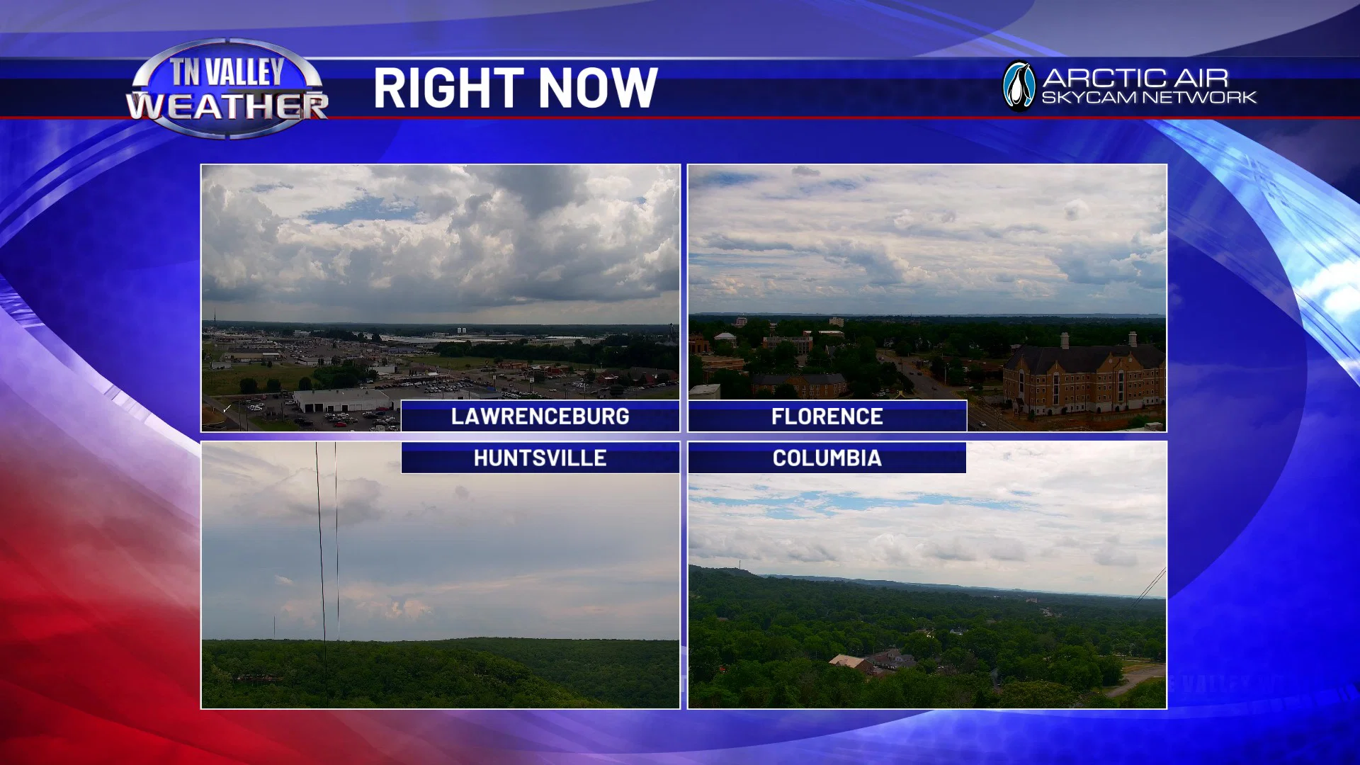
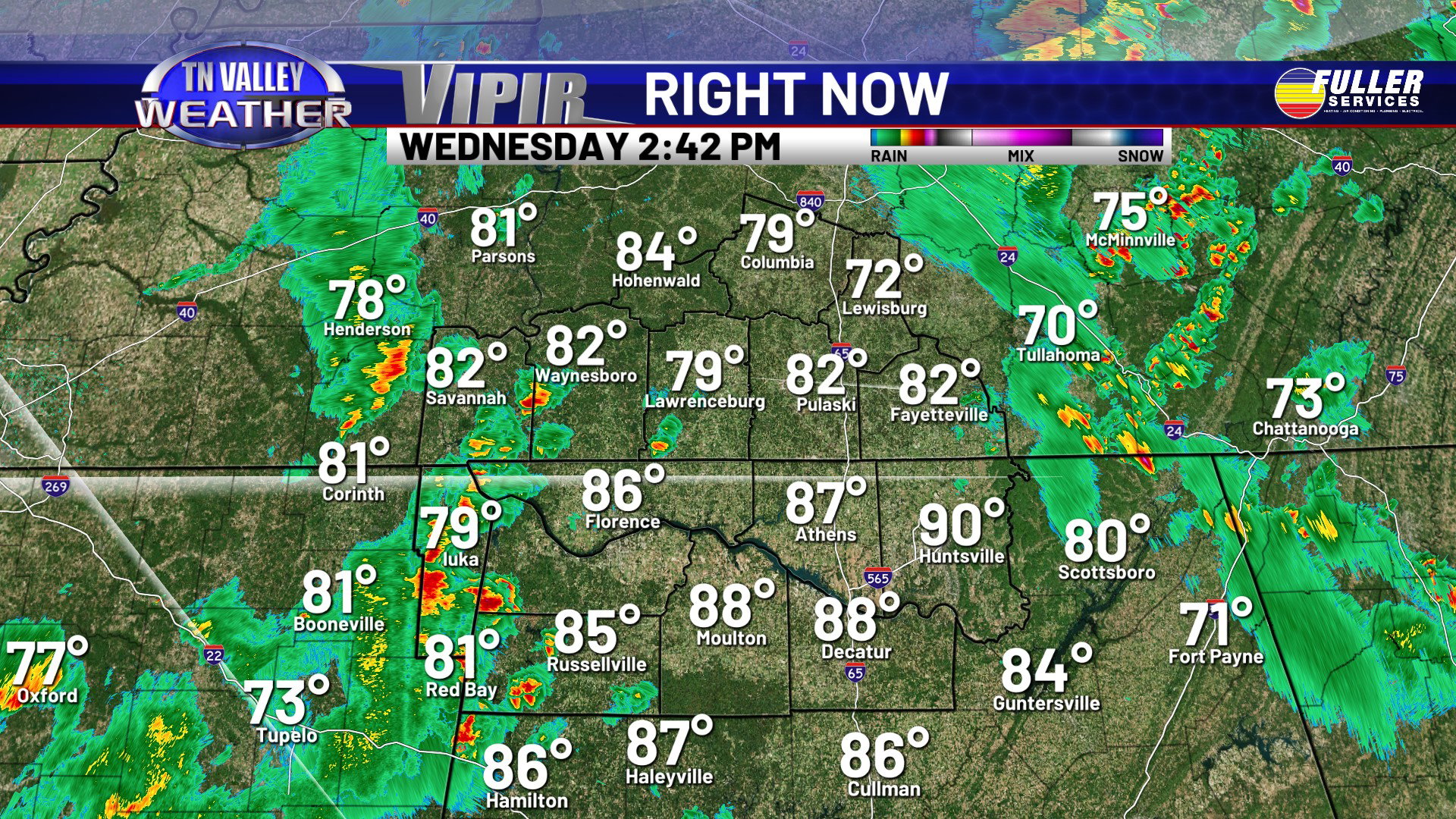
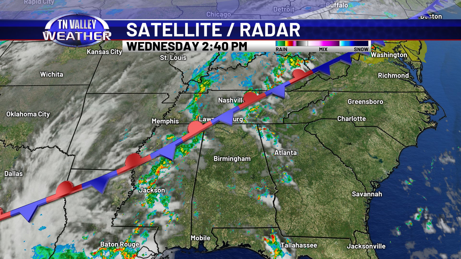
We’ve had a bit of sunshine across the area so far on this Wednesday, but clouds are building, and so are the showers and thunderstorms. After the earlier round of rain activity, we’ve had temperatures climb into the 80s, and now more showers and thunderstorms are moving into the area from western Tennessee and north Mississippi. This activity will continue eastward across much of the area as we go through the rest of the afternoon and the early evening hours. We aren’t expecting severe storms, but these are likely to produce heavy downpours, cloud to ground lightning, and maybe a few isolated 30 mph wind gusts. All of this is because of the cold front that’s been approaching from the northwest getting into the area and then stalling out near us as it washes out and weakens. This will be one of the main catalysts for elevated rain chances for the next 7 days or longer.
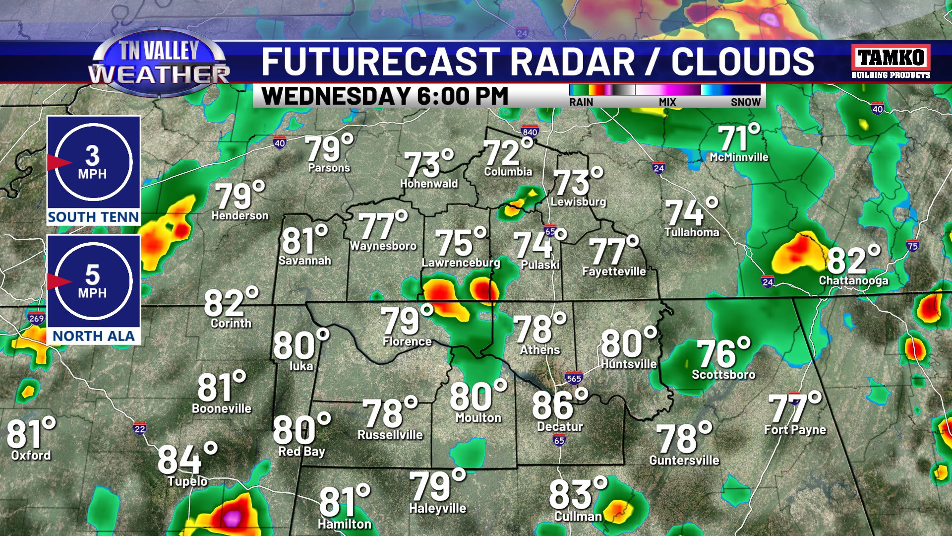
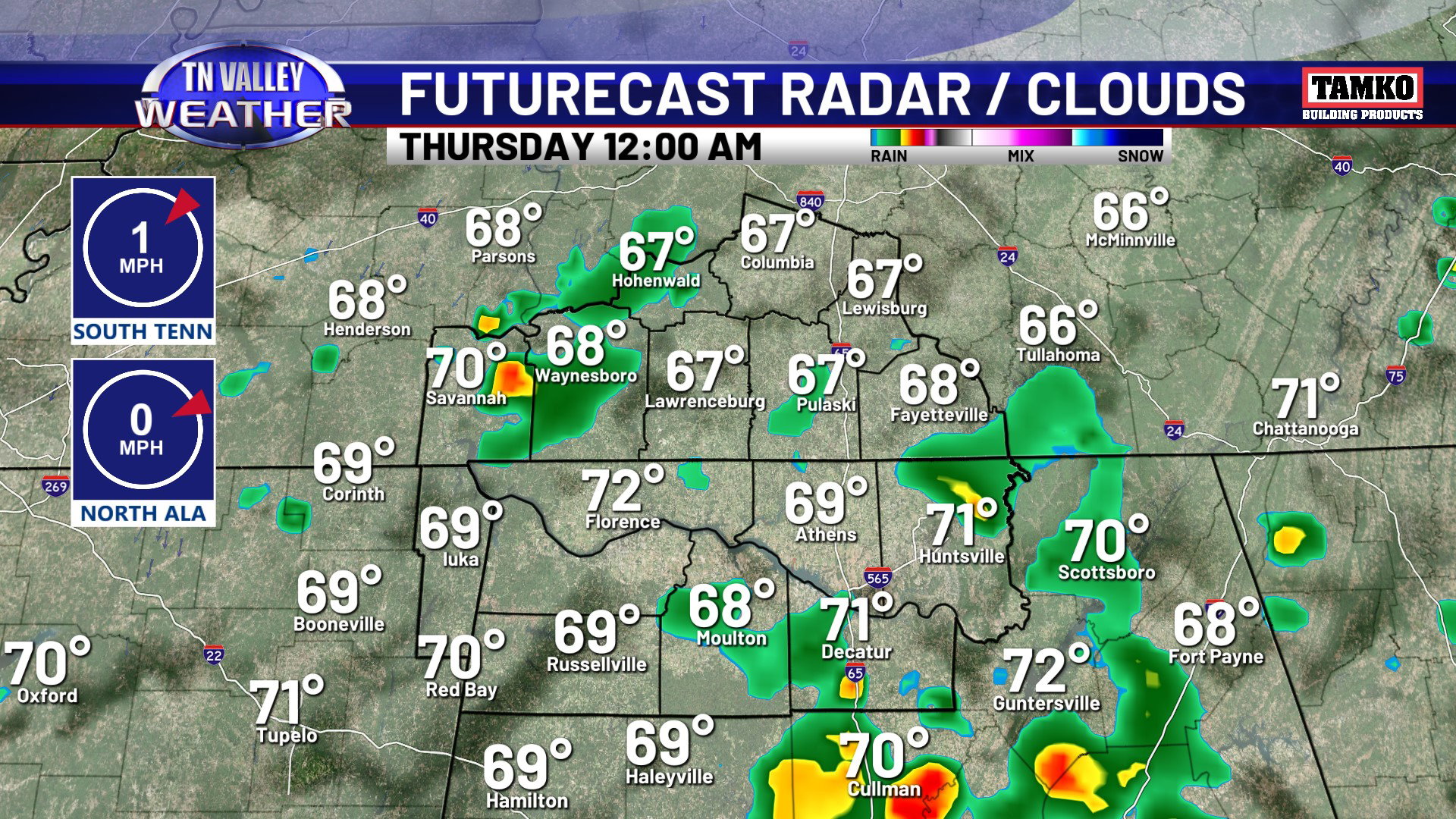
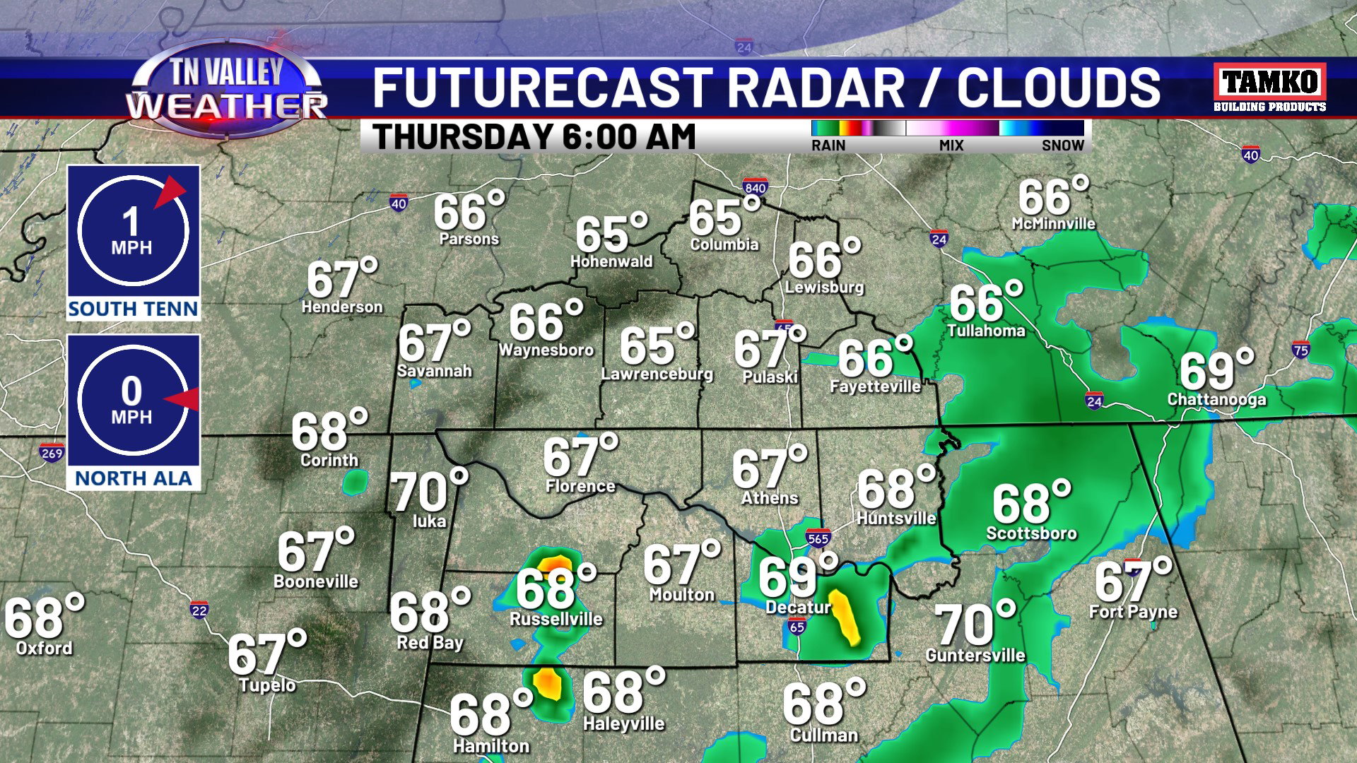
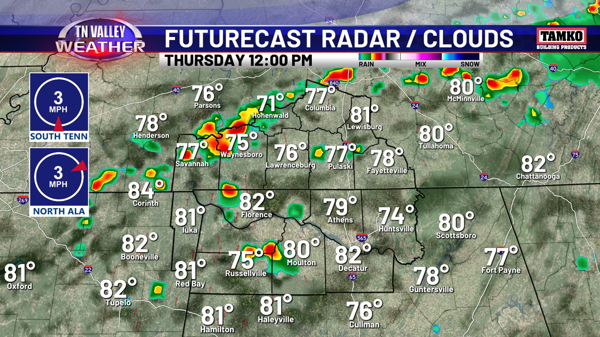
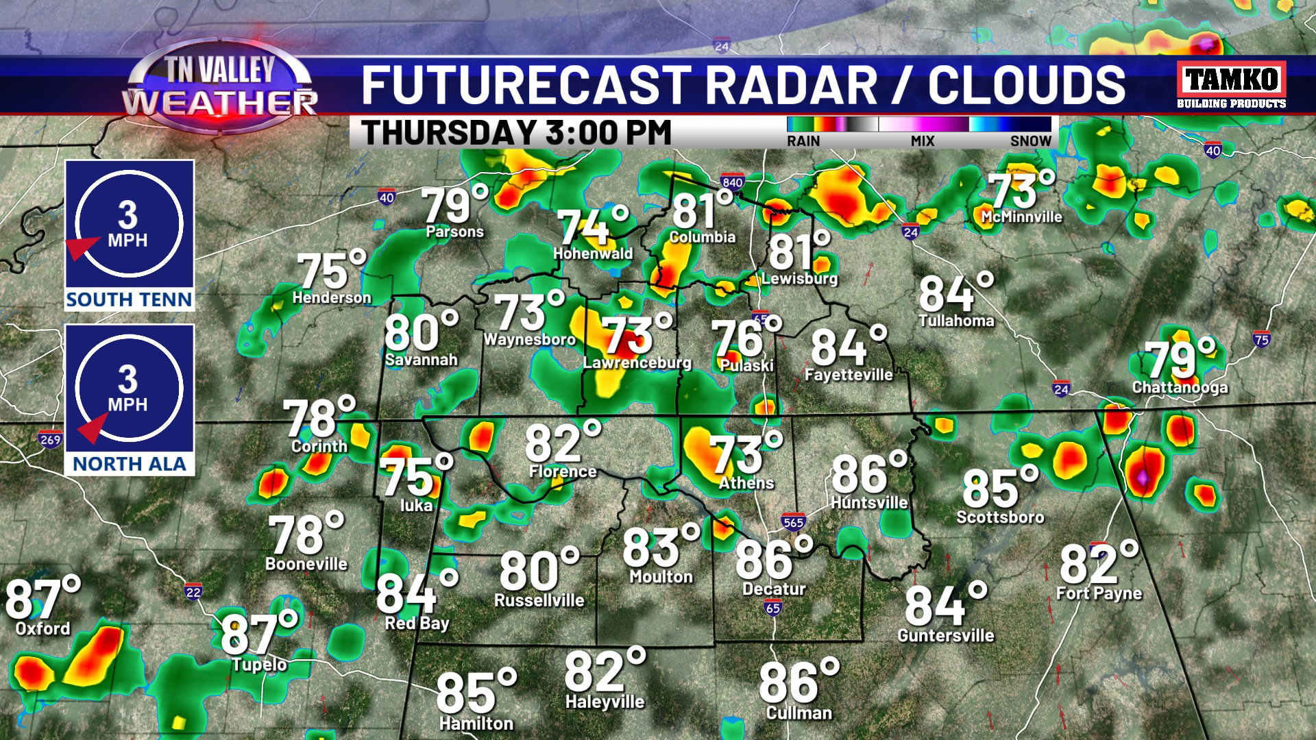
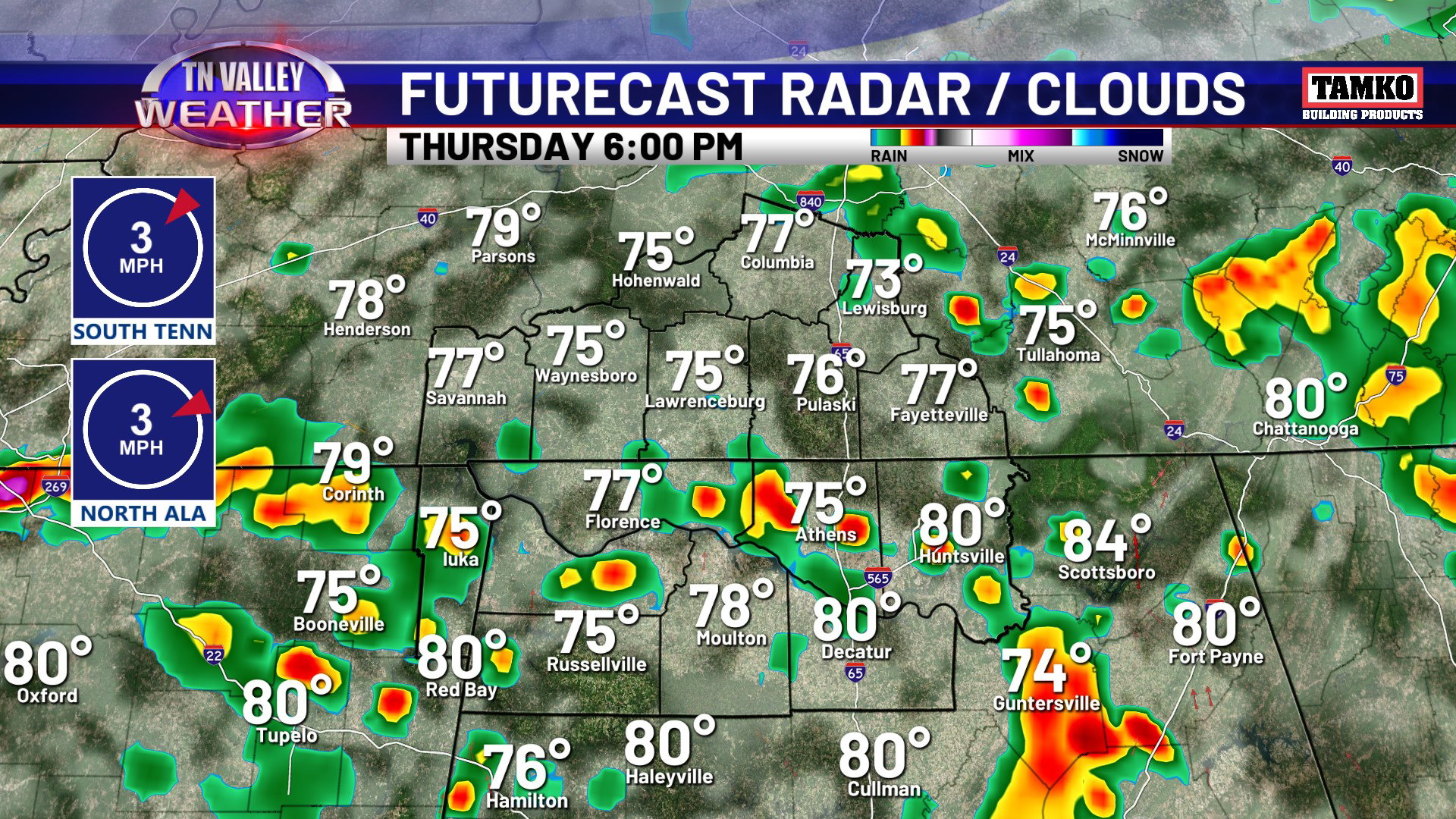
Rain and thunderstorms will continue off and on through the evening and overnight, but they will likely become less widespread deeper into the overnight as the rain stabilizes the atmosphere with time and we also lose daytime heating. A few showers or a rumble of thunder are possible during the morning hours of Thursday, but things become widespread again as we head into the afternoon and evening. Just like today, no storms are expected to be severe, but storms will be producing heavy downpours, lightning, and isolated 30-40 mph wind gusts. Typical late spring to early summer type stuff. Rain will continue a bit more efficiently into Thursday overnight because we will have the added component of lift from an approaching upper-level disturbance.
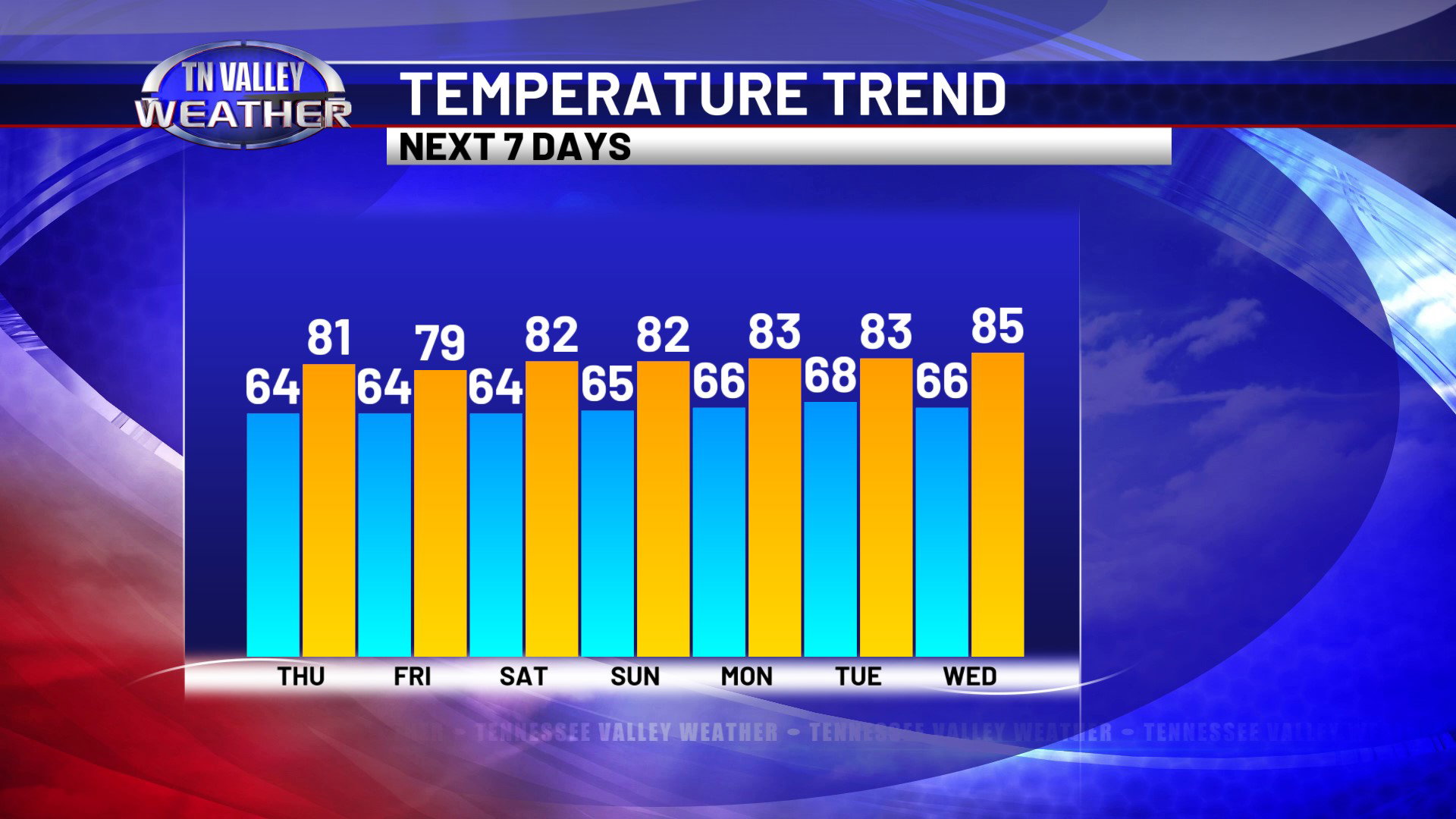
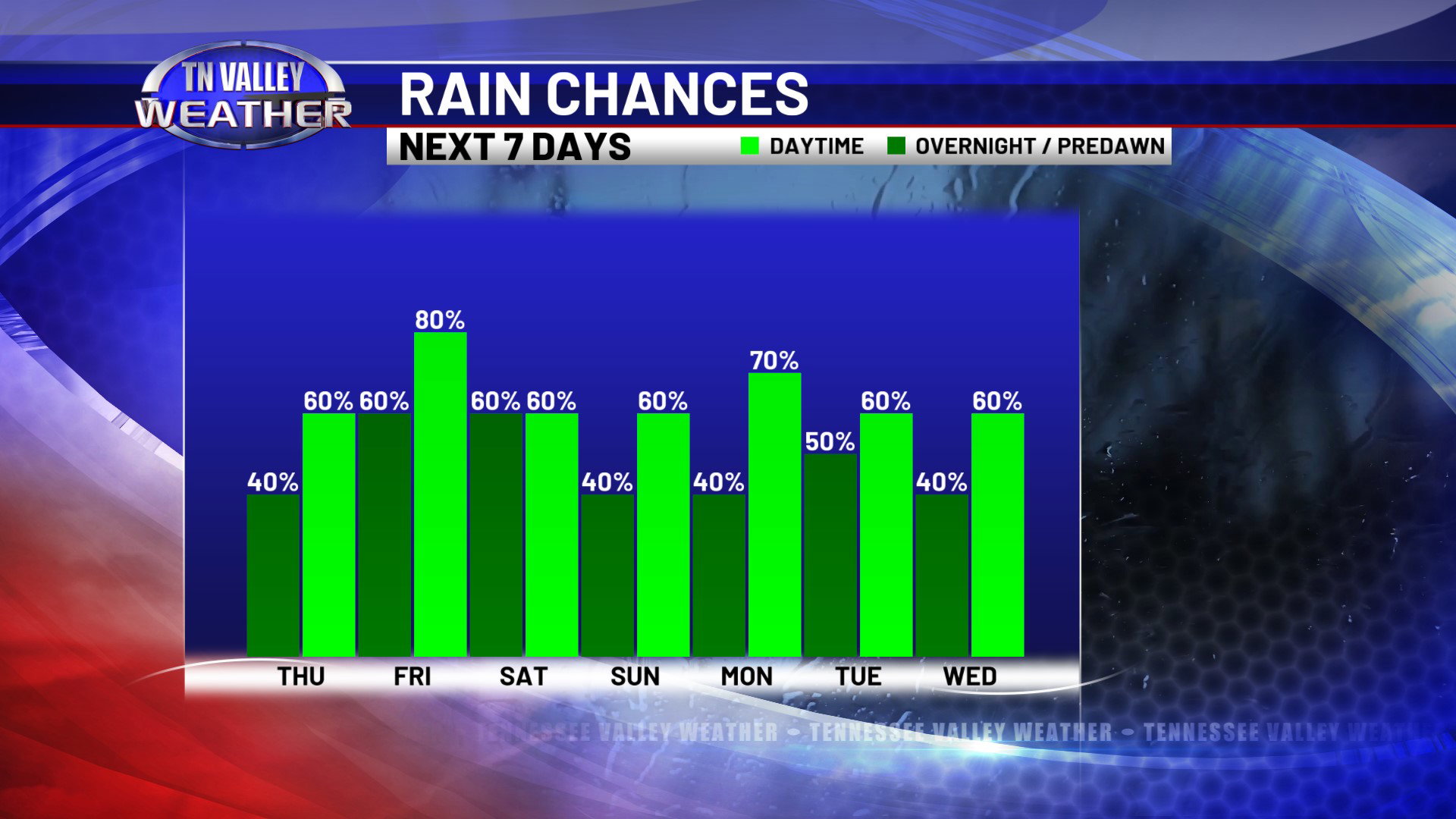
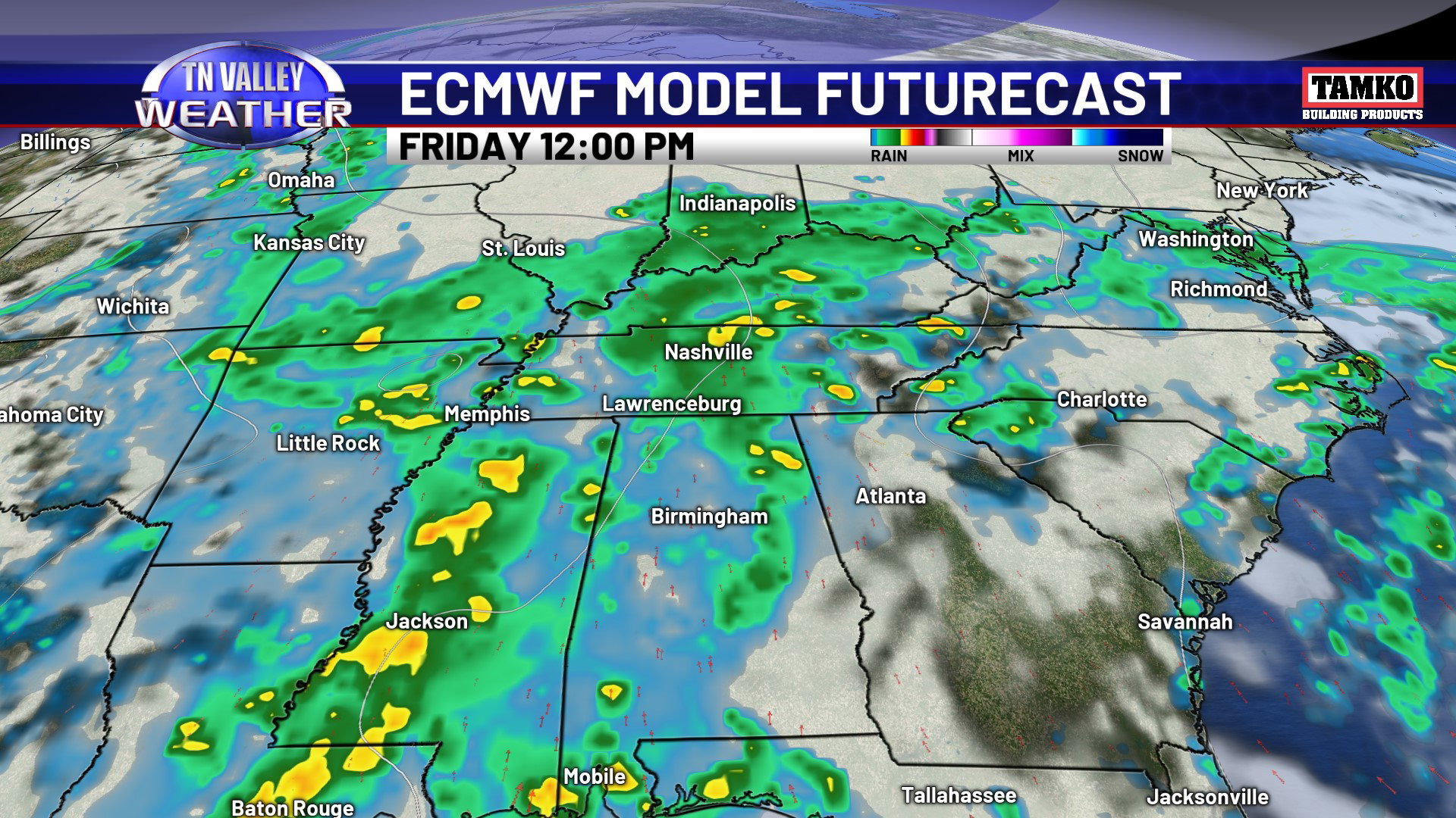
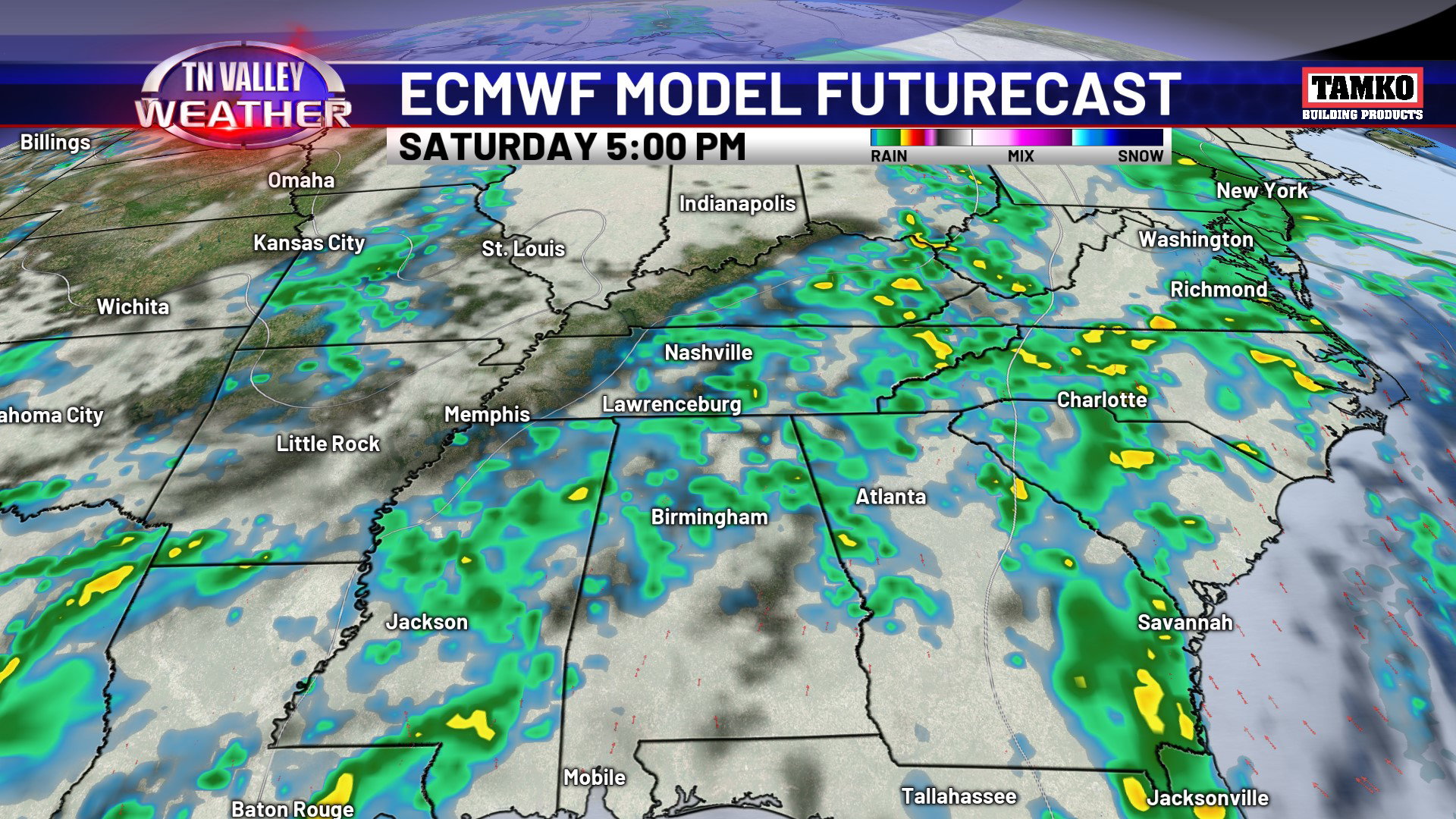
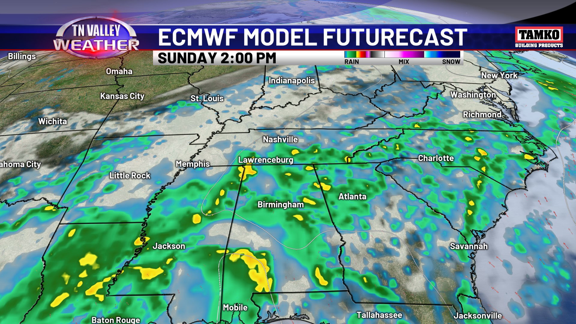
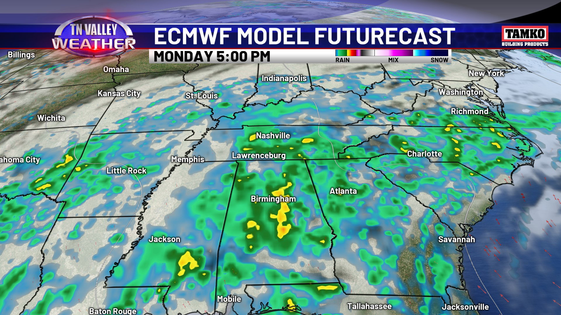

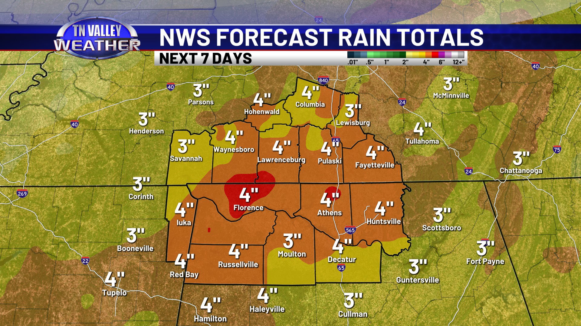
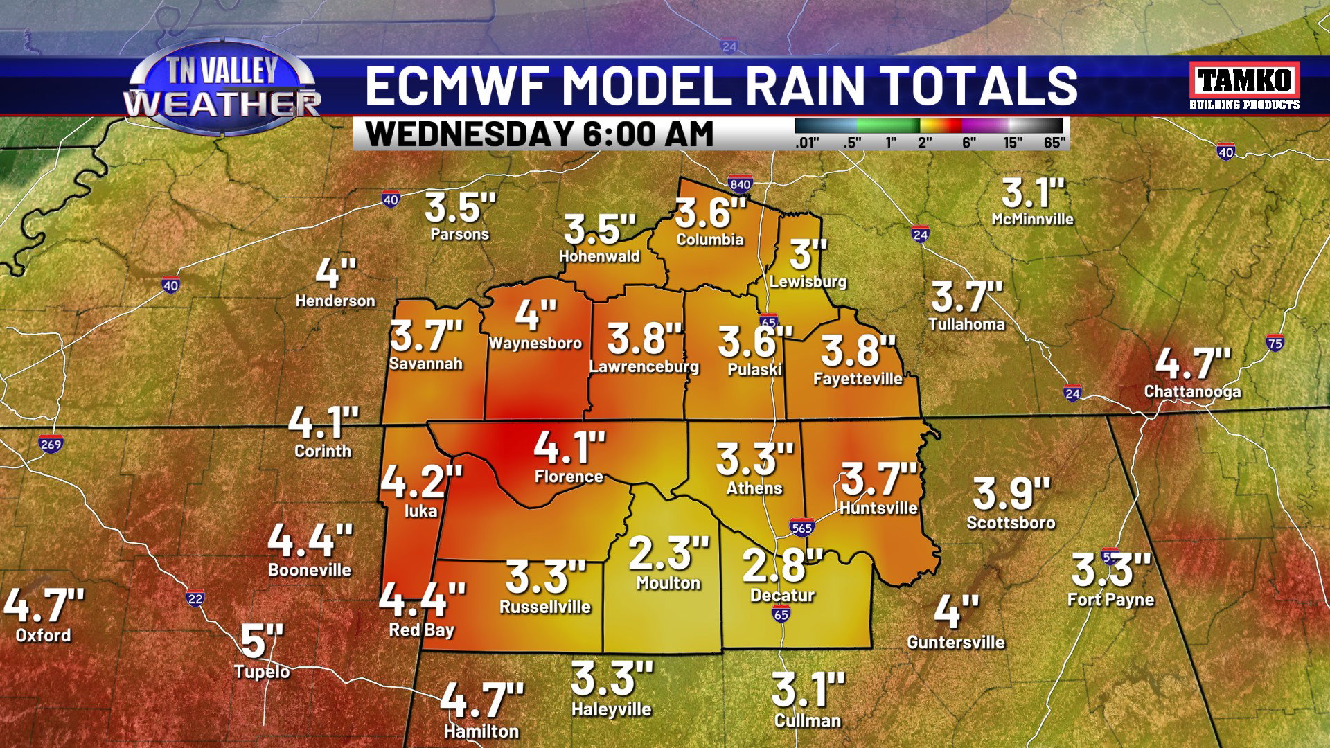
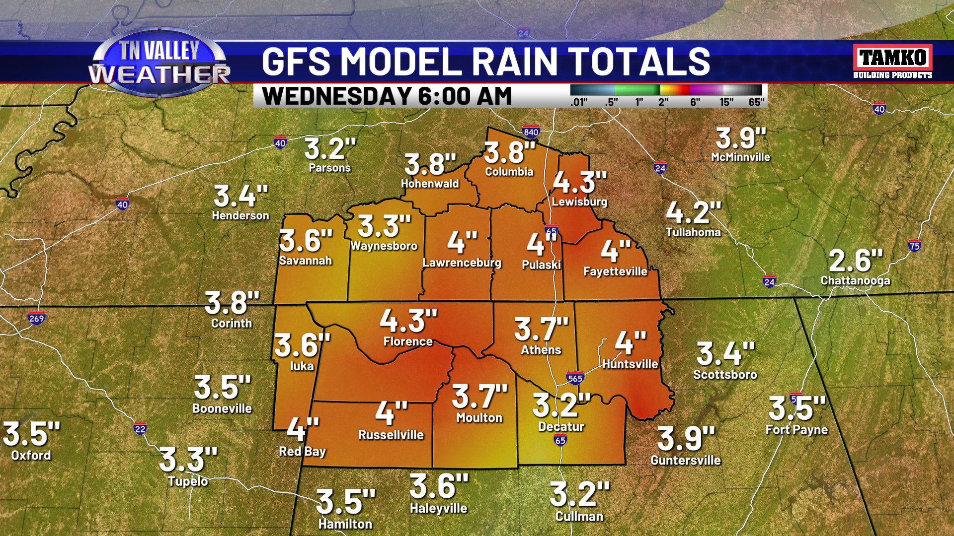
That upper-level disturbance lifts directly across the area on Friday, and showers and thunderstorms might be widespread for a large part of the day. Showers and thunderstorms are still likely on Saturday but might be a touch more scattered, and then things become widespread for much of the day again on Sunday and especially Monday on Memorial Day. Any day in here, rainfall will be locally heavy. Those elevated rain chances look to continue through at least the middle of next week, and possibly beyond that. The rainfall will eventually add up over time, and over the next 7 days, most all of the area looks to get a widespread 3.5 to 4.5 inches of rain, and there may be isolated heavier totals than that. This isn’t necessarily good for graduation ceremonies, ball tournaments, Memorial Day plans, etc., but this will certainly help a good bit with the ongoing drought once all is said and done!