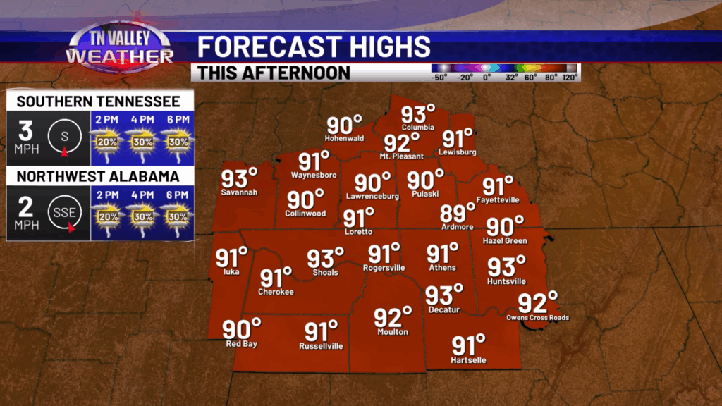
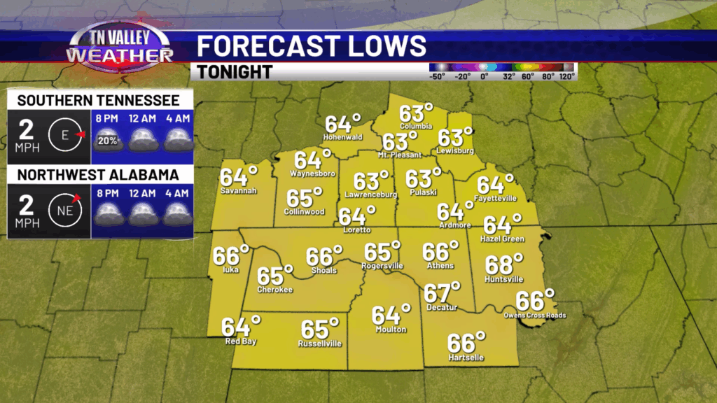
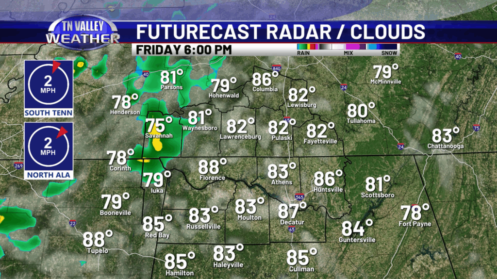
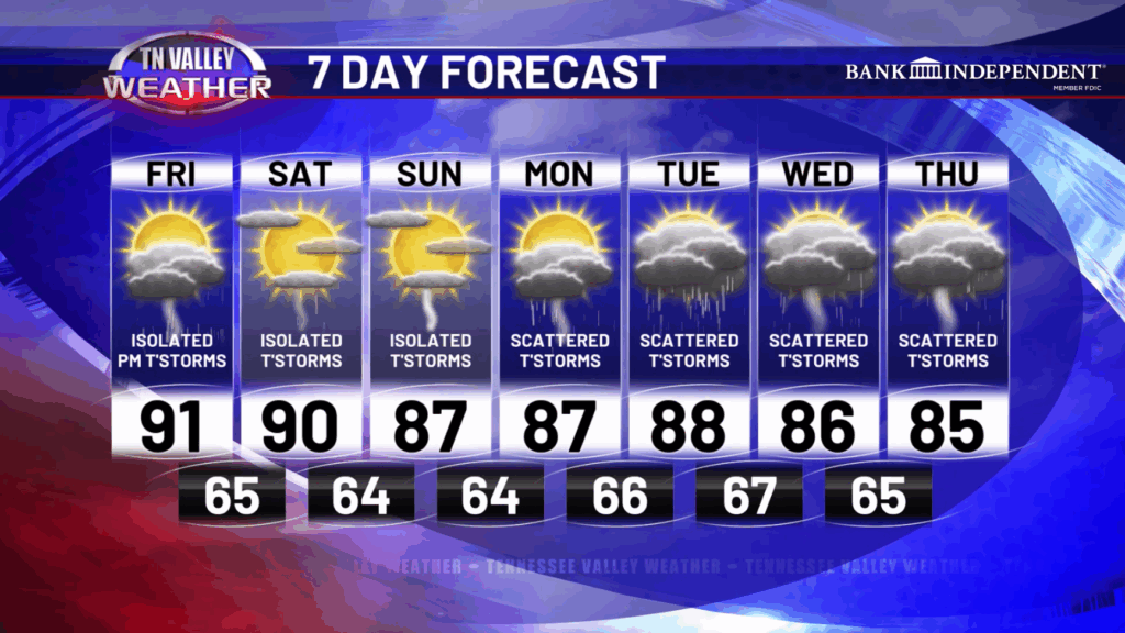
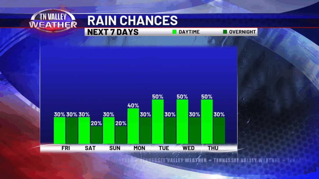
Happy Friday! After a dry day yesterday, rain chances return to the forecast today with isolated showers and storms during the afternoon and evening. Some high school football games could be impact by one of these so be sure to keep an eye on the radar! Temperatures today will be in the lower 90s with partly to mostly sunny skies. This evening, those showers and storms fade away after sunset with lows dropping down into the mid 60s.
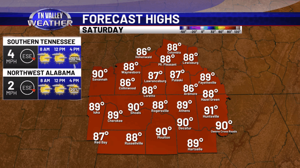
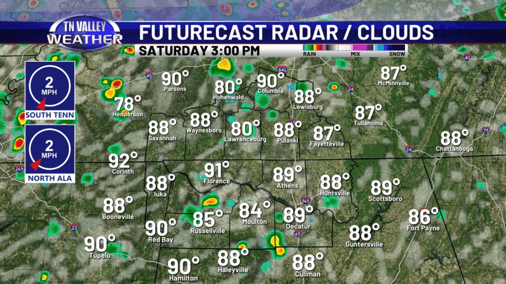
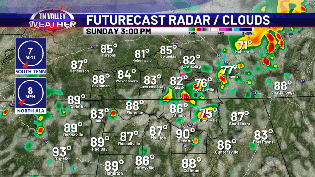
For Saturday and Sunday, more isolated to widely scattered showers and storms are expected during the afternoon and evening mainly. Highs will be in the upper 80s and lower 90s both days. Some of the storms could be on the stronger side with gusty winds, heavy rain and frequent lightning, but the severe threat is very low.
Going into next week, rain chances will go up even more with scattered to possibly numerous showers and storms Monday through Thursday. This should help reduce the spread of drought conditions across the area which is a welcomed sight! With more clouds and rain around, temperatures will begin to trend down into the mid 80s for highs by Thursday.
While strong to severe storms are not officially in the forecast currently, we will have to watch for a threat to possibly develop mid week (Tuesday-Wednesday) as there could be some stronger wind shear present. Something we will keep a close eye on in the coming days!
Have a great Friday and weekend!