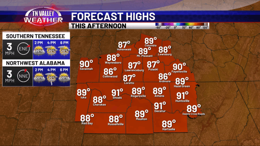
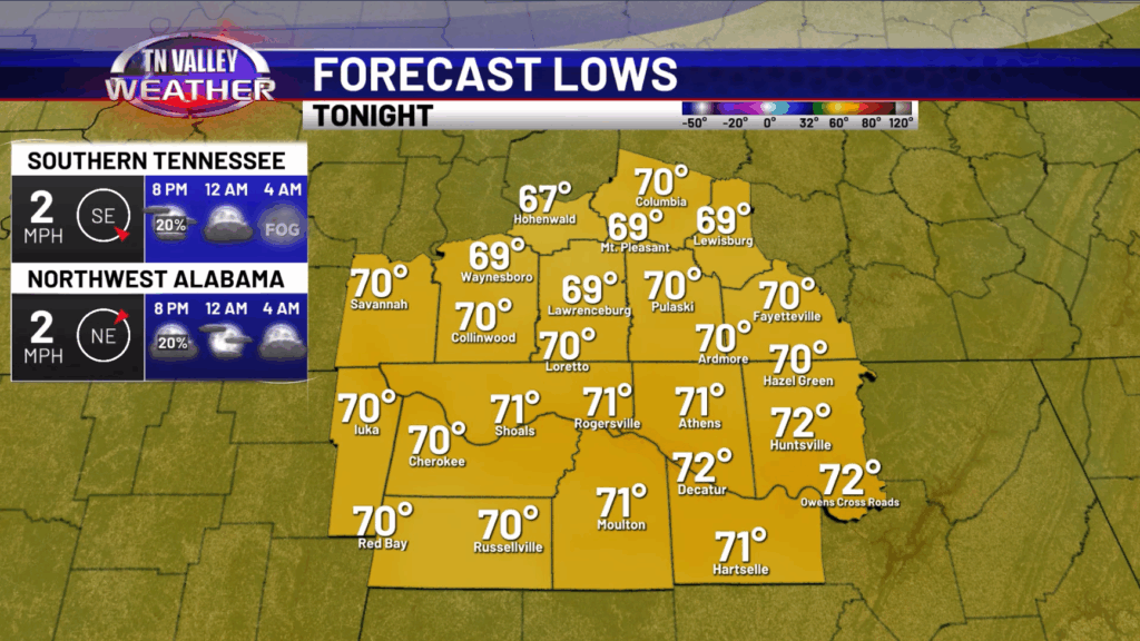
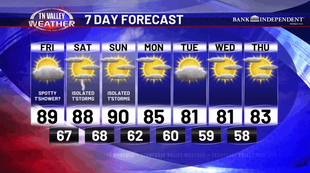
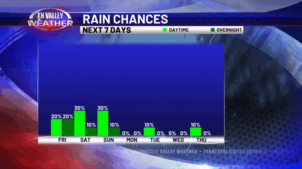
Happy Friday! We continue with the warm but not overly hot temperatures today and into the weekend. Today we will have highs in the upper 80s and lower 90s with some isolated showers and storms possible this afternoon and evening. Most places will just remain dry today. This evening, mostly dry conditions are expected for those Friday Night Football games, although an isolated shower or storm will be possible during the early evening hours. Lows will be in the upper 60s and lower 70s tonight.
On Saturday, a slightly better chance at some isolated to widely scattered showers and storms is expected with highs back in the upper 80s and lower 90s. If you have any outdoor plans, be sure to keep an eye on the radar but there will be a lot of places that remain dry once again.

On Sunday, we will have that anticipated cold front moving in bringing another round of some isolated showers and storms. Highs will still be in the upper 80s to lower 90s on Sunday. However, on Monday, we have that first bout of cooler air as highs will be in the mid 80s. Then, a reinforcing cold shot comes in on Tuesday which drops our highs into the upper 70s and lower 80s! Lows will be in the 50s to around 60 Tuesday morning through Thursday morning! We cannot even rule out some places flirting with the upper 40s for lows in the typical cooler spots out in the rural areas. A definite taste of Fall coming our way!
Have a great Friday and weekend!