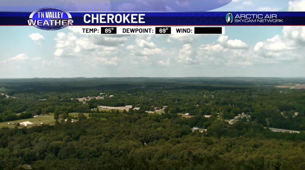
With those patchy fair weather cumulus clouds and that UV index around 10, this Weekend has started about like you’d expect as far as August is concerned. 80s and near 90 was the story for most all of us and humidity hasn’t gone anywhere, but a decent breeze (gusts to 10mph) has helped to provide a bit of relief for today.
Fortunately, if you’re not a fan of the unabated heat, we have some changes in the forecast coming up… not necessarily major cooldowns, but some more widespread rain chances to abate the scorching sun will be in the area in a matter of days. Let’s break it down.
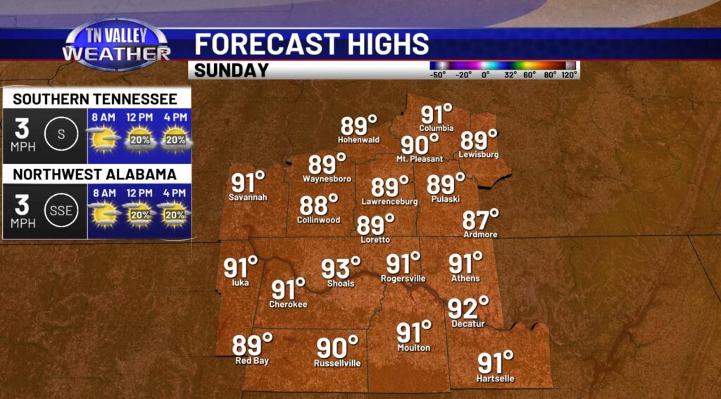
To wrap our Weekend up we don’t initially see any major changes compared to today – we’ll have highs near 90 on average, and a few shower chances lingering. Now, those rain chances aren’t particularly high; we will more likely than not only see those spotty popcorn type showers, especially in North Alabama. We likely won’t have to change our day plans around at all thanks to those rain chances being so low, so I’d say you are good to go as far as errands are concerned for our Sunday. It’s later in the week that rain chances escalate locally.
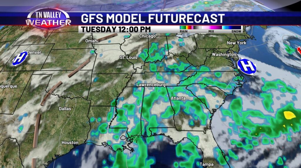
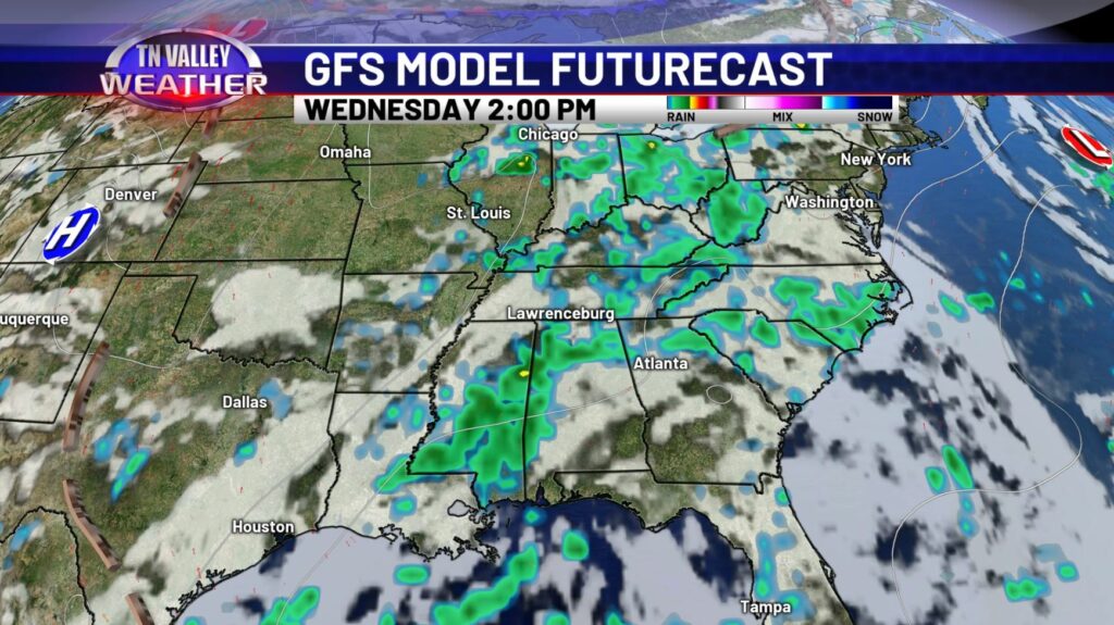
Scattered Thunderstorms begin Monday, but the current timeframe we’re monitoring for the best chance for widespread rain/storms is the midweek, namely Tuesday and Wednesday. At present, I hesitate to call either day a total washout, but these two days are certainly the days that have the best shots at being one, so keep the umbrella on hand, and if thunder roars, go indoors! Both before and after this midweek time frame the precipitation chances are more scattered in nature, though no one particular day of the next workweek looks totally dry (which is fairly typical in and of itself for this time of year).
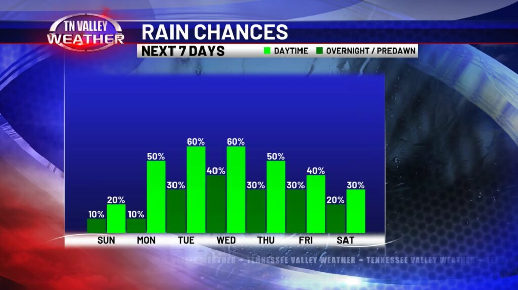
Taking a look at the rain chances for the next 7 days, you can certainly see that aforementioned steady staircase climb up – and back down – centered up on the middle portions of the workweek. Even still, overnight rain chances never exceed around 40%, with most nights being 30% or less, so our rain totals will likely not exceed .5 to 1 inch locally – a bit of a goldilocks zone for us right now, as some drought conditions have developed in spots of Southern Tennessee.
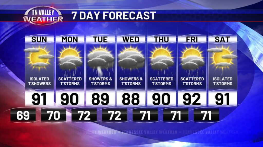
All said and done, those higher rain chances in the Tuesday-Wednesday timeframe do knock our expected highs down a few degrees compared to the background state of what we’d otherwise have with clear conditions, but we recover back to the lower 90s in a more steady fashion as those rain chances decrease (but still persist in some scattered fashion) for the end of the week. As mentioned earlier, perhaps run those outdoor errands today or tomorrow, if you can… because an umbrella will be necessary for a lot of us by midweek.