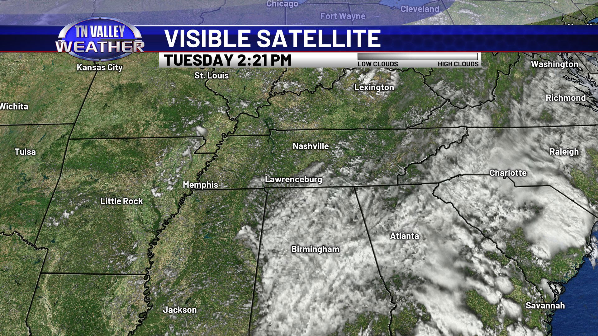
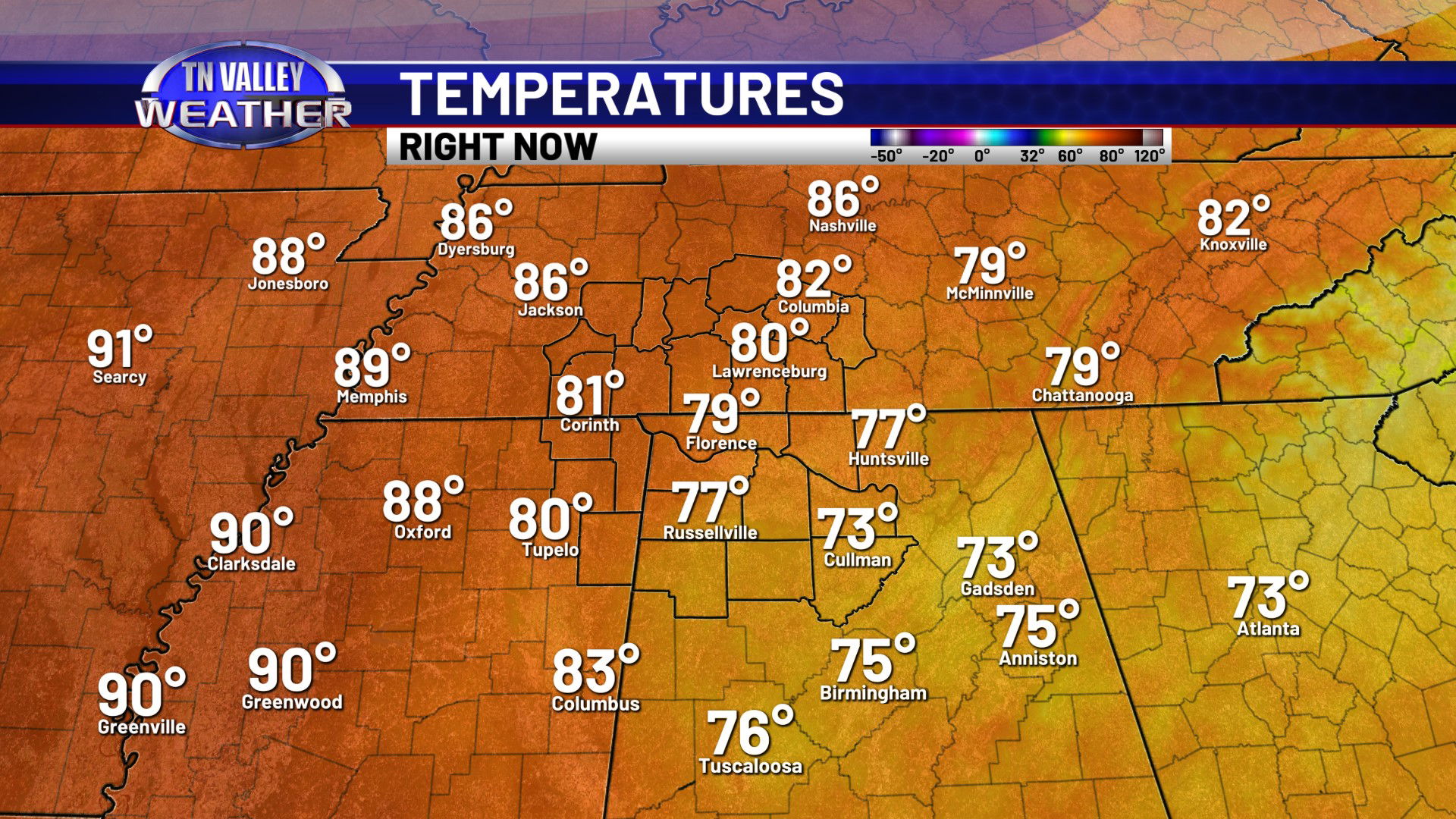
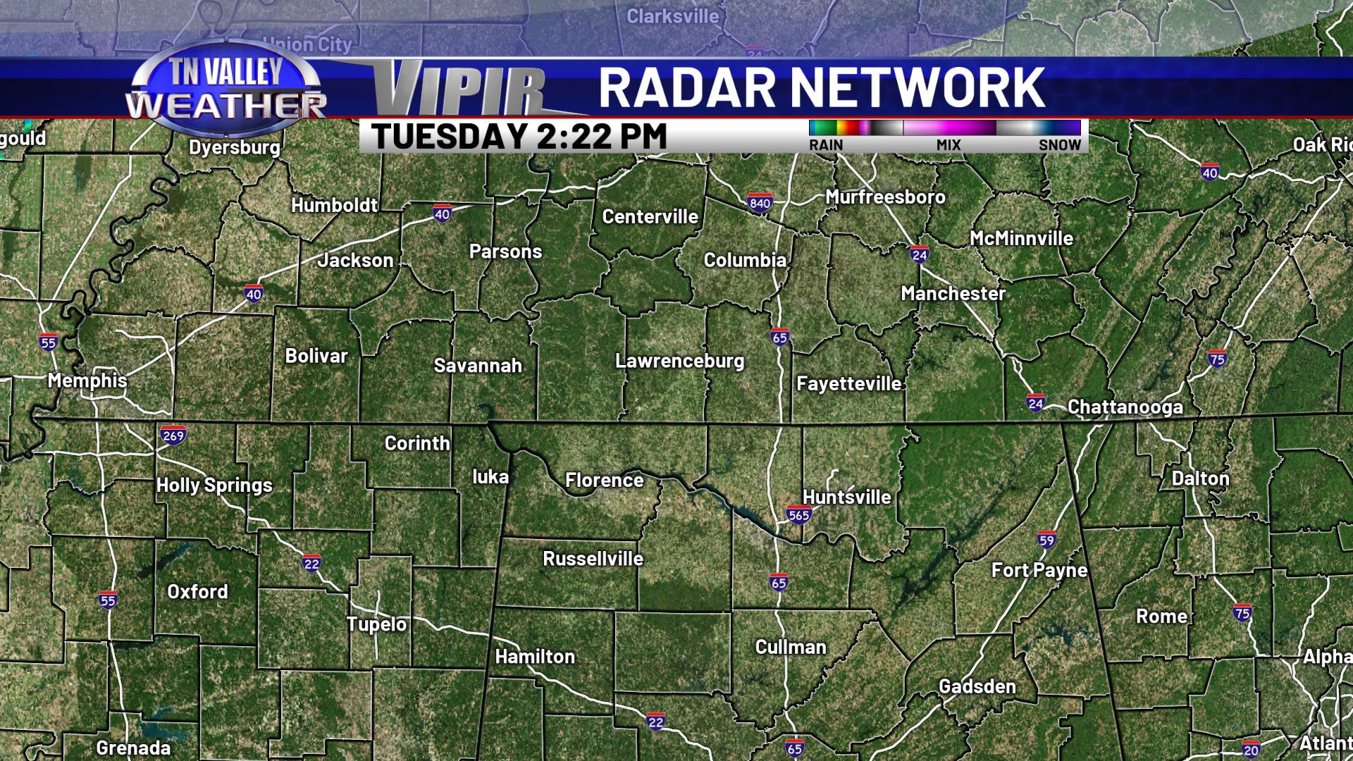
We’re still stuck heavily in the cloud cover and cooler temperatures again on this Tuesday. The thickest cloud cover is along and east of U.S. 43, and these areas of north Alabama into southern Tennessee remains in the mid to upper 70s. We have a little more in the way of sun west of that general area, and that has allowed the western half of our area to sneak up into the lower 80s this afternoon. But with temperatures averaging in the lower 90s this time of year, we are still running a good bit below average for even the areas that have had sun and slightly warmer temperatures. Despite all the clouds, radar is quiet this afternoon, but we can’t completely rule out a stray spotty shower or two. The vast majority of you will continue to stay dry though.
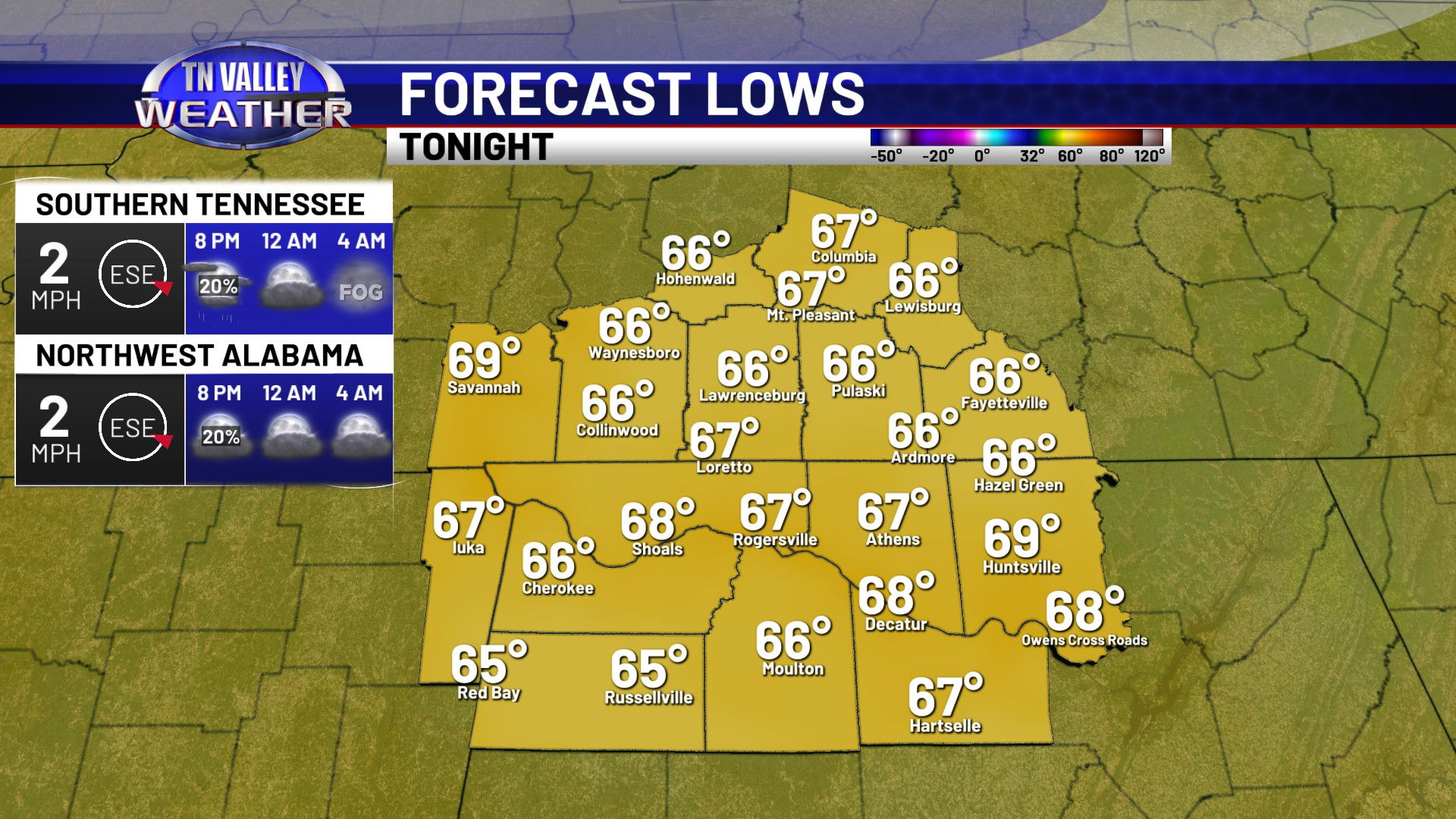
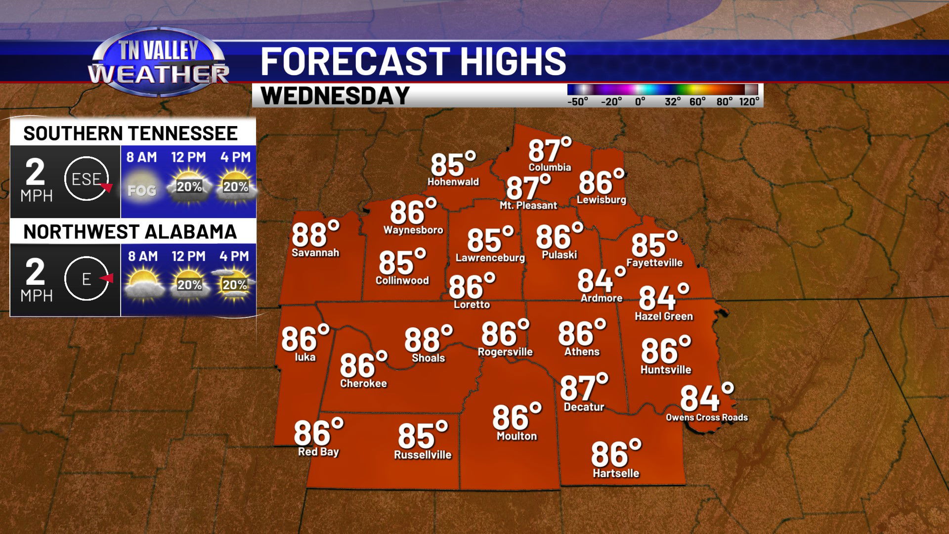
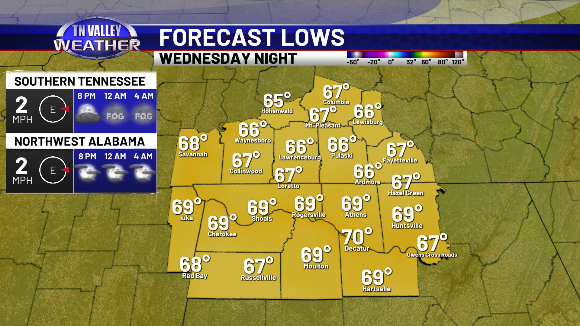
Any shower that pops up in the afternoon hours will end early this evening, and then partly cloudy skies will hang around overnight. We can’t even rule out some patchy fog in the early morning. Overnight lows will be in the mid to upper 60s. We will have a little more sunshine for Wednesday as the wedge of cooler air gradually continues to erode. This will allow temperatures to climb a little more, into the mid to upper 80s for afternoon highs. We have the chance of a few isolated showers and storms during the afternoon, but most folks will likely once again remain dry. Partly cloudy skies hang around Wednesday night, maybe some fog once again, and overnight lows will drop into the mid to upper 60s.
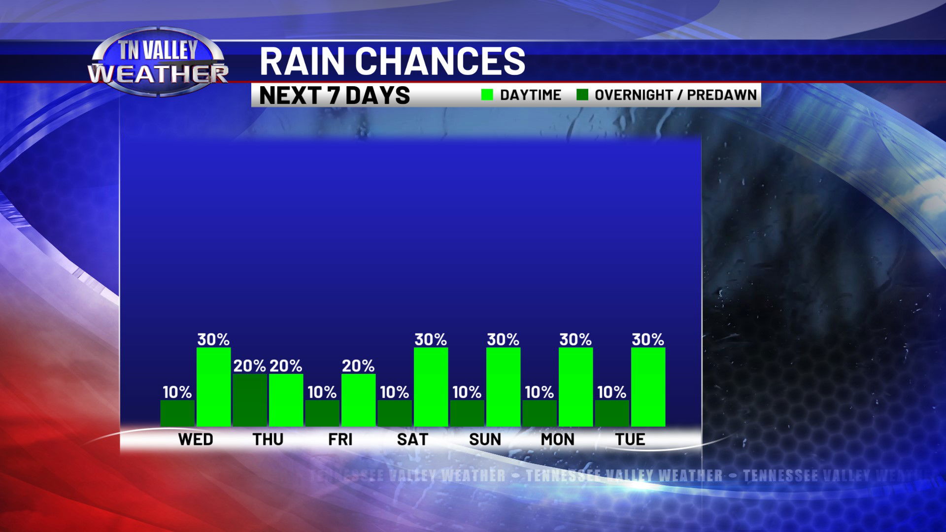
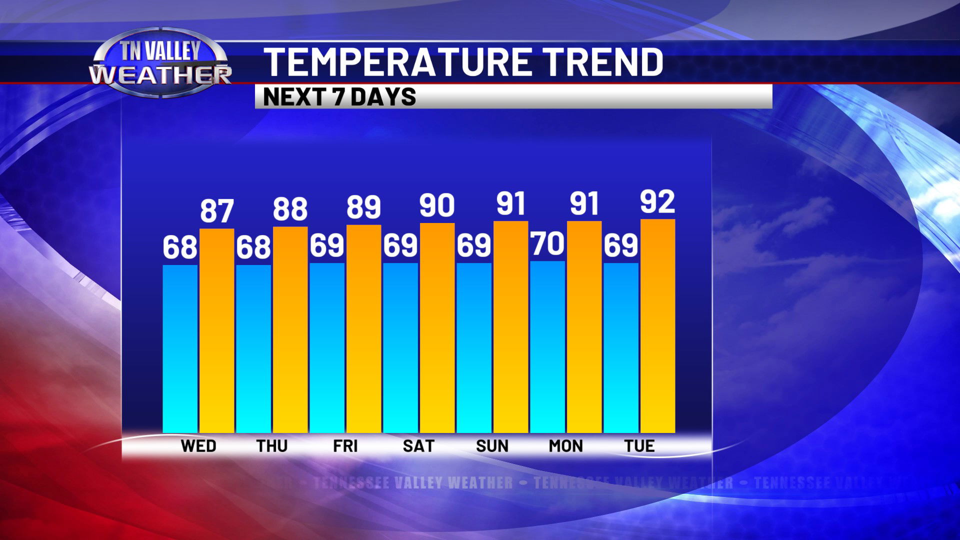
The biggest weather change we will see through the rest of the week and the weekend is that temperatures will gradually climb back through the upper 80s into the lower 90s. Partly cloudy skies can be expected each day with only isolated daily afternoon showers and thunderstorms. Overnight lows will remain between the mid 60s and 70 degrees through the rest of the week and weekend.