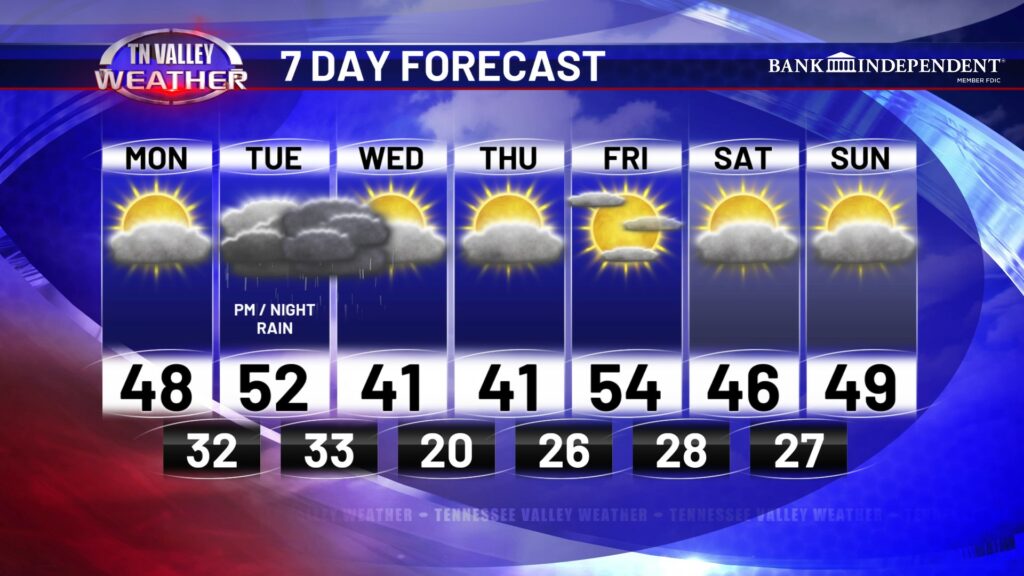
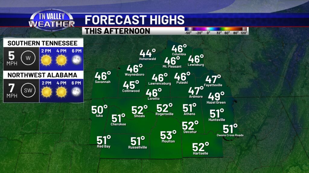
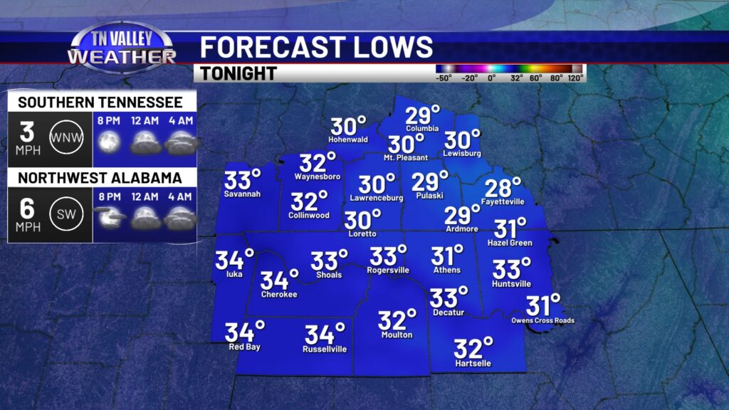
If that headline doesn’t make you happy, I don’t know what will! It’s about time temperatures get well above freezing here in the Tennessee Valley. We even have rain to talk about! Yes, rain! Sunshine and a southerly wind will help us get to the mid 40s to lower 50s this afternoon. North AL is where we will see the lower 50s, but for you folks in southern middle TN still dealing with ice, you will likely only reach the mid 40s this afternoon. Even at that, we will get in some beneficial melting today. Lows tonight will be coldest around midnight, before clouds move in overnight ahead of our next rain chance.
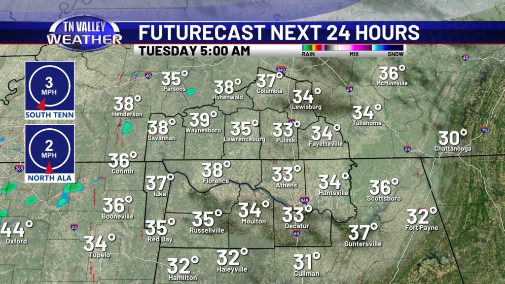
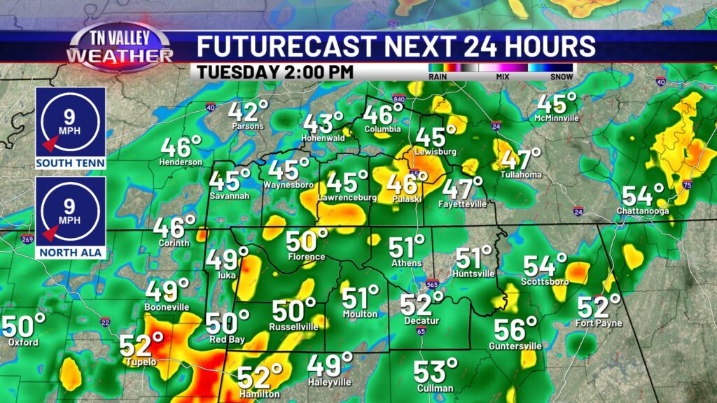
Tuesday will start off cloudy and dry, with rain moving in around lunch time. Grab the rain gear before you head out for the day, you will need it by the afternoon. Rain may be heavy at times and if you have any outdoor work you need to get done, the earlier the better. Before rain arrives, just about everybody should reach the lower 50s.
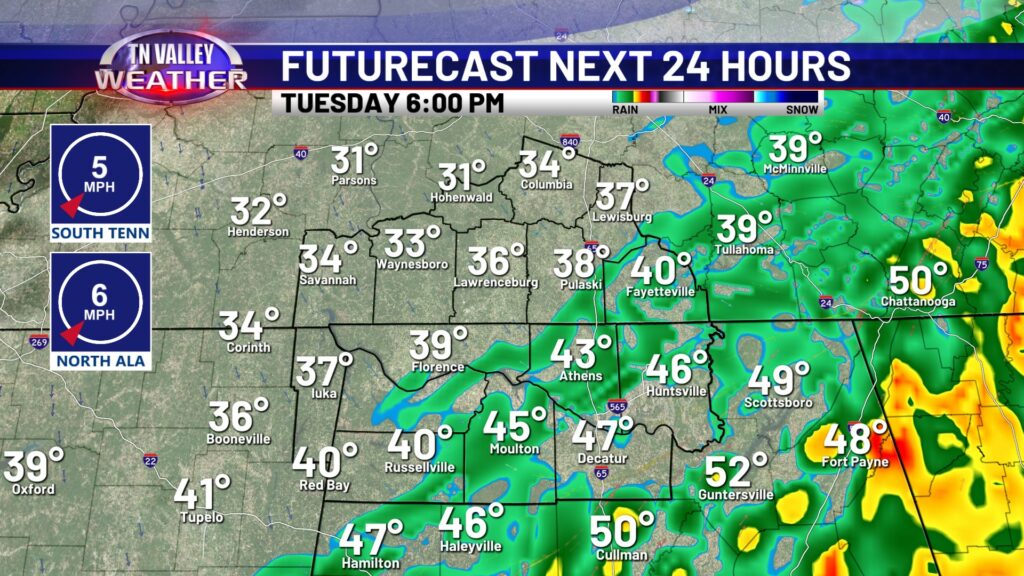
Showers will still be around during the evening after sunset, but we will start to see rain exit the area NW to SE by nighttime. Heavier rain is expected during the afternoon, and light remaining showers will finish it off through the evening. I do think Futurecast here is a bit too quick at getting rain out of here, but the overall trend is aligning with our thinking here.
Aside from Tuesday’s rain, the rest of the week is going to be pretty uneventful. I know that’s music to everyone’s ears, after the intense last few weeks we’ve had here in the Tennessee Valley. The good news is highs this entire week remain above freezing. Even 2-3 days of 50s during the afternoon! It will be noticeably colder Wednesday and Thursday, but no sign of any arctic blasts any time soon. *sigh of relief*