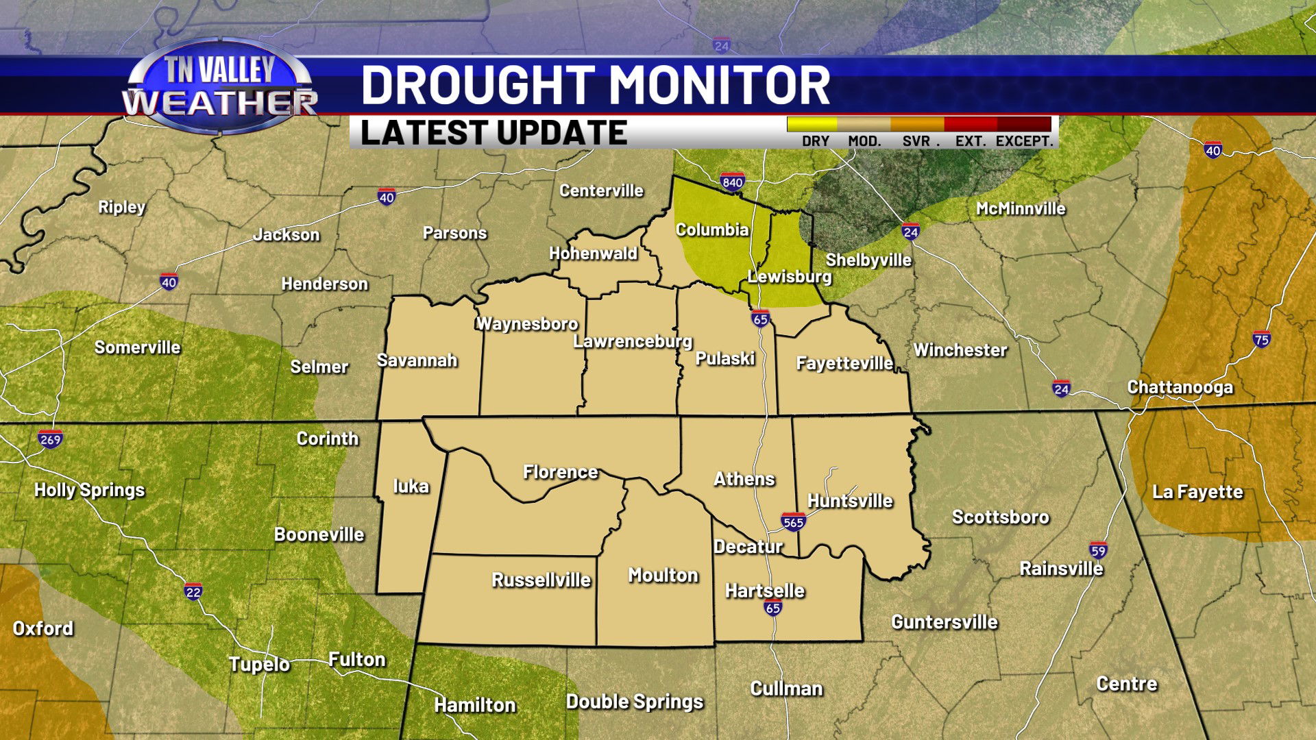
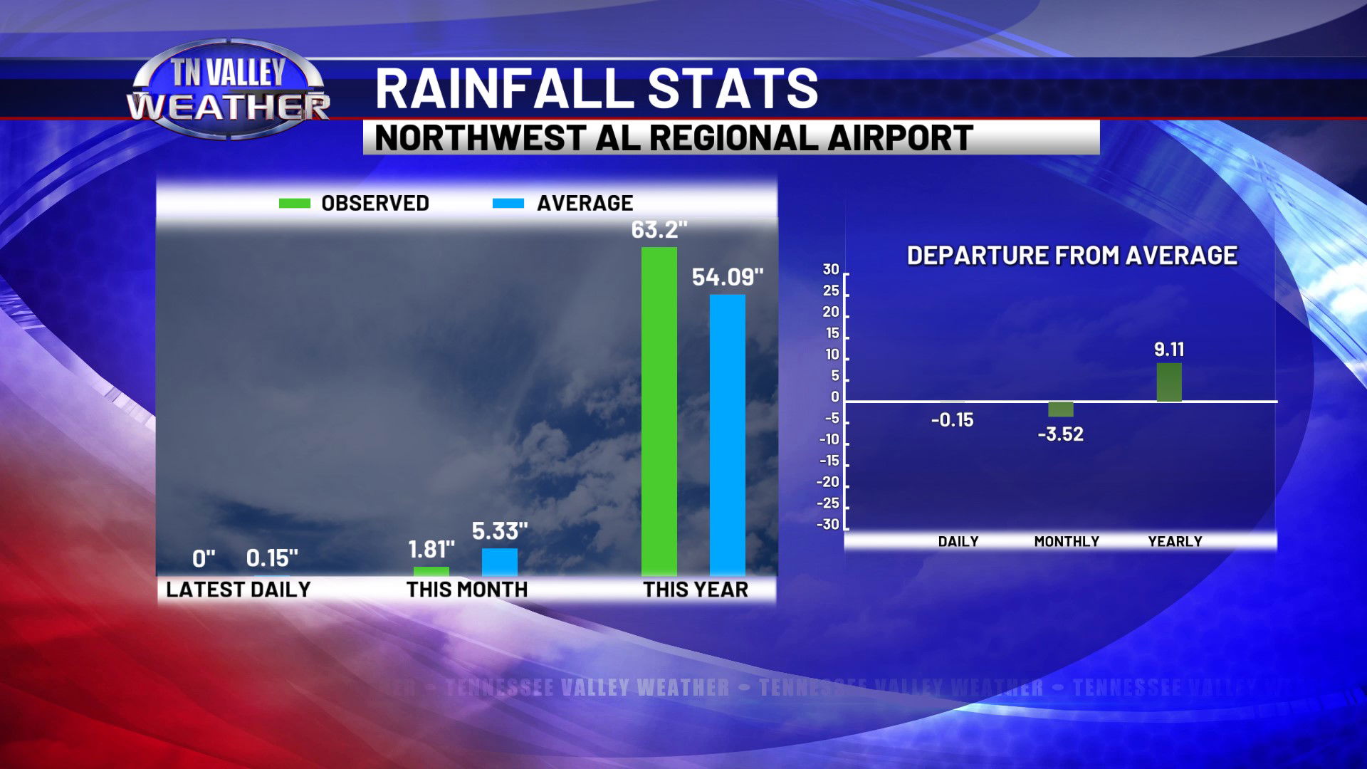
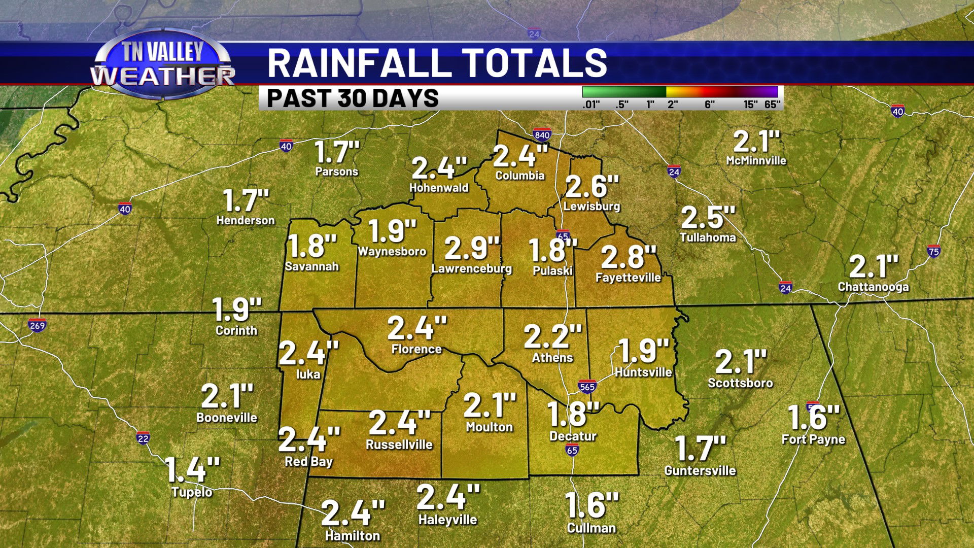
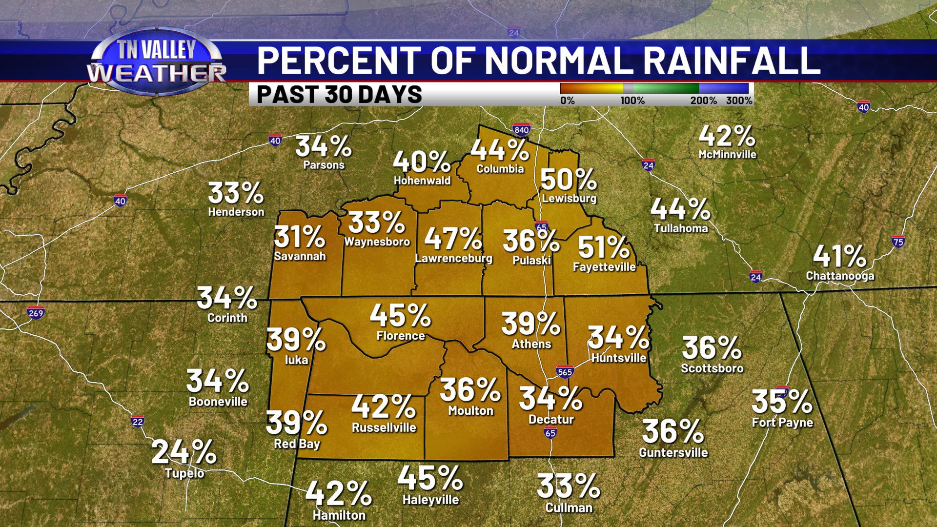
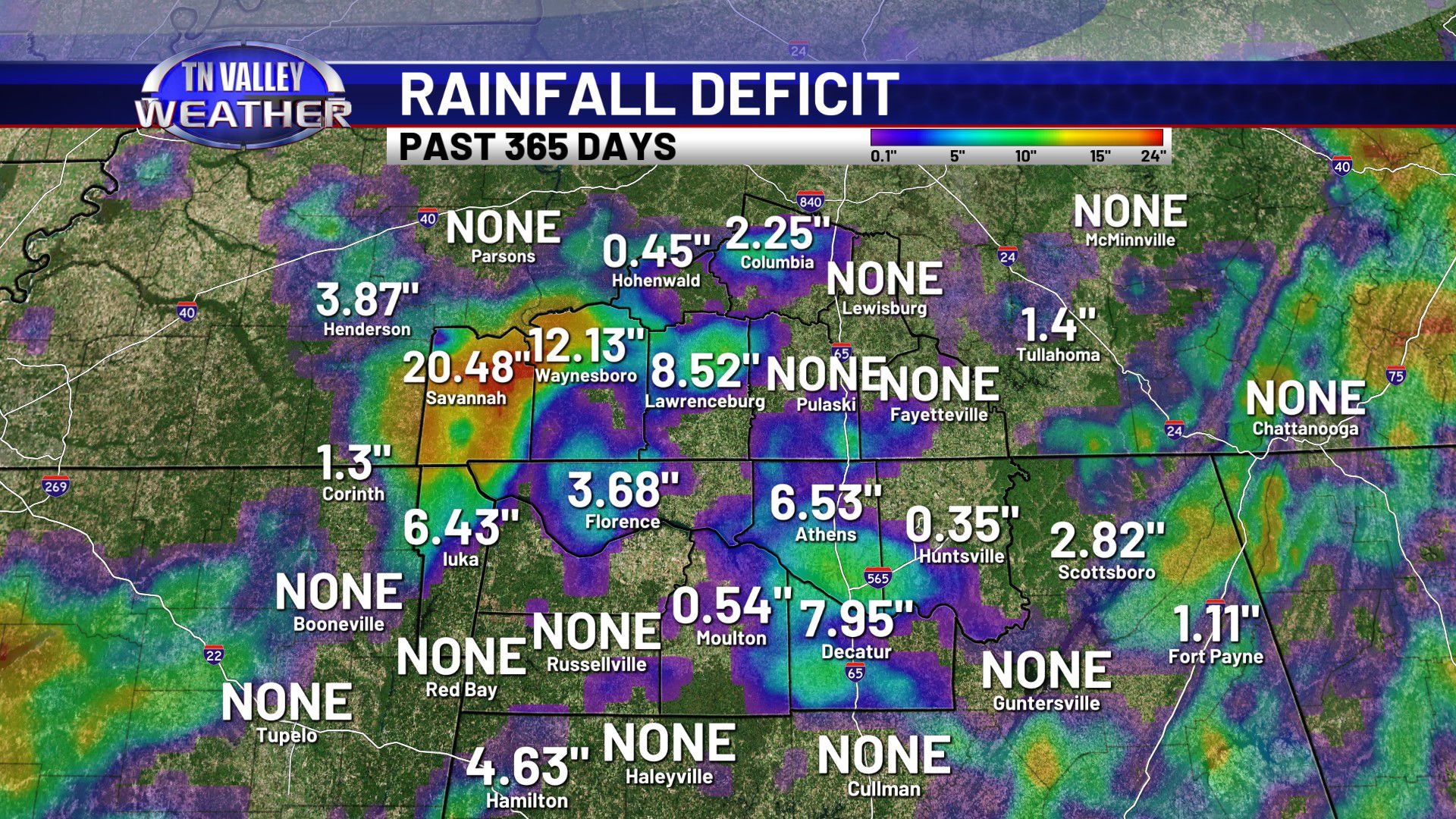
As we briefly mentioned in our year in review post yesterday, drought conditions have officially returned to the Tennessee Valley. The latest Drought Monitor update from the NWS Climate Prediction Center has almost all of our viewing area in Moderate level drought conditions now. While we have seen a few occasional rain events recently, they haven’t added up to a lot. Rainfall totals across our area for the past 30 days range in the 1.5 to 2.5″ range, with December climatologically being one of our wetter months of the year, averaging over 5″ of precipitation. The only reason we don’t have much larger yearly rainfall deficit numbers is because of the very wet first half of the year we had. Surprisingly, some of those January through June rainfall totals are keeping us above average for the year. The Muscle Shoals Airport, for instance, is still +9.11″ for the year despite the recent dry conditions, coming in at 63.2″ of precipitation for 2025.
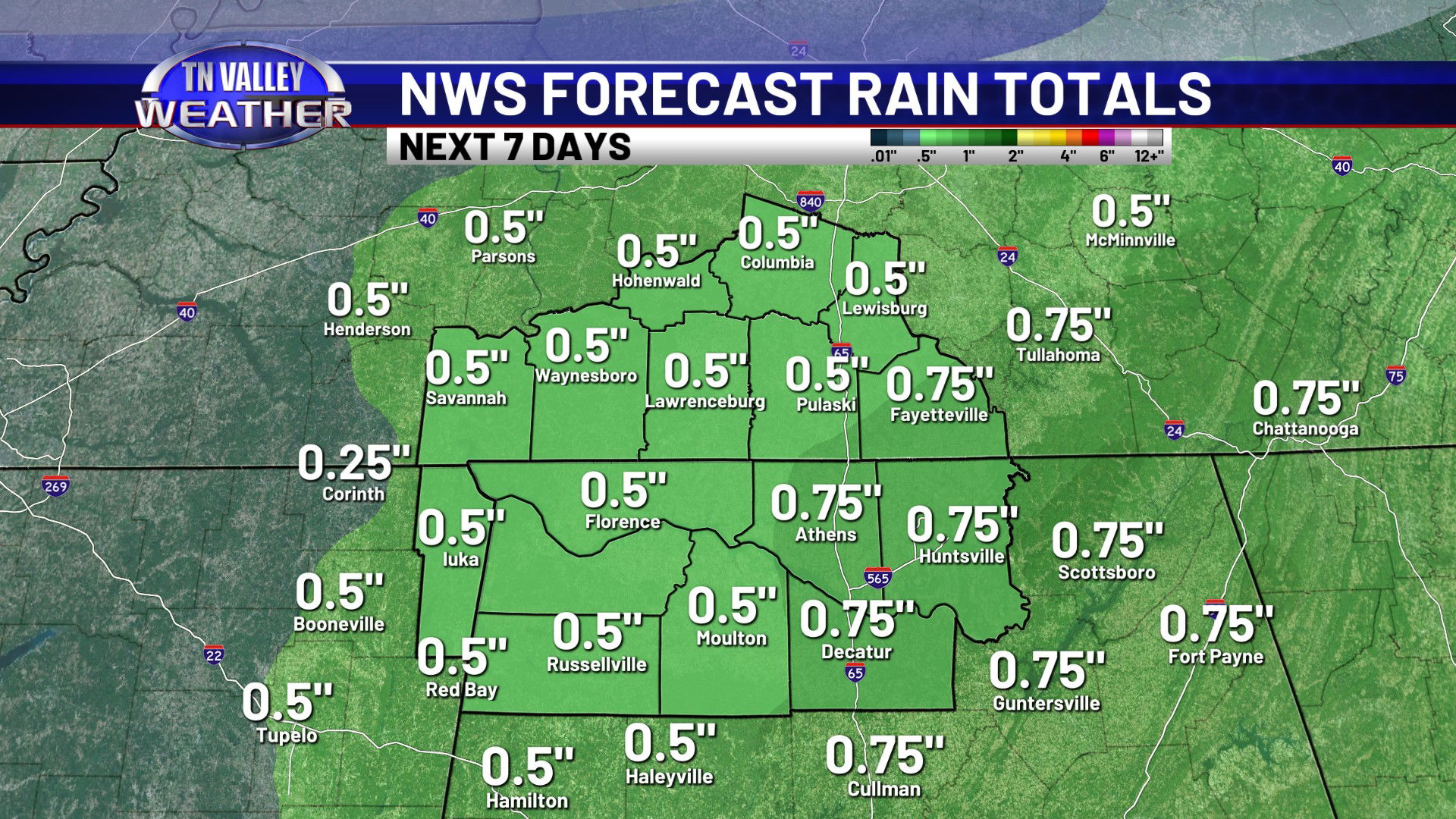
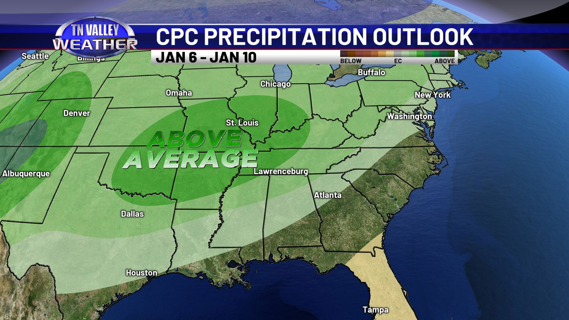
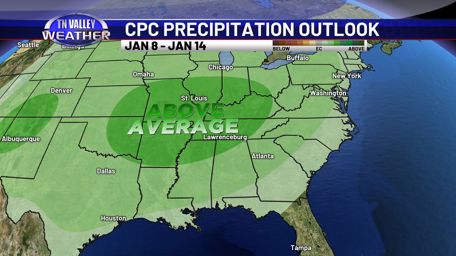
While we do have some rain in the forecast from Friday afternoon into Saturday morning, most rainfall totals look to stay around a half inch or a little more. Fortunately, there are signs the pattern may be getting ready to become more active as we head into the first half of January. The NWS Climate Prediction Center has us outlooked in above average precipitation chances in both their 6-10 day and 8-14 day outlooks, ranging in the time period for January 6th through the 14th. This is just basic extended range pattern recognition and CAN change, but we will certainly take any rainfall we can get! We have some significant makeup work to do for December being so dry, or we will have a hard time not developing more substantial drought conditions later in the year when we turn drier during the summer and fall.