
Despite some of the recent rounds of rain and storms the past few weeks, drought conditions not only continue across the Tennessee Valley, but have actually worsened a bit. The most recent update to the Drought Monitor shows “Moderate” drought conditions covering just about all of our viewing area across southern middle Tennessee, north Alabama, and far northeast Mississippi.
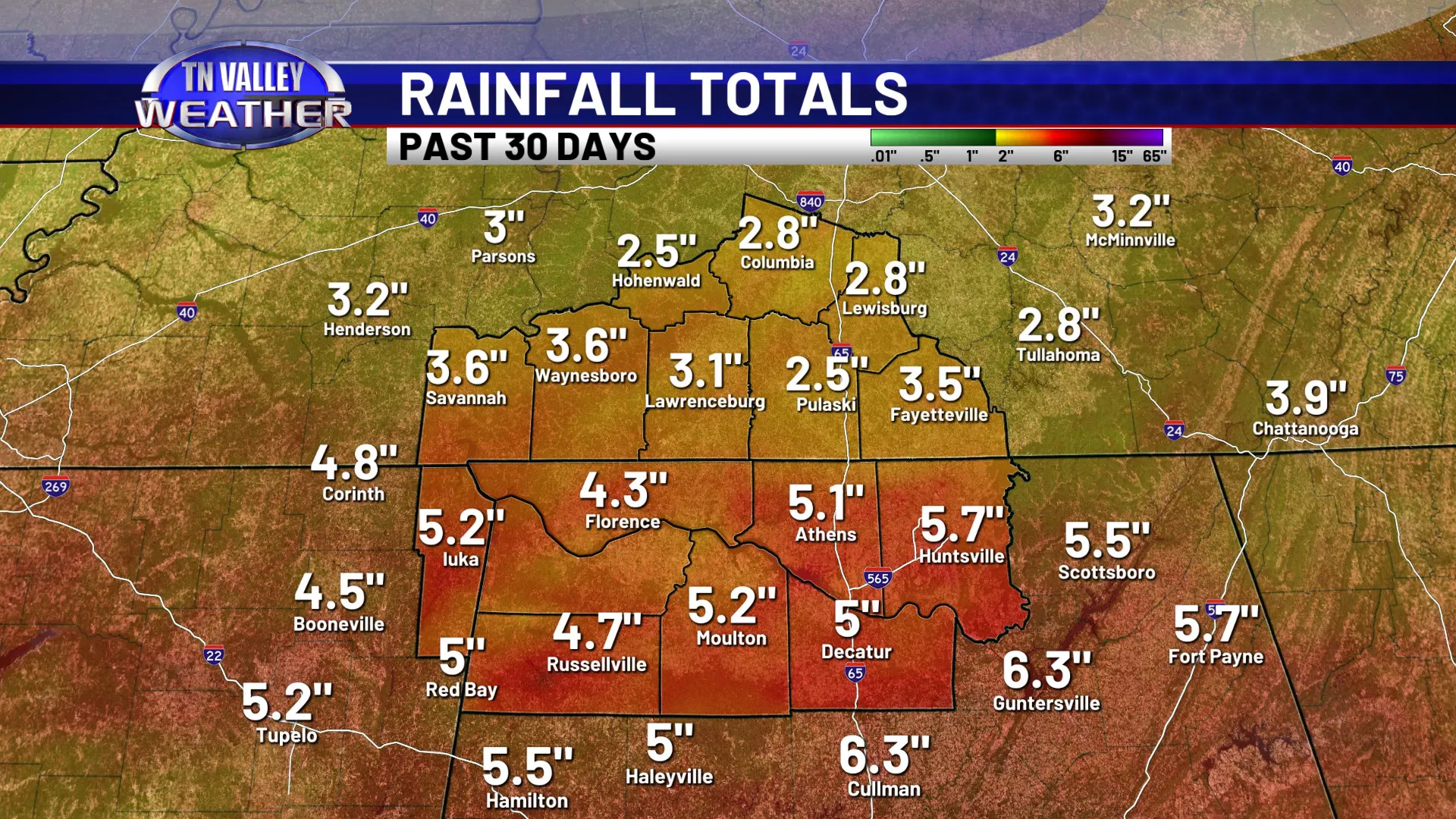
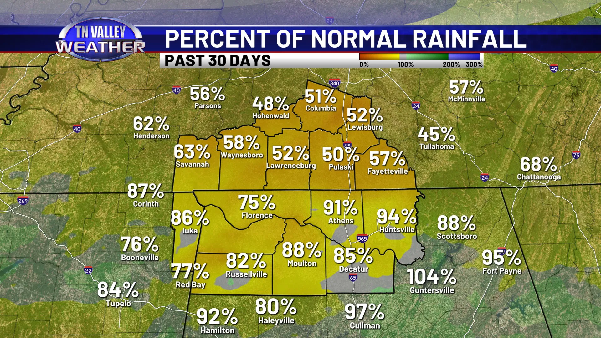

It’s NOT that we haven’t had any rainfall at all across the area. As mentioned, there have been a few different rounds of showers and storms across the area the past few weeks. However, it just hasn’t been enough. While a lot of north Alabama has gotten 4 to 5 inches of rain the past 30 days and has been anywhere from 75% to 95% of their normal rainfall, southern middle Tennessee hasn’t faired quite as well, with only about 2.5 to 3.5 inches of rain. That’s roughly only half of what they usually expect. This time of year, along with the fall and winter, is usually when we see our big rains for the year… and outside of a few wet spells here and there, we have been mostly below average since well back into last year. Rainfall deficits are starting to pile up now, with a large part of the area now running a rainfall deficit of 1 to 2 FEET for the past 365 days, and the main reason those numbers aren’t higher is because of the big rains from LAST SPRING still being on that count a little while longer. It’s not so much about whether there is mud in your yard for a couple of days after a storm event, but deep-layer water tables, lake and river levels, etc., are now starting to notice the deficit and suffer. We need some significant rain, and soon. Not all at once so that we end up with flooding issues, but we need it soon. We usually go into drier conditions overall as we head into the summer as the jet stream and storm track shifts north, and we do not need to go into those conditions being significantly below average on rainfall. That will seriously intensify drought conditions if that happens.
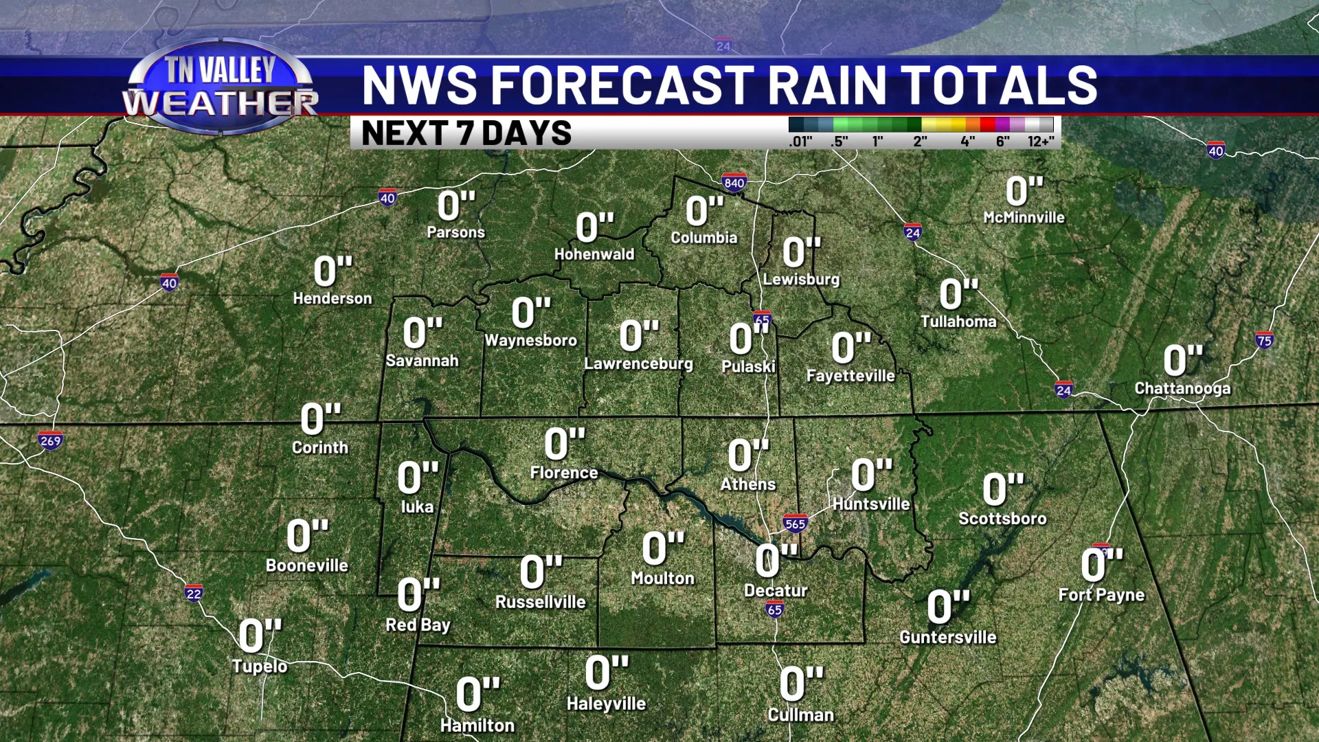
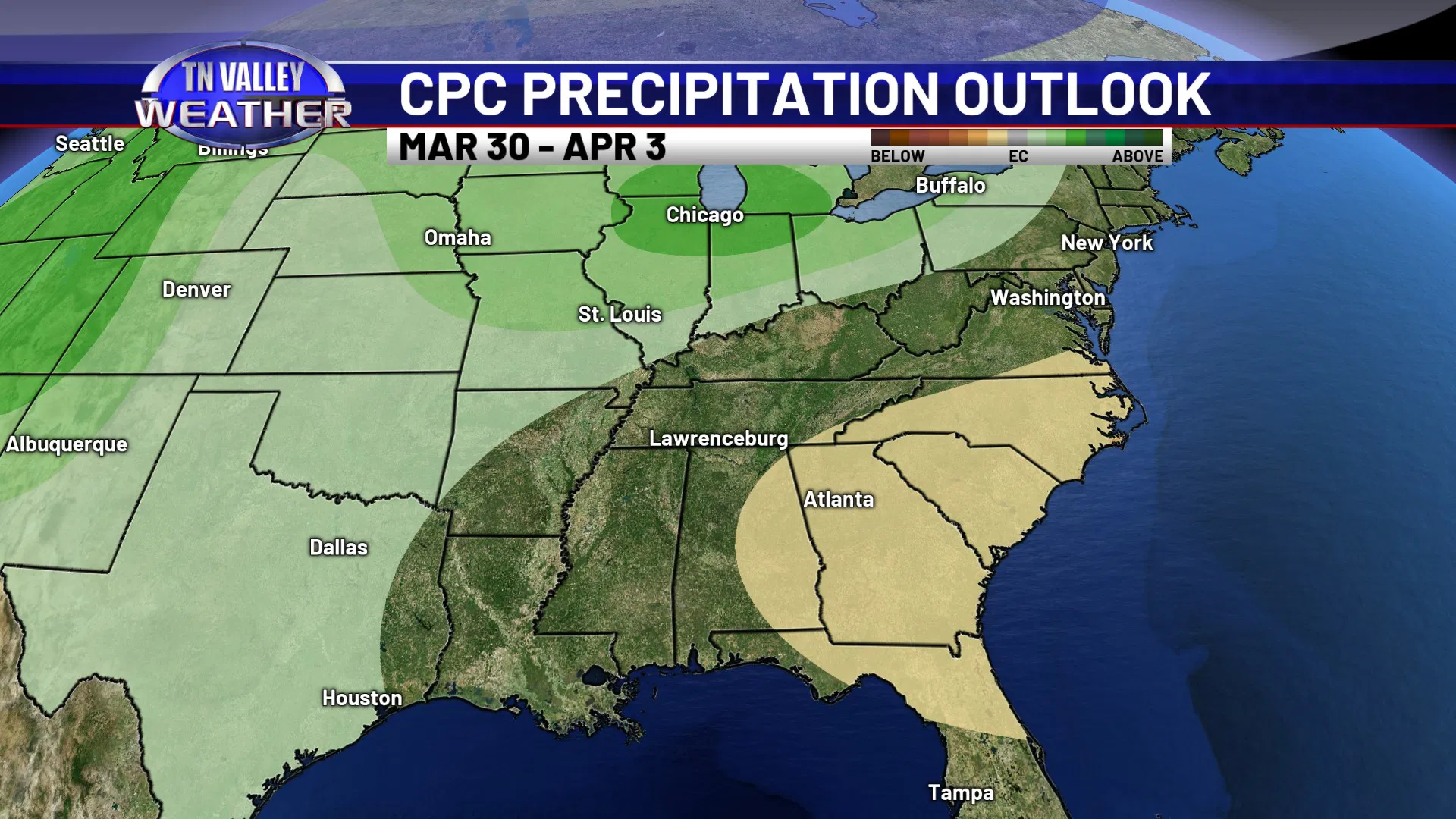
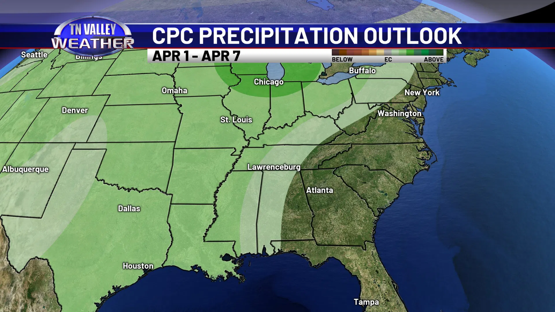
Unfortunately, we don’t see any credible signs of significant rain anytime really soon. The forecast rainfall totals for the next 7 days from the NWS are coming in as a big ZERO. Now, it won’t be completely 0.00″. We do expect a few spotty showers to come down Friday afternoon and night with the next cool front, but those showers will be in the process of dying out as they come across the area, and any rain we do see from them will likely come in at under one tenth of an inch. The NWS Climate Prediction Center’s precipitation outlook for the next 6-10 days has us in average to slightly below average chances for precipitation. However, their 8 to 14 day outlook that includes the first week of April, does start to shift us back toward above average probabilities. We are starting to see consistent signals that the pattern may get more active as we head into next month. We’re just not sure where exactly in the Southeast the heaviest rain will set up… if it will be close enough to here, or if it tries to stay a little to our north and west. Time will tell!