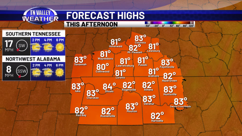
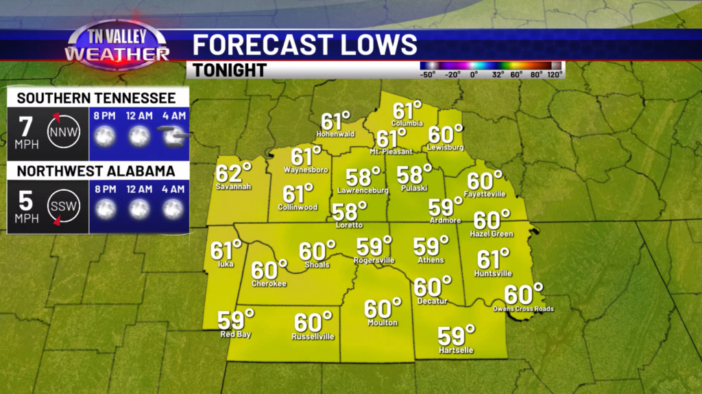
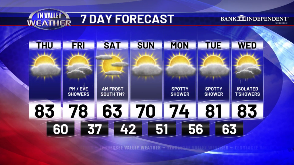
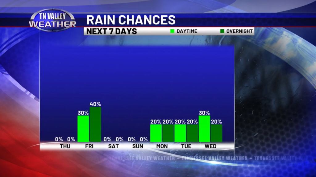
Good Thursday morning! Our warmest day of this week is today, with highs in the lower to middle 80s under mostly sunny to partly cloudy skies. No rain chances on the board for today. Winds will be breezy at times with gusts around 20-25mph. This evening, skies continue to be mostly clear with occasional gusts. Lows will be in the upper 50s and lower 60s.
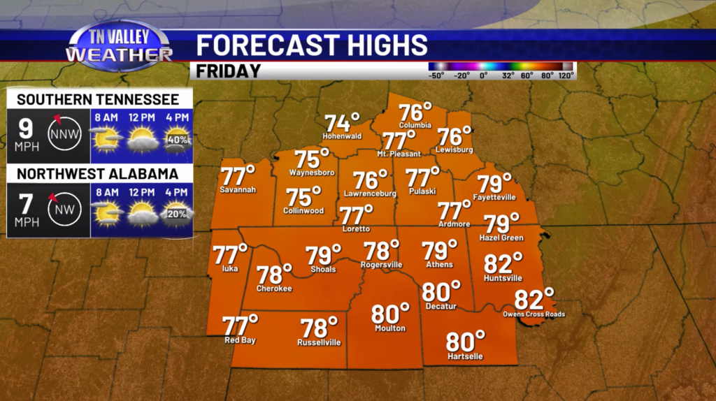
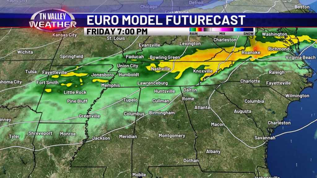
For Friday, the bulk of the day will likely be dry until we get into the mid afternoon hours. Showers will be moving in from the northwest ahead of a cold front. No severe weather is expected, and really no thunderstorm activity is anticipated as well. Highs will be in the 70s to near 80 for some. Showers will continue into the early to mid evening hours before dissipating.
The weekend will start off quite chilly with mid 30s expected Saturday morning and things really don’t get overly warm during the day with low 60s expected. There could be some patchy frost across Southern Tennessee during the morning hours. We do warm up into the upper 60s and lower 70s on Sunday with partly to mostly sunny skies.
Going into next week, we will see the return of the 80s on Tuesday, but rain chances also start to increase. Spotty showers will be possible Monday and Tuesday, and then more isolated to widely scattered showers and storms are anticipated on Wednesday. Currently, we do not see any severe weather in the works for Wednesday.
Have a great Thursday!