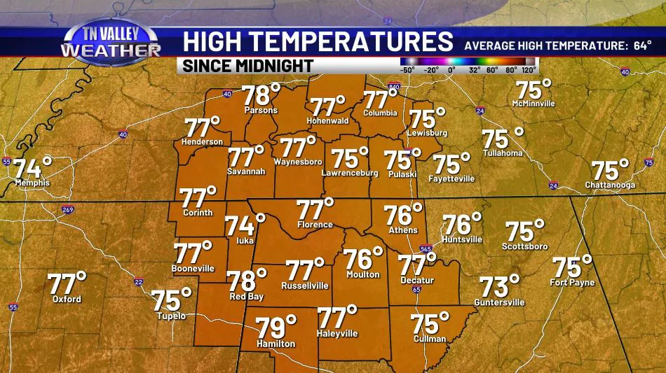
Sunny and warm was the name of the game today, continuing the trend we’ve been reaping the benefits of for some weeks now of well above average temperatures for this time of year. All of us managed mid-70s, with a few of us in the upper-70s too – and with clear skies? It was the kind of day you’d want to take advantage of and do some outdoor activities. Not only because it was nice, but because by tomorrow night? Conditions change in a big way. Let’s take a look.
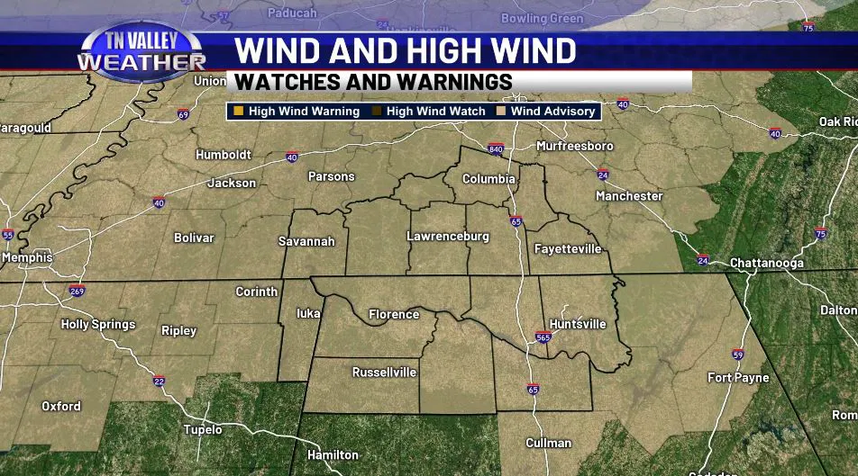
To start it’s important to note that we have a WIND ADVISORY in effect for the entire TN Valley through Monday morning, 1am. This is primary for the daytime hours of our Sunday, which again will see mid-upper 70s and some building clouds – and 20mph sustained winds! Gusts may be 35-40mph at times as well, and it’s important to note this is well BEFORE the thunderstorm activity which is largely left to the OVERNIGHT hours, so it’ll just be a plain windy day – but dry to start, for the most part.
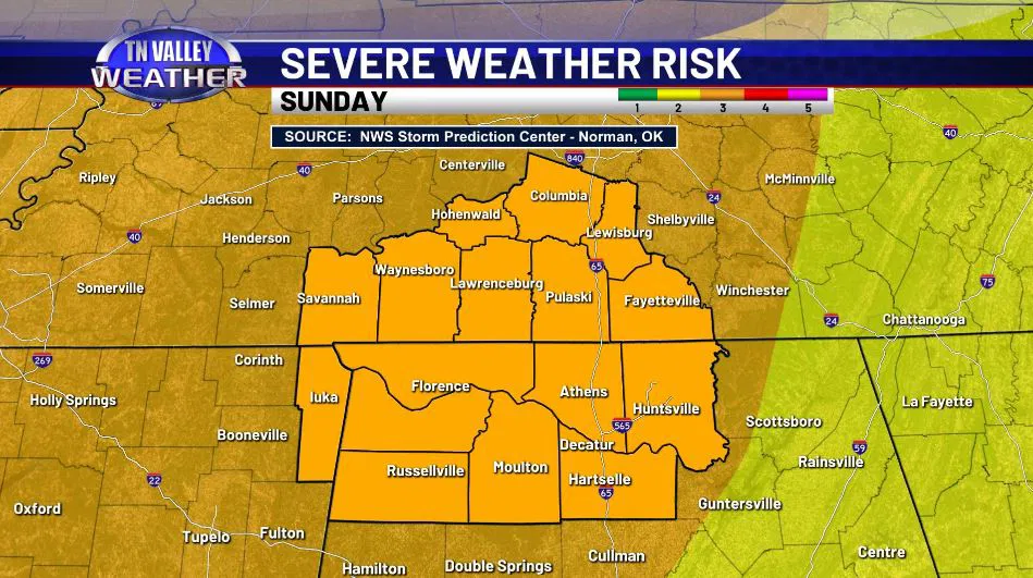
These strong southerly winds are essentially prepping the atmosphere for those SEVERE THUNDERSTORM chances as we head into the late evening and overnight hours of Sunday. The Storm Prediction Center in Norman, Oklahoma continues to hold onto a level 3 of 5 risk of severe weather across the ENTIRE Tennessee Valley, as far Southeast as Guntersville and as far West as Arkansas – clearly putting us right in the midst of it. Let’s break down the timeline and the threats at hand.
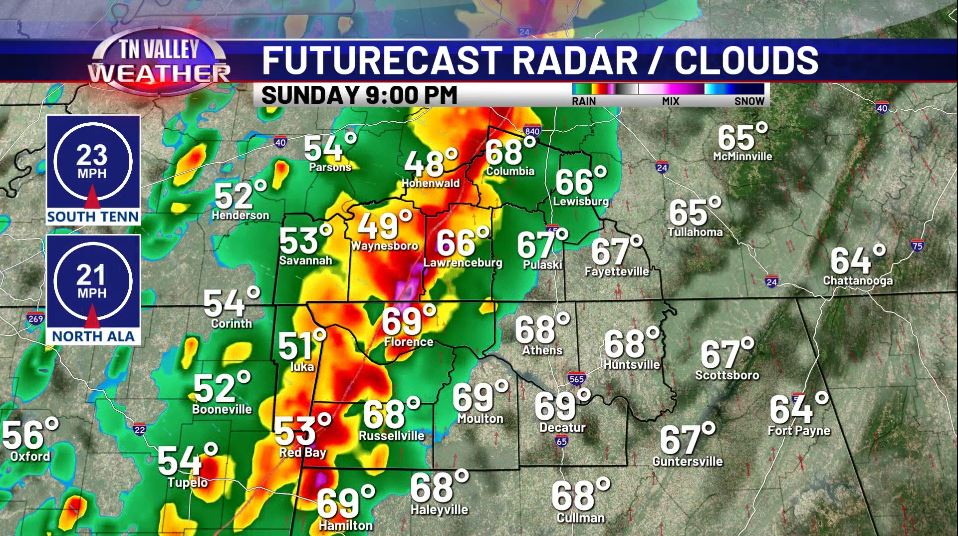
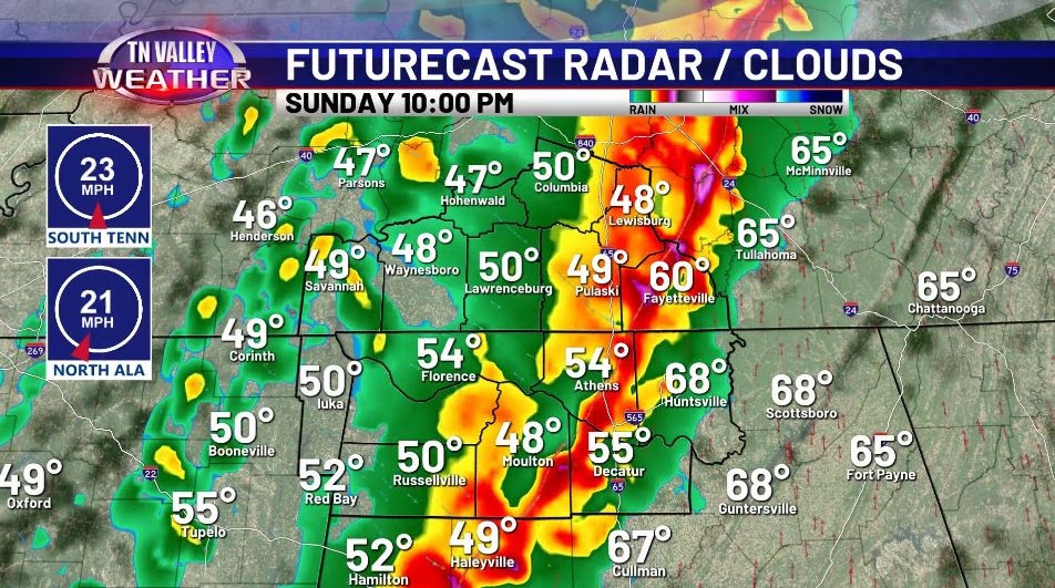
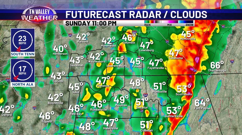
Taking a look at the Futurecast radar, we’re beginning to see several models hone in on a faster solution, which has this line of storms out of here sooner – but in here sooner as well. As of now, that puts our timeline from roughly 8:30pm to 11pm as far as the impacts in our area are concerned. We will have to monitor the structure of this line, as if we see more frequent breaks in the line this could lead to local wind surges 75+mph or an increased tornado threat in those sections – regardless of if that exact scenario pans out or not, as a baseline, the threats remain on the potentially significant and widespread side of the spectrum.
Given its linear nature, the mostly likely form of severe weather will be those damaging winds, anywhere from 60-75mph within the line. This is troubling for two reasons. Not only may that be widespread throughout the line, but in a very real sense these winds are “overkill” for some of the already weakened infrastructure in portions of the Valley impacted by the Ice Storm not long ago. In other words: it won’t take that kind of wind to do damage in some areas, so to see that projected widespread may indicate more significant impacts in some areas than usual. There also is that chance for a few tornadoes embedded throughout the line as conditions begin to slightly favor them more after sunset, so we will have to monitor the line very closely as it moves into our area. Hail and flooding are relatively minimal threats, as overall lines of storms don’t favor those modes as much. Stay tuned with us here on the website or on our free mobile app and we will have the latest forecasts and live coverage as it moves through.
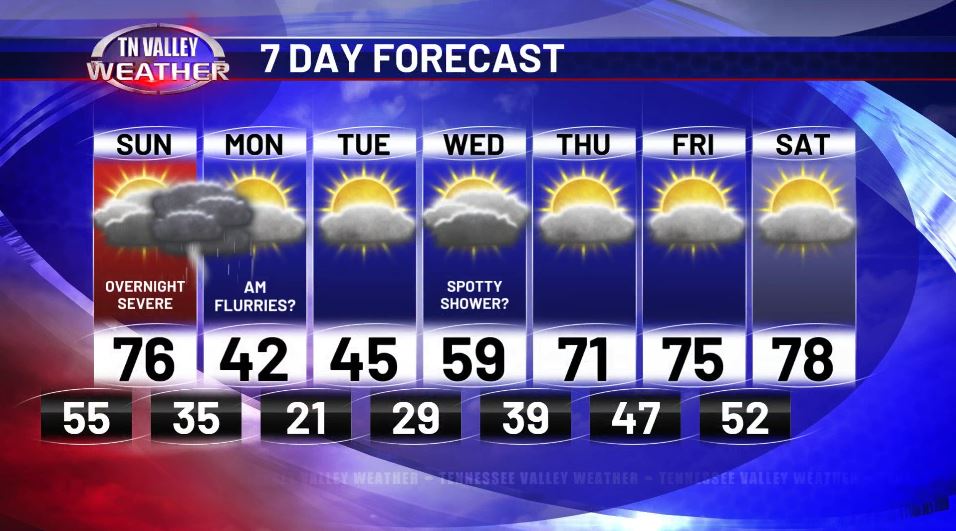
The front associated with this very potent system really does a reset on our pattern, to put it one way, especially in the first portions of the workweek. By Monday morning, we may even be seeing some FLURRIES as it wraps around, and our highs for a couple days? They don’t even break mid-40s! Thankfully we do recover by the end of the week and next weekend but not before a few more nights of freezing temperatures, so let’s keep that in mind. Stick with us tomorrow, and we’ll let you know how this system shakes out as we approach the first days of Spring…