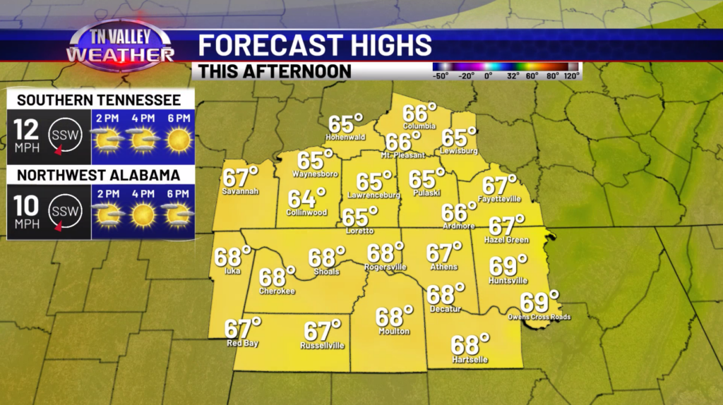
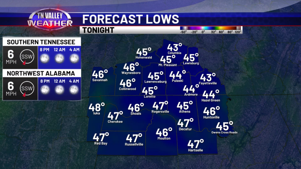
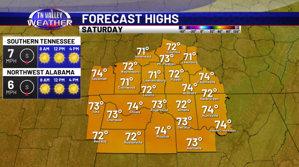
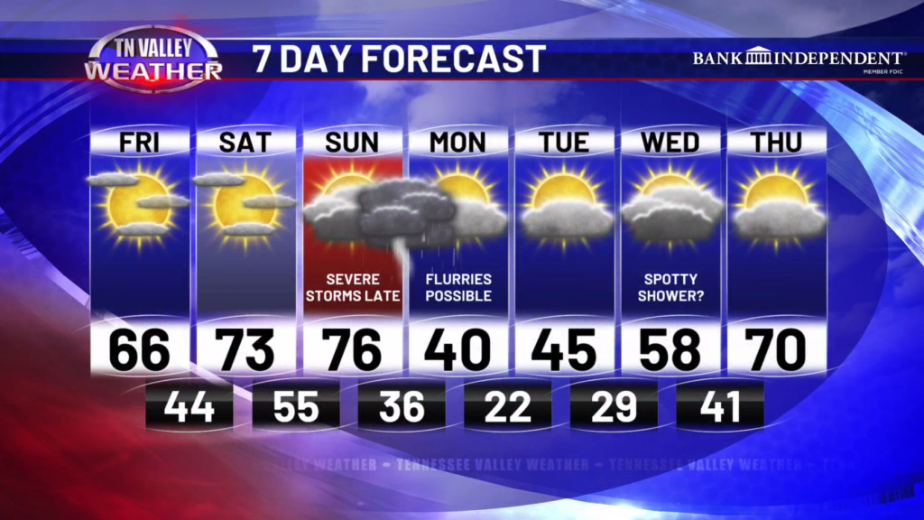
Happy Friday! Expect a warmer day today with highs in the middle to upper 60s along with a lot of sunshine! It will be a bit breezy at times, with gusts around 20-25mph. This evening, temperatures will cool off into the 50s during the evening hours, and then into the 40s by sunrise. Tomorrow, temperatures continue to climb with low to mid 70s expected under mostly sunny skies.
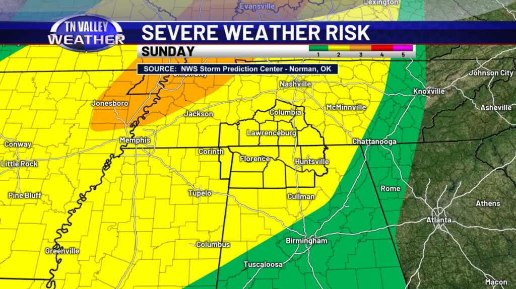
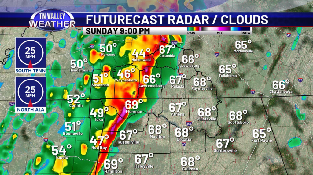
Our focus then turns to a impactful line of storms expected to move through late Sunday into the early overnight period Monday. This line will be capable of producing damaging winds 60-70mph, perhaps even over 70mph. There will also be enough low-level shear that some isolated line-embedded tornadoes would be possible. Currently, the SPC has our area under a SLIGHT risk, but we anticipate they will expand the ENHANCED risk into our area from the northwest in later outlooks. This does appear to be a significant severe risk materializing for our area so we need to watching things very closely.
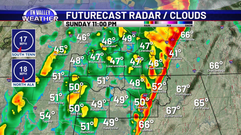
The overall timing of this system will be fine tuned over the coming days, but at the moment, the line appears to move in around 9-10pm across our western areas, and then will be over into Northeastern Alabama by 1-2am. Again, this timing could change over the coming days so keep checking back for the latest.

Behind this front, we will get much colder! Highs on Monday will struggle to reach 40 and there could be some flurries around but we don’t expect any winter weather impacts. Lows Monday night will drop into the lower 20s and then we manage to get into the middle 40s Tuesday. We do finally warm back up towards 70 degrees on Thursday!
Have a great Friday!