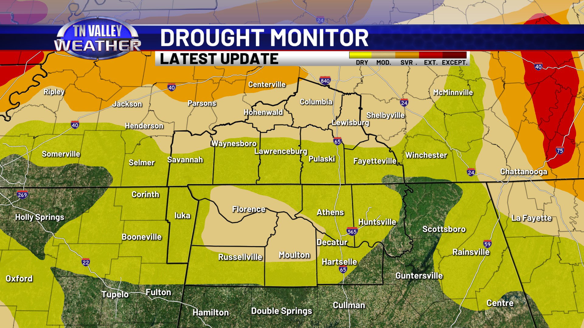
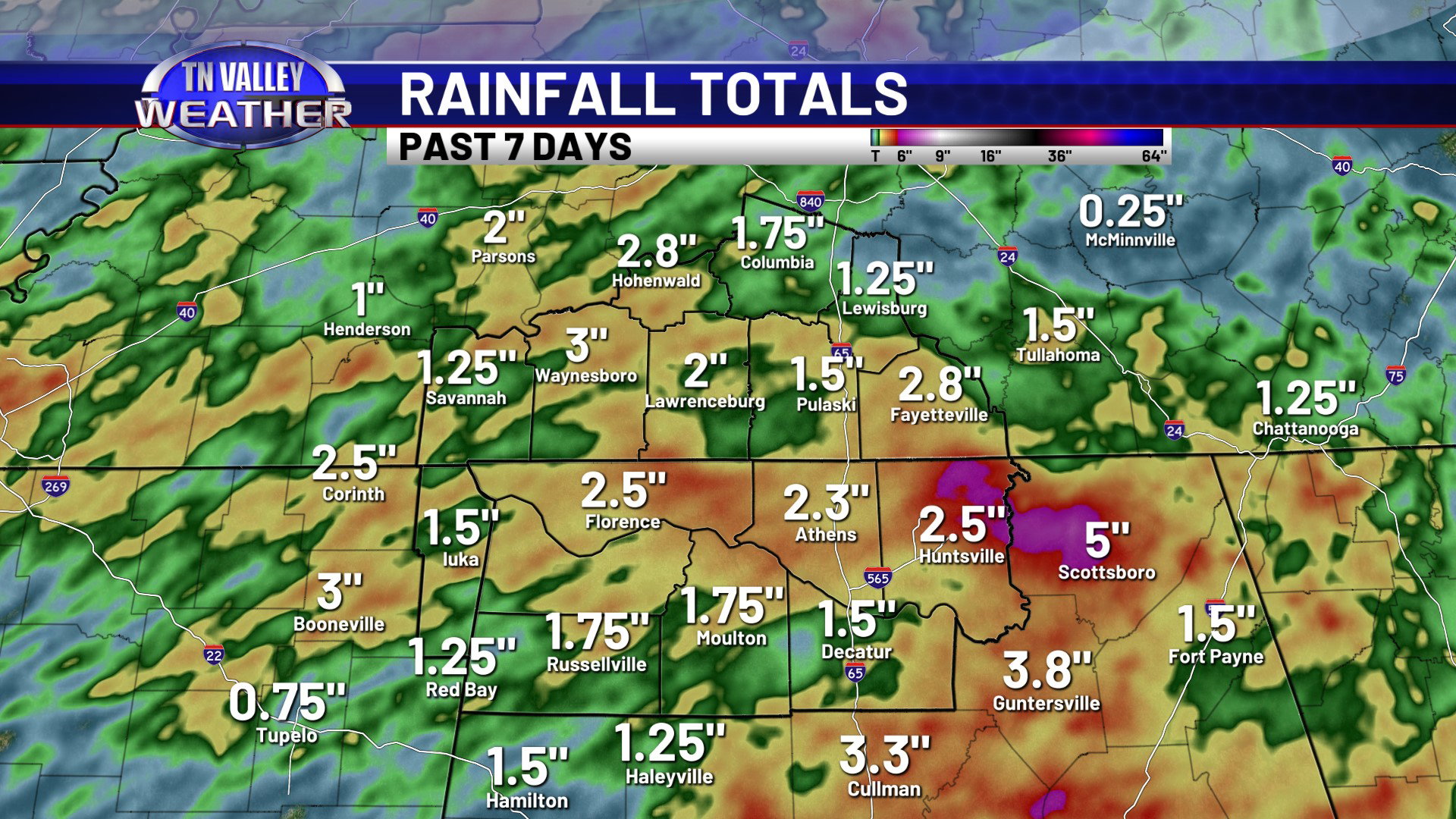
The past few weeks have brought major drought improvement to our local area! The latest official drought monitor update released back on Thursday has downgraded a large part of the viewing area to only “Abnormally Dry” conditions, with actual drought conditions only in place across the Shoals to Russellville and Moulton in north Alabama and then north of Highway 64 in middle Tennessee. With some areas being ranked in as much as “Extreme Drought” a few weeks ago, these are major improvements! Rainfall totals over the past 7 days alone have ranged from near or above 2″ areawide with many parts of southern Tennessee and north Alabama getting 3+” of rain. Some areas of eastern Lauderdale, Limestone, and north-central Madison Counties in north Alabama, over into western Jackson County outside of our viewing area, have seen as much as 5 to 8″ of rainfall the past 7 days alone in localized areas.
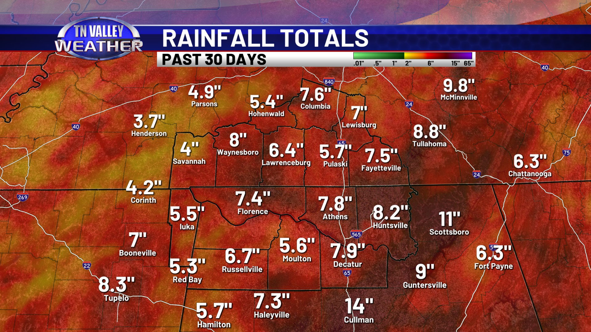
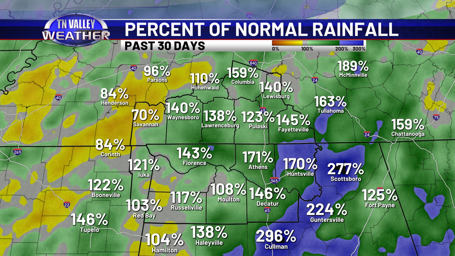
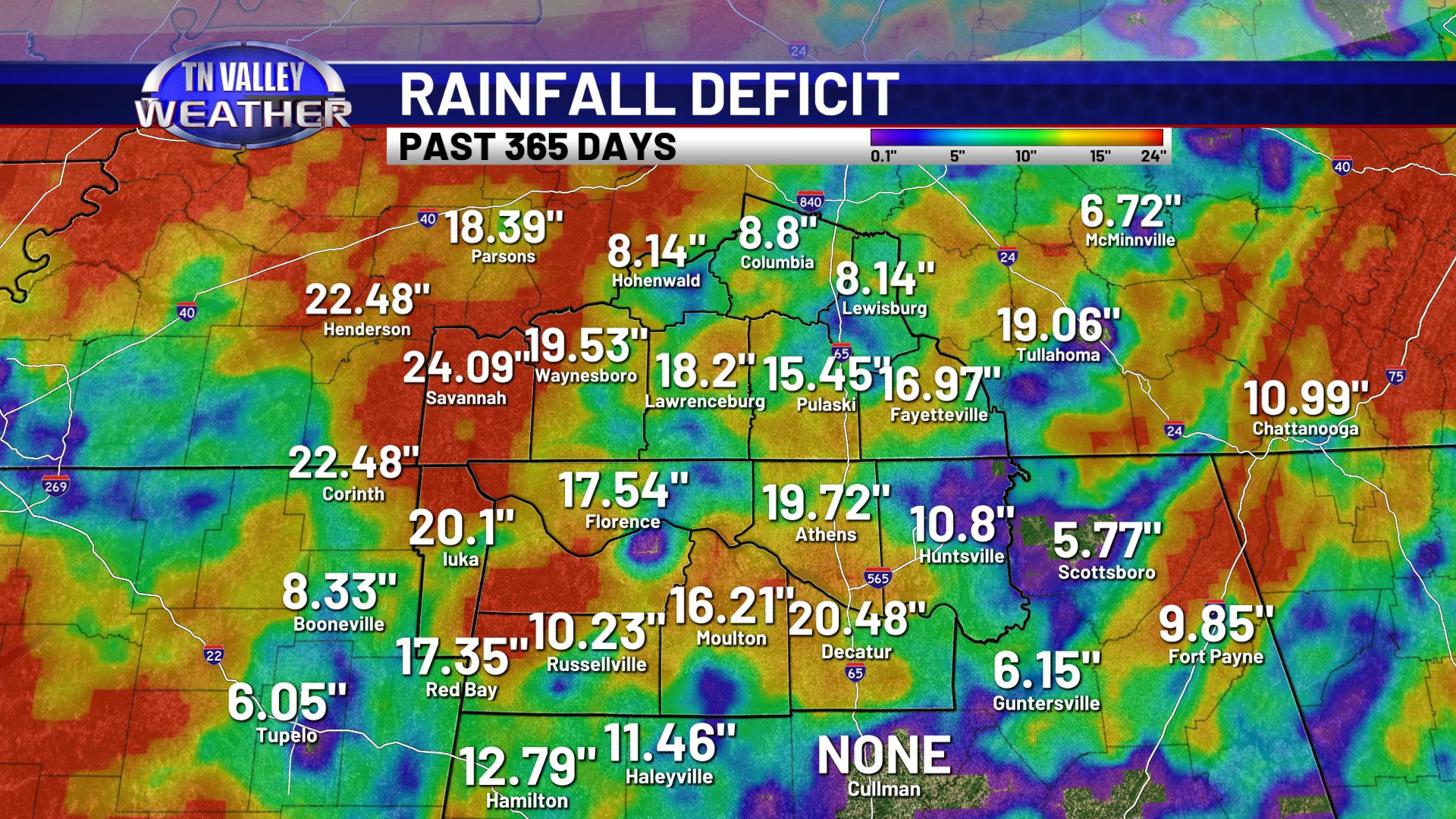
All of the area has seen 4 or more inches of rain over the past 30 days, with some areas seeing anywhere from 6 to 10″ of rain during that time. That is as much as one and a half to twice as much rainfall as we normally see during the same period on the calendar in any given random year. However, when we look at the longer-term rainfall deficits for the past 365 days, much of the area is still 1 to 2 FEET behind in rainfall for that period. It’s easy to see that while we have had big rain and major improvements lately, we still have a little bit of work to do for the long-term water tables, lake and river levels, etc.,.
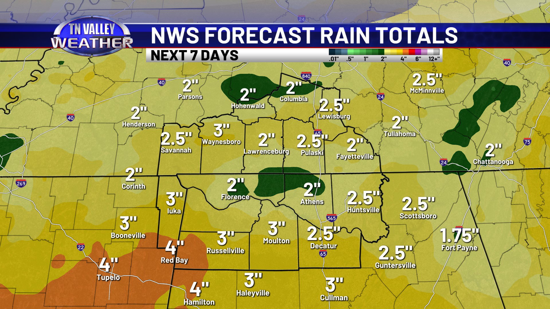
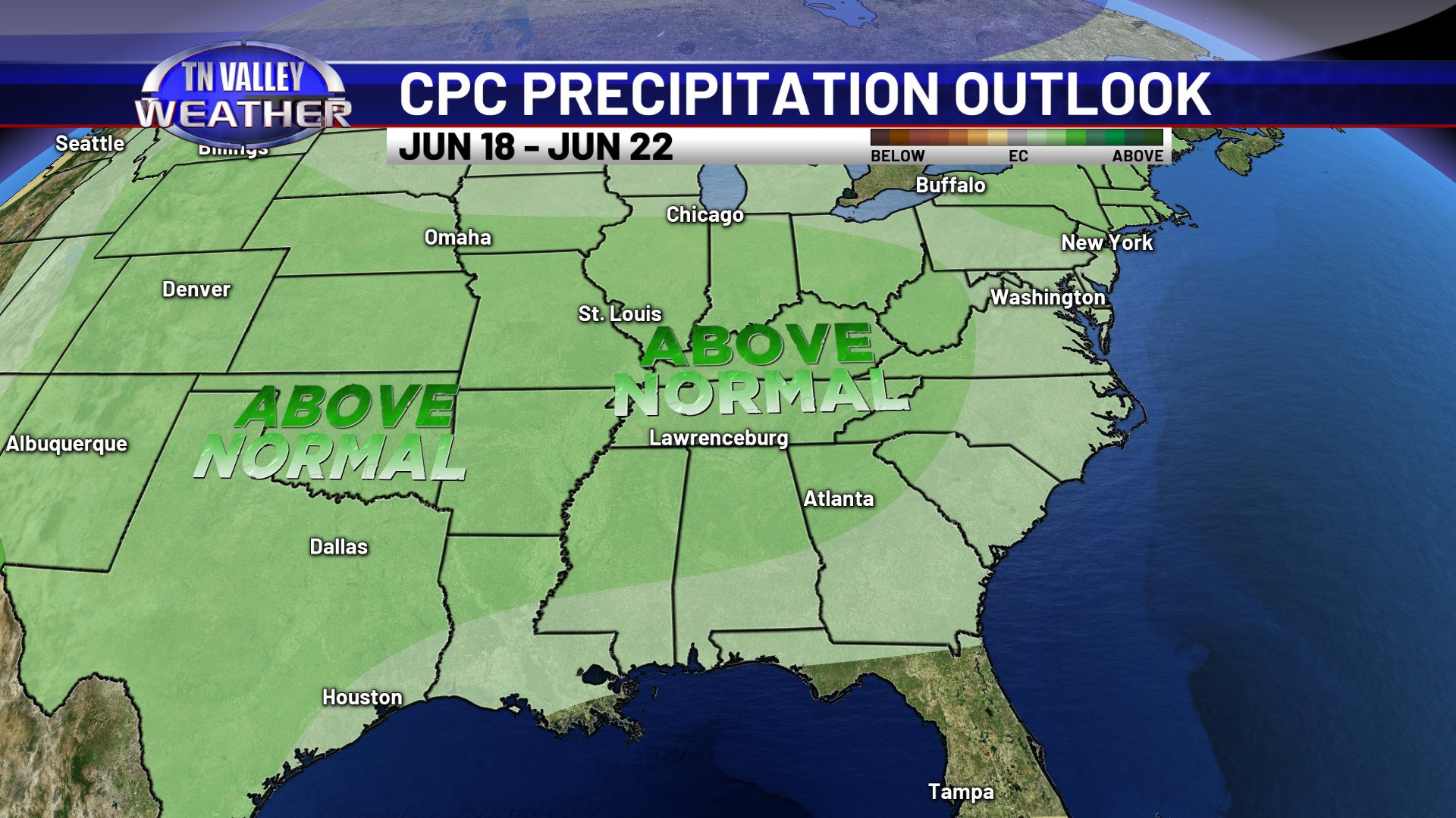
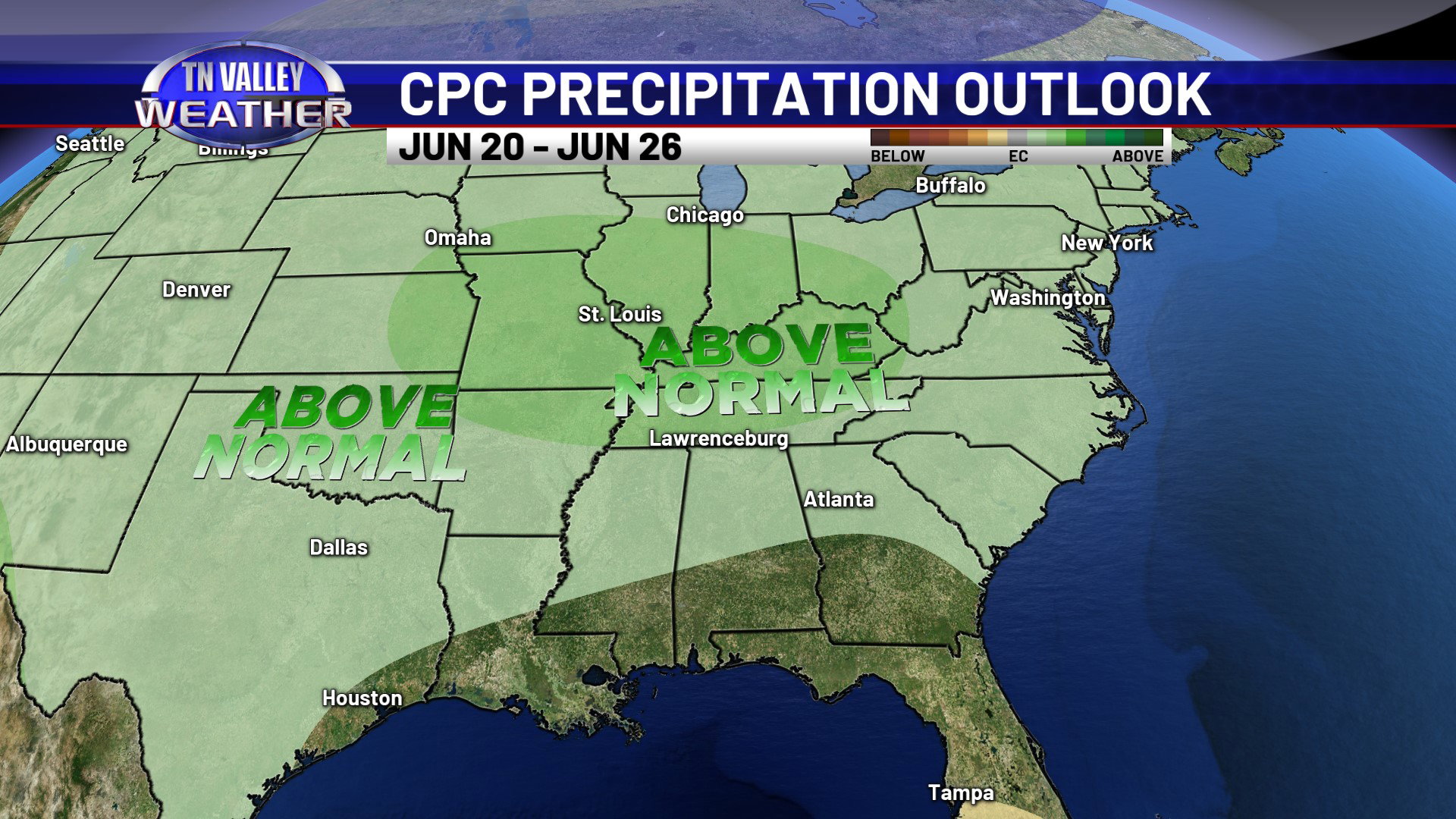
We do have more rain in the forecast, with scattered showers and thunderstorms off and on for the weekend into next week. Most all of the area is expected to get a general 2 to 3″ of rain over the next 7 days, and there could be isolated areas with heavier totals than that. And as we look forward through much of the rest of the month, precipitation chances are above climatological averages as we head through much of the rest of the month…