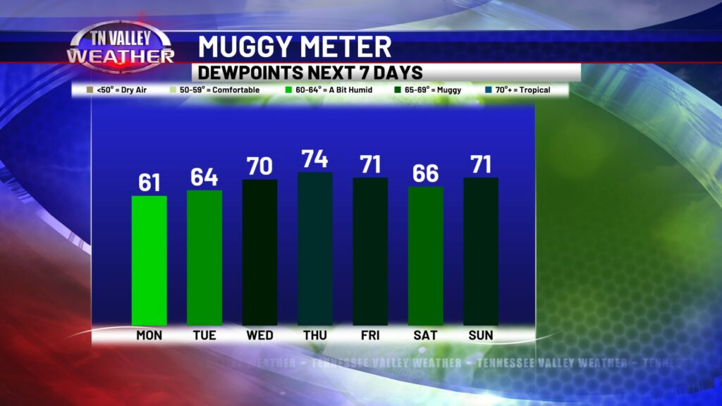
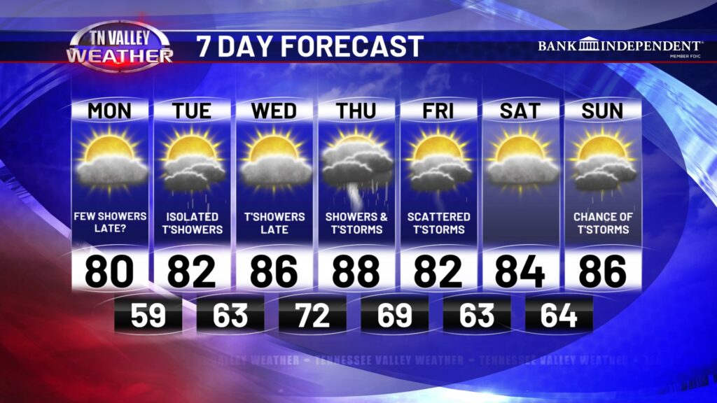
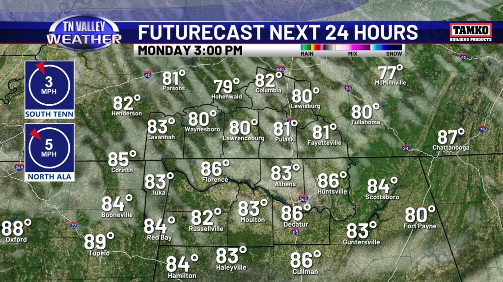
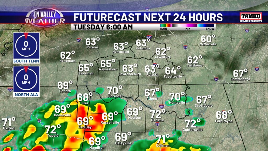
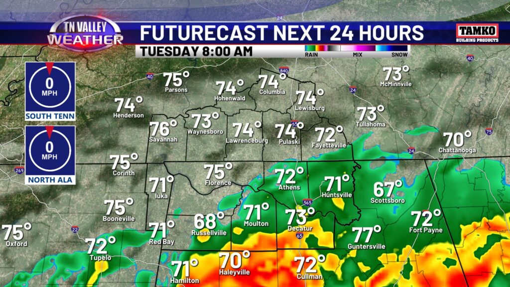
This week is not off to a bad start! Tolerable temperatures and tolerable humidity, we will take it for mid June! Highs today will be in the upper 70s to lower 80s, with dew points remaining in the lower 60s we should be comfortable the rest of the morning and the afternoon. We will also be dry today, with just some clouds moving in and out throughout the day. By the overnight, cloud cover will increase, especially south, and a few showers with maybe a rumble of thunder will move through early Tuesday morning. The more south you are, the better chance you have of seeing Tuesday morning rain. Otherwise, for southern middle Tennessee, expect cloud cover and even some patchy fog at times. I can’t rule out a shower sneaking up across the state line, either.
Heat and humidity will continue to increase throughout the rest of the week. Wednesday we may see a few spotty thundershowers, but better rain chances come overnight and into Thursday. Tropical moisture will meander from the gulf to the Tennessee Valley, providing scattered to widespread rain and storms. Some rainfall will be heavy at times Thursday, and we will be hot and humid. Rain and storms will linger into at least the first part of Friday before we catch a break.
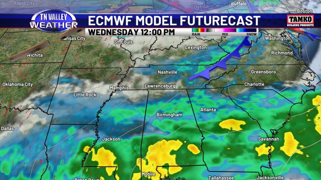
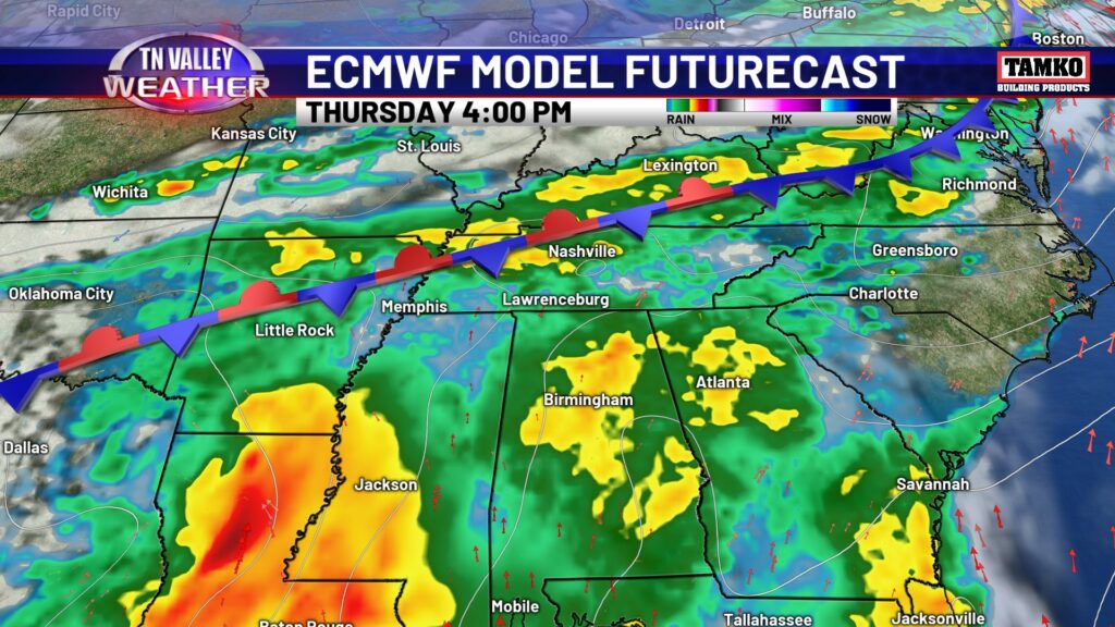
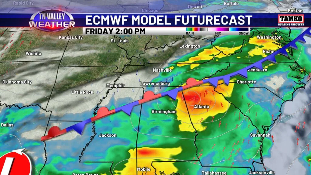
Enjoy the lower dew points we have to start off the week, because the air will be feeling much more juicy by Wednesday. That coincides with our increase in rain chances heading into Thursday. Thursday may end up being a washout, but every other day with a rain chance looks to have some dry periods as well.