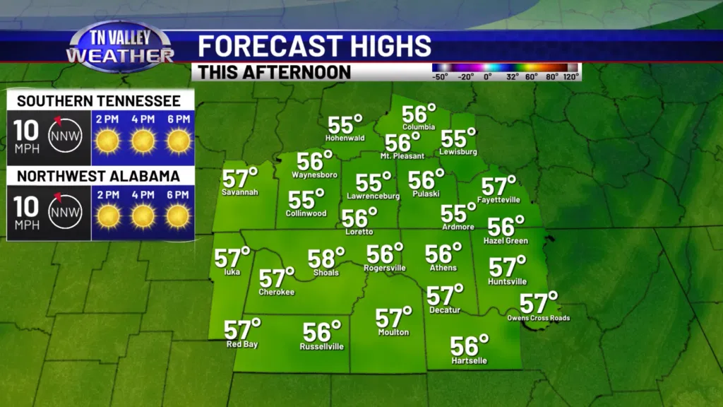
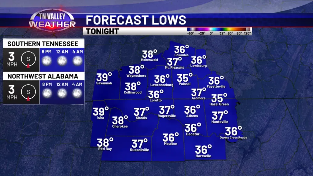
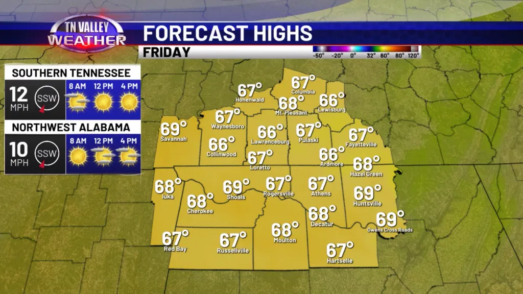
Good Thursday morning! After a long stretch of very warm weather, we are back below average for this time of year today. Highs will be in the middle and upper 50s with a breezy northwesterly wind gusting around 20-25mph at times. Tonight, those winds decrease and with clear skies, we will see lows drop into the middle and upper 30s. A light frost could be possible in some areas, but we do not expect widespread frost tonight. Tomorrow, we will see our temperatures rise back into the middle and upper 60s with a lot of sunshine.
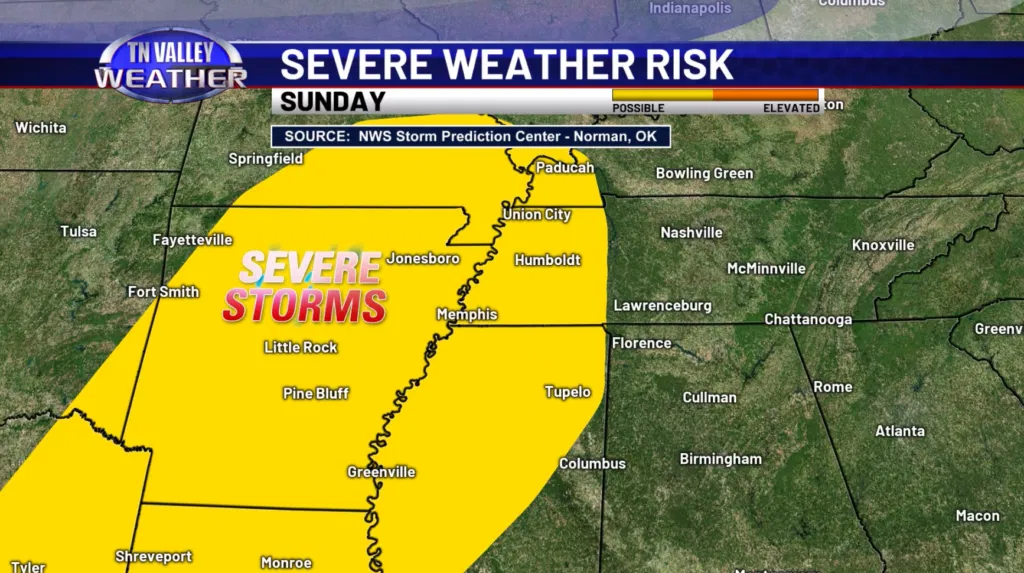
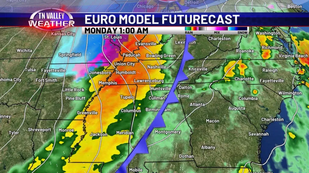
We are still dry on Saturday, but our next focus will be a strong cold front moving in late Sunday into early Monday morning. That will bring us our next round of thunderstorms, which could be on the stronger side. Currently, the Storm Prediction Center has a SLIGHT risk just to our west for Sunday, but that could be pushed into our area if we see an increase in dew points and instability for our area. It is too early to be specific on what kind of threats we will have, so keep checking back for the latest!
Our temperatures turn colder again to start next week with highs in the 40s both Monday and Tuesday. Lows will be down near the teens on Monday night!
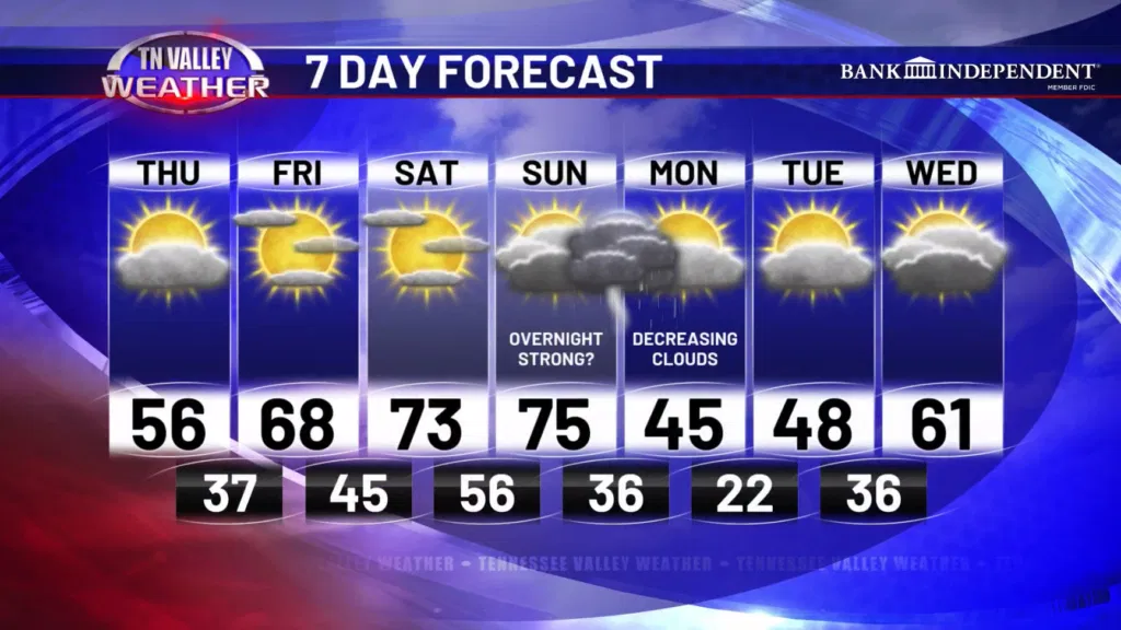
Have a great Thursday!