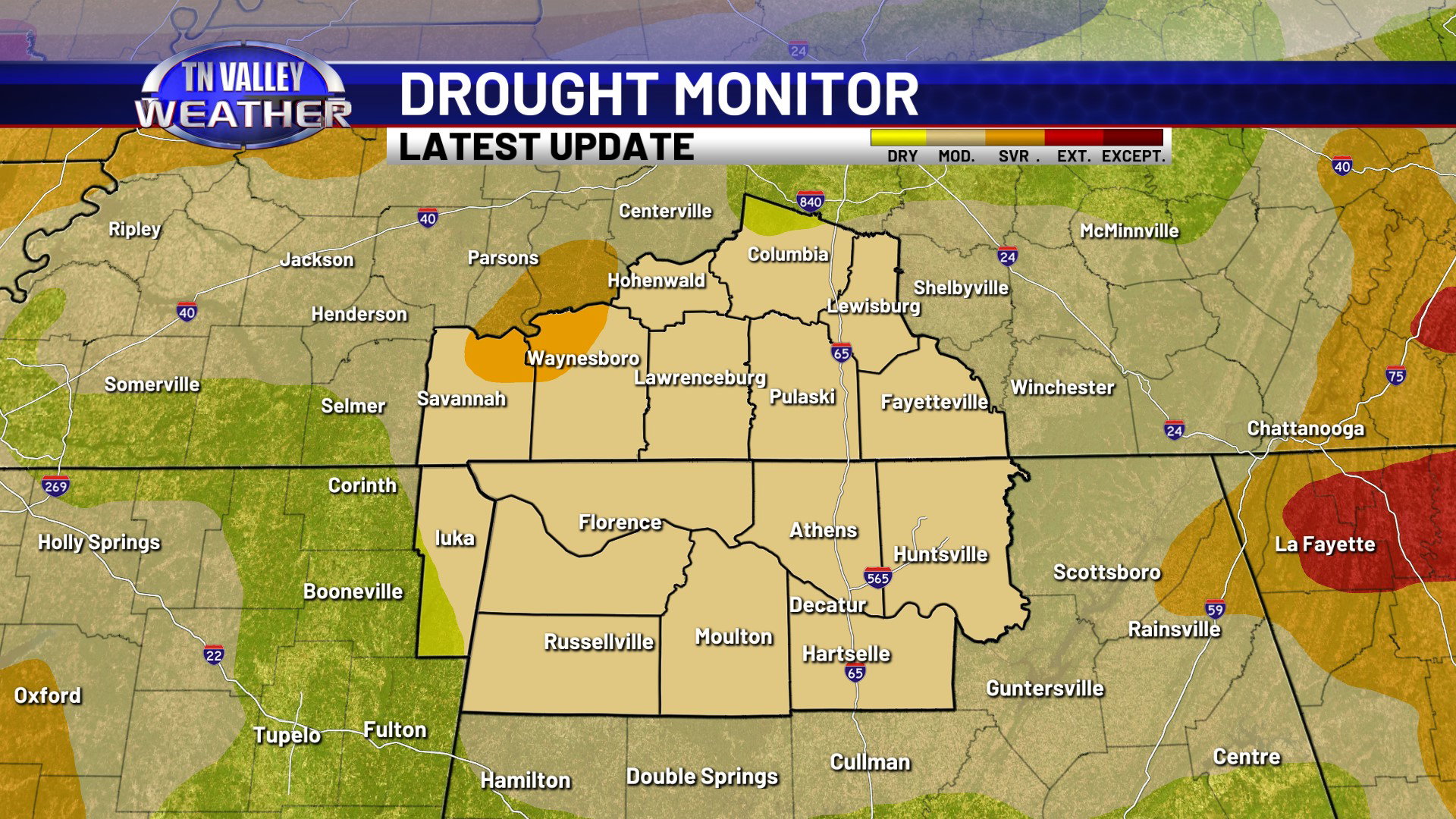
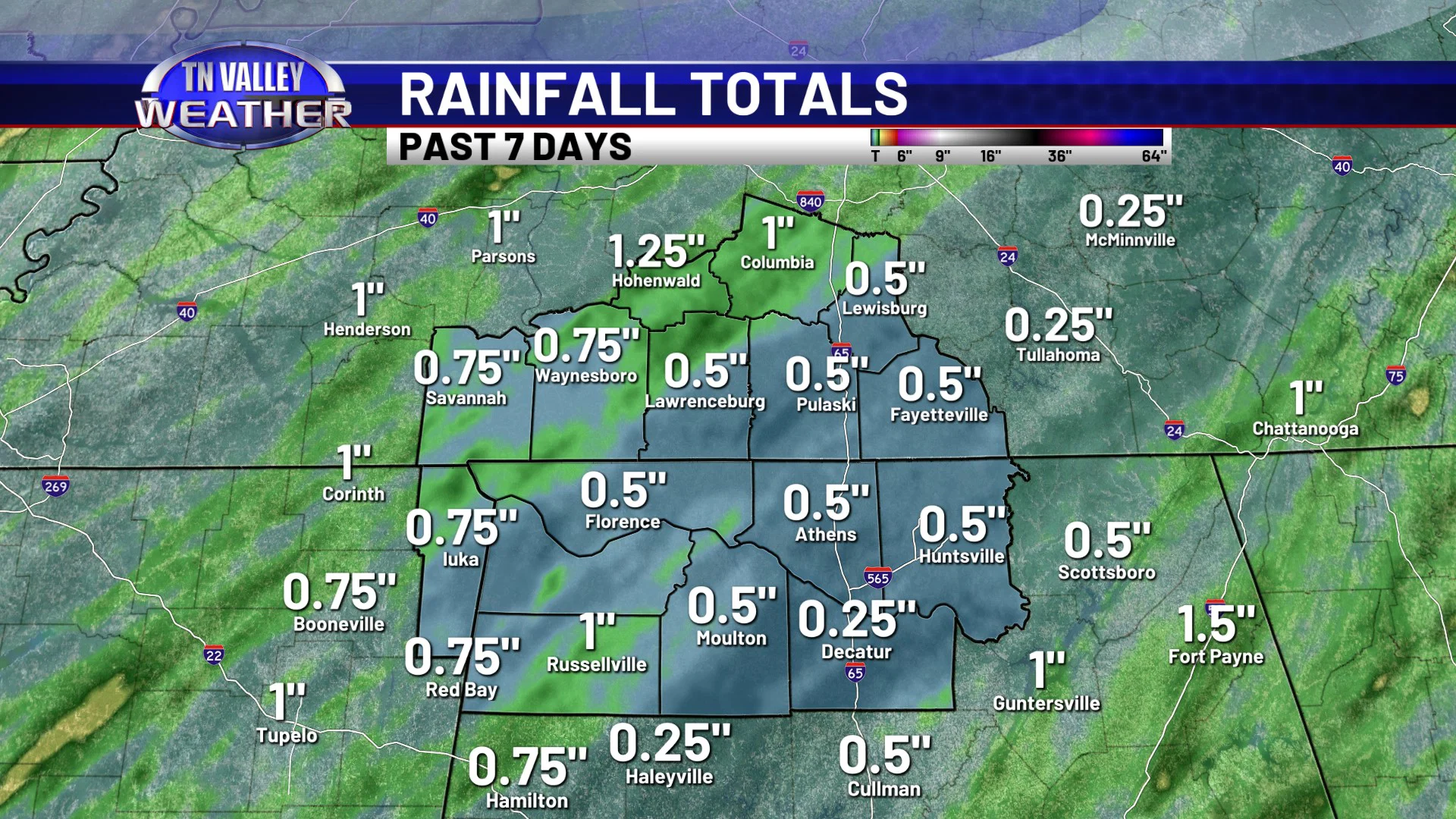
Despite the widespread showers and thunderstorms we had over the weekend, drought conditions continue across the Tennessee Valley, and they are gradually getting worse. All of the viewing area continues in “Moderate” drought conditions, but we are now starting to see “Severe” drought conditions begin to show up in portions of Hardin and Wayne Counties of Tennessee. This category designation will likely expand in the coming weeks if we don’t get significant rain soon. While a few areas did get over an inch of rain back this past Saturday afternoon and night with the showers and storms, most of the viewing area saw only around half of that amount. While it was a nice little short-term watering for the plants, it wasn’t remotely close enough to put any kind of dent in drought conditions.
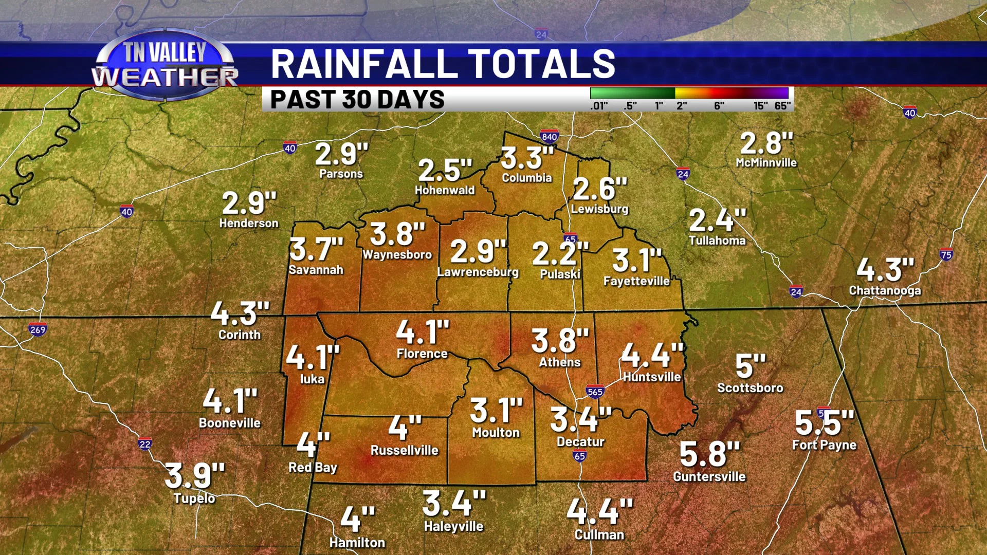
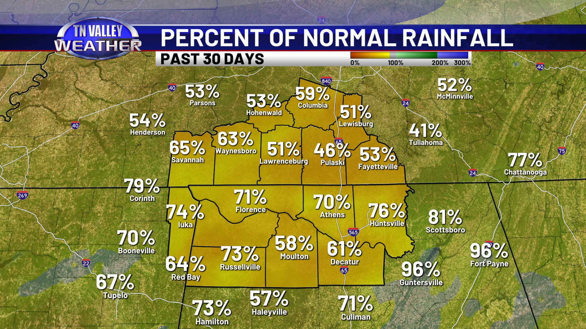
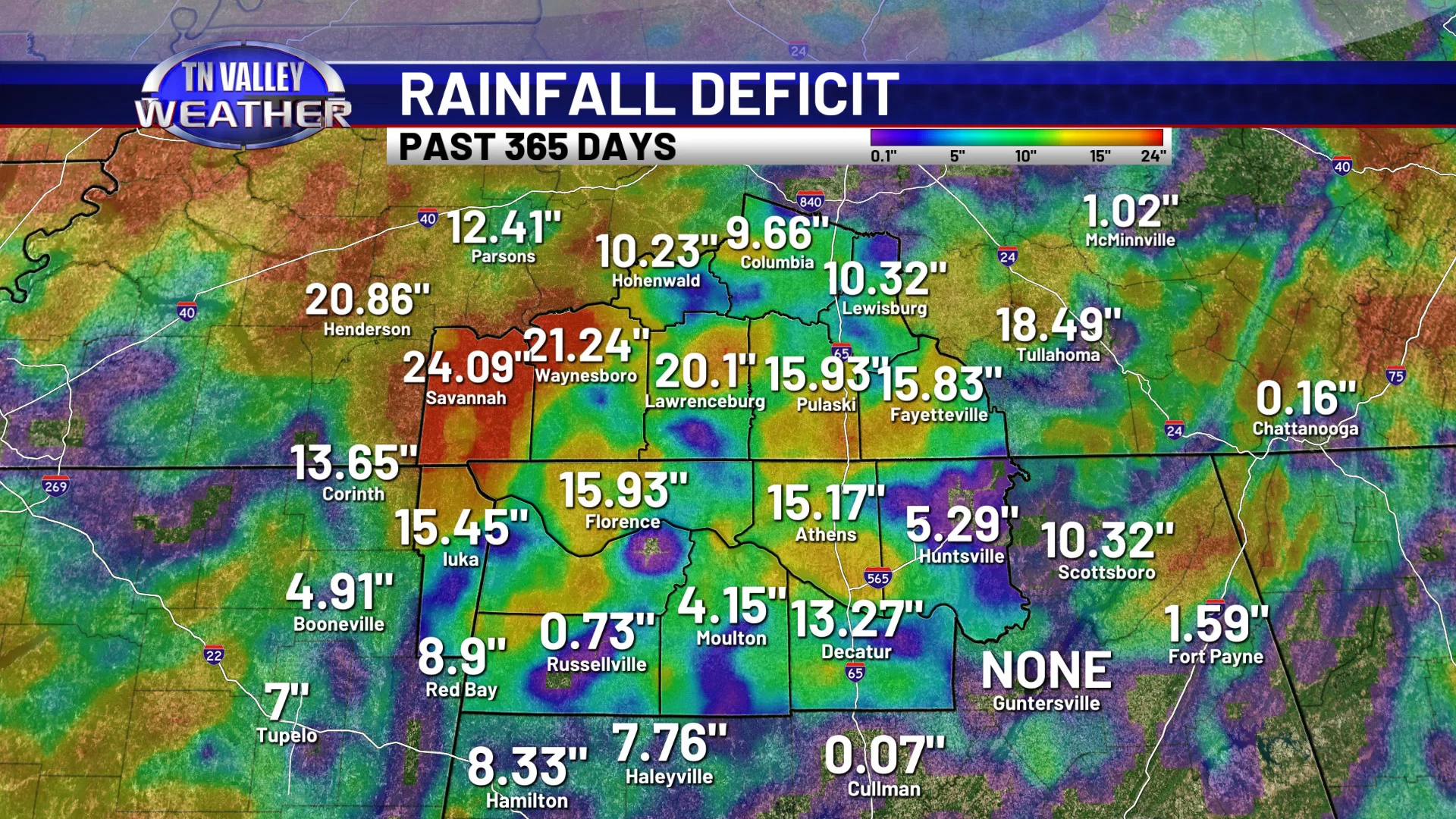
When we look at rainfall stats over the longer term, we haven’t been doing well at all. Most of the area has only gotten around 2 to 4 inches of rain in the past 30 days, which is roughly only 50 to 70% of what is normal for that period on the calendar. Rainfall deficits are starting to increase, with a large part of the area now running rainfall deficits of a FOOT or more over the past 365 days, and that includes the frequent rain and storm events we had last April through June!
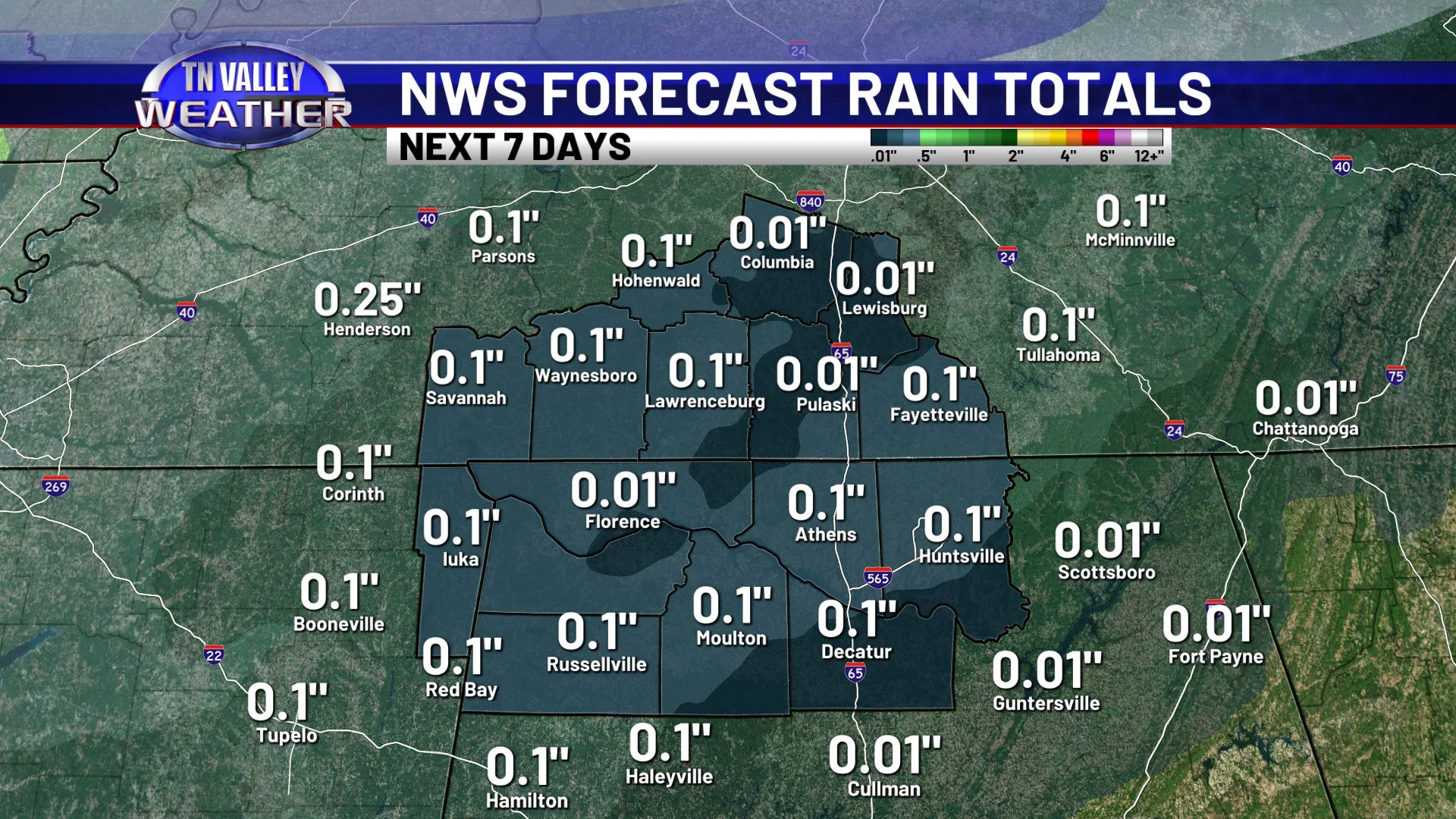
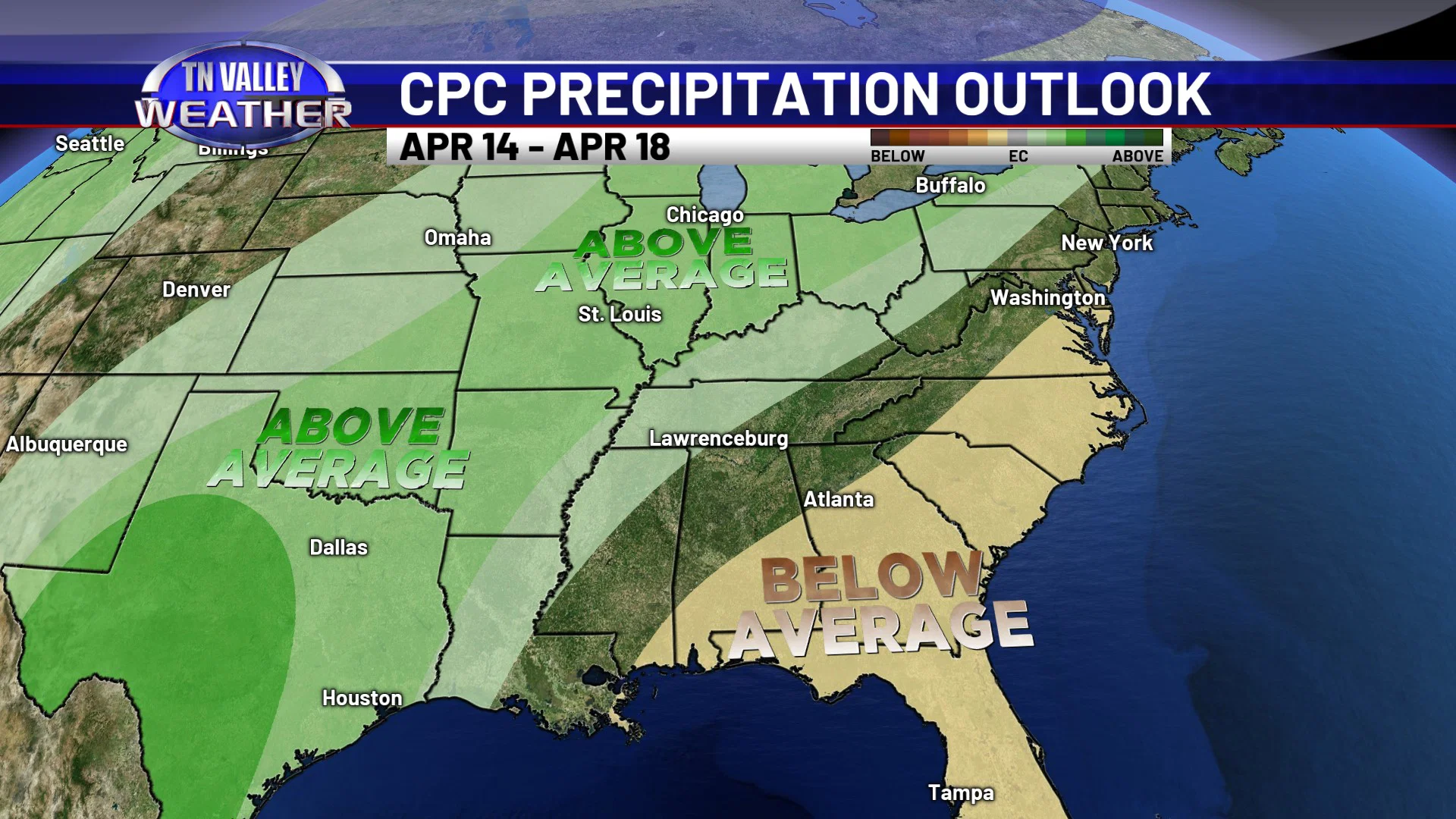
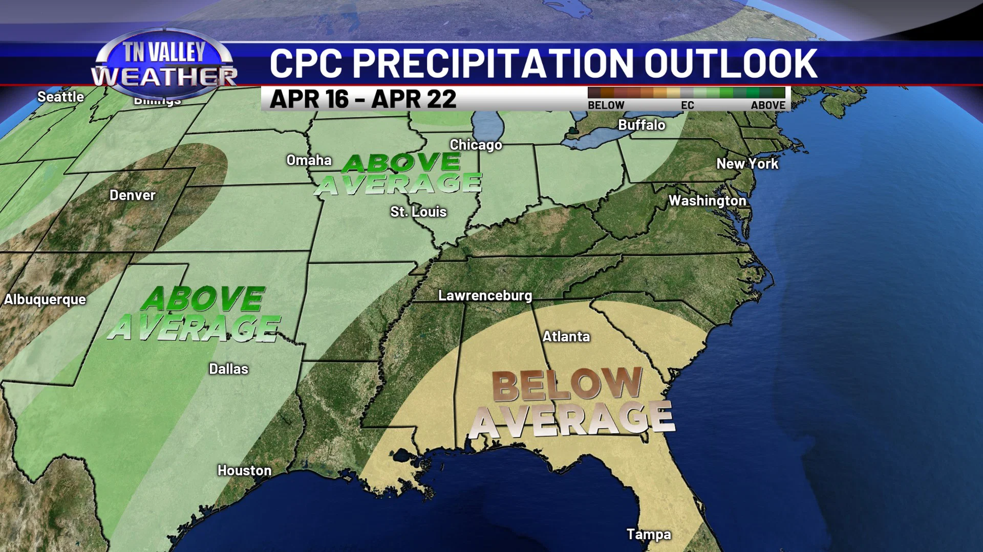
Unfortunately, we don’t see any significant signals for a big rainfall around here anytime soon. We do have a few isolated showers in the forecast next week, beginning as early as Monday. However, they will be very spotty, with most areas seeing a tenth of an inch or less of rain. There is some potential for another organized shower and storm event to come across toward next Wednesday or next Thursday, but that will likely be another system where rainfall totals are an inch or less. Through at least April 22nd, we don’t see any credible signals for a big rainfall across the area.