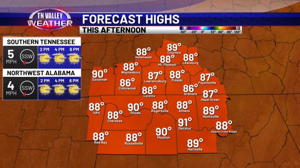
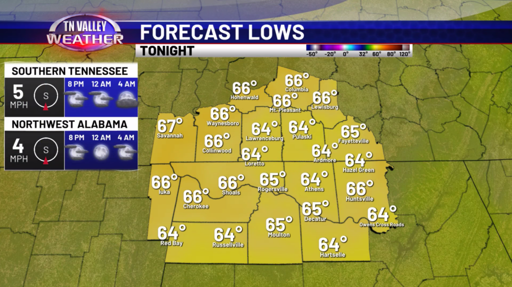
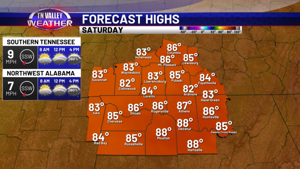
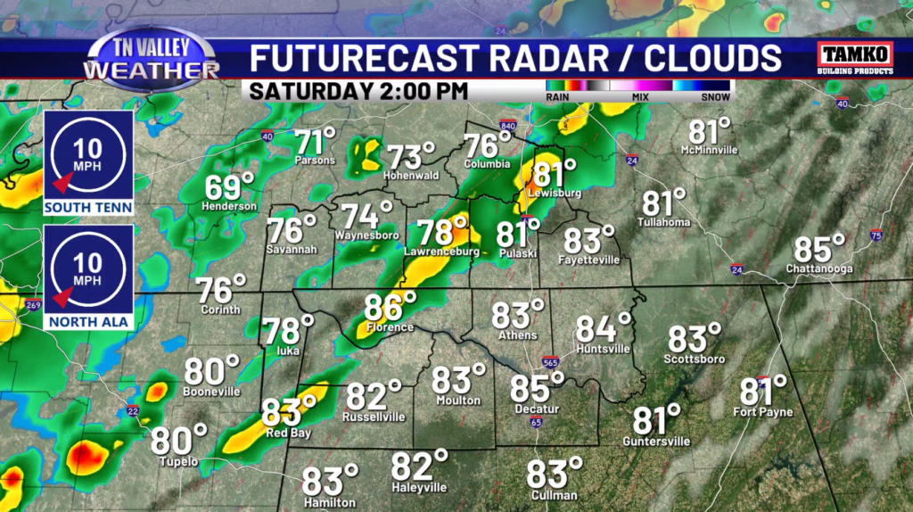
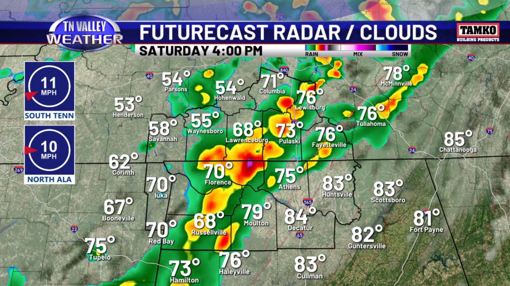
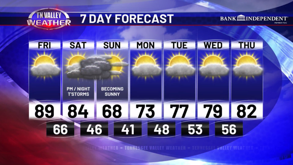
Happy Friday! A very warm to even hot day is expected as we round out the workweek. Highs will be in the upper 80s to around 90 today with mostly sunny skies. Definitely a little summer preview for this Friday in April! Tonight, lows will drop into the 60s overnight. Tomorrow, the morning hours should be dry but showers and storms will start to impact our area around noon-2pm. Highs will be in the low to mid 80s.
As for the storm threat, we really do not expect any big severe weather risk with this. However, there could be a strong storm or two with gusty winds around 30-40mph and lightning. The good thing coming from this will be the rainfall. Even though we aren’t getting widespread 2-3 inches, there will likely be some areas that get around an inch of rainfall. This will help some of the drought conditions, but it won’t remove it all together.
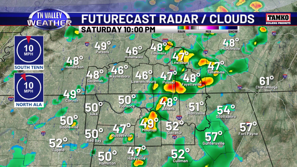
Going into Sunday, we expect a much cooler day with highs in the 60s with decreasing clouds. Sunday night into Monday morning, lows will drop into the upper 30s and lower 40s. At the moment, we don’t expect temperatures to drop far enough that frost becomes an issue.
We will gradually warm back up to the lower 80s by Thursday.
Have a great Friday and weekend!