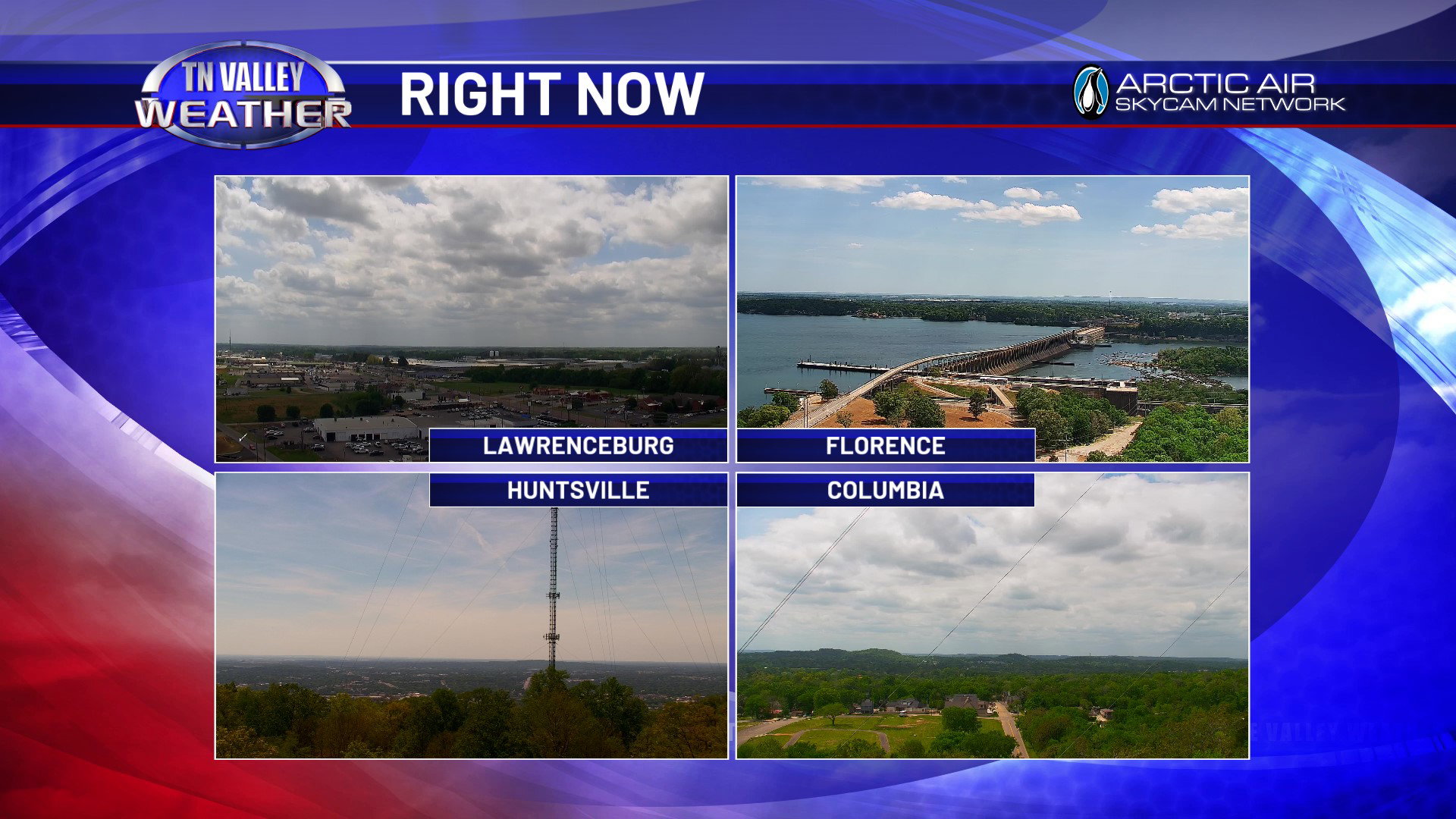
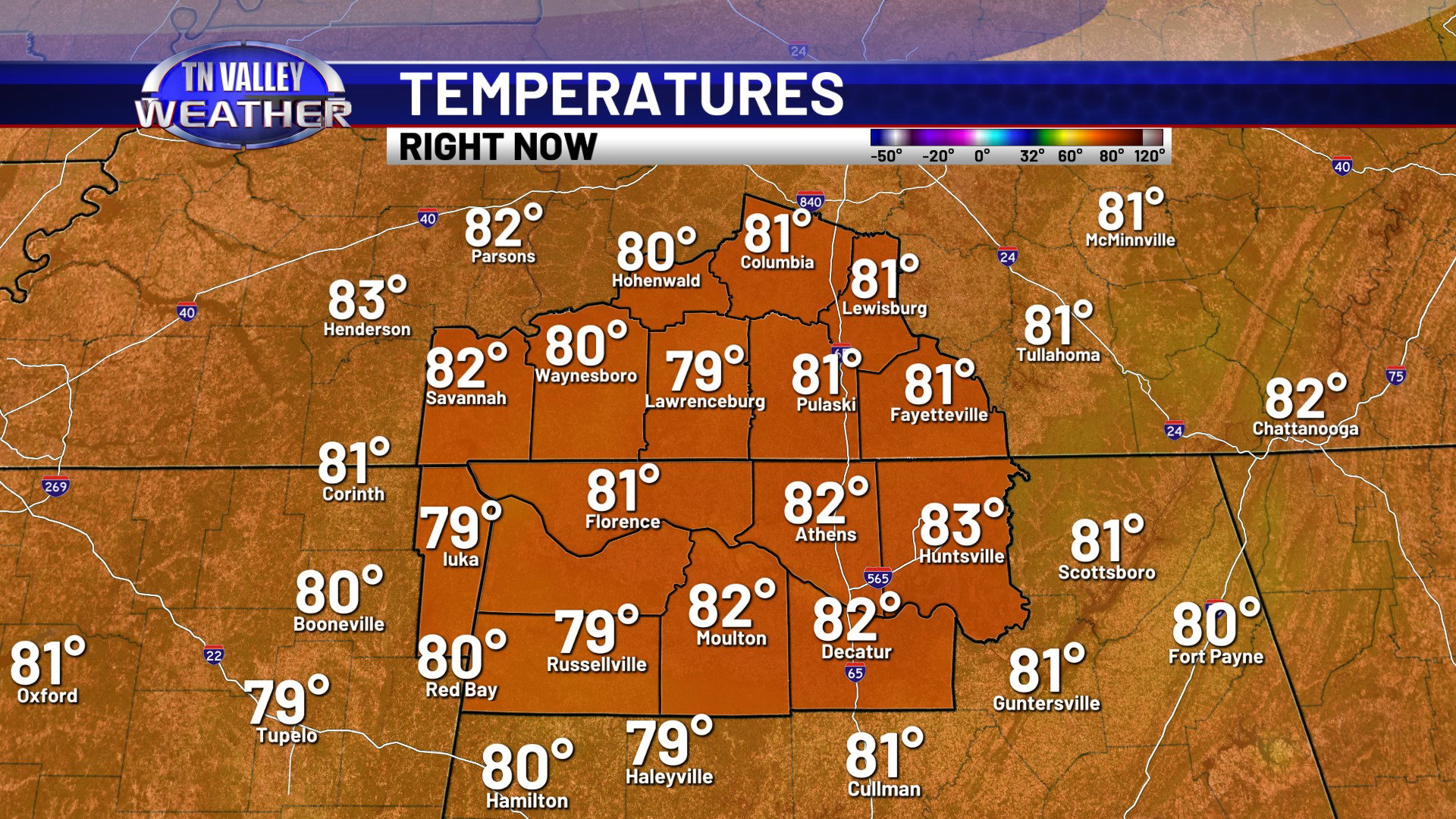
It’s another partly cloudy, breezy, and warm day across the Tennessee Valley on this Tuesday. We don’t have quite as much cloud cover as yesterday, but we still have a fair amount of cumulus cloud activity. All is quiet in terms of any precipitation though. Temperatures this afternoon are climbing into the lower 80s, and we stand to likely climb 2 or 3 more degrees in most areas before the end of the day.
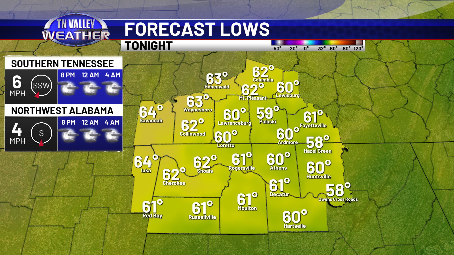
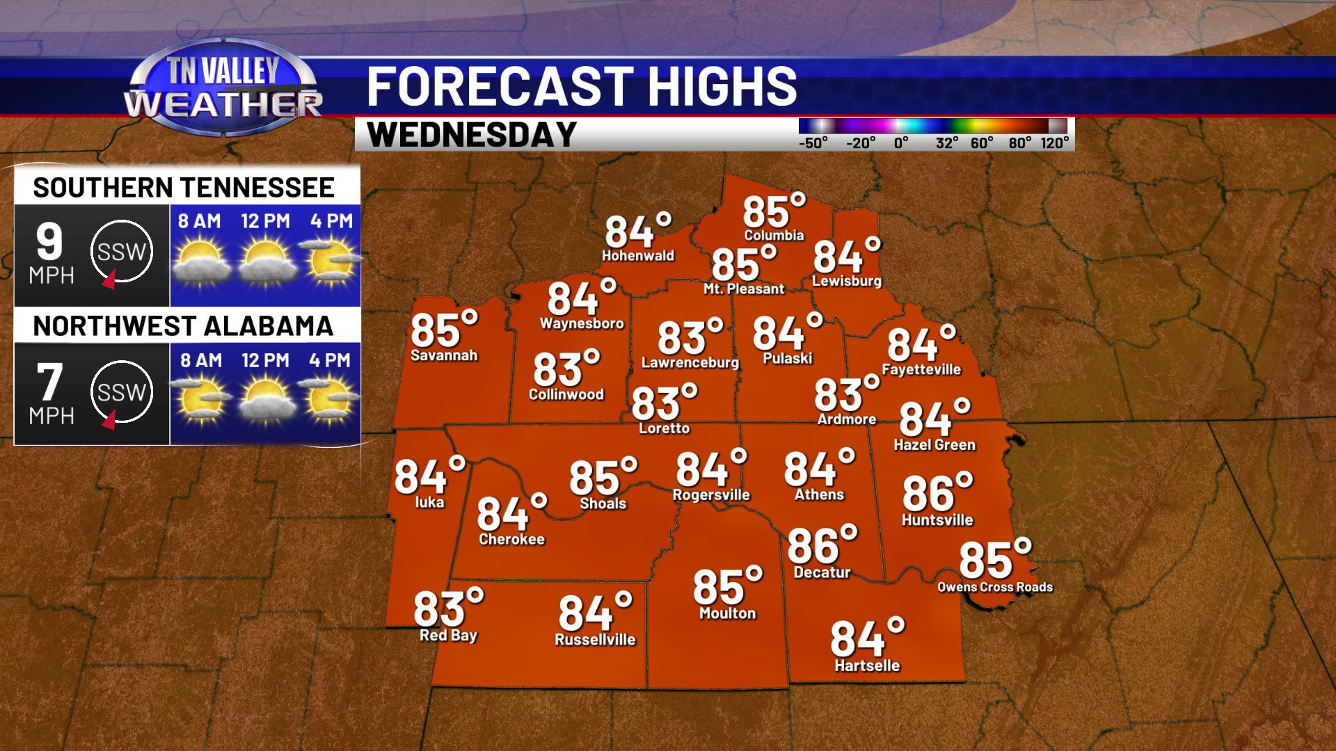
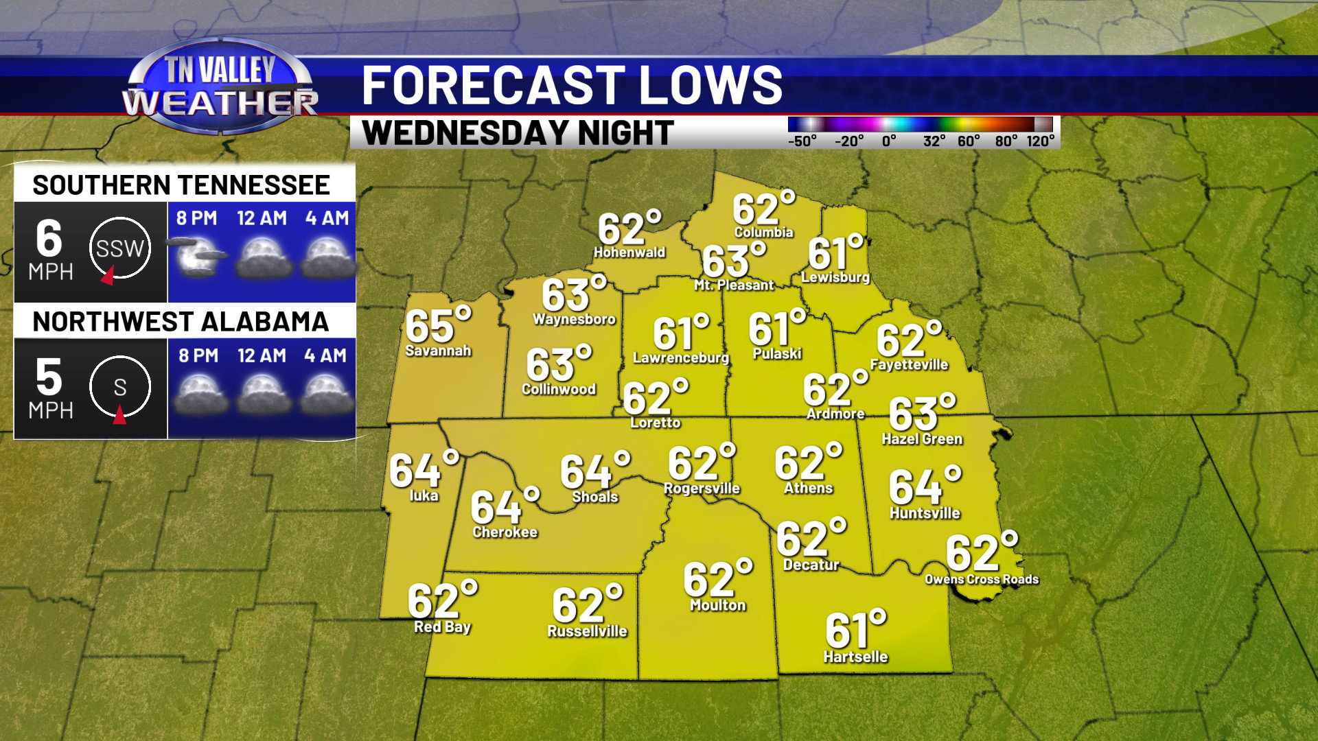
We’ll keep a few clouds into the overnight hours tonight. Lows will drop into the lower 60s for most of us. Daytime highs are up into the mid 80s again for Wednesday with partly cloudy skies and breeze southwest winds of 10 to 15 mph sustained, with gusts as high as 20 mph possible. Clouds will begin to gradually increase a bit as we head into Wednesday night, with the south to southwest wind continuing and overnight lows in the low to mid 60s.
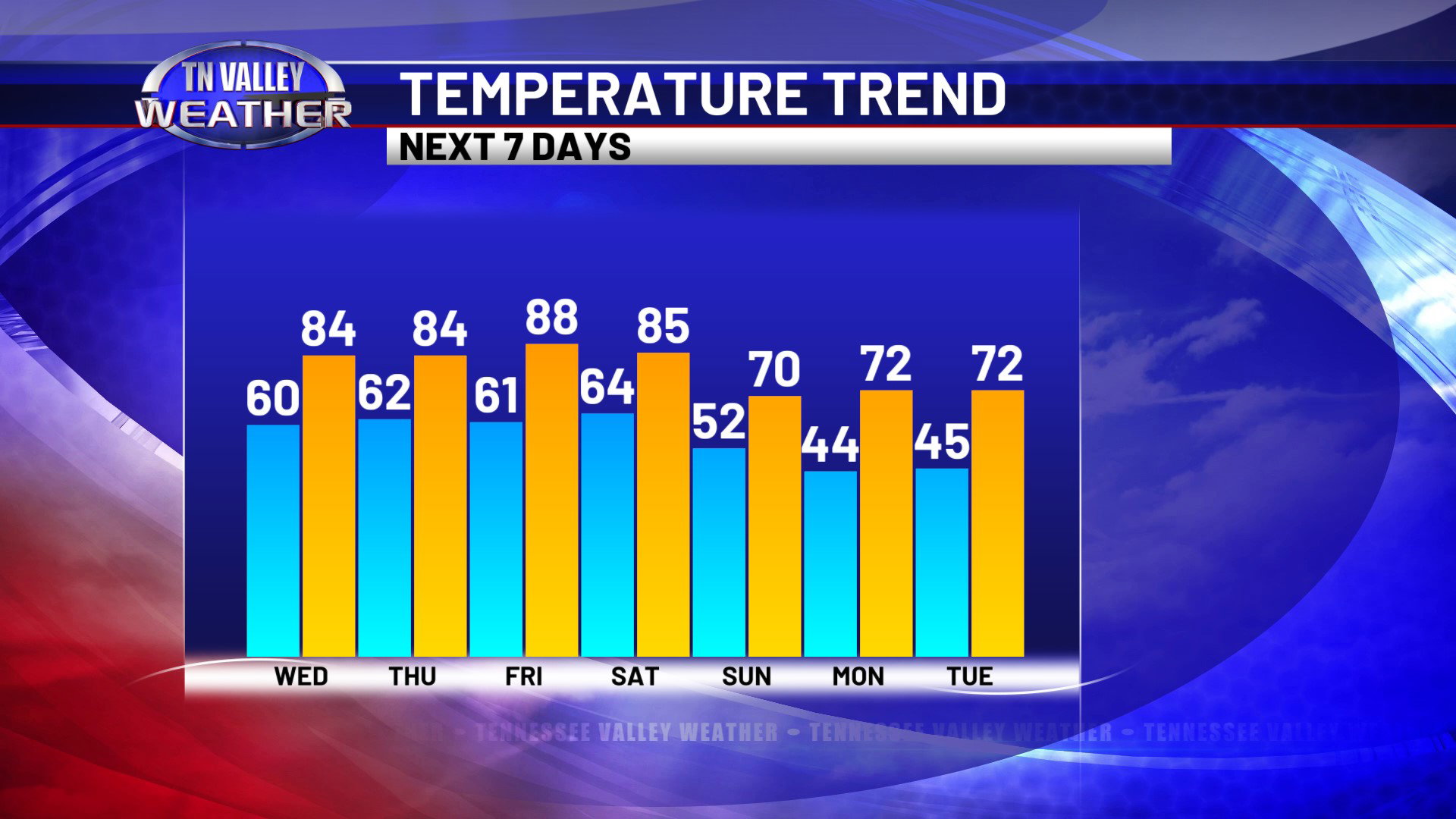
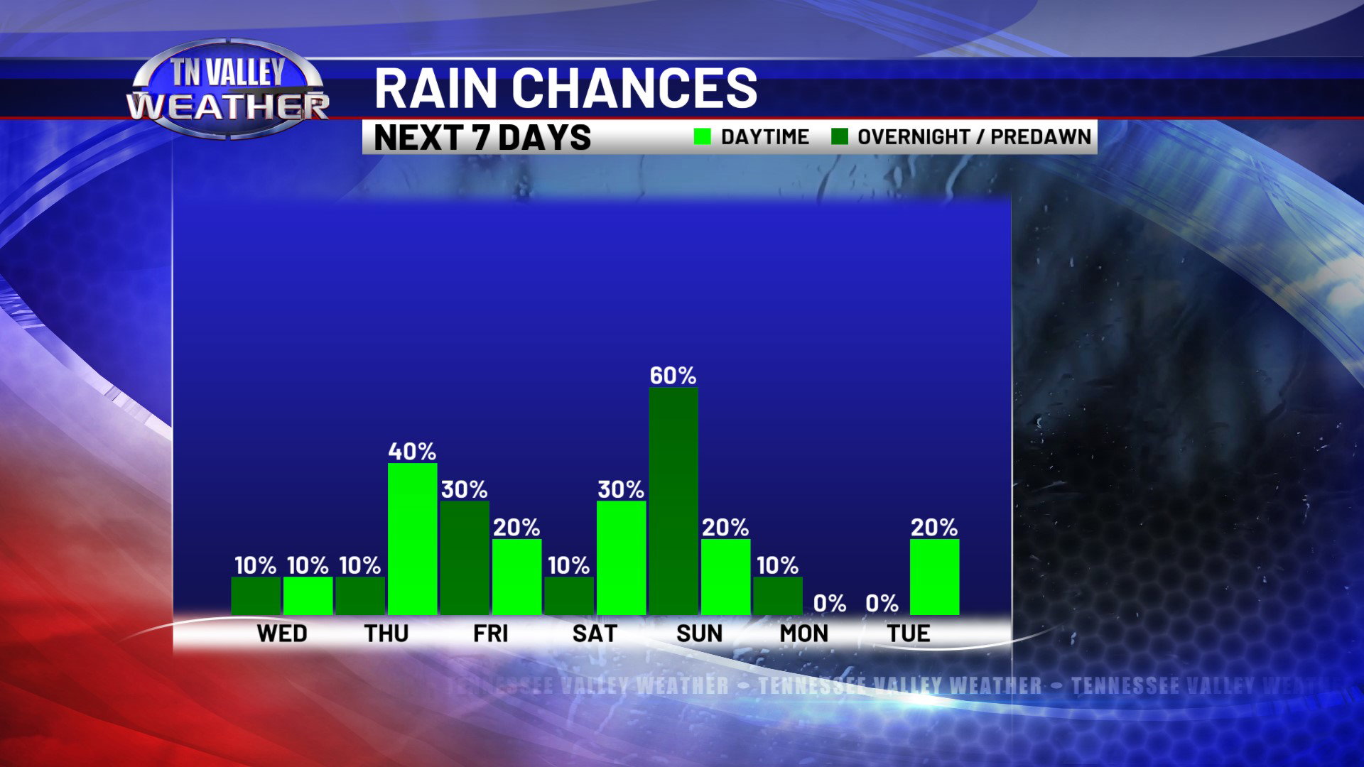
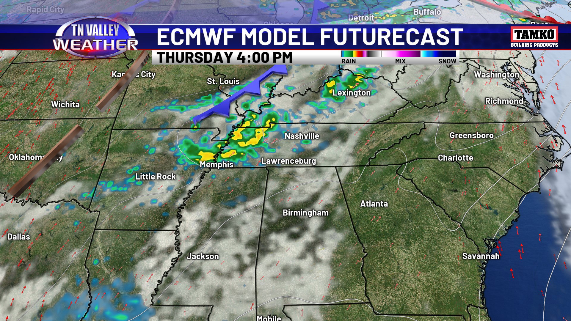
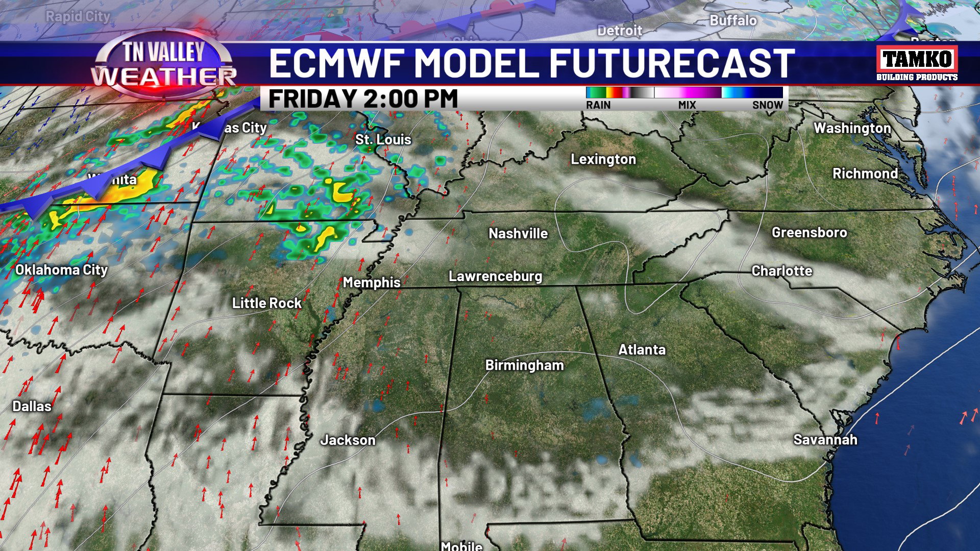
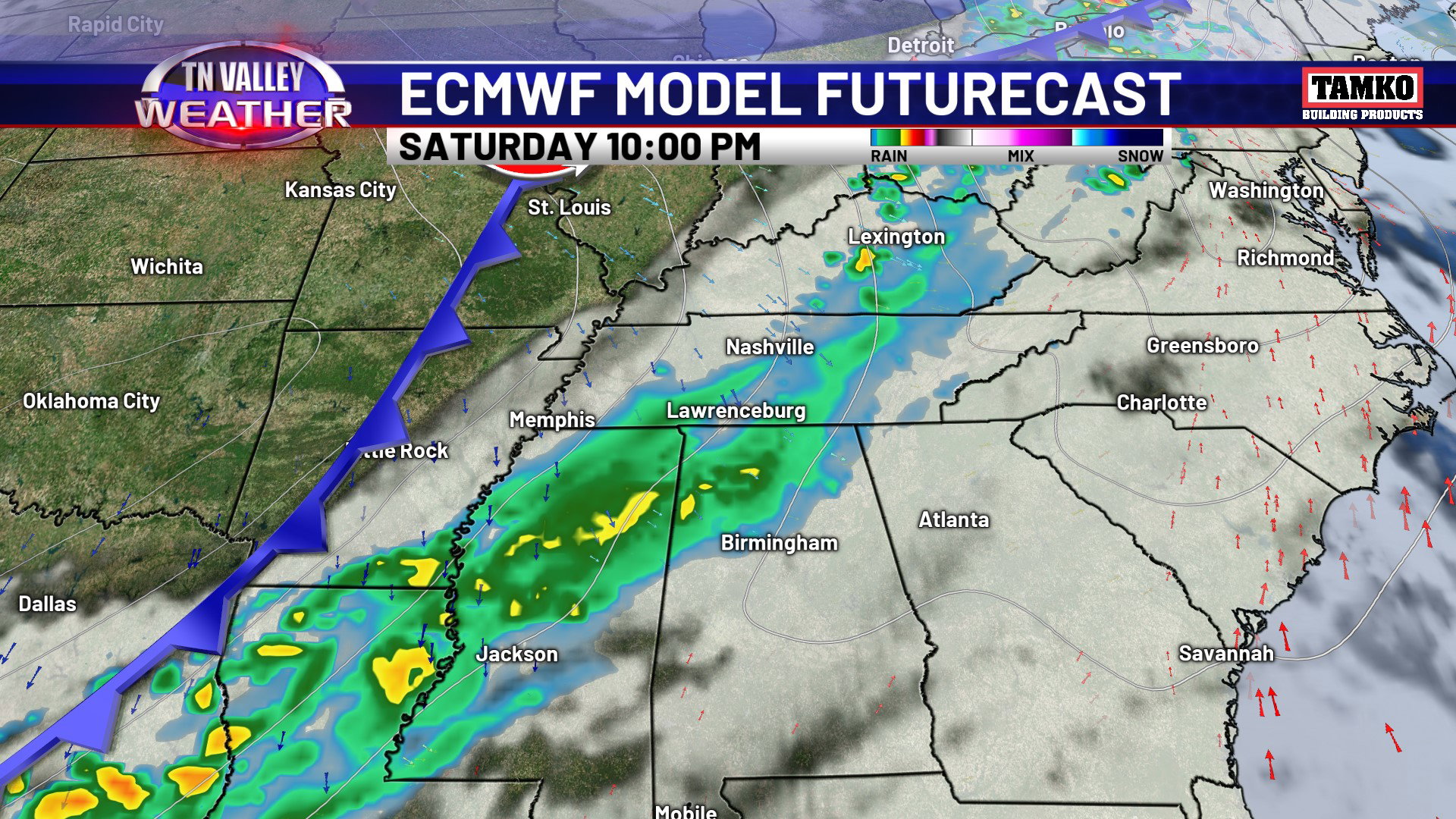
A weakening disturbance skirts us just to the northwest on Thursday, and this looks to give us the chance of a few scattered showers and thunderstorms by the afternoon and evening. It looks like the main activity stays to our northwest, however. We have the slightest chance of a shower on Friday, but we are mainly in between systems. Friday will be a very warm day, with daytime highs in the upper 80s… and a few folks especially in north Alabama possibly hitting 90 degrees. Our main rain chances for the forecast period come late Saturday afternoon into Saturday night as the next organized cold front moves in. It looks to bring widespread showers and thunderstorms. With the main dynamics and wind shear staying off to our north, we don’t see any signals for an organized severe storm risk right now, but we will watch it carefully. Rain totals with the system will likely be in the half inch to one inch range… not enough to bust the drought, but certainly enough to water the gardens and fields a bit! We shift into cooler air by Sunday into early next week behind the front, with daytime highs back into the upper 60s and lower 70s and overnight lows by Monday and Tuesday mornings into the 40s. No risk of a frost or freeze, but definitely a noticeable change after the very warm weather this week!
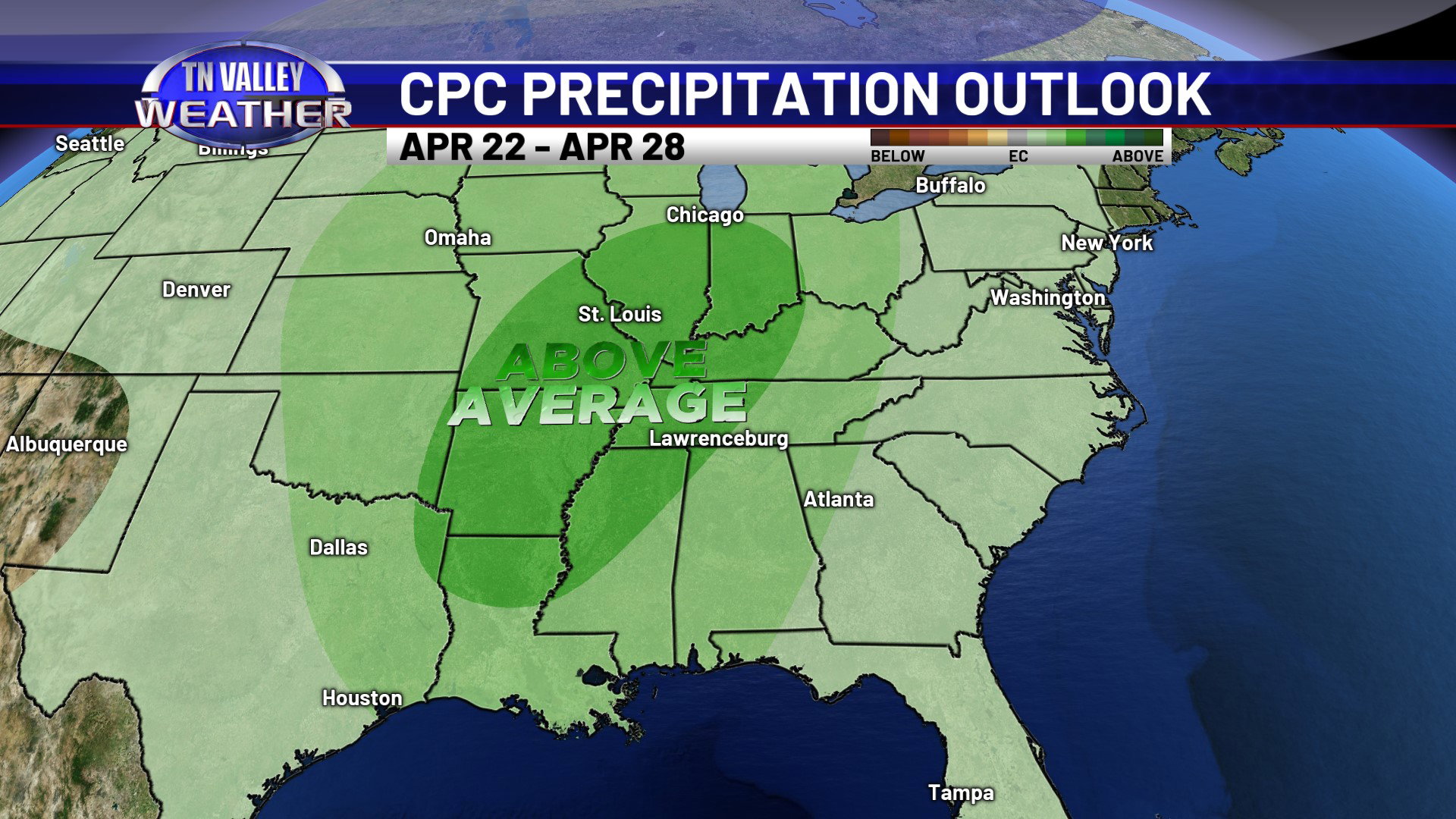
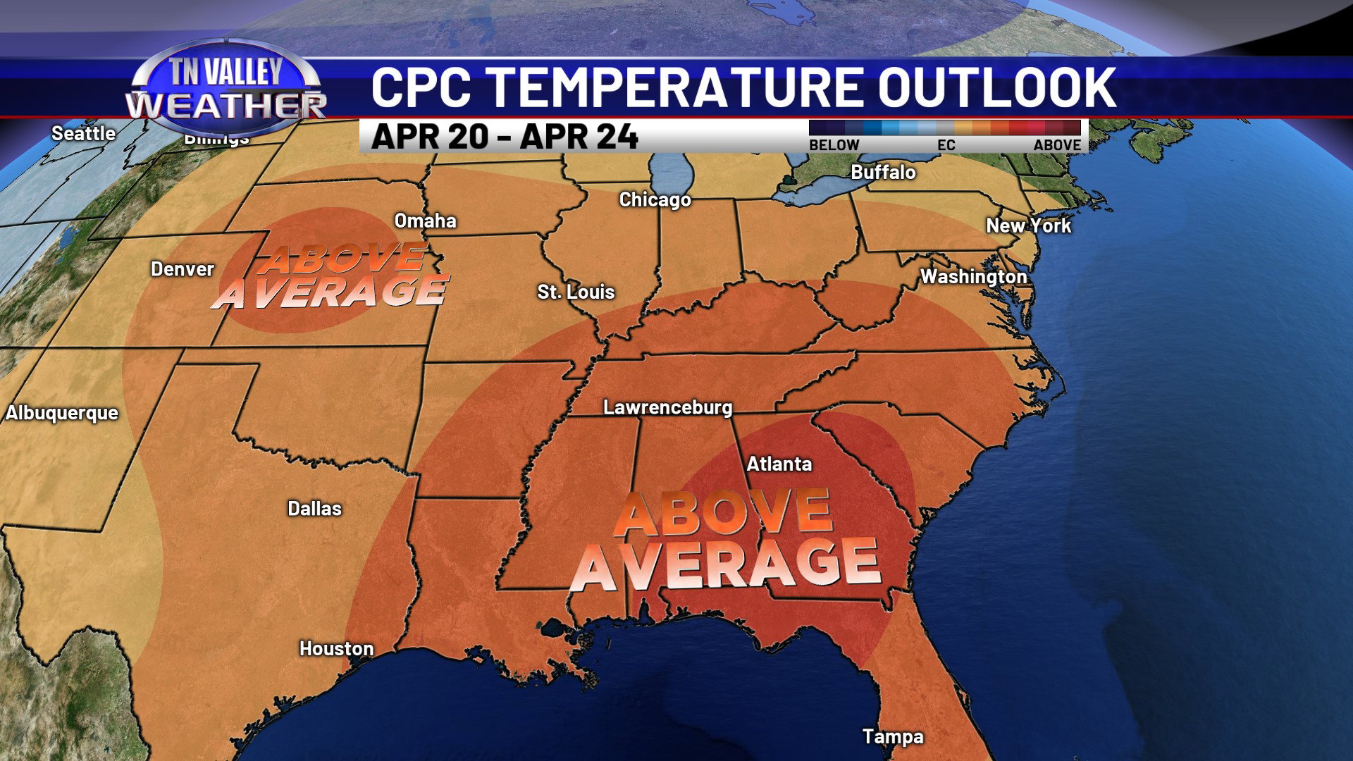
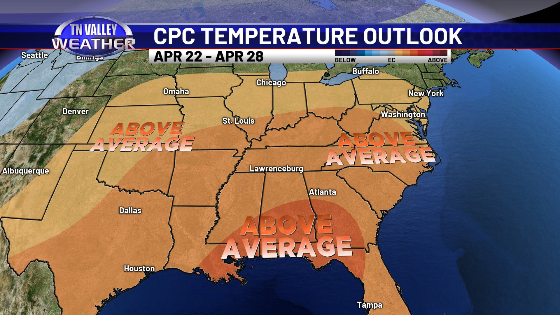
As we head into next week and on through the rest of the month, there are increasing signs that the upper-level ridge over us weakens some and allows the jet stream to shift closer. After the early next week cooler temps, we will likely shift back to above average temperatures again, but there are signals that our chances for showers and storms may increase as weather systems are able to track closer to us. We don’t see any big league rain events right now, but any increase in organized rain chances will help. As this happens, we will be on guard to see if any strong to severe storm chances try to materialize. We are in the climatological heart of our severe weather season here in the Tennessee Valley. For now though, we don’t see any immediate signs of trouble!