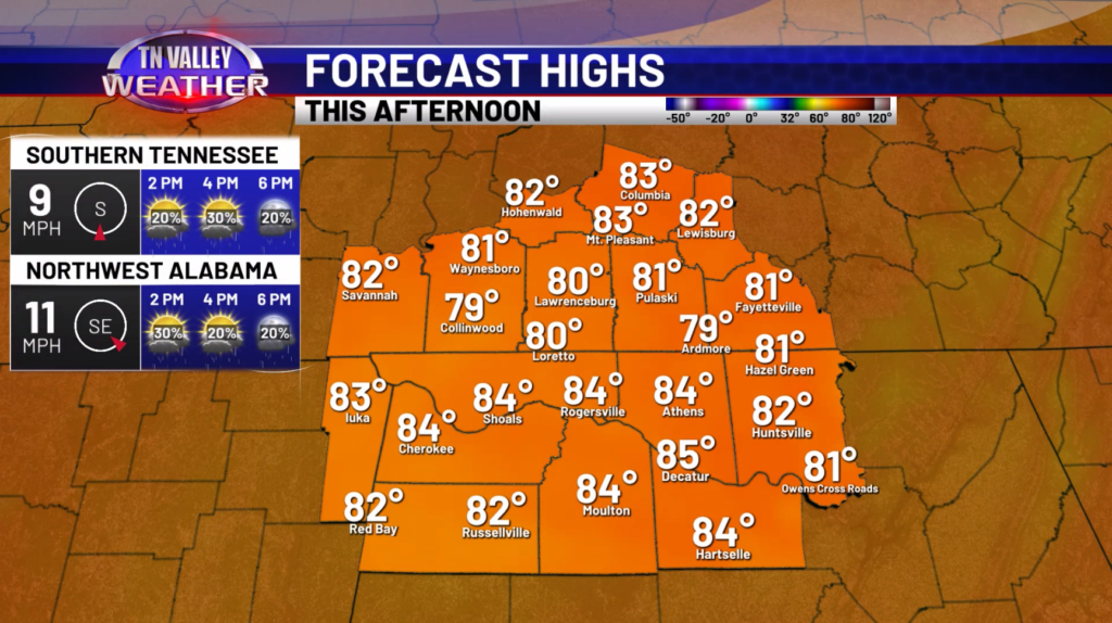
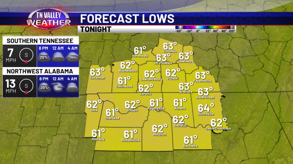
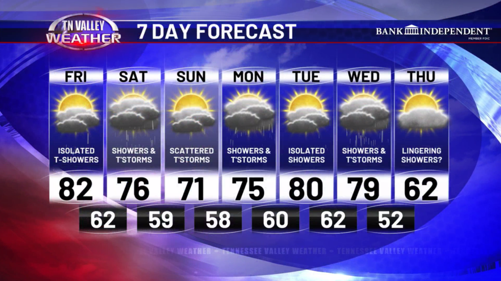
Happy Friday! Another very warm day is expected across the area, with highs in the low to mid 80s! There could be an isolated shower or storm this afternoon, but most places will likely remain dry until tomorrow. Winds today will be breezy at times with gusts around 20mph. This evening, any shower or storm that does develop will fade with the loss of daytime heating. Skies should remain partly to mostly cloudy.
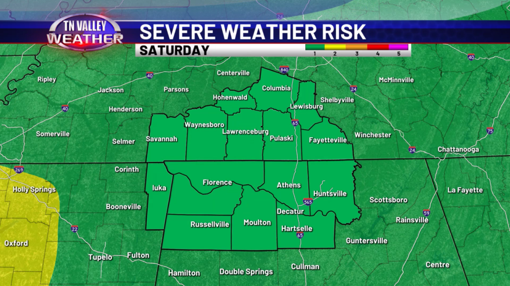
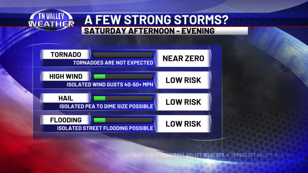
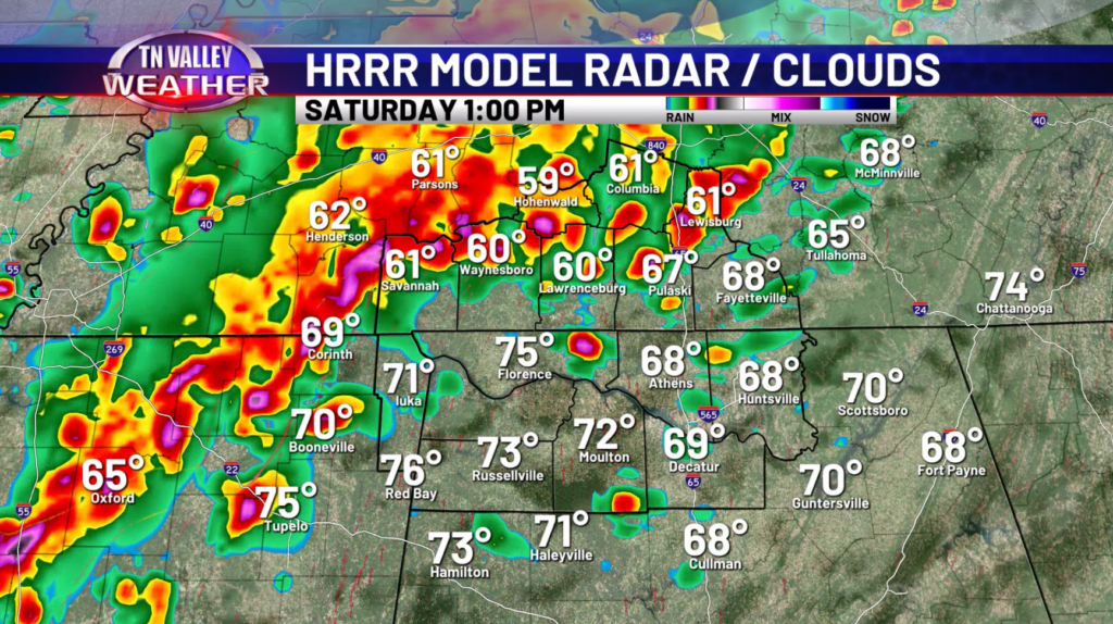
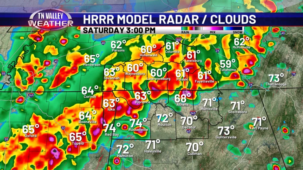
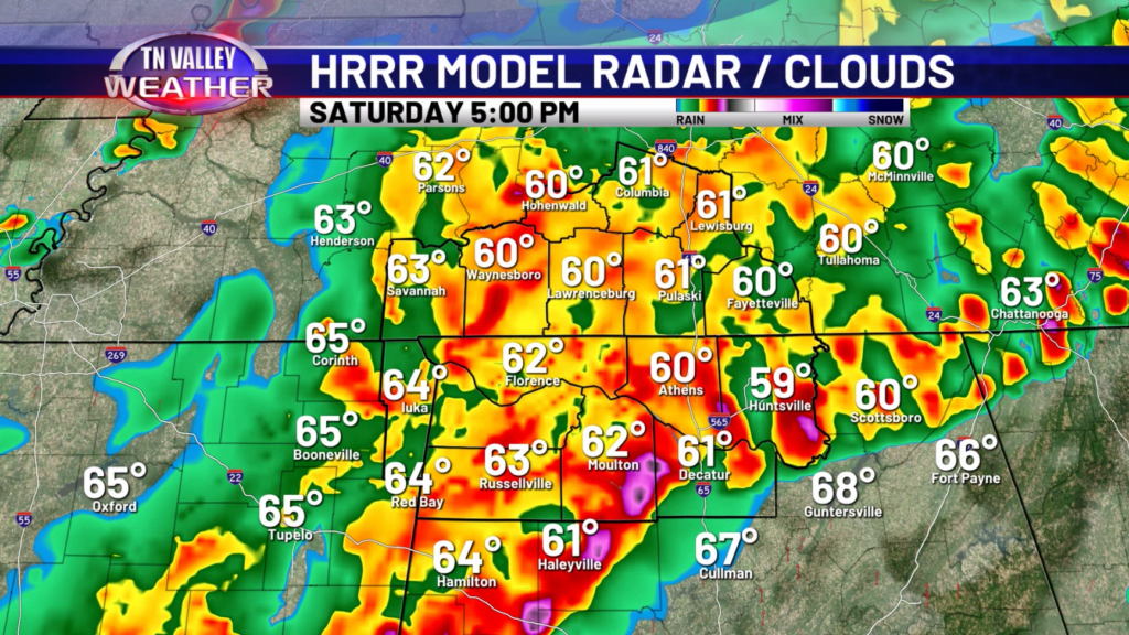
For tomorrow, our eyes will be on a line of storms tracking in during the midday to evening hours. At this moment, the line should start to weaken as it enters our area, but there will probably be a period of time where it is still packing a little punch. While most of the line should be below severe limits, there could be a few spots that have damaging winds of 60mph, prompting a severe thunderstorm warning. With the low-level wind shear very low, our tornado risk with this line is extremely limited.
We don’t anticipate this becoming a big severe weather maker for us, but there could be a few areas that get hit with some strong winds causing some issues. We will keep a close eye on trends in case this appears to be more than that.
On Sunday, we expect most of the rain and storms to be out of our area, but an isolated shower or storm will be possible during the day. More showers and storms are in the forecast for early next week with some stronger storms possible again on Wednesday. Cooler weather will return on Thursday.
Have a great Friday and weekend!