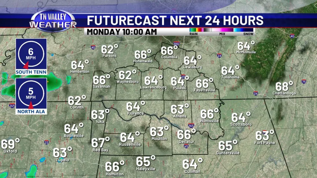
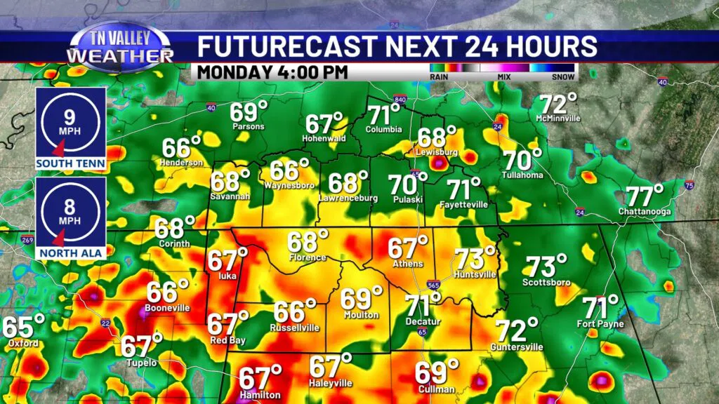
We’ve been dealing with dense fog all morning here in the Tennessee Valley. Once fog clears up, we will be left with a mostly cloudy sky and a dry few hours before rain and storms move in. The Storm Prediction Center has parts of the Tennessee Valley highlighted for strong to severe storms this afternoon, levels 1 and 2 respectively.
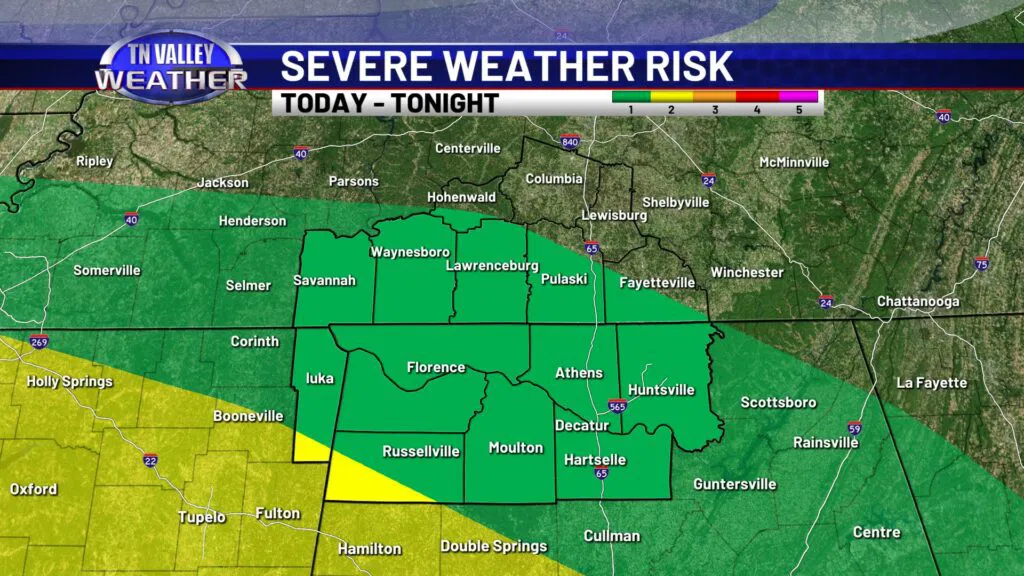
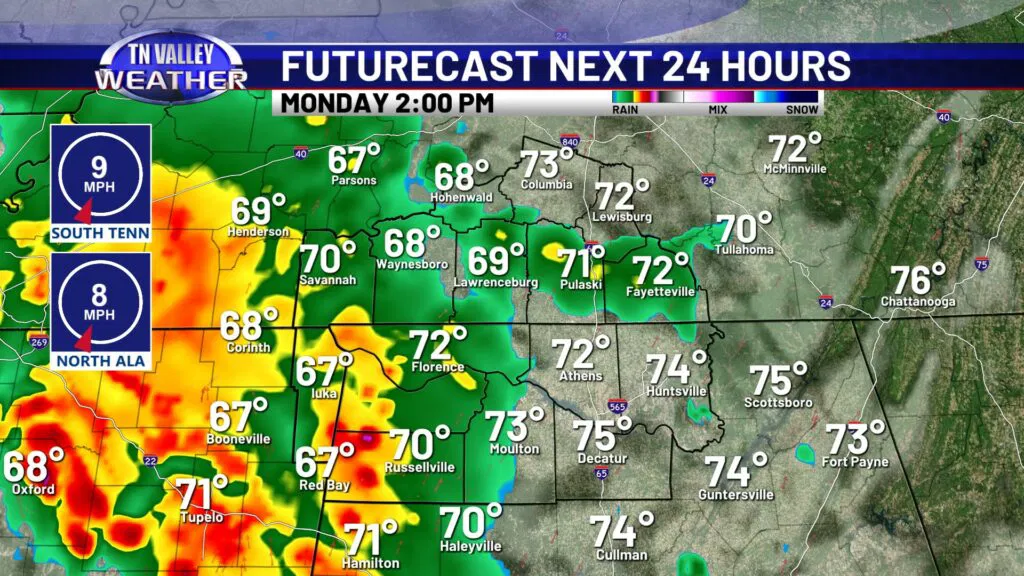
A few storms this afternoon may produce gusts up to 40mph with an isolated 50-60mph gust not out of the question. Otherwise expect heavy rain, frequent lightning, and maybe even some small hail. In terms of a tornado risk, it’s not something we are concerned about for today, but unfortunately can simply never be ruled out with strong storms in the forecast. While we aren’t expecting it, we will be watching closely for any threats and dangers. Most storms today will be general run-of-the-mill.
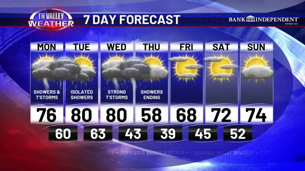
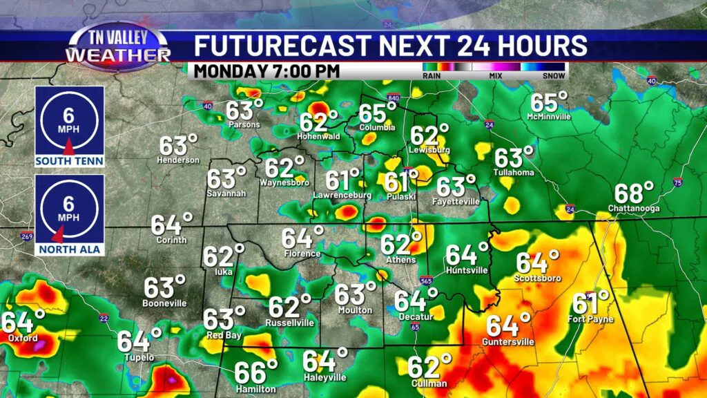
The timing of today’s storms looks to be mainly after 1-2pm, continuing through the rest of the afternoon and early evening. Showers and some thunder may linger through around midnight, and after that we will start to calm down and dry out.
Tuesday we catch a bit of a break. Clouds will be around along with some spotty rain showers, otherwise mostly dry with highs in the upper 70s to lower 80s.
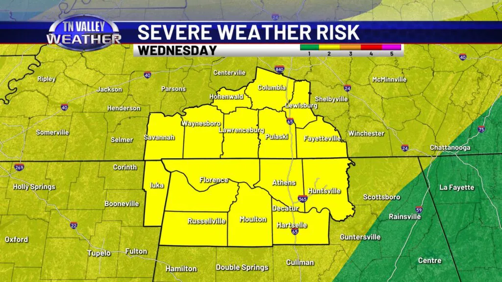
We are keeping a close eye on Wednesday’s cold front, bringing widespread rain and storms posing a severe weather threat for the Tennessee Valley. This front will be quite stout, especially in the temperature department. More on that below. The Storm Prediction Center has our entire viewing area in a Level 2 risk for severe weather Wednesday. At this time, it is looking like an afternoon-evening linear system with damaging winds as the main threat, but a tornado risk certainly cannot be ruled out. We will be able to get more specific with the timing as well as potential threats that we anticipate.
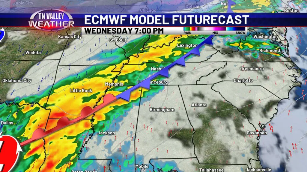
This mid-week cold front will flip our weather pattern for the rest of the week to cool and calm. Highs Thursday afternoon will only reach the upper 50s, and we will be dry through at least the first half of the weekend. Cooler weather is typically the trade-off for drier weather this time of year.