


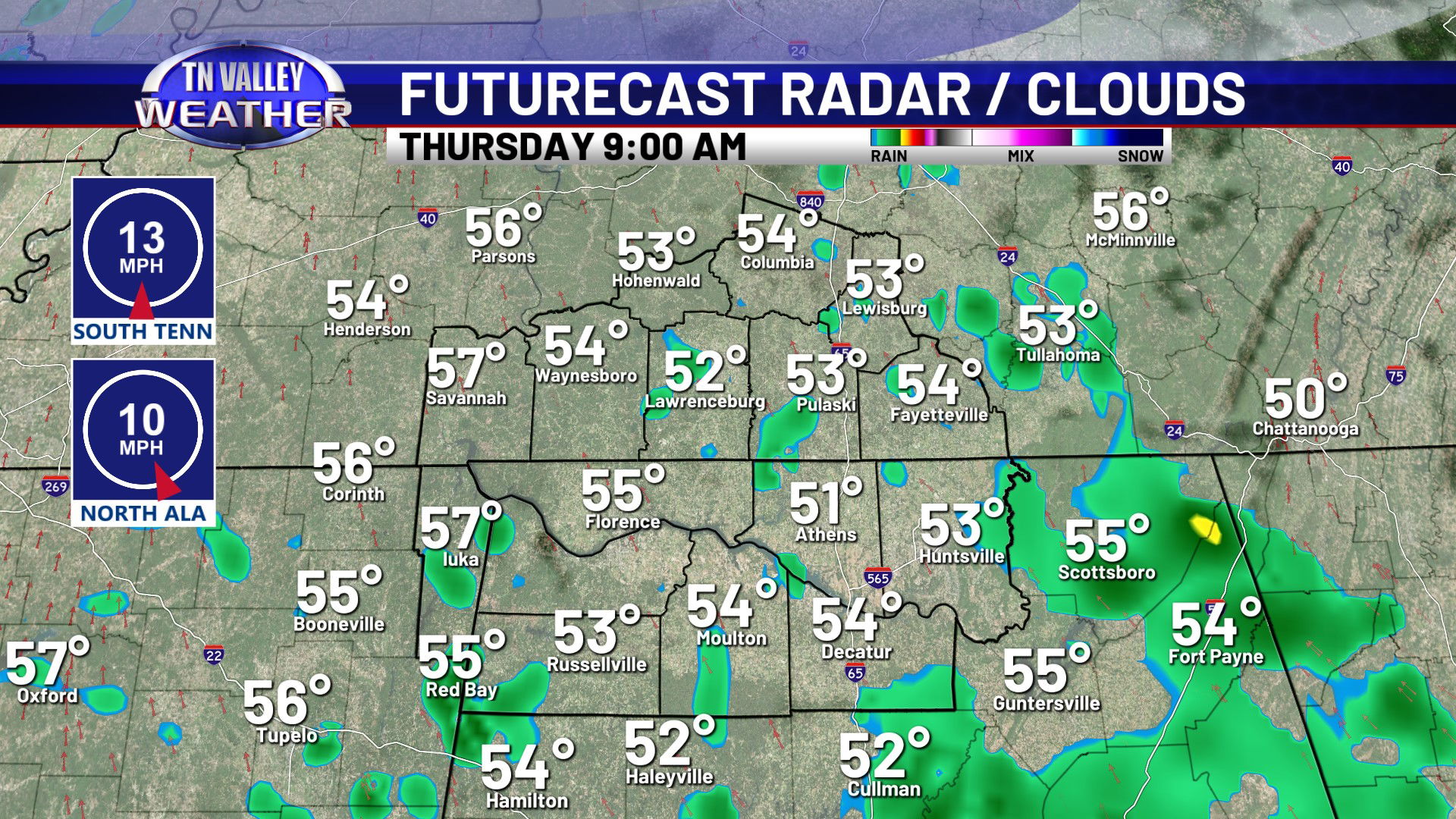
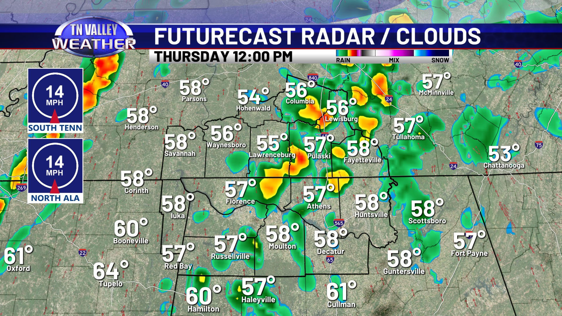
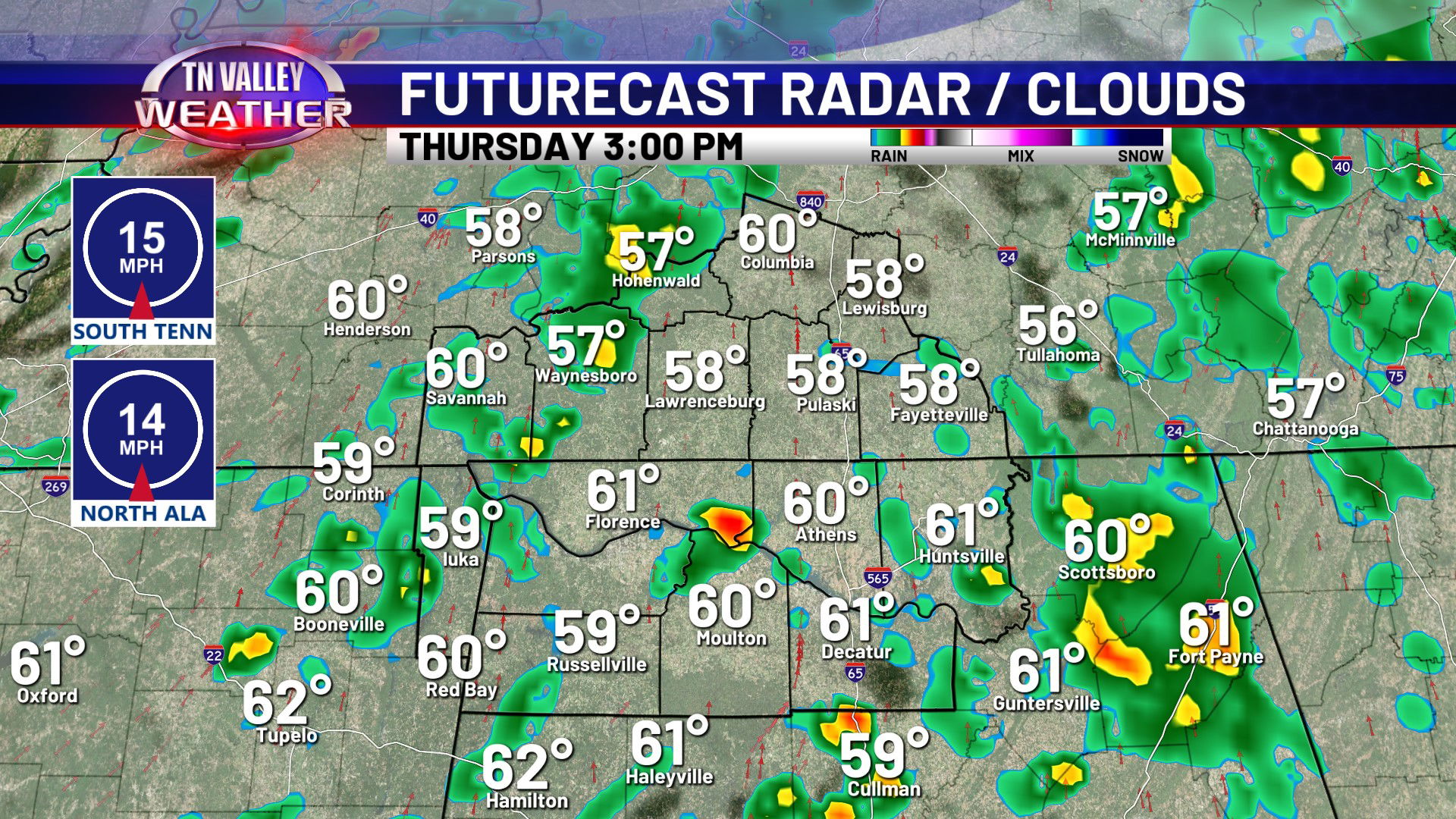


The arctic air has retreated for a bit. After being in the 50s with mostly cloudy skies today, and a few spotty showers, we will only drop into the mid 40s overnight as clouds continue, as well as a few spotty light showers. We will continue to be mostly cloudy and breezy for Thursday, with highs topping out between the mid 50s to lower 60s as a cold front approaches by the evening. Showers are possible as early as the morning hours but showers and a few rumbles of thunder are more likely as we head into the afternoon and evening hours. These will be moving east of our area by 9:00 to 10:00 pm. We may have a few rumbles of thunder, but severe storms are not expected. Please note that the NWS Storm Prediction Center has removed the Level 1 risk for damaging winds that they previously had in our area. We never agreed with it being needed, and they have since come around to our thinking and removed it.


We’re temporarily cooler on Friday behind the frontal system, dropping back to the mid 40s for daytime highs and the lower 30s for lows. We are back warmer again by the weekend though with more of a southerly wind and highs in the upper 50s to lower 60s. A few spotty showers are possible beginning Saturday night and then continuing off and on in waves through the middle of next week. We don’t see any signs of any big rain makers in that period, however. As we head into next week, we turn even warmer as the jet stream retreats way north and an upper ridge builds over the Southern Plains. Daytime highs climb well into the 60s, and we might be knocking on the door of 70 degrees by Christmas Eve and Christmas Day!