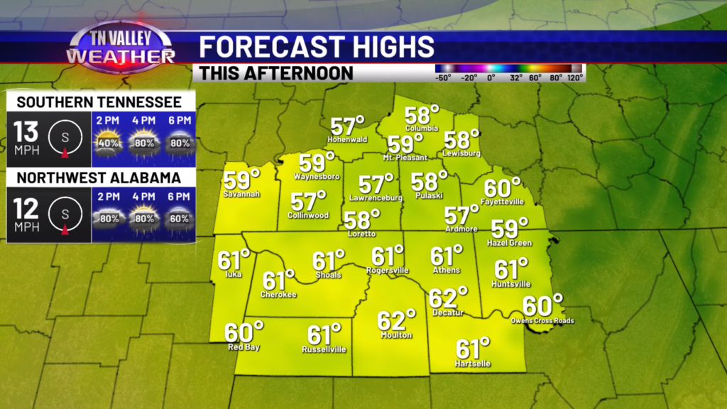
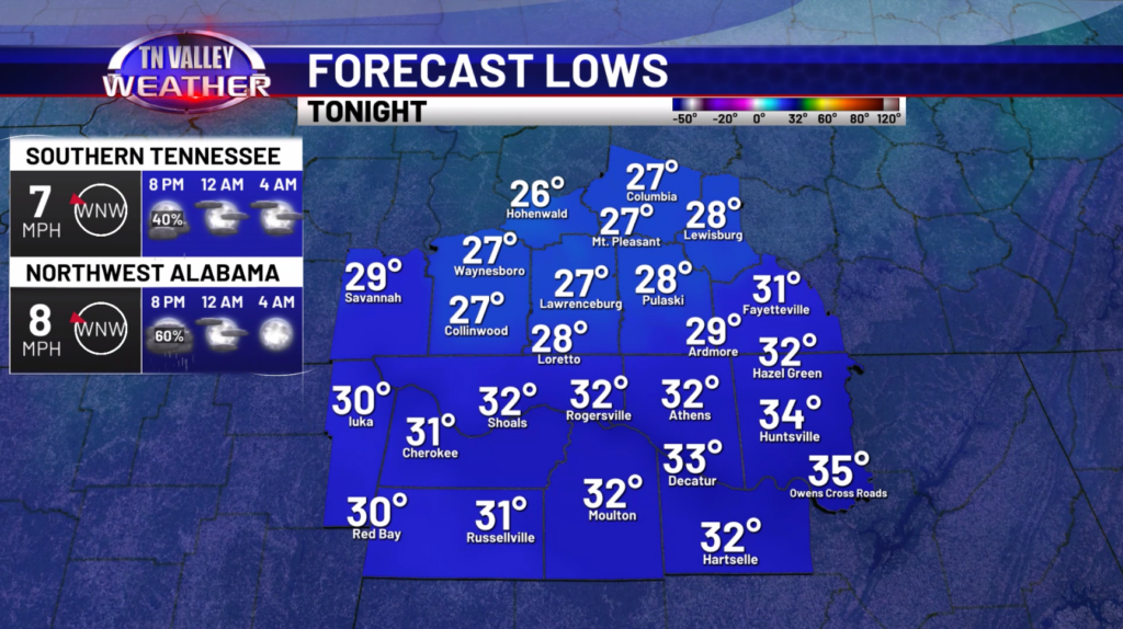
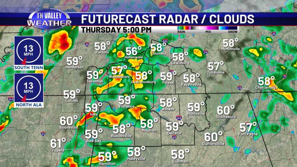
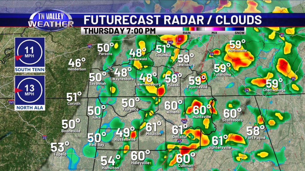
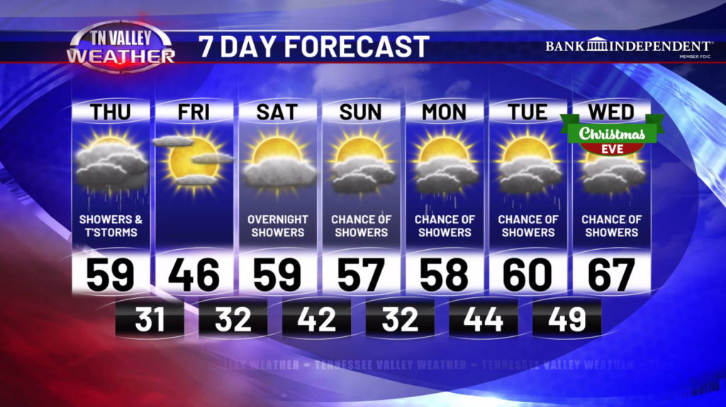
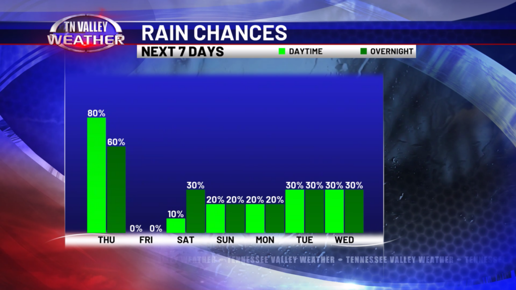
Happy Thursday! Periods of rain will continue through the rest of the day today with highs in the upper 50s and lower 60s. Later this afternoon and evening, storms will start to track in from the west with the approaching cold front. While some of these storms could be strong at times, the overall severe weather threat is very low. We only expect some gusty winds around 30-40mph to accompany the heavier storms. Most, if not all, the storm activity will be out of here by 9-10pm. Overnight tonight, we will see our temperatures drop into the upper 20s and lower 30s.
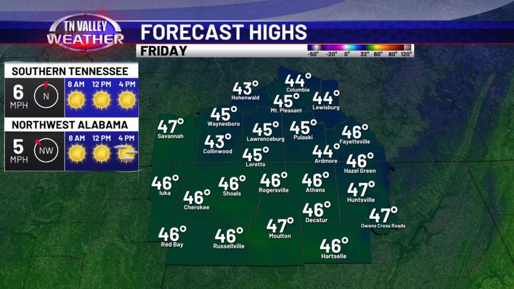
For Friday, a much cooler day is expected with highs in the 40s and some breezy northerly winds at times. The skies should be mostly if not completely clear during the day.
Going into the weekend, we will see the return of some warmer temperatures with highs in the 50s. Only a few showers are possible late Saturday and into Sunday. Christmas week will feature much warmer weather with highs possibly near 70 degrees on Christmas Eve! There could also be a few showers around each day leading up to Christmas.
Have a great Thursday!