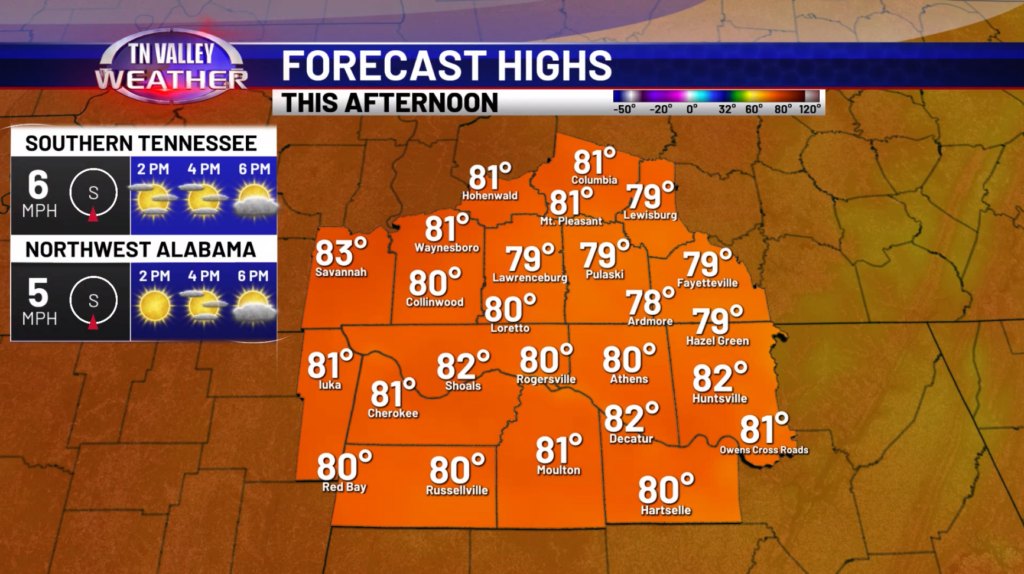
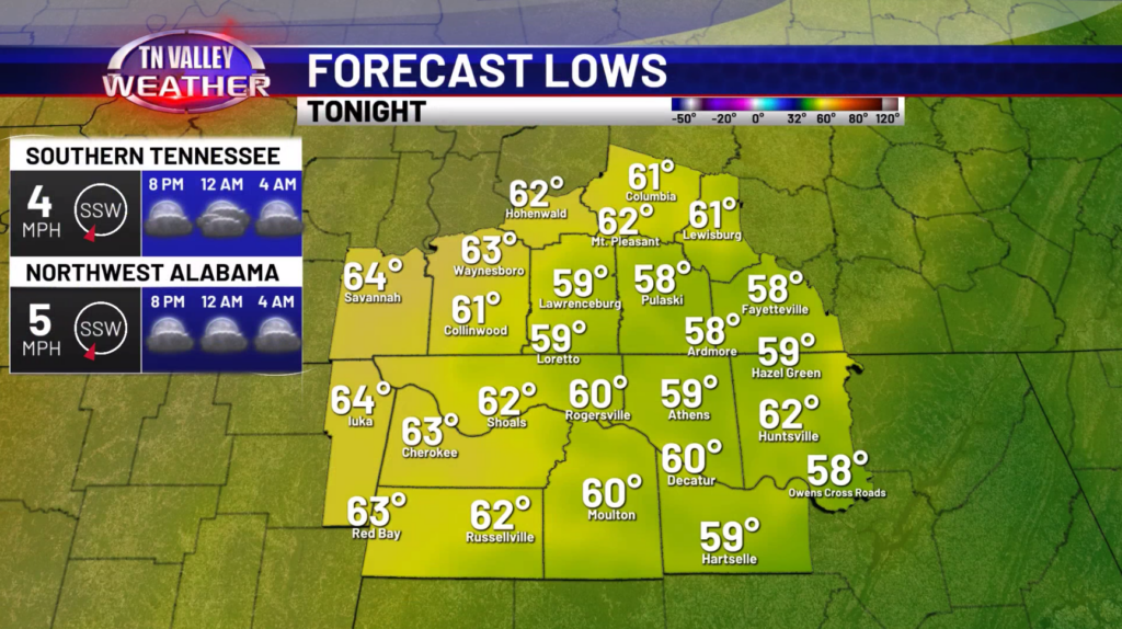
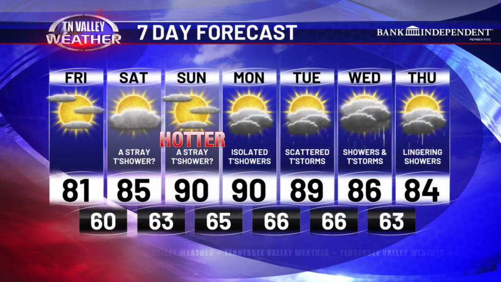
Happy Friday! Our warming trend starts today with highs getting back into the upper 70s and lower 80s. A mix of sun and clouds are expected but no rain chances are on the board for today. This evening, partly to mostly clear skies are expected with lows dropping down into the 50s and 60s.
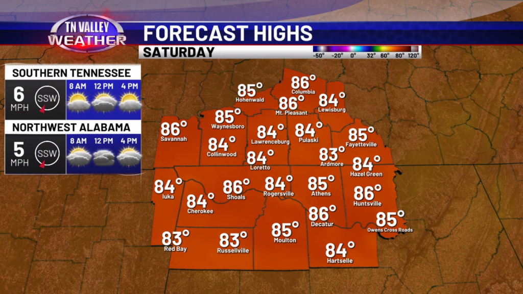
For tomorrow, highs will get into the mid and upper 80s with partly cloudy skies. Maybe an isolated shower or storm will be possible, but most places will be nice and dry.
Going into Sunday and Monday, we get hot across the Tennessee Valley! Highs will reach the upper 80s and lower 90s marking a return of summer-like weather. A rouge shower or storm will be possible on both days, but most places will remain dry.
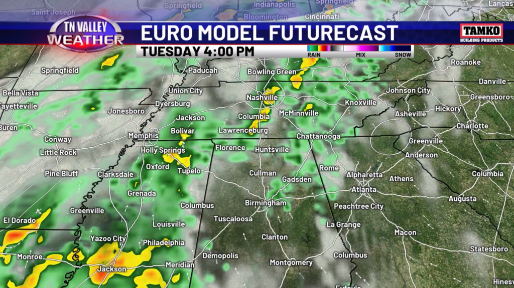
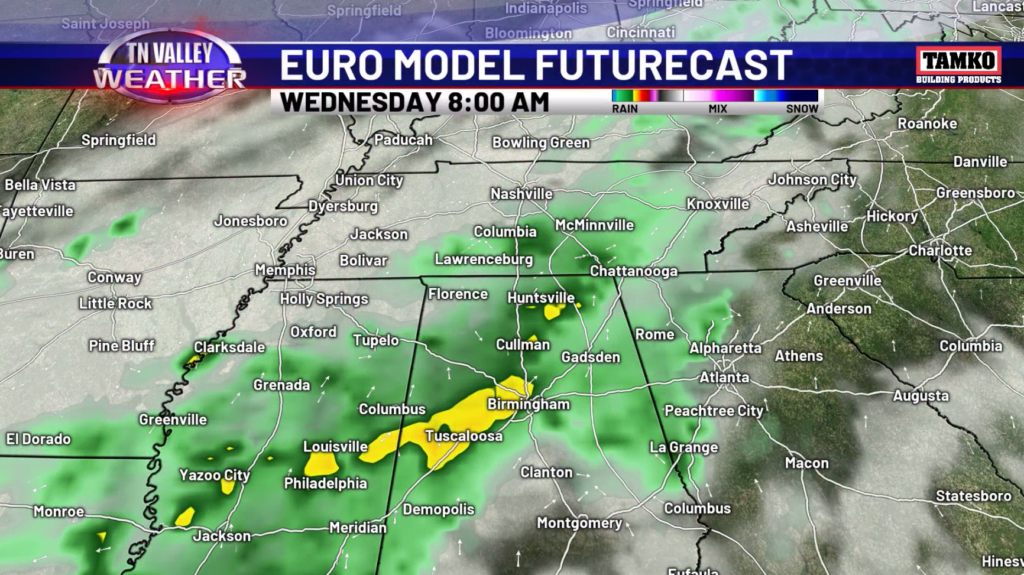
Better chance for showers and storms will come back into the forecast on Tuesday and Wednesday with some widespread rainfall anticipated. Highs will remain in the 80s going into the middle of next week and lows will remain in the 60s.
Have a great Friday and weekend!