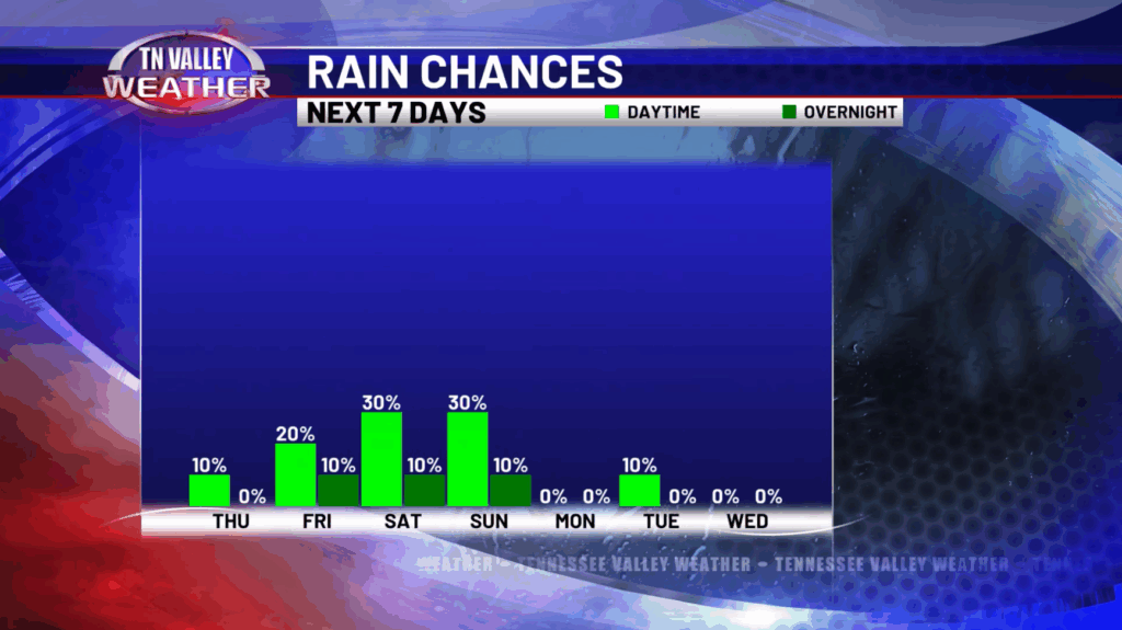
Good Thursday morning! After a round of strong and severe storms yesterday, our cold front has pushed through the area bringing some slightly cooler air. Although an isolated shower is possible today, most places will just remain dry with highs in the mid and upper 80s with a northerly breeze around 5-10mph. Skies will be partly cloudy. This evening, temperatures will drop into the upper 60s and lower 70s.
Going into your Friday, more of the same can be expected with very low rain chances and skies partly to mostly sunny. Highs will be in the upper 80s to around 90, so slightly warmer to round out the week.


For the weekend, temperatures will remain in the upper 80s to lower 90s with some isolated showers and storms possible. Our main focus will be another front moving in Sunday which will bring much cooler weather to the Tennessee Valley to start next week! Highs Monday will be in the mid 80s but then another reinforcing shot of cooler air will drop highs into the lower 80s Tuesday and Wednesday! Overnight lows Monday night and Tuesday night will likely be in the 50s to around 60 which will make it feel like early Fall! A very nice sight to see after some very hot days we have had over the past month.
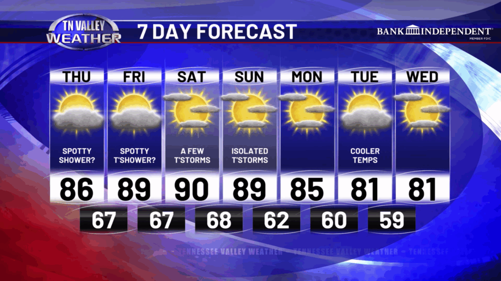
Have a great Thursday!