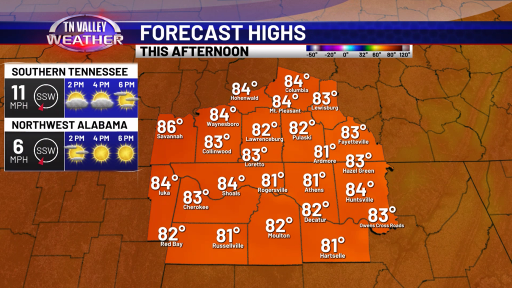
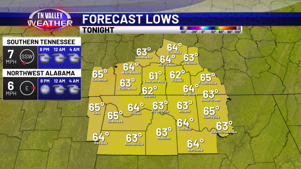
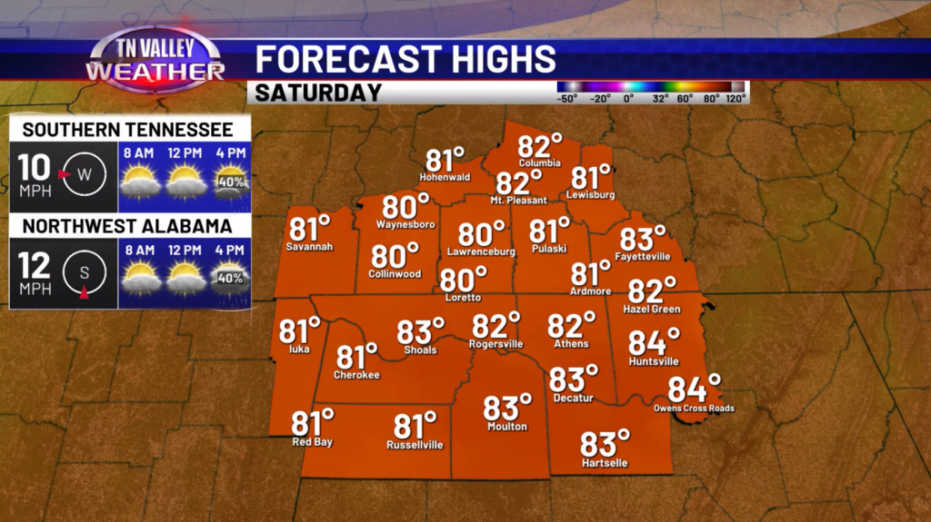
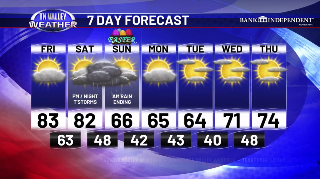
Good Friday morning! Mostly dry conditions are expected today with only a small chance of an isolated shower or storm. Highs today will be in the middle 80s with a breezy southerly wind gusting to 20mph at times. This evening, we are dry with lows down in the low to mid 60s. For tomorrow, we are dry early in the day but during the afternoon and evening, we will see showers and storms track on through. Highs will be in the low to mid 80s.
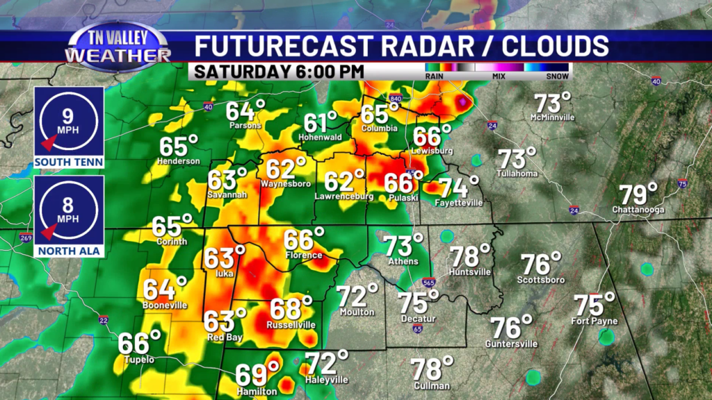
As for those storms, while we do not expect a big severe risk, a storm or two could be on the stronger side. The main threat would be some gusty winds around 40-50mph and some small hail. An isolated damaging wind gust is not out of the question but is not likely. We do not anticipate a tornado risk with these storms.
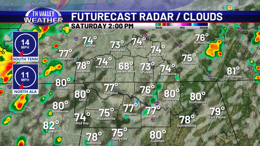
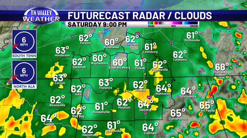
Storms should arrive during the late afternoon hours (4-5pm) and then track east with time through the evening. There could be some isolated showers and storms that develop ahead of the line. As the storms progress to the east, they should weaken. All the rain and storm activity will be out of our area by the time Easter morning rolls around.
Going into next week, cooler air will be in place with highs in the 60s Monday and Tuesday. We do get back into the 70s Wednesday and Thursday. No rain is currently expected during next week.
Have a great Friday and weekend!