Uncategorized

Sunshine and warm temperatures continue. Rain and t’storm chances on the horizon.

It’s turning out to be another beautiful, sunny, warm day across the Tennessee Valley on this Monday. High pressure is currently in control of the weather over the Southeast, and that’s currently keeping all the unsettled weather off to our north and west. Temperatures early this afternoon are climbing through the upper 70s to the

Sunshine and warm temperatures continue. Rain and t’storm chances on the horizon. Read More »

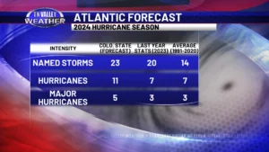
CSU’s 2024 Hurricane Forecast. Let’s cut through the hype and talk about what it does (and does not) mean.

Back on Thursday, Dr. Phil Klotzbach from Colorado State University released their 2024 forecast for the Atlantic hurricane season. Their forecast calls for what could be considered a very active hurricane season, and is the largest April forecast they have released. They are calling for 23 named storms, with 11 of those becoming full-fledged hurricanes,

CSU’s 2024 Hurricane Forecast. Let’s cut through the hype and talk about what it does (and does not) mean. Read More »

Elevated severe storm threat in our area later today into this evening. Here’s the latest info!

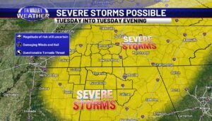
The latest information early this Tuesday morning from the NWS Storm Prediction Center maintains the Level 3 of 5 “Enhanced Risk” of severe storms for this afternoon and evening for all of our area. The timeline we have shown since yesterday morning has not changed. The main severe weather risk for our viewing area remains

Elevated severe storm threat in our area later today into this evening. Here’s the latest info! Read More »

“RED ALERT”? Here’s the criteria we have for OUR version of this, and a few comments about being responsible with it!

If you pay any attention at all to weather information online or from broadcast outlets, you have at some point seen flashy red graphics used to draw your attention to the potential for impactful weather. Various outlets call this different things, based on their station’s branding. You may hear terms like “First Alert Weather Day”,

“RED ALERT”? Here’s the criteria we have for OUR version of this, and a few comments about being responsible with it! Read More »

Stormy and windy tonight. Gorgeous rest of the week. Easter looking great!

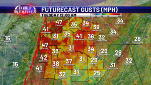
It’s a windy one out there today, folks! We have a Wind Advisory in effect through Tuesday morning. Expect sustained winds 20-30mph, and gusts up to 50mph. The strongest winds will be tonight, as a line of showers and storms power through the region. Before we get there, expect highs in the mid to upper

Stormy and windy tonight. Gorgeous rest of the week. Easter looking great! Read More »

Partly sunny and warm today. Rain chances and a quick shot of cooler temps ahead.

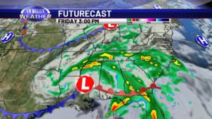
We’ve had some sunshine across the Tennessee Valley on this Thursday, but clouds are beginning to thicken up ahead of the next weather system off to our southwest. Temperatures are mainly in the upper 60s and lower 70s as of the early afternoon, but I expect us to climb into the low to mid 70s

Partly sunny and warm today. Rain chances and a quick shot of cooler temps ahead. Read More »