Bouncing temps but quiet weather next few days. Warmer next week!
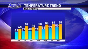
After a run at milder temperatures and some rain yesterday, we have been back to chilly weather on this Wednesday as clouds have stuck around. That will continue into tonight with clouds only gradually beginning to break up. Overnight lows will be colder, into the low to mid 20s. We return to partial sunshine on […]
Bouncing temps but quiet weather next few days. Warmer next week! Read More »