skip to content

Weather Blog

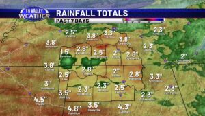
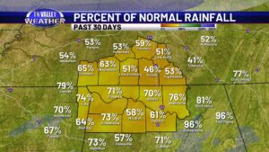
A quick check in on drought conditions across the area. Yes, we still have dry conditions, but there has been improvement.

We haven’t talked about it in a little bit because of being busy with winter storms, storm threats, and generally active weather for the last several days, but there are still drought conditions in place across the area. The good news, though, is that there has been some improvement. “Exceptional” level drought conditions are no […]

A quick check in on drought conditions across the area. Yes, we still have dry conditions, but there has been improvement. Read More »

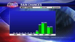
Mild air for now. Rain arrives Friday evening. Arctic express for next week!

Today was one of the mildest days we’ve had around the Tennessee Valley for over a week now! Most locations got into the mid to upper 50s for daytime highs, and the Muscle Shoals airport almost hit 60 degrees! Winds will go light to calm overnight, and with mostly clear skies, temperatures will drop into

Mild air for now. Rain arrives Friday evening. Arctic express for next week! Read More »

Welcome new followers! Where and how to get the most info from Tennessee Valley Weather…

After any major weather event in our area, we always pick up several new followers on our various platforms. That has held true after the recent winter storm in our area. For all of you that have stumbled upon us over the last 10 to 14 days, we would like to take the opportunity to

Welcome new followers! Where and how to get the most info from Tennessee Valley Weather… Read More »

Temperature Rollercoaster Ride: brief warm-up to be replaced by much colder air.

High pressure remains nearby the Tennessee Valley not only today but for the next few days. It’ll eventually get the boot and our next weather maker will pounce in this weekend. Until then, enjoy the sunshine as we gradually warm up this week. Temps this afternoon will be in the mid to upper 40s, with

Temperature Rollercoaster Ride: brief warm-up to be replaced by much colder air. Read More »

Winter Storm Warning- Friday’s UPDATED snow and ice forecast for the Tennessee Valley.

A Winter Storm Warning is in effect for the entire Tennessee Valley Weather viewing area. Cloud cover will increase throughout the afternoon today ahead of the system, with the first snowflakes/sleet pellets falling mainly after 3am. We have made some slight adjustments to our forecast, which I will highlight first. The TL;DR version: we are

Winter Storm Warning- Friday’s UPDATED snow and ice forecast for the Tennessee Valley. Read More »

A Tuesday evening look at the Tennessee Valley’s winter storm situation coming for Friday

As of early this Tuesday evening, we still have this WINTER STORM WATCH in place across north Mississippi and west Tennessee that includes Hardin County TN and Tishomingo County MS of our viewing area. This watch goes into effect beginning 6:00 pm Thursday evening and runs until 6:00 am Saturday morning. Local National Weather Service

A Tuesday evening look at the Tennessee Valley’s winter storm situation coming for Friday Read More »

Cold and windy today. A few flurries possible. More significant wintry weather chances by Friday.

Rain and storms from last night have shifted east of our area, and arctic air is spilling into the Tennessee Valley this early Monday morning. We have already reached our official high temperatures for today, with temps holding steady in the lower 30s through today or even dropping slightly into the upper 20s during the

Cold and windy today. A few flurries possible. More significant wintry weather chances by Friday. Read More »