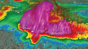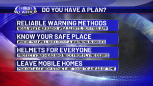
Elevated severe storm threat in our area later today into this evening. Here’s the latest info!
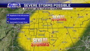
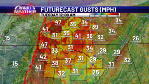
The latest information early this Tuesday morning from the NWS Storm Prediction Center maintains the Level 3 of 5 “Enhanced Risk” of severe storms for this afternoon and evening for all of our area. The timeline we have shown since yesterday morning has not changed. The main severe weather risk for our viewing area remains […]